All Activity
- Past hour
-
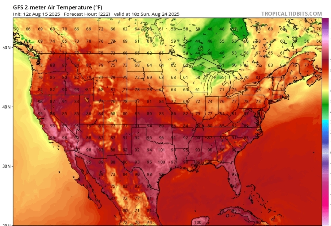
Haha, just noticed the valid time is all.
-

2025 Atlantic Hurricane Season
BarryStantonGBP replied to BarryStantonGBP's topic in Tropical Headquarters
Any extrapolations? -
you said "it wouldn't take much" It would take a lot for that - that should be a clue to the extreme unlikeliness without even touching theory.
-
not a "close call" or scrape on any operational model, nevermind a direct hit. Inside D7
-
Yeah you guys have had one tough summer. I have a friend in Cape Breton and she says it's been awful.
-
DO NOT LOOK. GFS OP has formable Fernand. Well within believable range. Maybe get lucky in the tracking of having a storm on the grid till the end of October. Likely not given the phase of the MJO.
-

Hurricane Erin - 75 mph - 996 mb - WNW @ 18
Eskimo Joe replied to BarryStantonGBP's topic in Tropical Headquarters
Unless I'm seeing things, Erin appears like she's trying to pop an eye. -
Oh would you like 2:00 p.m.? Still not '90s. Or even close...

-
dropped to -5% chance
-

Hurricane Erin - 75 mph - 996 mb - WNW @ 18
NorthHillsWx replied to BarryStantonGBP's topic in Tropical Headquarters
At present it looks like the track for Erin has ticked west enough to cause the least amount of impacts to land. Bermuda, while not out of the woods, seems to avoid the core on most modeling now as it splits the island and obx -
It goes out only to Aug 29th, when it is in phase 5.
-
Similarly here. Snagged a pop up shower. Didn’t get cored, but enough to water the gardens.
-
 Same..6 day heatwave 91/70/94 We will get Sunday but tomorrow will be close
 -
2025 Atlantic Hurricane Season
BarryStantonGBP replied to BarryStantonGBP's topic in Tropical Headquarters
What does the gefs say for September in terms of the mjo -
Today is my baby's gender reveal to see if my wife will be having a boy or girl.
-
Ask Scooter . He posted it yesterday
-

Hurricane Erin - 75 mph - 996 mb - WNW @ 18
GaWx replied to BarryStantonGBP's topic in Tropical Headquarters
Yeah, no change in winds, but the minimum SLP did drop 3 mb to 993 mb. -

Occasional Thoughts on Climate Change
Typhoon Tip replied to donsutherland1's topic in Climate Change
The problem with that analysis/method is that it doesn't consider alternate pathways that may also be capable of forcing thermal distribution. It only assesses observations in support of his idea. -
Isn’t that valid at 8am on Sunday?
-
90 + the weekend after next? You sure about that chief?
-
just need to lift that out a bit and move it up the coast before it gets kicked out.. 6 days out anything can happen and its close enough where we track
-

Hurricane Erin - 75 mph - 996 mb - WNW @ 18
Wannabehippie replied to BarryStantonGBP's topic in Tropical Headquarters
Latest advisory on Erin, no change in intensity. 2:00 PM AST Fri Aug 15 Location: 18.6°N 56.8°W Moving: WNW at 17 mph Min pressure: 993 mb Max sustained: 75 mph -
It seems that the musings back in July about the Atlantic SST profile being unfavorable for a big tropical season were correct in spite of a -ENSO. @DonSutherland1 was spot on with his call of a -AAM regime setting up in August as well
-
Just like in winter, Not getting anything into NE with that look.
-
The ridge developing around Nova Scotia is the most interesting piece. The "giant" gyre is also sliding east and north with time... It's the feature of a developing -NAO...