All Activity
- Past hour
-

December 2025 regional war/obs/disco thread
powderfreak replied to Torch Tiger's topic in New England
Tuesday into Wednesday could be a nice refresh.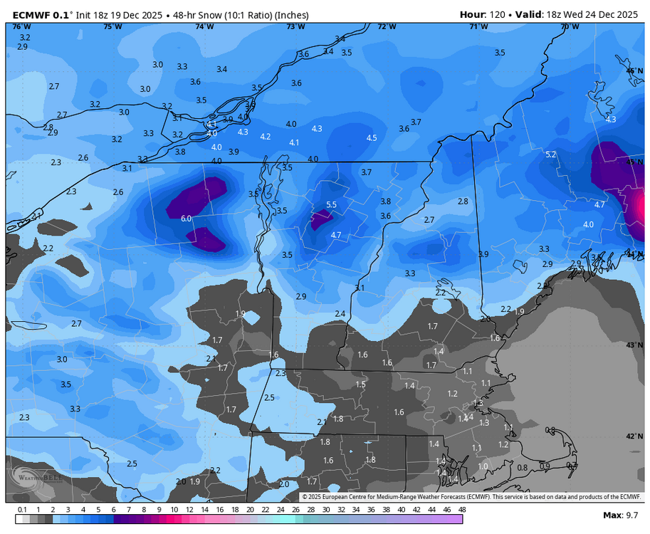
-

December 2025 regional war/obs/disco thread
TauntonBlizzard2013 replied to Torch Tiger's topic in New England
The always frigid OBX high pressure. Our biggest snows come from those -
I’m in Bretton Woods. I mean, it may be a disaster but there’s more snow on the ground than last year at this point with more on the way. At least here and we usually bear the brunt of cutters compared to low lying areas. Haven’t really looked at Tuesday and honestly I doubt anyone really knows. Still 4 days away! All I’d say is - there will be a bit more snow than now
-

Central PA Winter 25/26 Discussion and Obs
Blizzard of 93 replied to MAG5035's topic in Upstate New York/Pennsylvania
Wild weather day! Heavy rain, followed by 2 hours of relatively warm sunshine, then more heavy rain & wind. Then, Snow showers when leaving my office in Harrisburg & snow showers in Marysville with a light dusting on car tops. -

December 2025 Short/Medium Range Forecast Thread
Holston_River_Rambler replied to John1122's topic in Tennessee Valley
Someone posted on southernwx that the extended Euro control showed a pretty good way out of this mess. I see Golfman posted the snow map above, I can throw up some gifs of the 500mb anomalies and MSLPs if there is interest. -
Nice Video! Thanks for sharing.
-
Rotting block and improving PAC hopefully by then so maybe something.
-
Colin ? Noreaster?
-
Seems like there was a good core of wind that went from SE CT NE to RI and metro west, just west of that rain band to the east. Probably drier air helping to mix a bit. While east had similar winds, they had a stronger LLJ. However I think the rain helped keep things below 70 which would have been attainable.
-
Hideous.

-

Central PA Winter 25/26 Discussion and Obs
canderson replied to MAG5035's topic in Upstate New York/Pennsylvania
If anyone sees three of my downspout extenders I’d love to have them back. Same goes for the Christmas tree that was at the broad street market. It got blown somewhere. -
Bah... my damage report hasn't made the LSR yet.
-

December 2025 regional war/obs/disco thread
40/70 Benchmark replied to Torch Tiger's topic in New England
Guy I talk shop with online is whispering about a big coastal between Jan 8-12. -
Any wind with it?
-

2025-2026 ENSO
michsnowfreak replied to 40/70 Benchmark's topic in Weather Forecasting and Discussion
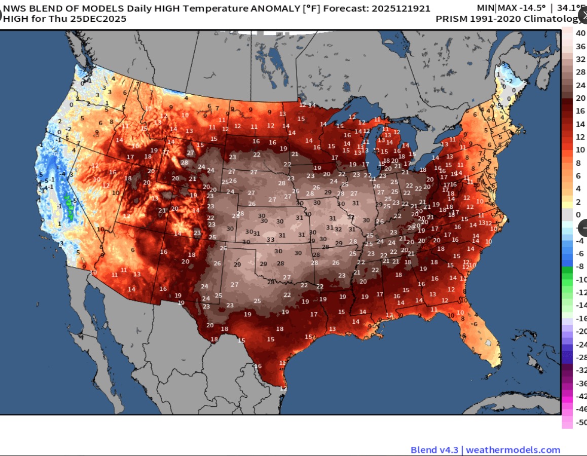
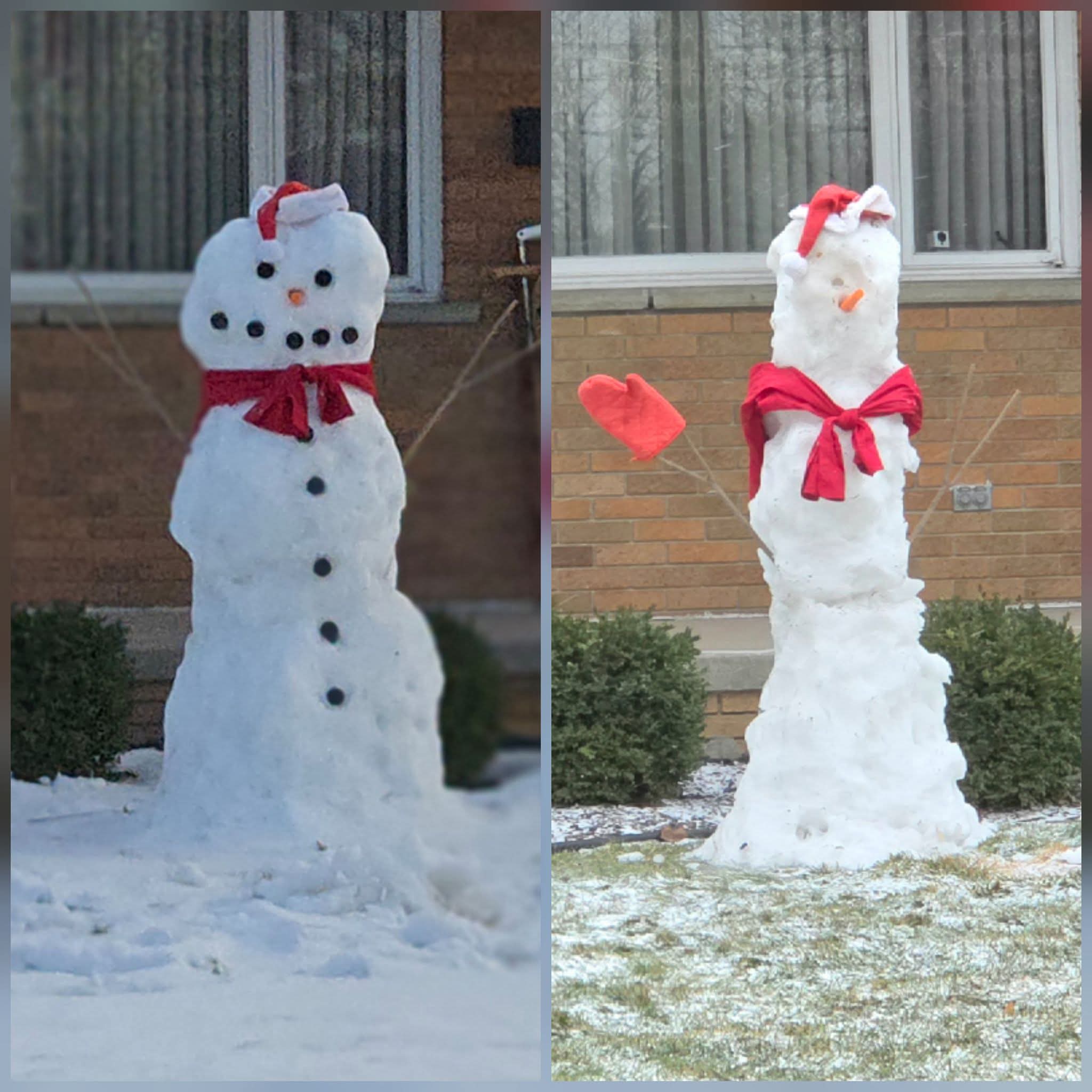
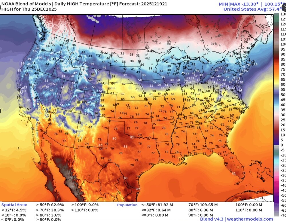
First time all of December we saw bare ground today (though we got a fresh dusting), neighbors snowman appears to be on ozempic. Im liking the look of both euro and cfs weeklies for January. Only christmas week appears hostile, and wouldn't you know it, the core of the warmth here will be Dec 25-26. The insane temp departures to the south won't make it to the north for long, but it certainly looks like a mild holiday week.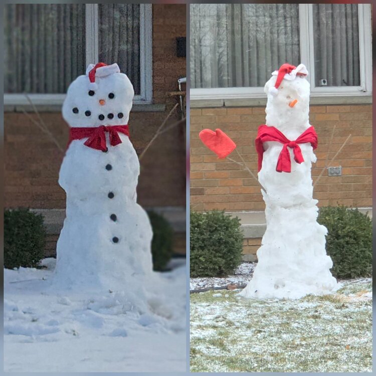
-
Max temp: 54° Rain: half inch Wind: meh Meltdown: yes
-

December 2025 regional war/obs/disco thread
Kitz Craver replied to Torch Tiger's topic in New England
Ryan’s 7day was pretty vomit worthy… -
That cold high to the southeast
-
In Rainthuen highest gust was 41...
-
Might be the first time in 16 years it’s snowed (even if just flurries) on my anniversary
-

Central PA Winter 25/26 Discussion and Obs
Voyager replied to MAG5035's topic in Upstate New York/Pennsylvania
Everywhere. It's totally messing up my afternoon/night. -
36/32 with flurries.
-
Like I was saying, only a matter of time before the torch reached the northeast. No snow or cold to be seen throuhh early January. We risk a January 2020 and January 2023 repeat imo. Save this
-
Winter 2025-26 Medium/Long Range Discussion
michsnowfreak replied to michsnowfreak's topic in Lakes/Ohio Valley
This doesn't remind me of 2022-23 at all. That was a brutal cold shot but it lasted like 5-7 days. We had a solid 3+ weeks of cold/snow in the region this time. And this break isn't necessarily going to last as long as some of these posts imply. Per both the euro and cfs weeklies the above avg temps are gone before the end of the first week of Jan in the Lakes (add one more seek for thr southern sub). And there will be fleeting snow chances before then. -

Winter 2025-26 Medium/Long Range Discussion
OrdIowPitMsp replied to michsnowfreak's topic in Lakes/Ohio Valley
22/23 was a good time at MSP 3rd snowiest winter on record - 90.3” 9th longest 1” consecutive snow depth streak - 117 days