All Activity
- Past hour
-
Lol recurving canes draw in Candian air. August looks to finish out without another bout of HHH
-
"TURN ON ANYTHING YOU'LL GET IT." "THIS PLACE SURE GONE CRAZY."
-
My micro-climate is now Mediterranean from mid-June to mid-August. Summer dry season due to lake shadow. Green grass isn’t a thing in this time period now. It never used to be so prominent, but lack of good forcing means geography dominates everything.
-
-
Limping?
-
Not a single mosquito tonight. Crickets songs are slowing. It's good to be alive.
-

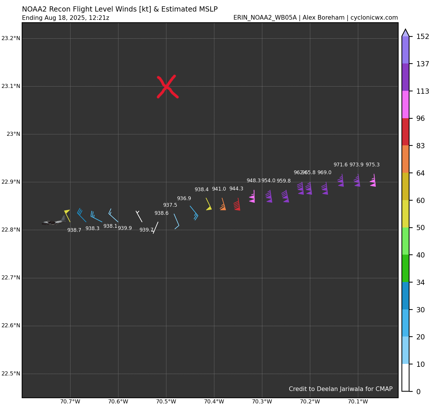
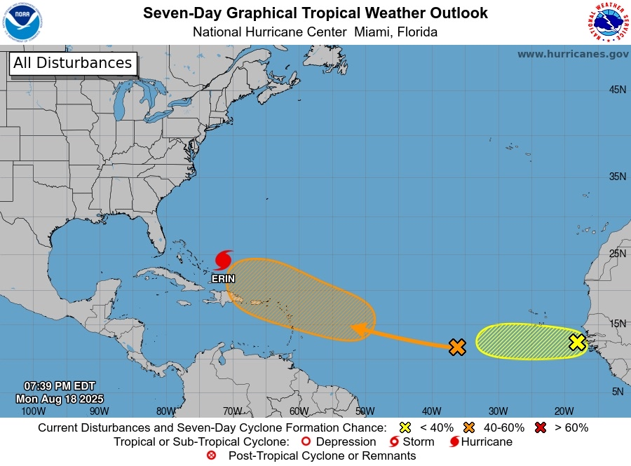
Hurricane Erin: 140 MPH - 937 mb - NW @ 10
ineedsnow replied to BarryStantonGBP's topic in Tropical Headquarters
recon shows it south of the 8pm advisory -

-
Officially uninstalled.
-

NEW DISTURBANCE: Central Tropical Atlantic (10/60)
MJO812 replied to BarryStantonGBP's topic in Tropical Headquarters
-
Thanks
-

Mid to long range discussion- 2025
WinstonSalemArlington replied to wncsnow's topic in Southeastern States
Pre-Labor Day -
NHC is to far north with the 8pm advisory according to recon
-
The clouds are crying over the lack of dews
-
Looks like the contrail is precipitating. Like those fall streaks you see out of wispy cirrus. Either that or it’s those damn govt chemtrails again.
-
Yup, more rain imby in 3 days than in the past 6 weeks
-
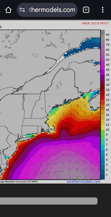
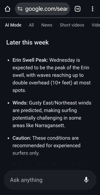
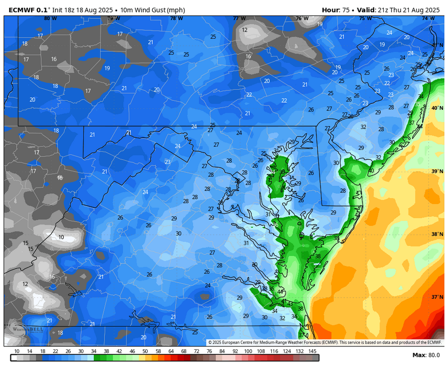
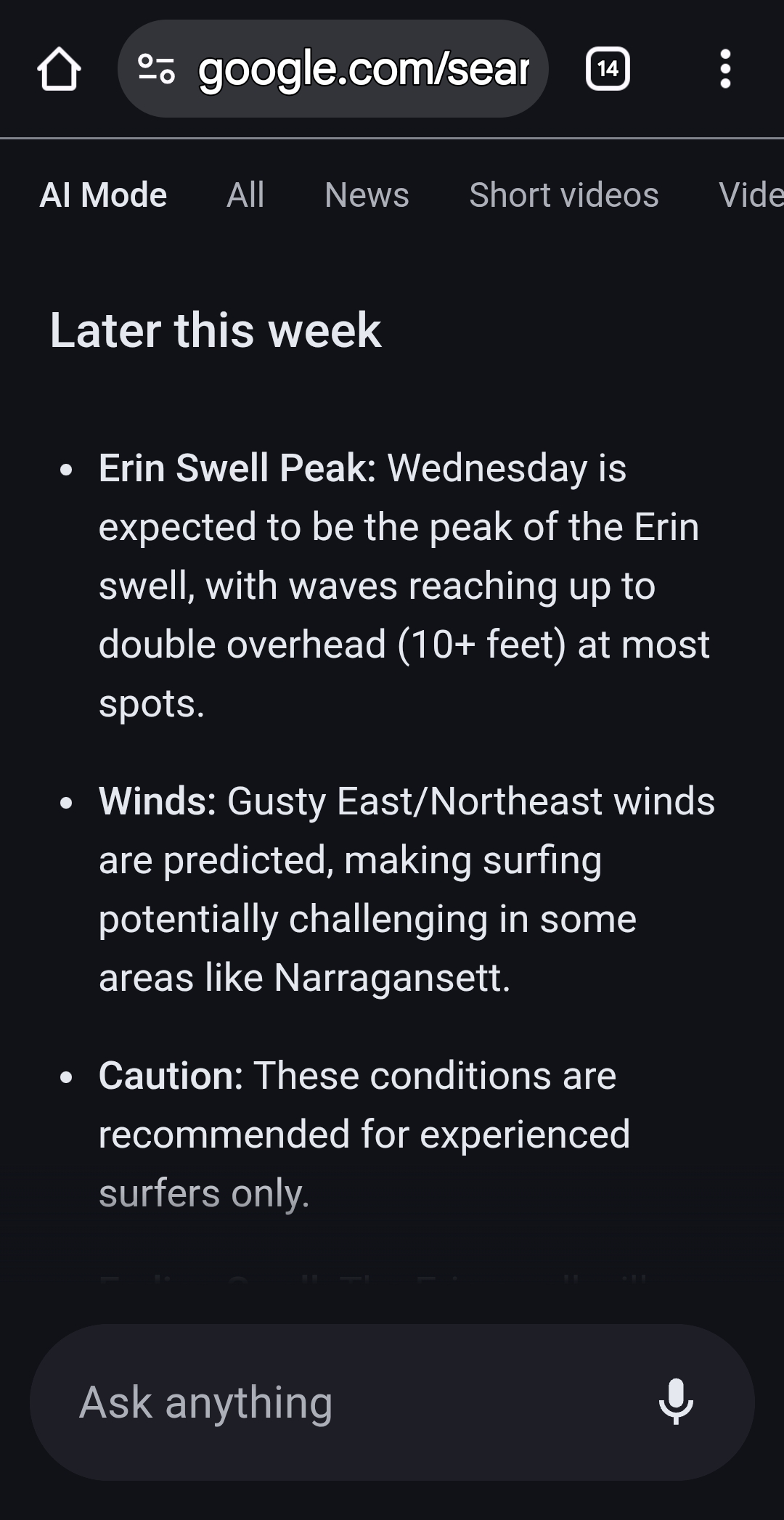
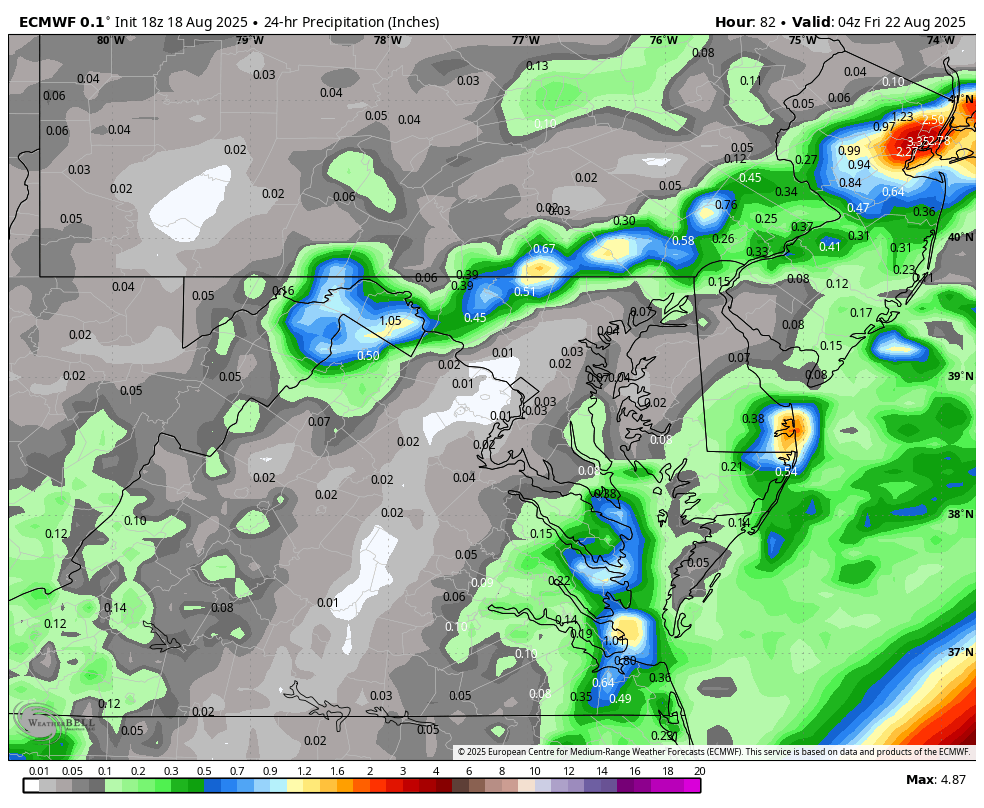
Thursday does not look like a good beach day...18Z EURO.

-

Hurricane Erin: 140 MPH - 937 mb - NW @ 10
Wannabehippie replied to BarryStantonGBP's topic in Tropical Headquarters
8:00 PM EDT Mon Aug 18 Location: 24.1°N 71.5°W Moving: NW at 10 mph Min pressure: 947 mb Max sustained: 130 mph Weakening a bit, and going NW now. -
I think they are actually called contrail cirrus or consistent contrail. The sky was covered with them late this afternoon out here. .
-
 Can I wish myself to reality? If so let’s go. But I want the pressure 930s. That’s an Irene NY pressure and that was nothing burger.
 -

-
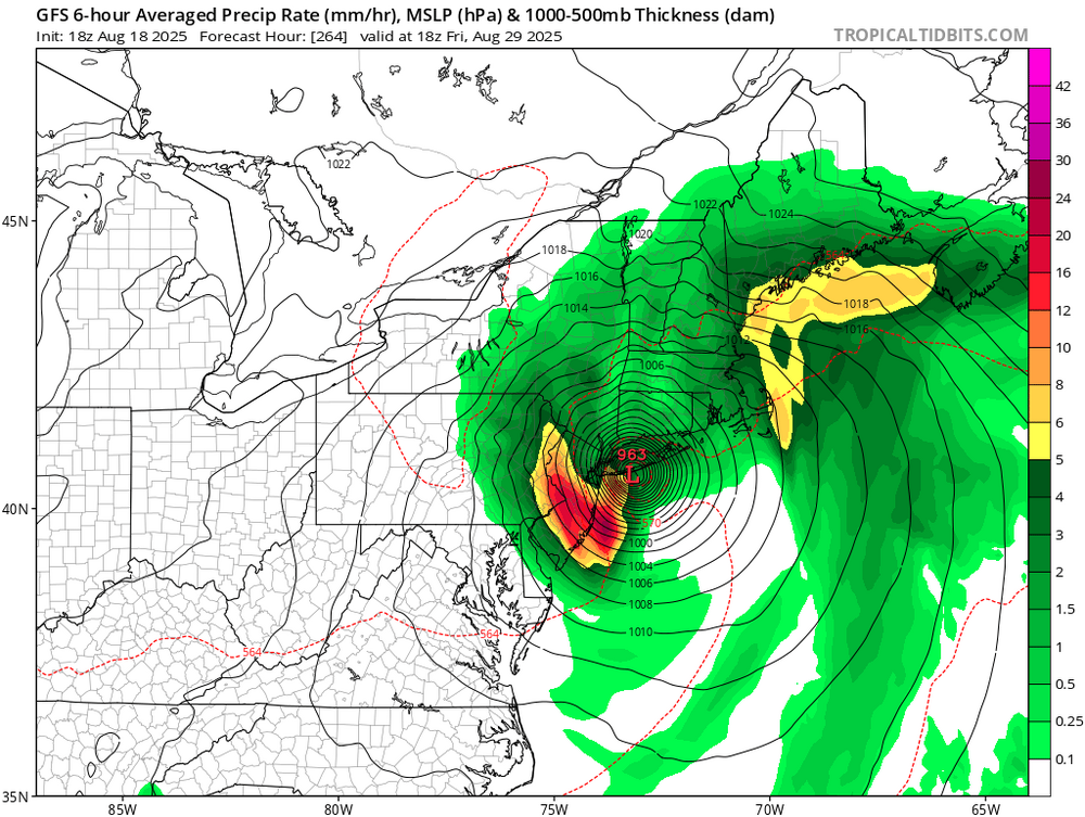
 Euro went crazy for Wednesday/Thursday. 3-5" now
 -
You know how in the winter .. models show a cold , snowy pattern. People are excited , slapping Coc k’s virtually etc.. and then slowly one by one the rug is pulled out .. the WAR stronger than modelled , models over estimating the trough etc. When that happens over the next few days for next week and beyond. The melts from ACATT are going to be awesome . Here’s a hint. Erin coming so far west .. much much farther than any model had ,, and Ferdinand next week .. tropics bring their environments north . The bumps will be so fun next week
-

Hurricane Erin: 140 MPH - 937 mb - NW @ 10
wthrmn654 replied to BarryStantonGBP's topic in Tropical Headquarters
Icon and euro AI for the win -
I know they have a name for every type of cloud. What the hell are these? Not sure I've seen them before. And no it's not a contrail.


.thumb.png.4150b06c63a21f61052e47a612bf1818.png)