All Activity
- Past hour
-
You love to see it https://x.com/bam_weather/status/1953762571917328395?s=46&t=dhcbvkjmRcyBVQtDxJ3lRg
-
 57.3 my low temperature.
 -
Last summer had a couple decent TS, after 2 years with meh. So far this warm season, we had one strike within 3 miles in May but no others within 5 miles. Only 4 days with any thunder so far, lowest thru this date since we moved here in 1998. The past 2 weeks have given us 0.03" RA and the Sandy River flow is below the 10th percentile.
-
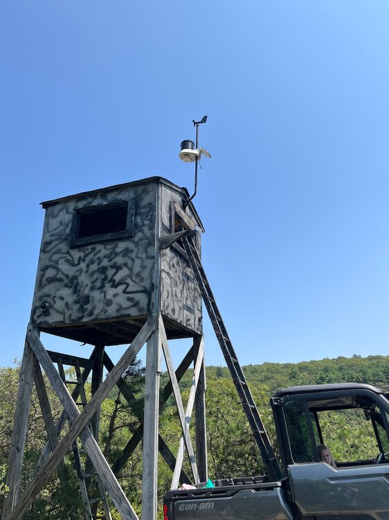
Haven’t posted in a while, but I thought this sub would be interested for future weather events, I installed a Kestrelmet 6000 cellular weather station on top of Schunnemunk Mountain. It’s at 1,450’ elevation. Should be interesting for wind gusts and elevation based temp differences in the winter! Link is below: https://ambientweather.net/share/6fLle4
-
 Might feel a little better with the westerly flow outcome honestly. I’d rather it 100/65 vs the 92/77 we have with the southerly flow. That way we maybe notch another 100 and the disgusting humidity is kept away. These 75-80 dews we get now are hideous.
 -
Hottest summer ever through October
-
Up until couple years ago, there was a 3yr stretch where we just didn't get any storms. Last summer was decent. This year, back to meh. Sent from my SM-S921U using Tapatalk
-
 57 here right now-feels great! Nice to see the big heat backing off too for next week (still hot though but 90 is better than 98)
 -
We 6z GFS
-
Man, even if there’s a bootleg cool down from Northeast winds, dews and heat come right back
-
Sell any cold front too
-
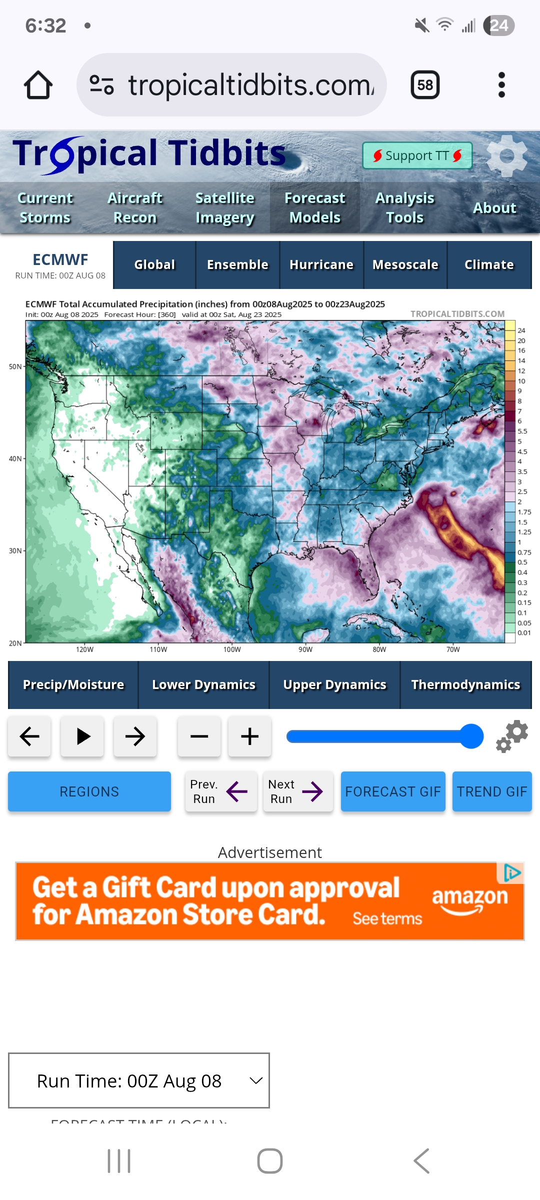
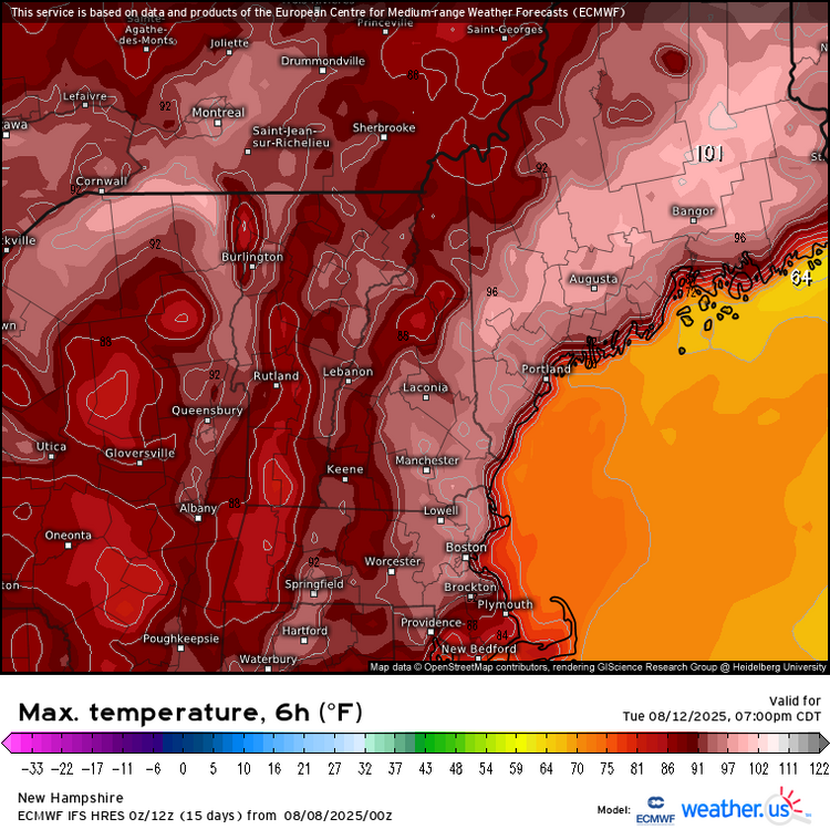
 Officially the coolest start to August since 2013 which was a nice break from the wall to wall heat since late June. Hoping the 0z Euro has a clue about the more onshore flow and the 100° heat misses to the north in Maine. But the GFS still has more westerly flow and gets the warm spots to 101° on Wednesday. We are one of the parts of the country where a small shift to more southerly flow can make the difference between 90s and low 100s. Time Series Summary for NEWARK LIBERTY INTL AP, NJ August 1-7 Average Temperature Click column heading to sort ascending, click again to sort descending. 2025-08-07 74.5 1 2024-08-07 81.7 0 2023-08-07 75.6 0 2022-08-07 83.1 0 2021-08-07 75.6 0 2020-08-07 78.7 0 2019-08-07 77.9 0 2018-08-07 82.2 0 2017-08-07 74.9 0 2016-08-07 75.8 0 2015-08-07 79.1 0 2014-08-07 75.9 0 2013-08-07 73.2 0 2012-08-07 80.4 0 2011-08-07 80.6 0 2010-08-07 79.9 0
 -
I have a feeling some others, won't be so optimistic about the heat. But i'm sure they'll sweat through it.
-
Down to 54 here-feels like fall. Unfortunately short lived.
-
always the safest bet.
-
Coldest August ever.
-
@Gawx
-
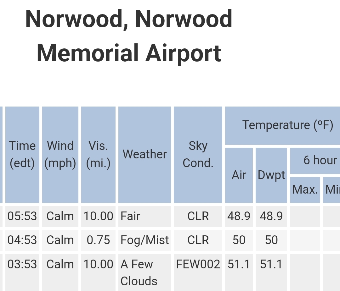
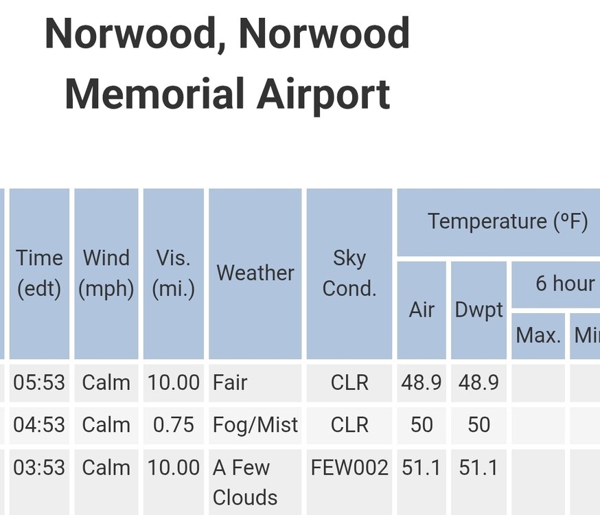
Fine you want to use Norwood.
-
Seeing the hazy look from the smoke driving around yesterday made me think of hazy/hot/humid weather back in the 70s and 80s, but the temp was cool. Weird! Looks like a beautiful stretch coming up -- until we cook next week
-
Loop it it's kind of funny.
- Today
-
14 day heat wave and desert Stein out the window on one run.
-

2025-2026 ENSO
so_whats_happening replied to 40/70 Benchmark's topic in Weather Forecasting and Discussion
I still find it very weird that we can use new baselines and the anomalies that are associated with them as facts (especially temps) but yet we use this chart above as fact taking out that baseline increase... https://psl.noaa.gov/map/clim/sst.anom.anim.week.html https://coralreefwatch.noaa.gov/data_current/5km/v3.1_op/animation/gif/ssta_animation_30day_large.gif -
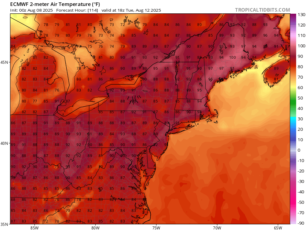
The 0z Euro backed off the 100° heat and has more onshore flow. But the GFS still has 101° heat on Wednesday. With the late July heatwave, the Euro had a cool bias and missed a few of the 100s that verified. Would be nice if this 0z Euro had a clue and the 100° heat misses to our north in Maine.

-
If anything, the -PMM has increased in strength…more support for a possible La Niña event this fall/winter:
-
Sky net and Euro in sync lol. Nice cold front day 7 on both. That's a change.