All Activity
- Past hour
-

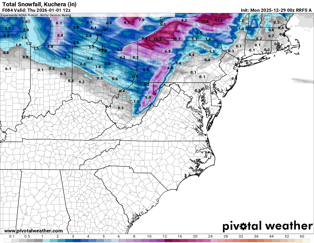
Ice Ice Baby December 28-29 Storm Discussion
MarkO replied to Baroclinic Zone's topic in New England
31.6 and rising.Good luck to the folks north of me. <<edit> lost power up north. -
To an extent this is true,but besides a NAO the first step is a good PNA in our parts , really some deception to East Tn to the West.TN,mountains im sure causes part of this,while the east wants to see a more stronger -NAO,it dont work like that from the close to the Cumberland to West it just leads with us with cold dry with cutters,compared to the east,we really live in a weird climo in Tn in winter,its really unusual to see the state wide snowfall at the sane time
-
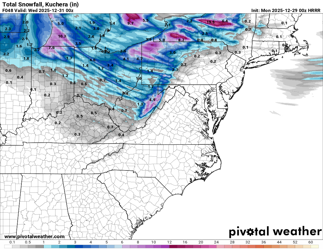
The period of snow showers/squalls along the trough axis that will swing southeast across lower MI/far northeast IN and northern OH during the day Monday will be accompanied by some impressive conditions...the temperatures will be cold enough for the relatively shallow snow showers to produce good dendrites, and winds will be gusting 45-55 MPH. The low levels will be unstable enough for the snow showers to have some convective component, so they'll be squally. The snow/blowing snow combination will be impressive for a 1-3 hour period. I'm guessing some snow squall warnings are a possibility.
-

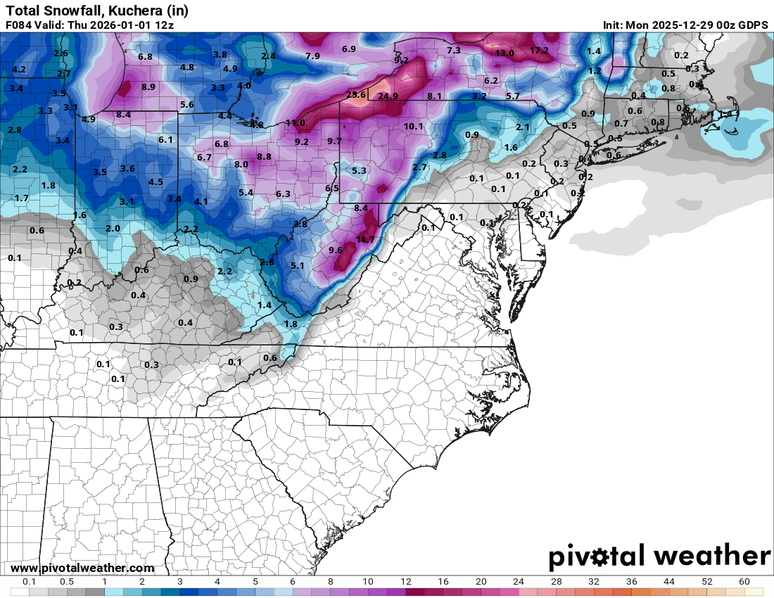
Ice Ice Baby December 28-29 Storm Discussion
Sugarloaf1989 replied to Baroclinic Zone's topic in New England
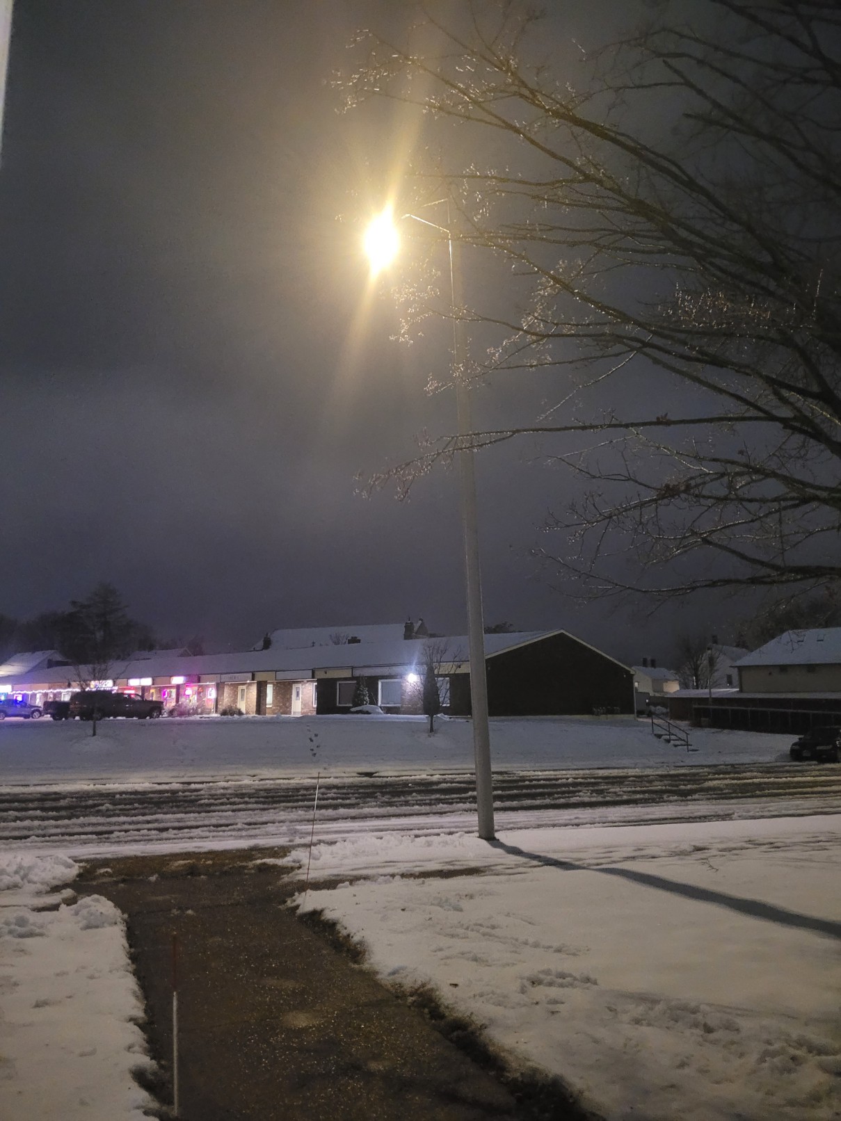
32F at 1am. Still ice covered trees. Forecast to be 33F at 2am. On December 2nd 2025. It stayed below freezing.
-
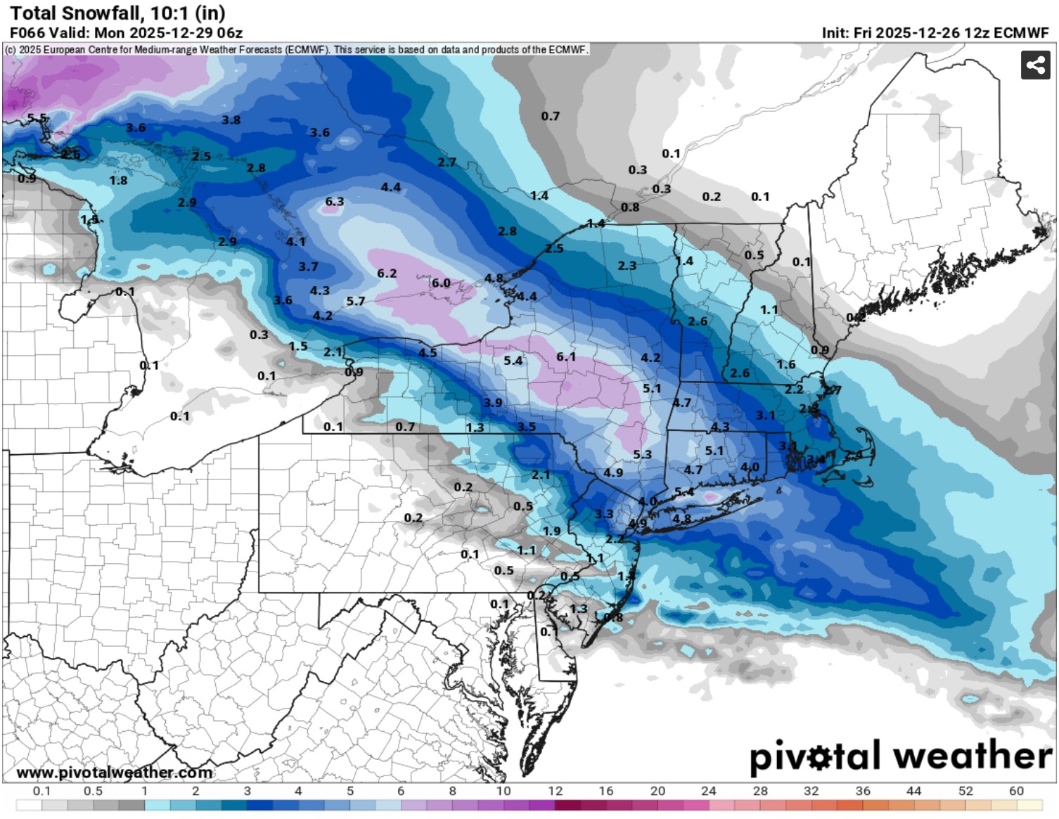
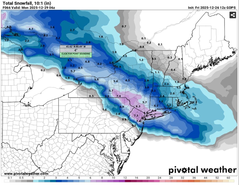
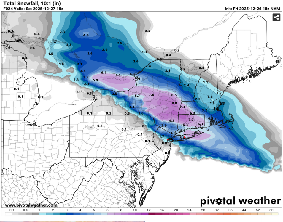
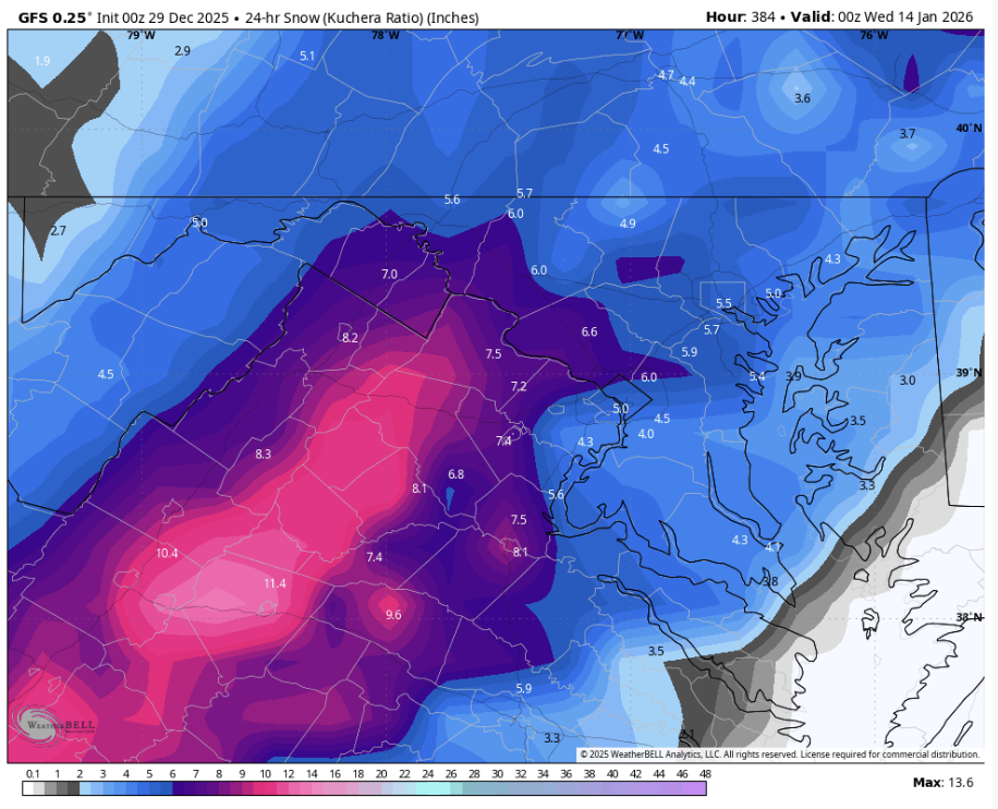
Not only did the NAM capture the gradient across our area better than all other models, it also correctly shifted north of the consensus days before the event. The ECM, for example, incorrectly still had snow in southern NJ overnight Thurs. As Don said, the NAM was an outlier during this time. BUT IT WAS CORRECT, which makes it even more impressive.
-

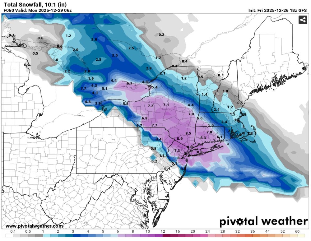
Ice Ice Baby December 28-29 Storm Discussion
dendrite replied to Baroclinic Zone's topic in New England
29.5° Driveway is icy, but a lot of standing water too. -
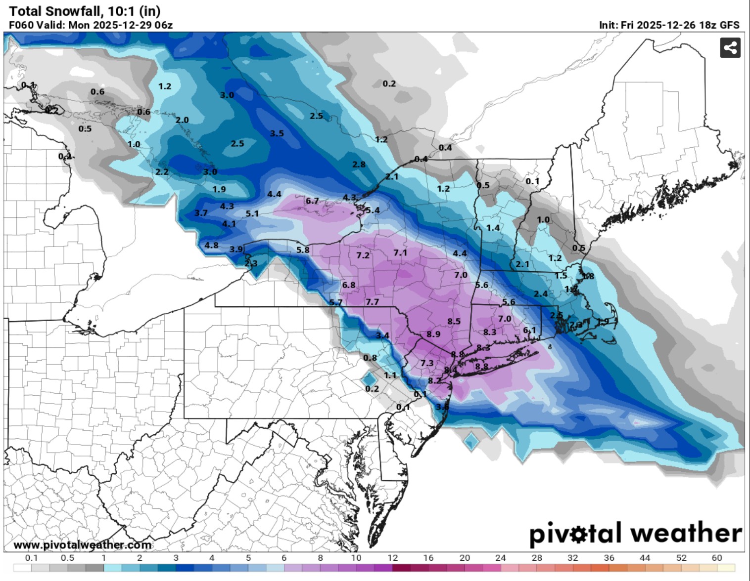
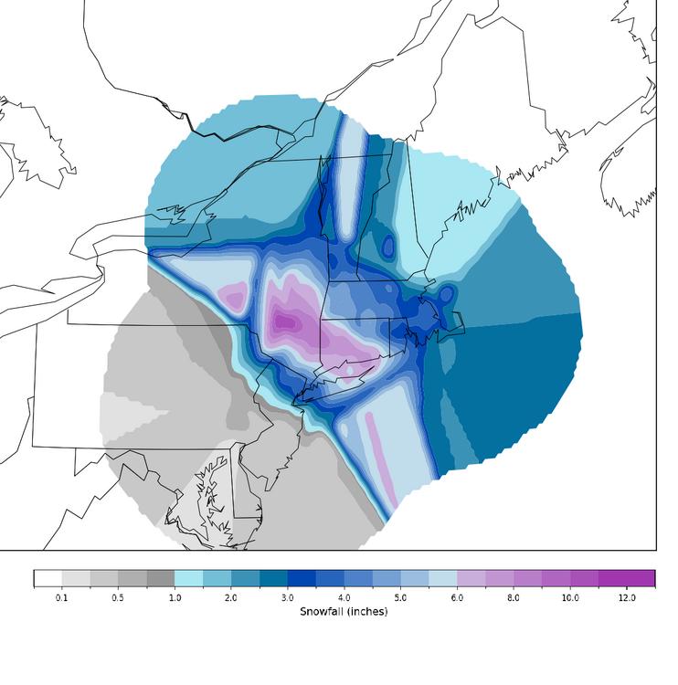
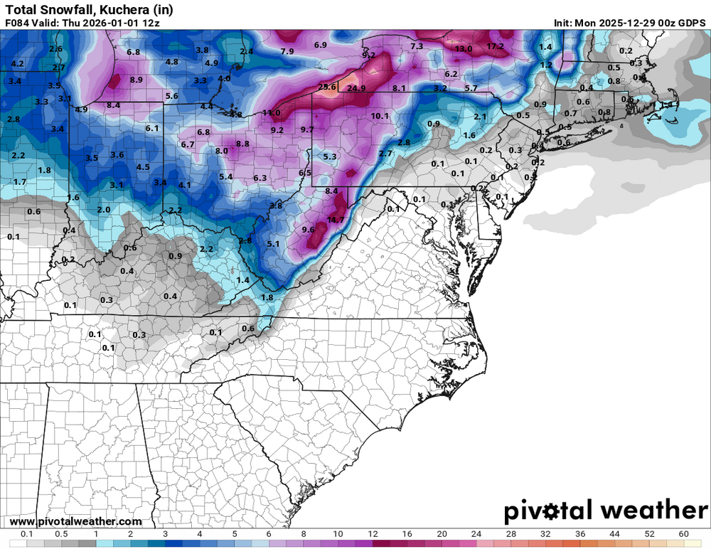
18z NAM (10:1) vs. interpolated and smoothed NWS reports (PHI, OKX, ALB, and BOS)
-
.thumb.png.4150b06c63a21f61052e47a612bf1818.png)
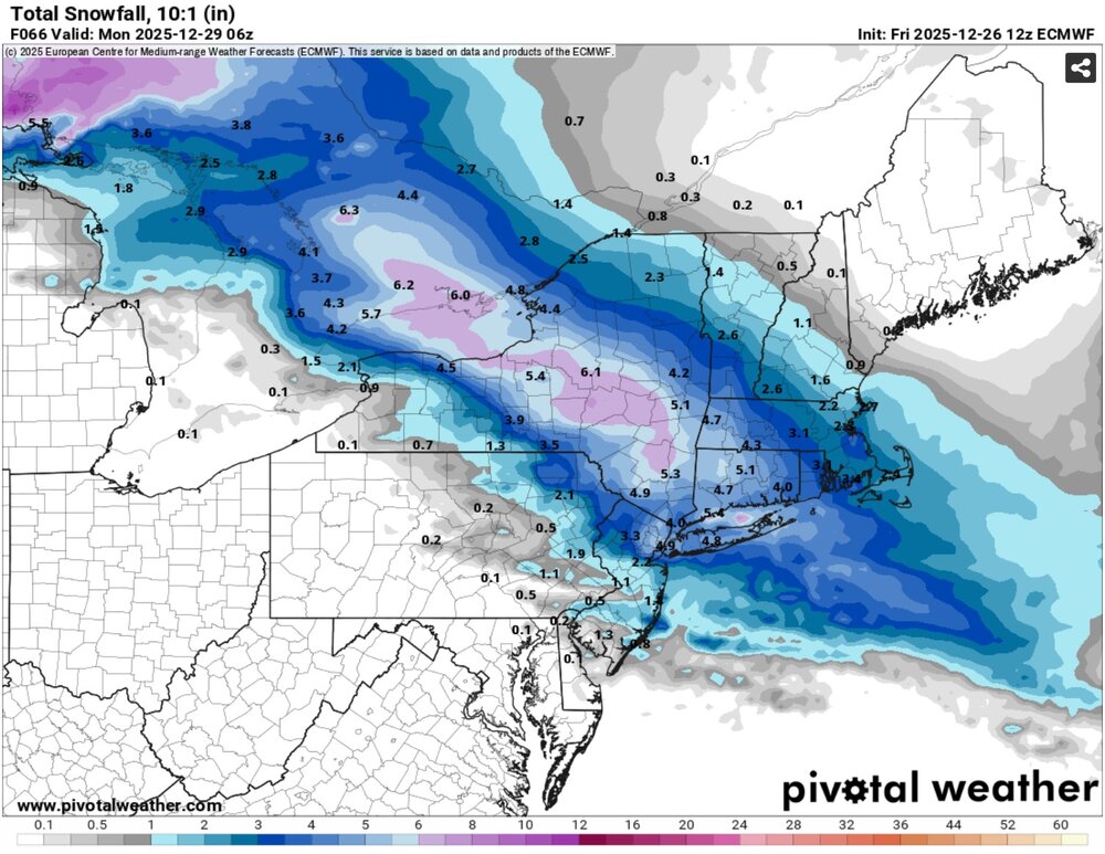
Ice Ice Baby December 28-29 Storm Discussion
HIPPYVALLEY replied to Baroclinic Zone's topic in New England
Up to 29F now. -

January 2026 regional war/obs/disco thread
WinterWolf replied to Baroclinic Zone's topic in New England
The fundamental building blocks of a very nice pattern are there….it’s a shame that you can’t seem to understand that. That’s all we need to know at this point..details TBD. -

Ice Ice Baby December 28-29 Storm Discussion
CoastalWx replied to Baroclinic Zone's topic in New England
32 with slippery patches for sure -
That makes sense. This is why I don’t answer the phone and delete all emails.
-
Ice Ice Baby December 28-29 Storm Discussion
CoastalWx replied to Baroclinic Zone's topic in New England
It’s 32. About to melt -
Ice Ice Baby December 28-29 Storm Discussion
dendrite replied to Baroclinic Zone's topic in New England
29.3° -ZR - Today
-
Yeah, exactly. Just looking at latest GEM it shows a big Storm but Thermals are marginal at best. Western US Ridge, Huge West based Gl Block but, big Thorn Vort over Alaska working in Tandem with the Gl HP in not allowing CAA into the States and pulling Canadian air to the Asian side. So, if enough cold could get in here under that monster -NAO ee would be in Business.
-
i think their pregame stuff starts at 7pm ET
-
It really was, a full 6 degrees above the old monthly record!
-
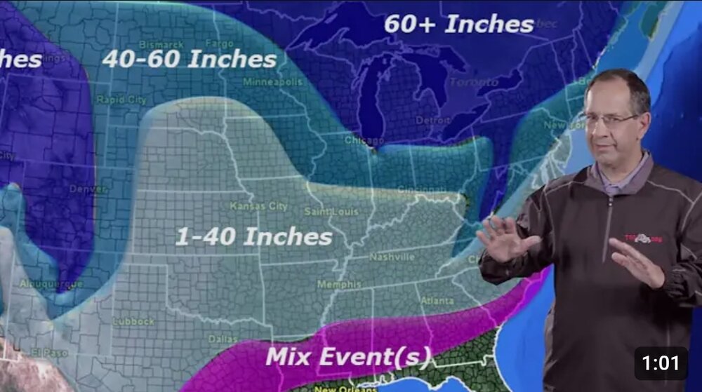
So we’re out to January 14 now? Noted
-
The NBC crew tonight said it was at 7, which I assumed was true since it’s on their network. But no. It’s 820
-

Pittsburgh/Western PA WINTER ‘25/‘26
colonel717 replied to Burghblizz's topic in Upstate New York/Pennsylvania
Gonna be some nice squalls then Canadian likes the clipper.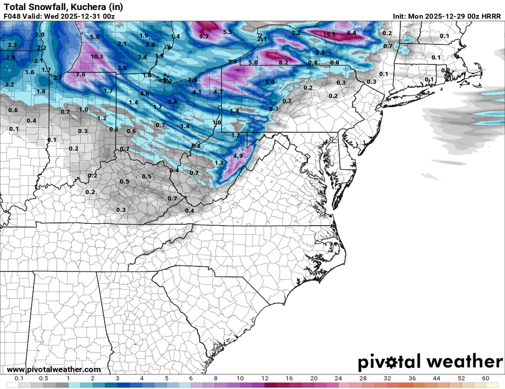

-
4-8" with @SnowenOutThere and crew getting about a foot. I'd take this, and most people would be ecstatic with this except Ji.
-
I dunno,its just what i see now but planetary waves can disrupt the pattern,its nothing like equatorial waves
-
That Alaskan Thorn . That Menace needs booted out.
-
-
Ice Ice Baby December 28-29 Storm Discussion
Sugarloaf1989 replied to Baroclinic Zone's topic in New England
32F here past midnight with freezing rain. Snowpack is ice covered.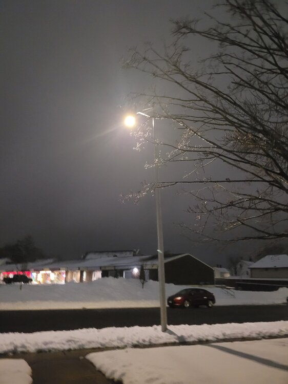
-
The end of the GFS is a nice snowstorm and then we somehow mix on I-95.