All Activity
- Past hour
-

E PA/NJ/DE Summer 2025 Obs/Discussion
Kevin Reilly replied to Hurricane Agnes's topic in Philadelphia Region
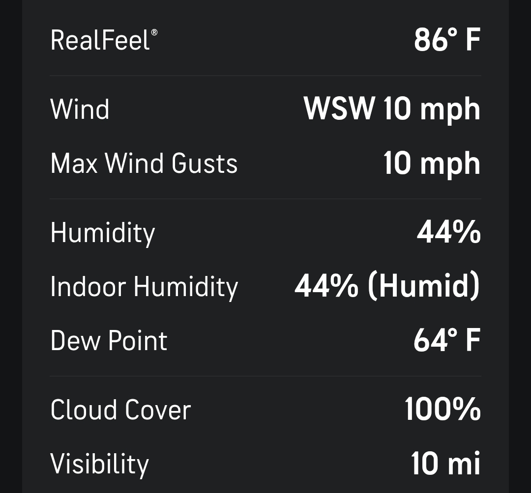
Light to moderate rain some left over lightning and loud thunder. 69f humidity 97% dew point 69f Total rainfall: 2.52" -
Been raining here since 630 and there was an earlier round this afternoon. Radar estimates have me at over 2” with areas just south and east in the 3-5” range.
-

July 2025 Obs/Disco ... possible historic month for heat
DavisStraight replied to Typhoon Tip's topic in New England
Hartford has a high amount of sightings for some reason. -

E PA/NJ/DE Summer 2025 Obs/Discussion
BBasile replied to Hurricane Agnes's topic in Philadelphia Region
Just an example of why some locations measure more rain than others (mine) lol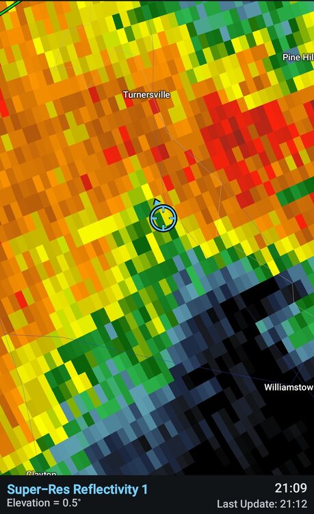
-
July 2025 Obs/Disco ... possible historic month for heat
DavisStraight replied to Typhoon Tip's topic in New England
I had a big bear in my yard two weeks ago, first time I've ever seen one in my neck of the woods, looked at me and my pup and just went on his way. -
.1” rain this evening. Just light stuff here - the heavy was south.
-

July 2025 Obs/Disco ... possible historic month for heat
CoastalWx replied to Typhoon Tip's topic in New England
That’s a lot of convection to the south. Hopefully not robbing the moisture. -
E PA/NJ/DE Summer 2025 Obs/Discussion
BBasile replied to Hurricane Agnes's topic in Philadelphia Region
Well, it's raining. -

July 2025 Obs/Disco ... possible historic month for heat
Torch Tiger replied to Typhoon Tip's topic in New England
Dry evening, take -

July 2025 Obs/Disco ... possible historic month for heat
HoarfrostHubb replied to Typhoon Tip's topic in New England
1.10” so far today. Most of that was this morning. -
Highs:EWR: 97TEB: 94LGA: 93BLM: 91New Brnsck: 91PHL: 91NYC: 90ACY: 89TTN: 89JFK: 88 * no intra hour ISP: 88
-
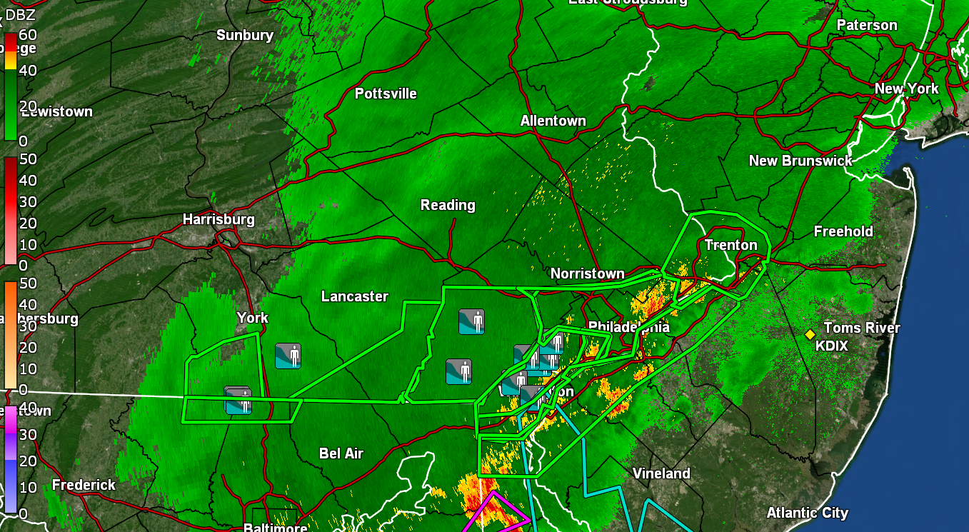
Crazy storm here Tornado Warning issued July 9 at 8:46PM EDT until July 9 at 9:15PM EDT by NWS Mount Holly NJ TORPHI The National Weather Service in Mount Holly NJ has issued a * Tornado Warning for... Southwestern New Castle County in northern Delaware... Northeastern Kent County in northeastern Maryland... * Until 915 PM EDT. * At 845 PM EDT, a severe thunderstorm capable of producing a tornado was located over Delaney Corner, or 10 miles south of Middletown, moving northeast at 20 mph. HAZARD...Tornado. SOURCE...Radar indicated rotation. IMPACT...Flying debris will be dangerous to those caught without shelter. Mobile homes will be damaged or destroyed. Damage to roofs, windows, and vehicles will occur. Tree damage is likely. * Locations impacted include... Middletown, Massey, Delaney Corner, and Townsend. Instructions TAKE COVER NOW! Move to a basement or an interior room on the lowest floor of a sturdy building. Avoid windows. If you are outdoors, in a mobile home, or in a vehicle, move to the closest substantial shelter and protect yourself from flying debris. Tornadoes are extremely difficult to see and confirm at night. Do not wait to see or hear the tornado. TAKE COVER NOW! Torrential rainfall is occurring with this storm, and may lead to flash flooding. Do not drive your vehicle through flooded roadways.
-

July 2025 Discussion-OBS - seasonable summer variability
SACRUS replied to wdrag's topic in New York City Metro
Highs: EWR: 97 TEB: 94 LGA: 93 BLM: 91 New Brnsck: 91 PHL: 91 NYC: 90 ACY: 89 TTN: 89 JFK: 88 * no intra hour ISP: 88 -

E PA/NJ/DE Summer 2025 Obs/Discussion
Hurricane Agnes replied to Hurricane Agnes's topic in Philadelphia Region
My rain rates have gradually increased to almost 1"/hr give or take, as the heaviest, and now back down to about 1/3"/hr and currently have 0.53" in the bucket at post time. Temp down to 74 with dp 73. Most of the current heavier returns have moved to my east. Looks like a TOR up in DE.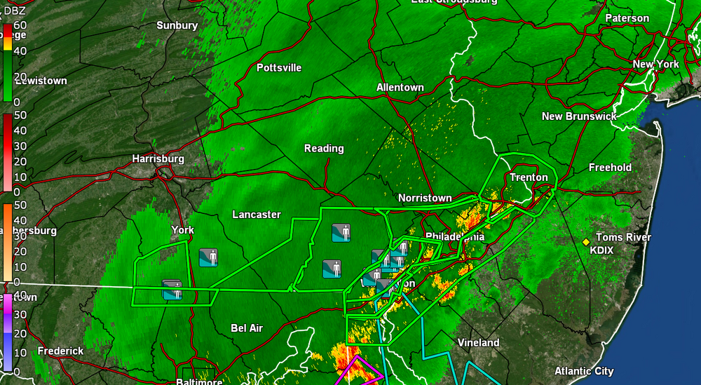
-

E PA/NJ/DE Summer 2025 Obs/Discussion
Violentweatherfan replied to Hurricane Agnes's topic in Philadelphia Region
That’s twice now in the past two days lower bucks get hit. Straight up 95 to Trenton -

July 2025 Obs/Disco ... possible historic month for heat
Damage In Tolland replied to Typhoon Tip's topic in New England
Just give us some more lightning . Folks who need the rain can take it -
Closest pws to us in Del Ray was 1.38.
-

July 2025 Discussion-OBS - seasonable summer variability
Stormlover74 replied to wdrag's topic in New York City Metro
What storms? They're all south of us -

July 2025 Discussion-OBS - seasonable summer variability
steve392 replied to wdrag's topic in New York City Metro
Even with all this rain and sticky air feeling, how is my humidity this low?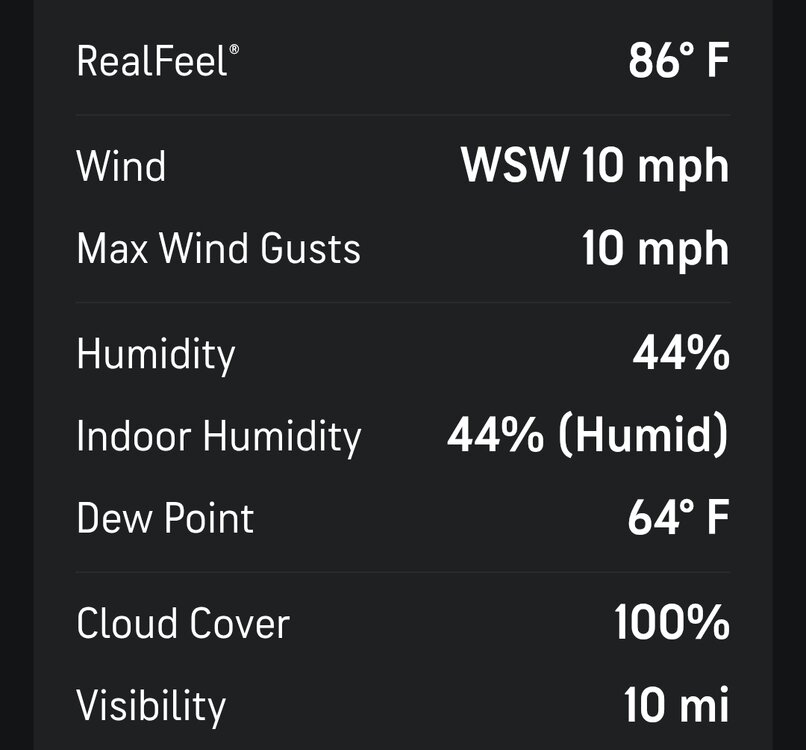
-

July 2025 Obs/Disco ... possible historic month for heat
metagraphica replied to Typhoon Tip's topic in New England
Of course it fizzled out right overhead. -
.91” for the day per mesonet
-

July 2025 Obs/Disco ... possible historic month for heat
ineedsnow replied to Typhoon Tip's topic in New England
meet in the middle? -
July 2025 Discussion-OBS - seasonable summer variability
steve392 replied to wdrag's topic in New York City Metro
Storms falling apart for nenj.... Again. I really wish I could understand what happens in the atmosphere that this happens as it approaches Bergen County. -

2025 Atlantic Hurricane Season
BarryStantonGBP replied to BarryStantonGBP's topic in Tropical Headquarters
now here's a storm2k post I actually agree with -

July 2025 Obs/Disco ... possible historic month for heat
Ginx snewx replied to Typhoon Tip's topic in New England
18Z Euro has .8 here