All Activity
- Past hour
-
A beautiful 55 degrees this morning.
-
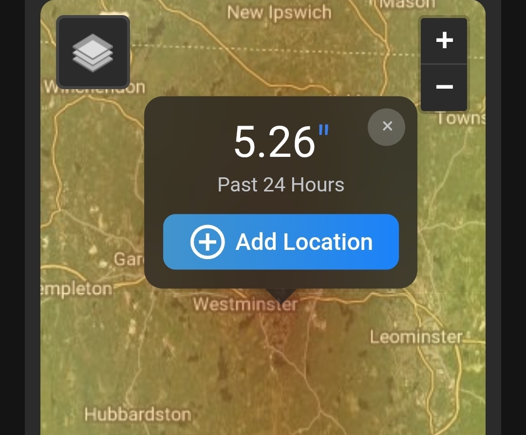
1.94" overall since the early morning hours yesterday. MTD: 7.39"
-
 Generic Viagra online and Viagra online price cheap viagra https://hr.bjx.com.cn/go.aspx?u=http://medmennews.com Generic Viagra for sale and https://mantiseye.com/community/jhihiwafjg buy viagra here [url=http://alfachat.ru/exit.php?linkurl=medmennews.com]Viagra without a doctor prescription Canada[/url] Viagra online price or [url=http://la-maison-des-amis.com/user/vlkjltuxqy/]viagra canada[/url] Cheap generic Viagra online
 -
Looks more high dew type stuff than 95+ heat.
-
 Some sneaky big totals up near you. How much did you get?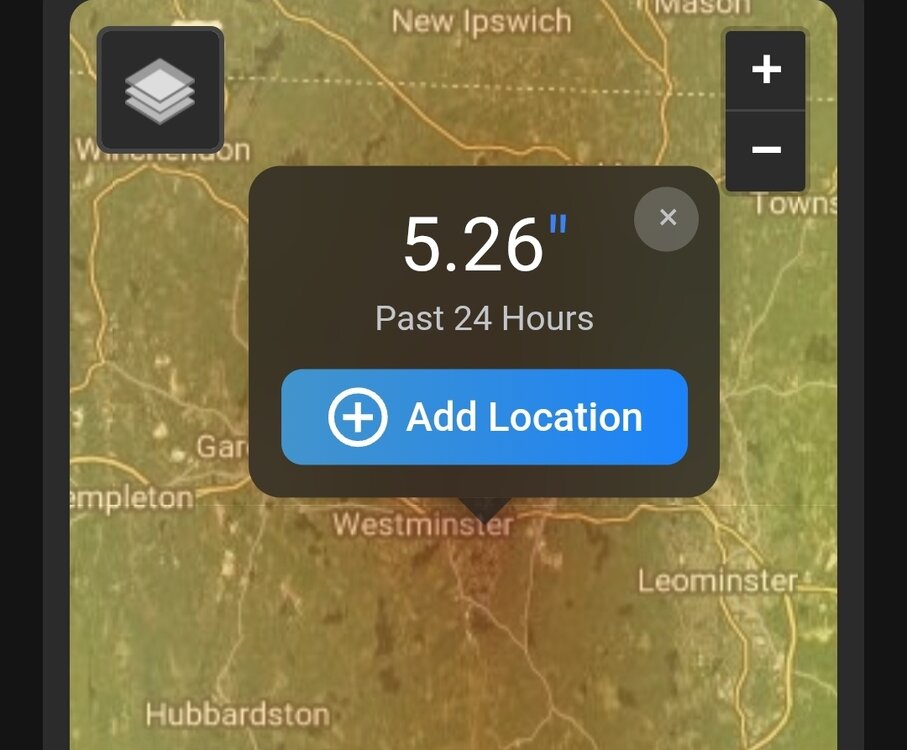
-
RIP winter 2026-2027...we never even knew ya. Quick @Weather Will post up that CFS DJF prediction to steer us back toward the light. Or somebody post up the latest JB tweet to give us hope.
-
 Should be some good downpours again later on..
 -

2026-2027 Super El Nino
snowman19 replied to Stormchaserchuck1's topic in Weather Forecasting and Discussion
Comparison of the difference in SSTs, last summer to this summer, same time frame….huge wow, night and day, not just at ENSO, but the +PMM as well. You can also see the IOD flip to positive with the big cooling in the eastern IOD region around Indonesia, not shown but there has also been very substantial warming in the western IOD region -

Central PA Summer 2026 Discussion/Obs Thread
mahantango#1 replied to Voyager's topic in Upstate New York/Pennsylvania
-
Not too much more last night. Total now 1.55 in southborough and 0.96 in Sherborn.
-
 Ha some decent rains and thunder WoR again last night. Good soaking here last evening and overnight.
 - Today
-
Viagra without a doctor prescription Canada: Viagra generic over the counter - Viagra online price
-
 3.2" storm total in the Holyoke Highlands so far. Mostly fairly slow steady rain, with a couple good downpours to check out the gutters and sewer backflow valve..
 -
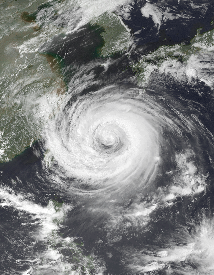
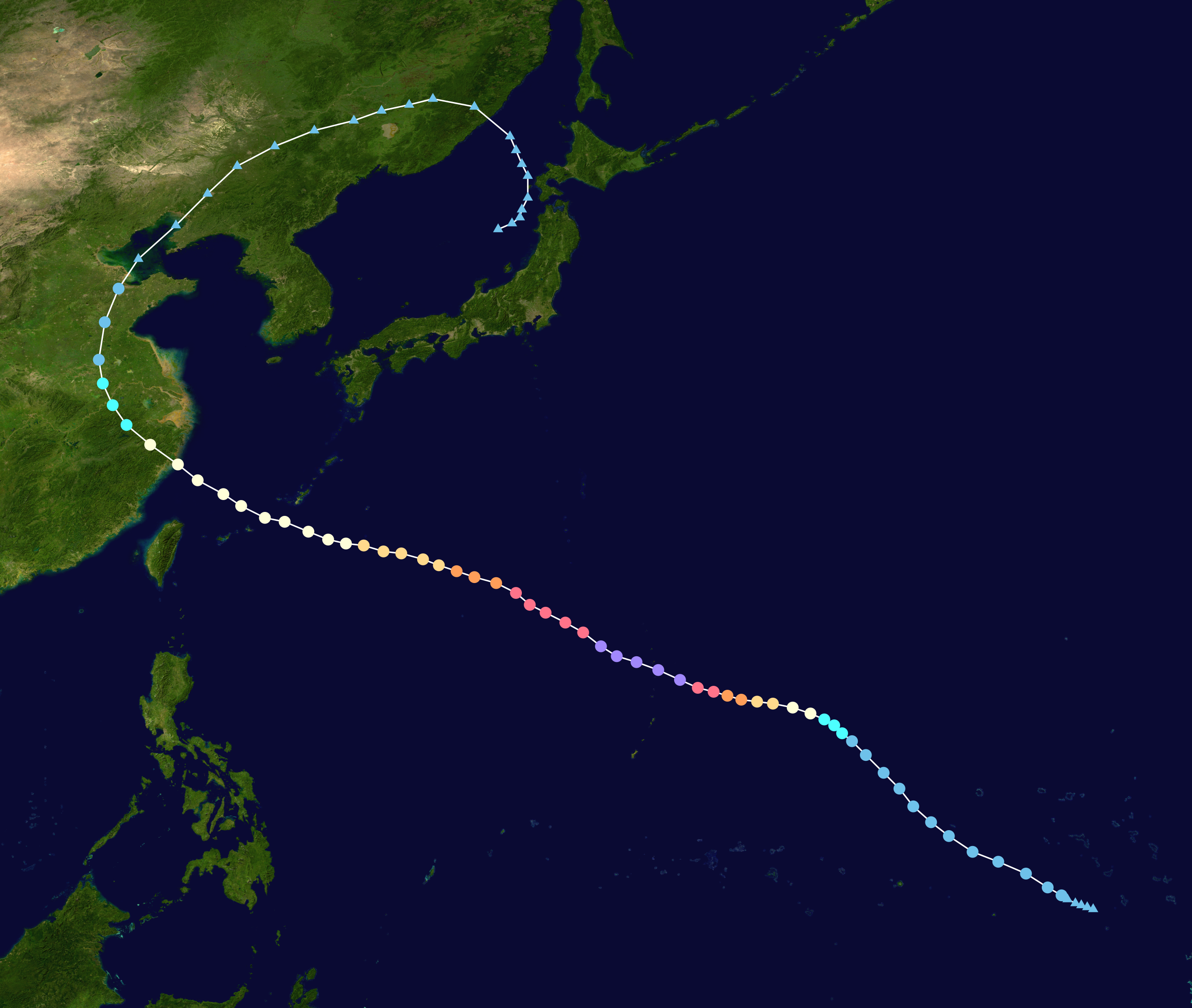
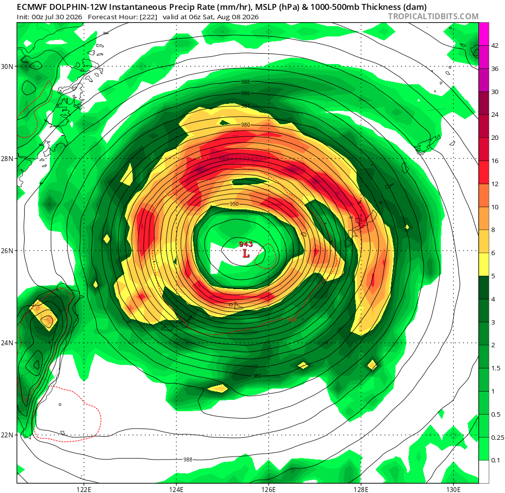
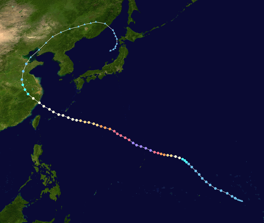
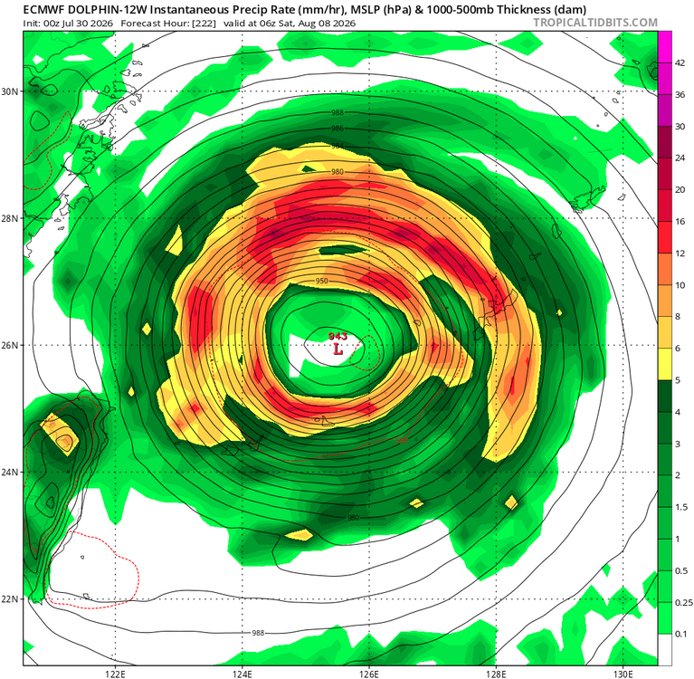
 Since Dolphin has already peaked twice and another ERC imminent it seems, the storm will continue to expand in size overall, and it may undergo another ERC. All along, it is slowly gaining latitude. What this means is that despite the very low pressures shown once it gets to the RODN and ZSSS areas, the storm will almost certainly expanded even more w/ a very large eye. The ECMWF shows this well. Take a look at its 222 hr (yes, I know this is way out, but model agreement is excellent as to the large-scale pattern as to Dolphin's track). The eye is about 120 nm in diameter! This is not unreasonable and has happened many times for long-tracked TC in the NWPAC. STY Winnie in 1997 is among the most classic examples. It had a 200 nm eye when it approached China! See attachments. The point being once a TC has maxed out in the deep tropics, it is very difficult for it to attain that same kind of intense status again b/c 1) ERCs expand the storm progressively, and 2) as you gain latitude, Coriolis increases which results in a decrease in max tangential wind speeds and acts to expand the TC. So the TC often has the same net energy as a Cat 5, but it is much more spread out, so winds may only be Cat 3. Also, Dolphin may become an annular hurricane, which is a stable status where the eye is quite large, and there is almost no banding. It looks like a truck tire w/ stark symmetry. https://en.wikipedia.org/wiki/Annular_tropical_cyclone TC Winnie 1997 https://x.com/WxPatel/status/1416591836504862720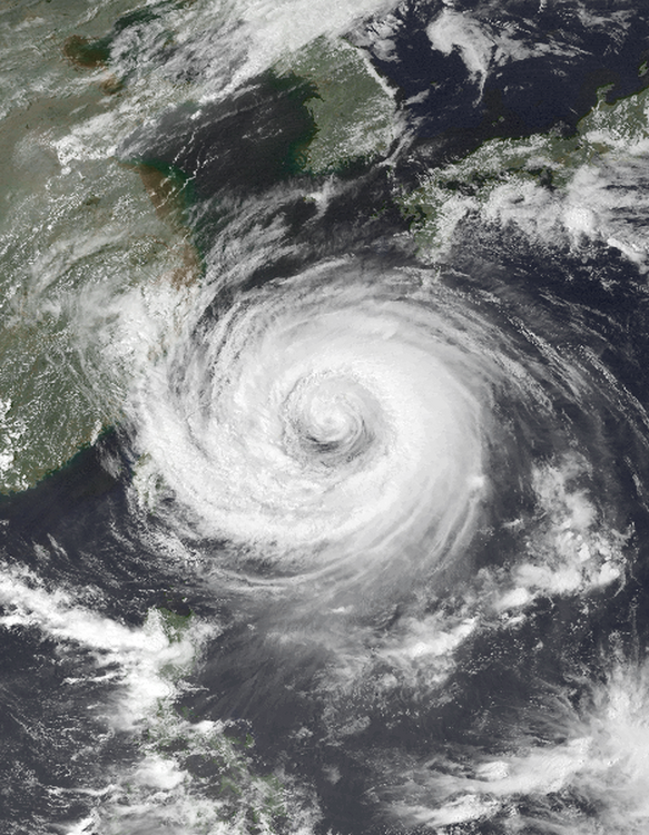
-
viagra canada [url=http://medmennews.com/#]Med Men News[/url] generic sildenafil
-
https://medmennews.com/# over the counter sildenafil viagra canada
-
Cheapest Sildenafil online: MedMenNews - Generic Viagra online
-
Sildenafil 100mg price: MedMenNews - Cheap Viagra 100mg
-
Thanks. It has to be rare.
-
Tornadic waterspout is the answer: A tornadic waterspout is a true tornado that forms over water or moves from land to water. It develops downward from a severe thunderstorm, bringing high winds, large hail, and lightning. [1, 2, 3]
-
buy Viagra online: Med Men News - Viagra online price
-
The supercell started in Richmond, VA. Dropped a tornado on the James river. Could have been anywhere.
-
"Tornadic waterspouts", also accurately referred to as "tornadoes over water", are formed from mesocyclones in a manner essentially identical to land-based tornadoes in connection with severe thunderstorms, but simply occurring over water.[22] A tornado which travels from land to a body of water would also be considered a tornadic waterspout.[23] Since the vast majority of mesocyclonic thunderstorms in the United States occur in land-locked areas, true tornadic waterspouts are correspondingly rarer than their fair-weather counterparts in that country. https://en.wikipedia.org/wiki/Waterspout
-
 1.22 today