All Activity
- Past hour
-
 smoke every year is the new norm eh can't remember having to deal with this prior to the last few years.
 -
 Nice blue sky here but that won’t be lasting for much longer.
 -

2026 Atlantic Hurricane Season
Windspeed replied to Stormchaserchuck1's topic in Tropical Headquarters
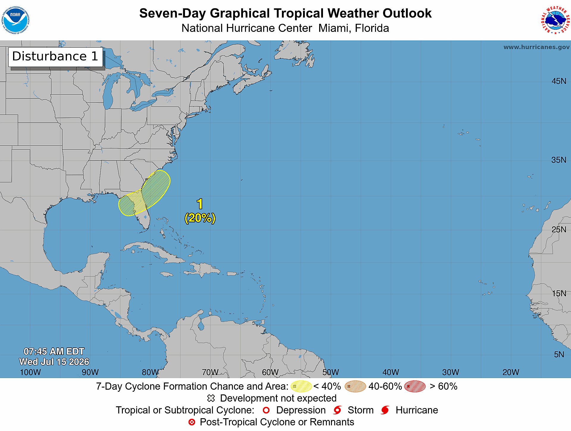
Potential surface disturbance in the NE GOM is still hinted by ensembles. But realistically, any surface low would need steering currents to remain weak to gain development time and any potential vorticity to resolve away from land for something substantial to form. -
 I hope one of these works out for us
 -
Pittsburgh PA Summer 2026 Thread
RitualOfTheTrout replied to TheClimateChanger's topic in Upstate New York/Pennsylvania
Today is the best shot, afterwards ridge shifting back west and wildfire smoke probably put a cap on extreme heat. -
 Be curious to see where we end up with for temperatures today. I don't think statistical guidance (MOS/NBM) factor in smoke so you almost have to guess how much to take off them for temps. Almost may have to subtract something like 7-12F
 -
The trough in the east should quickly pull whatever develops down here northward. Maybe 1-1.5 days over water in the northeastern Gulf
-
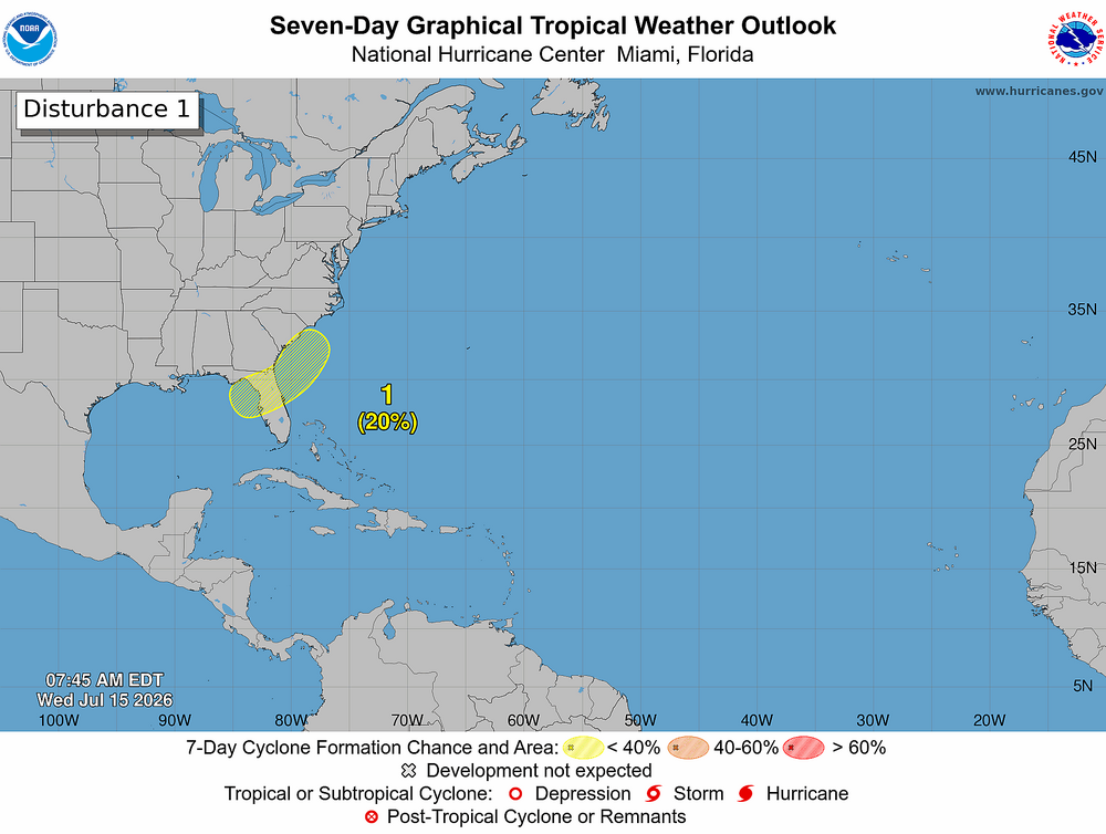
Northeastern Gulf of America: An area of low pressure is expected to form during the weekend over the northeastern Gulf of America. Subsequent slow development of this system is possible while it moves slowly northeastward over the northeastern Gulf and or near the southeastern coast of the United States by early next week. * Formation chance through 48 hours...low...near 0 percent. * Formation chance through 7 days...low...20 percent.
-
well modeled looks like we wait until the weekend
-
 It may be more yellow than yesterday right now. Love it. Clean air is working into NNE though.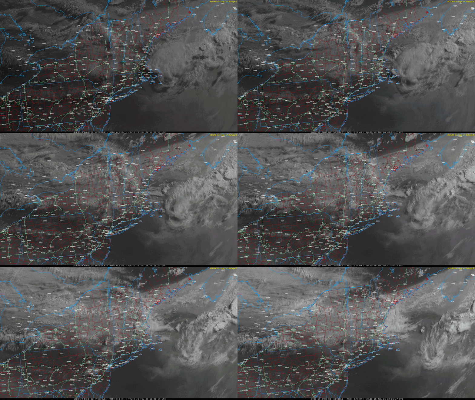
-

Central PA Summer 2026 Discussion/Obs Thread
Elim72 replied to Voyager's topic in Upstate New York/Pennsylvania
It's another one of those days.
-
Nope, this was never a thing growing up. It's almost like... something's changing with the climate and it makes these events more likely.
-
Just went outside and the smoke smell is thick and there's a coating of fine ash on everything.
-
Smokey and Very HOT Today !
-
-
Bottomed out at 76 here, up to 82/72 now
-

Central PA Summer 2026 Discussion/Obs Thread
mahantango#1 replied to Voyager's topic in Upstate New York/Pennsylvania
-
 Not even a drop of rain here.
 -
Central PA Summer 2026 Discussion/Obs Thread
mahantango#1 replied to Voyager's topic in Upstate New York/Pennsylvania
-
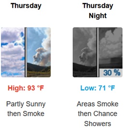
This will be one of the most important smoke forecasts in recent years. Areas south of the smoke are forecast to get to 100°-103°. Parts of the region where the smoke is thickest will have very poor air quality with temperatures in the 80s.
-
 80 by 8 most of the local weather stations are reporting low 80s already
 -
Really wondered what would have happened if we didn't have the influences of the smoke yesterday.
-
 Excellent! Burning eyes and asthma baby!
 -
They made it all the way to southern NH and then disappeared
-
Tomorrow looks like it will be very bad for smoke...even worse than today