All Activity
- Past hour
-

Occasional Thoughts on Climate Change
donsutherland1 replied to donsutherland1's topic in Climate Change
Given the literature, a climate change contribution appears likely. As I replied to Larry, that doesn't mean that climate change was the main or leading cause. A lot more research will be needed for that determination, as well as to estimate the magnitude of climate-related contribution. Your theoretical point is a fair argument. My conclusion is based largely on the body of literature. -
Occasional Thoughts on Climate Change
donsutherland1 replied to donsutherland1's topic in Climate Change
Climate change is likely a contributing factor. It's too soon to know whether it was the main cause. A lot for research will be needed to pin down the main cause. The only thing that appears extremely unlikely given the literature is Martz's contention that it had no impact. -

Septorcher 2026 Discussion - Endless Summer
dendrite replied to Damage In Tolland's topic in New England
I like how it generated a new state in northern FL. -
 medication in mexico and mexico pharmacy order from mexico https://www.google.gr/url?sa=t&url=https://mexiph.com farmacia online usa and https://www.liveviolet.net/user/rnmyqmtfxe/videos mexico city pharmacy [url=https://images.google.com.co/url?q=https://mexiph.com]online drugs order[/url] mexican rx pharm or [url=https://lifnest.site/user/vcnqwjkqchvcnqwjkqch/?um_action=edit]pharmacies in mexico that ship to the us[/url] is mexipharmacy legit
 -
Occasional Thoughts on Climate Change
donsutherland1 replied to donsutherland1's topic in Climate Change
A look at Phoenix's just-concluded summer (3rd hottest on record). Summers 2020-2026 have averaged 96.4F (35.8C). Prior to 2020, the hottest summers were 2013 and 2015 with mean temperatures of 95.1F (35.1C). The extreme has become routine.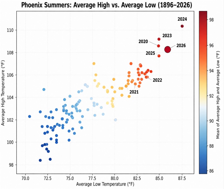
-
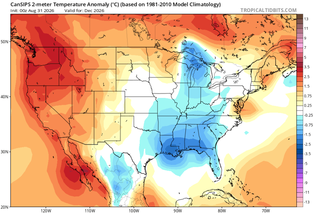
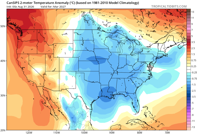
I’d be shocked if December is anything else than a torch.
-

Septorcher 2026 Discussion - Endless Summer
ineedsnow replied to Damage In Tolland's topic in New England
This guy is ridiculous https://x.com/MeteoMark/status/2094755178758963487 -
Septorcher 2026 Discussion - Endless Summer
dendrite replied to Damage In Tolland's topic in New England
At least the chickens haven’t been drinking out of mud puddles this summer.
-
DLH Aug mean of 65.2 is ranked 32nd warmest of 81 unique temps. Midpoint temp is 64.3. Precip of 2.30" ranked 39th driest of 139 unique amounts. Midpoint amount is 3.48". (PWS near old wx bureau site had 67.3 for the mean of Aug tied 13th warmest). Summer mean of 65.8 is ranked 8th(t) warmest of 62 unique temps. Midpoint temp is 63.0. Precip of 11.27" is 70th wettest of 142 unique amounts. Midpoint amount is 11.25". (PWS site had a summer mean of 66.0 which is ranked 8th warmest). TH co-op Aug mean 65.0 is ranked 34th(t) warmest of 70 unique temps. Midpoint temp is 64.9. Precip of 1.80" is ranked 20th driest of 119 unique amounts. Midpoint amount is 3.38". Summer mean temp of 60.8 is ranked 44th(t) warmest (20th(t) coolest) of 63 unique temps. Midpoint temp is 62.1. Precip of 8.92" is ranked 35th driest of 124 unique amounts. Midpoint amount is 10.90". DLH & TH had an avg, dry Aug, but summer overall was very warm with avg precip in DLH. TH, on the other hand, had a very cool, drier summer. Big difference between conditions on the shore, and at the head of the Lake for summer wx this year.
-

2026-2027 Record-breaking El Nino
40/70 Benchmark replied to Stormchaserchuck1's topic in Weather Forecasting and Discussion
1983 is also the only super El Nino with a somewhat negative WPO. -
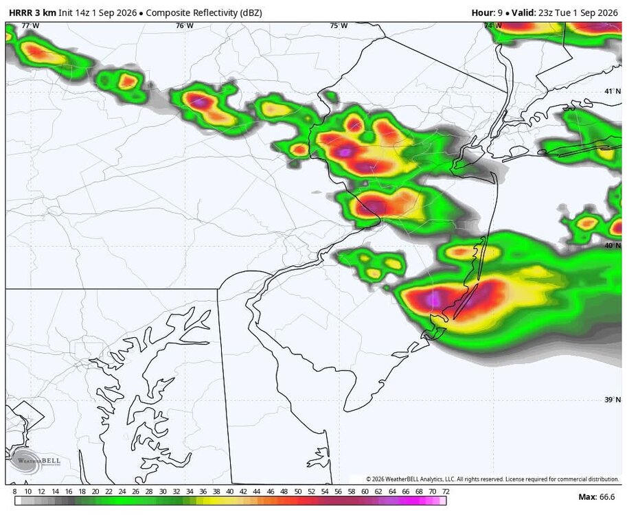
We'll see
-
and yet it still feels like orlando out there
-
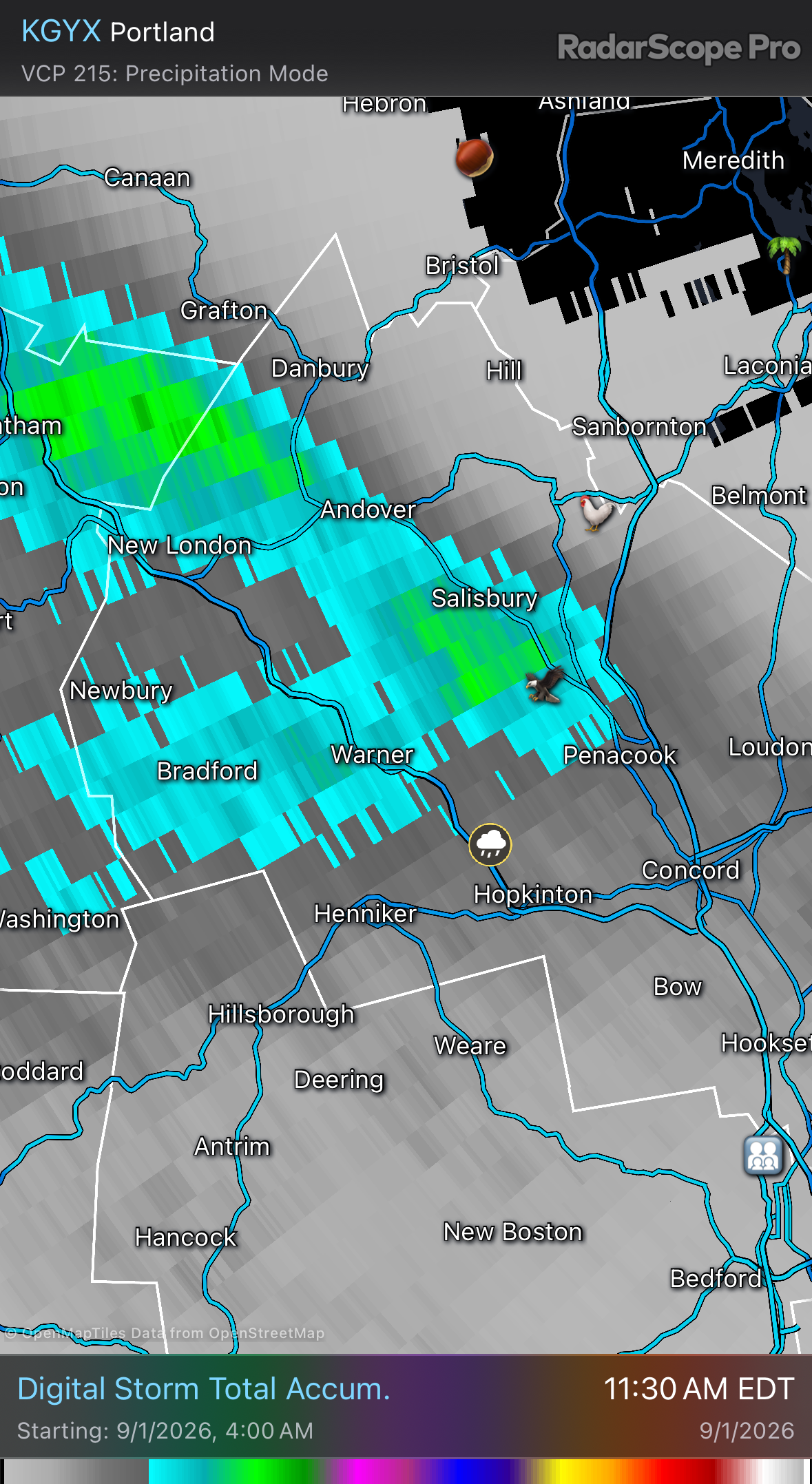
Outta time, but a pretty cool evolution to watch unfold this morning
-
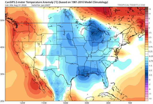
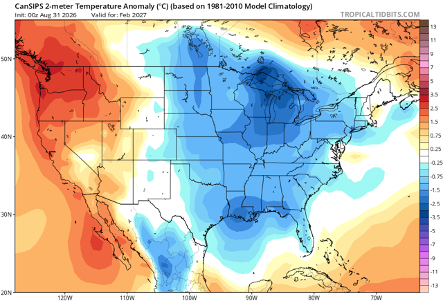
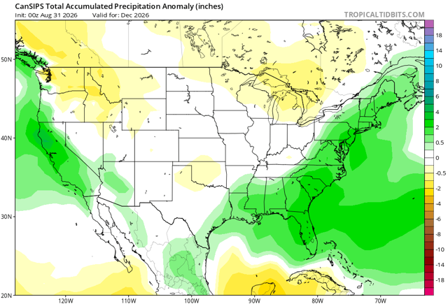
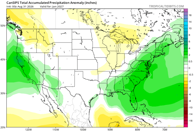
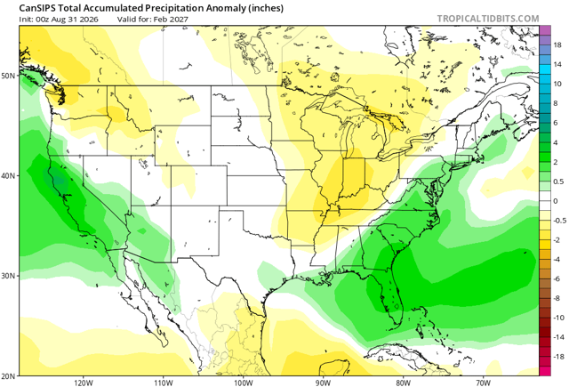
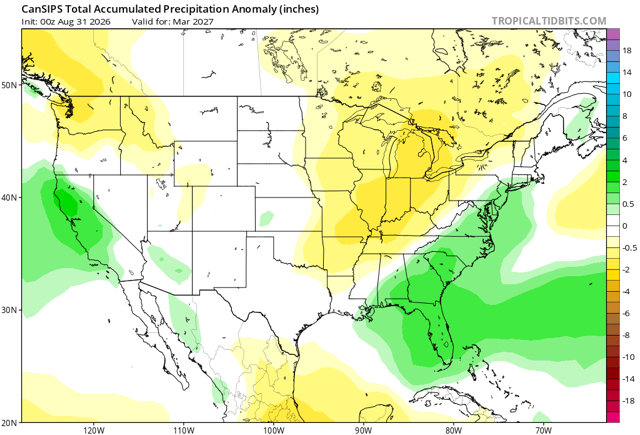
Cfs warm December but looks good for later winter with plenty precip. Here’s hoping.
-
The corn fields have really started to brown up over the past week or so. Evapotranspiration from the corn crop is very quickly crapping out.
-
^weenie run. not holding my breath
-
KLOT 82/82 rn. Sweating bullets out there to start September
-
Yes please
-
Now what does this have to do with the failure and landslide? We don't yet know whether the ice failed first and brought rock down with it, or if the rock failed first and brought down the glacier. But the glacier had likely been changing in response to a warming climate. 8/ Dr. Robert Rohde @RARohde · 28m Melting glaciers on a steep slope will thin and weaken, and become more prone to fracture and collapse. They also produce water that can seep into cracks in the ground and lubricate the ice-rock interface. 9/ Meltwater and higher temperatures can also cause permafrost to thaw. At elevations like this, where annual average temperatures are well below freezing, permafrost often plays a role in sealing cracks and reinforcing the underlying rock. Thus thawing can weaken the rock. 10/ Post-event photos suggest that the ice (and possibly rock) failed close to the top of the existing slope. If much of the rock and ice remained solid until the point of failure, then the top of the slope would likely have the greatest stresses. https://x.com/theiaincameron/status/2093619041105539386 11/ Was the tragedy in Nepal and Tibet due, in part, to climate change? My view is probably yes. The connection remains circumstantial and lacks a smoking gun, but the circumstances certainly make it seem likely. 15/ 10:42 AM · Sep 1, 2026 · All landslides involve an interplay of complex factors Glaciologists and geologists will work to pin down the details, but melting is known to make events like this more likely, and given the circumstances it would be surprising if global warming wasn't a factor here.
-
DCA has already hit 91F - gross.
-
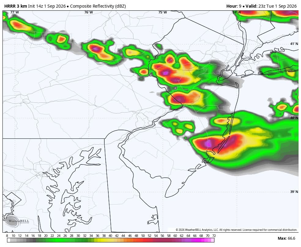
After this early afternoon stuff, more stuff popping later?
-

2026-2027 Record-breaking El Nino
mitchnick replied to Stormchaserchuck1's topic in Weather Forecasting and Discussion
That and 6 hours of nearly nonstop thunder snow imby...along with the 4" that fell between Noon and 1pm. Lol -
Beer
-
Today is going to be the hottest day out of the bunch most likely. Oppressive out there with a current dew point of 79. Good call on the expanded heat advisory from LOT
-
Tropical Storm Edouard Discussion Number 5 NWS National Hurricane Center Miami FL AL052026 1000 AM CDT Tue Sep 01 2026 Edouard is a small but strengthening tropical storm. The center has been trackable this morning using NWS radar data from Lake Charles, Louisiana (KLCH), and recent data show the inner-core structure of the system is becoming better organized. There has been a notable increase in deep convection near and to the south of the center, and a recent dropsonde released in that area reported mean boundary layer winds of 61 kt. Doppler velocities have also notably strengthened during the past couple of hours, and adjusting these data to estimate a surface wind support raising the initial intensity to 45 kt. The last center dropsonde from the Air Force Hurricane Hunters showed the central pressure has fallen to 1000 mb. Environmental and oceanic conditions are conducive for additional strengthening for as long as the center remains offshore. With very warm Gulf waters and weak vertical wind shear, the hurricane regional models continue to highlight the potential for continued strengthening through landfall. The 12-h forecast point for Edouard is well inland, but note that additional strengthening is expected that cannot be easily reflected in the official forecast. A Tropical Storm Warning and Hurricane Watch remain in effect for portions of the Upper Texas coast and southwestern Louisiana. Given the improved radar structure of Edouard and the expectation of additional strengthening, NHC will issue hourly Tropical Cyclone Updates (TCU) beginning at 1100 am CDT (16 UTC). Once inland, Edouard is likely to rapidly weaken and should dissipate on Wednesday. Some short-term wobbles have been observed in radar data during the past few hours, but the longer-term motion of Edouard is northwestward (305/7 kt). This general motion is expected to continue through tonight, which will bring the center of Edouard onshore near the Texas/Louisiana border within the warning area this afternoon and then inland across southeastern Texas tonight. The updated NHC track forecast lies slightly to the right of the previous prediction based on the latest consensus trends. Key Messages: 1. Edouard is strengthening as it approaches the northwest Gulf Coast, and tropical storm conditions are beginning along the southwestern Louisiana and Upper Texas coasts. Hurricane conditions, especially in gusts, are still possible from High Island to Cameron later today. 2. A Storm Surge Warning is in effect along the immediate coast from High Island, Texas, to the Vermilion/Cameron Parish Line, Louisiana, where peak values of 3 to 5 feet above ground level are possible. 3. Heavy rain will impact parts of the Upper Texas coast through east-central Texas into far Southwest Louisiana today and Wednesday as Edouard tracks inland. Flash flooding is likely across this region, especially in urban areas. River flooding may also be possible. FORECAST POSITIONS AND MAX WINDS INIT 01/1500Z 29.4N 93.3W 45 KT 50 MPH 12H 02/0000Z 30.2N 94.2W 40 KT 45 MPH...INLAND 24H 02/1200Z 31.2N 95.2W 25 KT 30 MPH...POST-TROP/INLAND 36H 03/0000Z...DISSIPATED $$ Forecaster Reinhart