All Activity
- Past hour
-

The “I bring the mojo” Jan 30-Feb 1 potential winter storm
Snowncanes replied to lilj4425's topic in Southeastern States
Not bad, just not the Canadian lol. Also this is 10:1 so up those totals a bit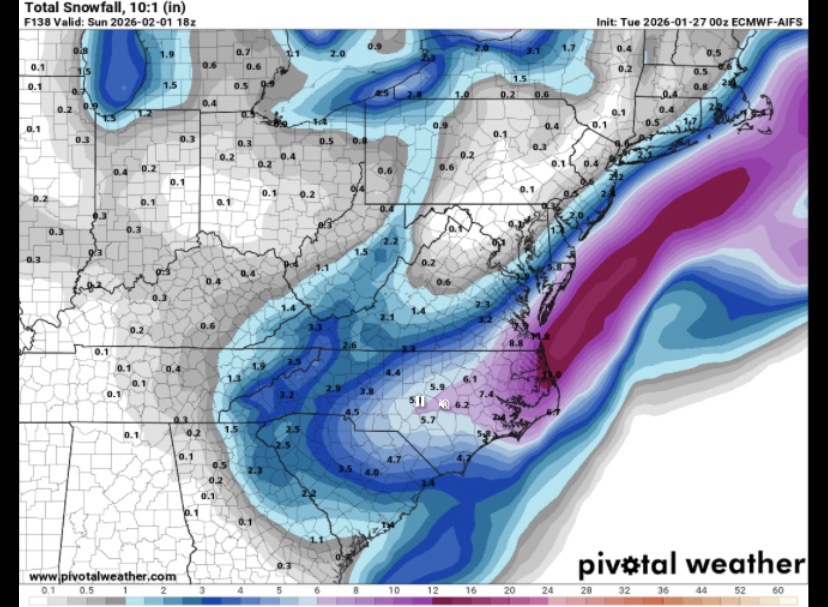
-
The EURO AI moved east from 18Z - this thing has to take on a more negative tilt IMO.
-
AIFS-Op definitely trending in the wrong direction today.
-
Still early...but AI Euro starting off bad isn't encouraging....brb
-

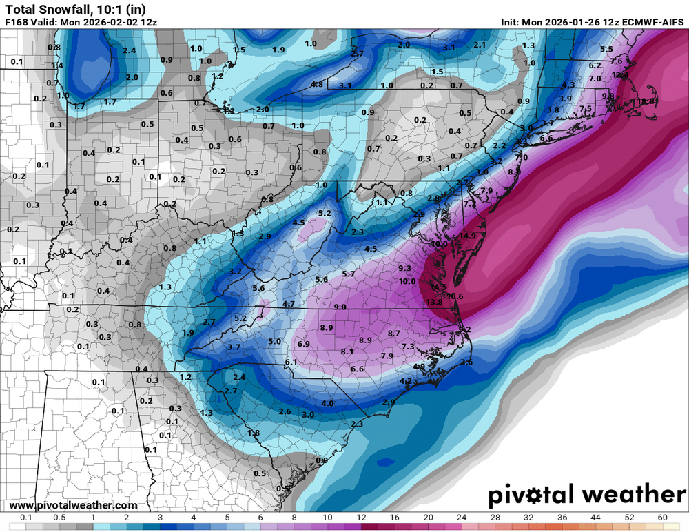
Possible coastal storm centered on Feb 1 2026.
Prismshine Productions replied to Typhoon Tip's topic in New England
Skynet shifted SE Sent from my SM-S166V using Tapatalk -
Doesn't even look that bad up top. Maybe a tick east with the NS energy. I think it just shaved the NW precip shield back
-
PBP?
-
Euro Ai is blah.
-
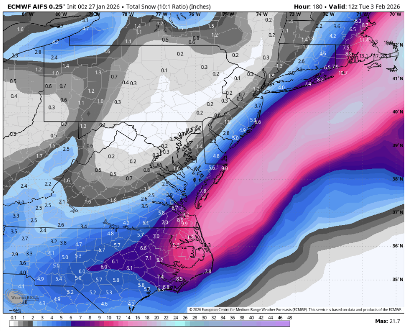
AIFS is ever so slightly S and E of 18z which is ever so slightly further E of the 12z at 0z Sunday.
-
Approximately 14-15" in Rochester, VT. Measured 11" this morning and looks like another 4" fell while we were away. Skiing at Pico was heavenly. Sugarbush tomorrow.
-
12z for comparison
-
 BOS database management failing here, not sure why they are appearing to stack rank by single-day snowfall amounts (in the case of partial snowfall for 2003 storm) and compare to a 2-day total here. 2003 Presidents’ Day blizzard saw 27.6 for Boston and is actually the #1 all-time. 23.2” is still good for 8th all-time, just not right behind 2003.
 -

The “I bring the mojo” Jan 30-Feb 1 potential winter storm
wncsnow replied to lilj4425's topic in Southeastern States
AI Euro is slightly weaker and less precipitation. Not really east just not as negative tilt. Meh -
Mommy…..mommy….sucking thumb in the fetal position .
-
At 12z this and the regular Euro followed copied each other...
-
sounds like a flat roof to me - most of the sloped roofs lose the snow faster especially south facing ones
-
0z Euro AI worse, OTS I have no idea what h5 looks like though
-
we'll see if the gefs/gfs shift the qpf west next update
-
And we're off. Euro's a running
-
So you think the low will track due north or almost due north?
-
Still snowing here. Pixie dust.
-

Possible coastal storm centered on Feb 1 2026.
WinterWolf replied to Typhoon Tip's topic in New England
Thanks Don…didn’t realize that was an ensemble mean..that was why I was a little confused. Makes sense. -
it might not totally "miss" AND there is a reason a HECS has never verified a week after a MECS in NYC in recorded history . Very unlikely . BUT not impossible. IMO