All Activity
- Past hour
-

December 2025 regional war/obs/disco thread
RUNNAWAYICEBERG replied to Torch Tiger's topic in New England
Not really. 4 years running of good tracks without a good airmass to tap into. Cold first then track. -

Fall/Winter Banter - Football, Basketball, Snowball?
Carvers Gap replied to John1122's topic in Tennessee Valley
@John1122, these last two basketball games and football game....like watching it snow in New Orleans, man. -
I'm actually not quite sure what goes wrong as I agree that on paper that what happens out west and to the north looks better with less push/suppression of the NS. My best guess is something happens either internally with the shortwave or the interaction between it and the low of Mexico causes its energy to become more stretched and further eastward based. Looking at it more the only real difference seems to be that the shortwave remains a bit more connected to the low of Mexico and there are slightly stronger H5 winds which as @CAPE pointed out hurts us by stretching out the vort. 0z wind map 18z wind map
-
.thumb.png.a8b917227b69a76da2cbc94017909de9.png)
-
3k NAM looked good at the end of its run.
-
Hi Res Nam is a little more interesting and colder
-
NAM still not showing much
-

Central PA Fall Discussions and Obs
Itstrainingtime replied to ChescoWx's topic in Upstate New York/Pennsylvania
I wish I could have shoveled. -
Here’s one I like (sadly it only goes up to 2013) http://www.raymondcmartinjr.com/weather/1996/Weather.html Gives me a nice trip down memory lane having lived through many of these storms. There are many maps at all levels of the atmosphere that shows the evolution of each storm. You’ll notice that the most powerful winter storms have a dual jet structure, where the low develops under the overlapping of both the left exit of one jet streak and the right rear entrance of another jet streak. Like double jeopardy. Rare, but truly amazing when it happens, and thats why they get so powerful. Look at the blizzard of 1996, perfect textbook example.
-
I’d be surprised if there was any significant warmup in the east given the MJO wave strength. We’ve seen before beyond D8-10 ensembles often can show a pattern that doesn’t really resemble what the expected MJO phase will be and then once you get closer it does. We’ve seen many maps like the above at day 15 when we have a strong wave in 3 or 4 and we know it’s going to be wrong
-
Strung out mess.
-

The Return of the 12/5 Snowstorm
NorthArlington101 replied to SnowenOutThere's topic in Mid Atlantic
Not as big a fan at 60 but thought things were headed north toggling back and forth the precip down in south. Mayhaps not Nope thru 69 -
Meh....so far
-
We probably picked up another .25" since I went out to clear snow an hour ago. Not a pellet of sleet today that I saw.
-
The snow pattern, the 'smiley face', ID/MT to NM/CO to Ozarks to interior New England I mentioned in October is showing up. It's a good pattern, most of the US will get a lot of snow this year, but probably not where 95% of you live. You'll see everything shift south 200-300 miles during the peak cold waves, but it won't stay that far south for periods long enough for major snows to the south of the main smiley face.
-

Central PA Fall Discussions and Obs
canderson replied to ChescoWx's topic in Upstate New York/Pennsylvania
Has anyone seen how much mdt reported? -
Still pinging here in North Salem as well. We did have a brief period where it was probably 80% fzra and 20% sleet but that didn't last long. It was just enough to produce a light crusty layer on top of the earlier snow/sleet accumulation. It seems the fzra is done but we're definitely sleet at the moment. Although it isn't quite the event I had hoped for, it's still nice to have something in the month of December which has been eluding this area for the last few years.
-
The Return of the 12/5 Snowstorm
NorthArlington101 replied to SnowenOutThere's topic in Mid Atlantic
I think I look the like of the NAM thus far thru 51 , but I’m no @SnowenOutThere -
Probably would have got to warning criteria if not for 2-3 hours of sleet.
-
That's a good thing. You don't want paint on your windows.
-

Kick-Off '25-'26 Winter Storm Obs
TauntonBlizzard2013 replied to 40/70 Benchmark's topic in New England
Cant even get the pity flakes at the end. We are in a serious rut -
Subsurface heat at 100-180W 0-300m down was pretty much unchanged from Oct-Nov. -0.47 in Nov, -0.41 Oct. Vastly smaller reservoir of cold water. We're on our third or fourth advisory level snow event for the high terrain locally. November was actually around 2x normal precipitation for the Northern half of the state, so the +6-8F temps didn't really matter at elevation. Still frigid above 8,000 ft on storm days. 14 inches of snow fell at Taos Powderhorn, 11,000 feet up, since Nov 17. They'll get 6-10 of dry power in all likelihood by Thursday morning. The resorts that get 200+ inches a year look like they're doing OK so far. For those who saw me include 2022-23 in the analog group at low weight - I do think there are some periods through April with extreme precipitation events in the SW, and that wasn't really present in 2024-25 or 2013-14. But they'll be much rarer than in that winter. But the one system in late November was pretty impressive for the moisture content.
-
Thank you so much for this post, and sorry for the confusing initial wording. This also helps clarify to me a how the arctic front theory of storm formation (while generally "wrong") can make some sense as I assume it comes from seeing the stretch between air masses as a line of vorticity that eventually spins up into a concentrated area to force surface low formation. Of course, it doesn't actually get into why that happens but it makes more sense regardless. If I read your post right in sensible terms we are in the best place for surface low development when we have a strong baroclinic boundary to our south (aids in convergence though my course didn't go too much in depth with it so I'll just accept a stronger temp gradient is better), a jet streak that is either positioned to the northwest (right entrance which I guess may be associated with a negatively tilted trough usually?) or a jet to our southeast (maybe more for broad bowl patterns?), and a condensed ball of vorticity (shortwave) to act as the initial perturbation in the system. I also know that 500mb low wise a sharper amplitude with shorter wavelength wave tends to increase vorticity though I don't actually know why (to be honest my ability to connect vorticity to low pressure is sketchy at best and I'd appreciate resources to find that connection). Additionally, If you have any websites to look at the upper air patterns for past storms I'd love to dive into that to see examples of this.
-
December 2025 regional war/obs/disco thread
TauntonBlizzard2013 replied to Torch Tiger's topic in New England
Horrible. Not even sure we’ve had a 6” event since then. Nearly 4 years -
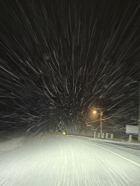
Yeah, just saw a great Xmas play put together by the Weathervane Theater. Roads are nasty though. Snowing quite heavily at home


.png.df03f219280a639d476d30e8f1f09dd0.png)


.thumb.png.4150b06c63a21f61052e47a612bf1818.png)


