All Activity
- Past hour
-
If you saw the condition of my road you would understand the graveyard of hubcaps off to the side (if anyone still used hubcaps). It is wretched and embarrassing.
-
When a person that lived with Santa Ana winds in southern California for 35 years says they are tired of this 'blanking wind' in only 5 years, yeah, we do wind well.
-
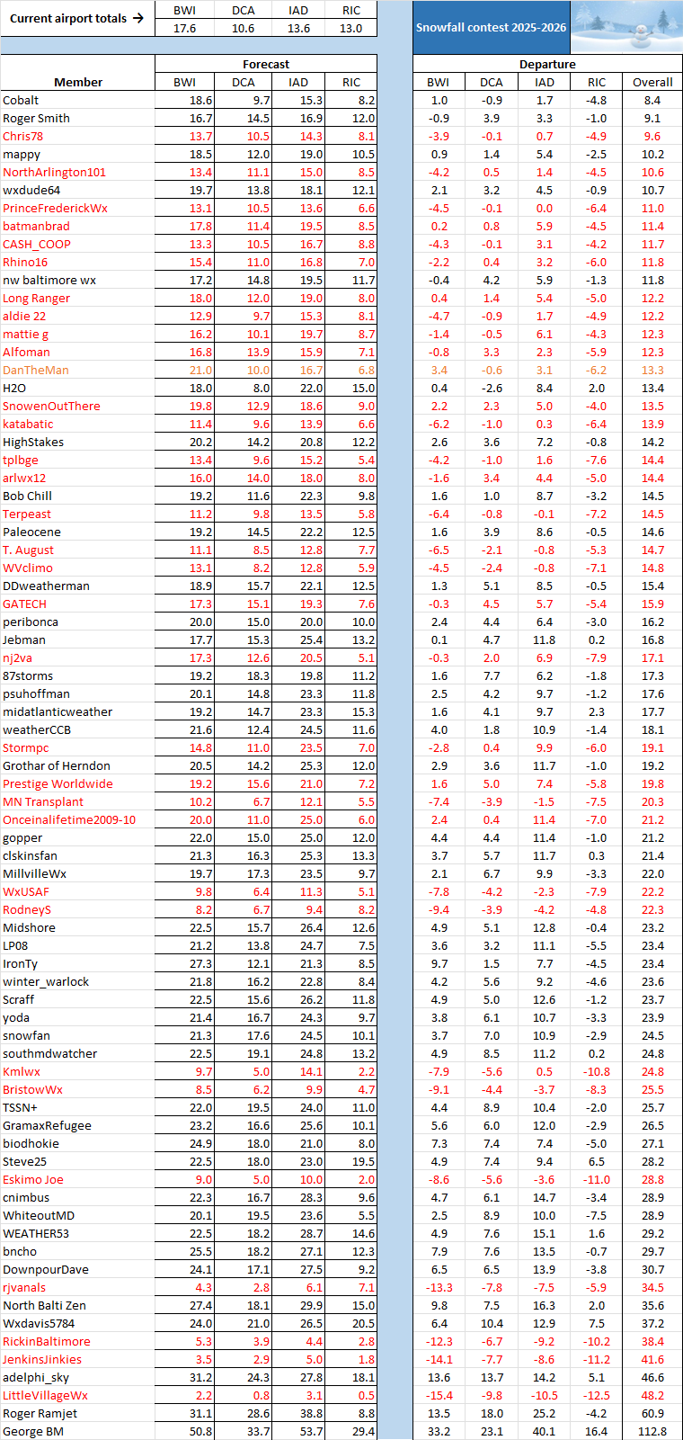
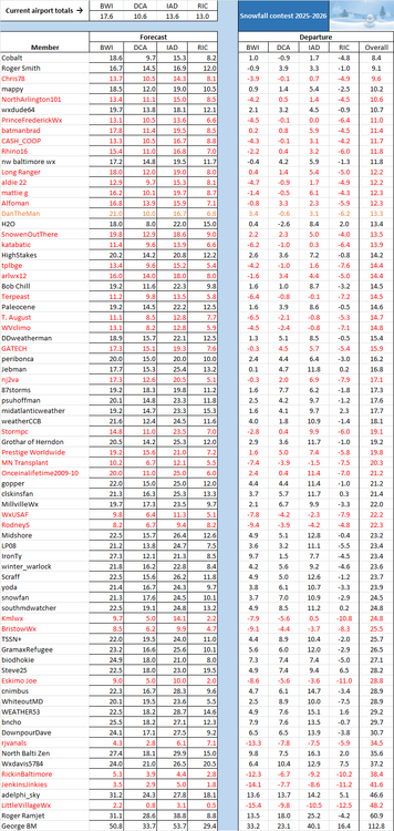
The reevaluation has now been completed and is just what the doctor ordered for @Cobalt. BWI's Thursday snow total has been revised from a trace to 1.0 inch, which makes perfect sense -- the hourly observations there on Thursday listed "heavy snow" and a temperature of 33.1 degrees at 13:54 and "light snow" and that same temperature at 14:54, with precipitation during those two hours totaling 0.19 inches. An inch of snow thereafter translates into a snow/precipitation ratio of 5.3, which is reasonable with a wet snow. On the other hand, only a trace of snow with those hourly observations would have been close to impossible. So Cobalt is our new leader, but @Roger Smithremains in strong condition; see below.
-
The last AFD from Milwaukee-Sullivan is from midnight Friday? I can’t get anything newer.
-
March 23rd on the Euro
-
We'll see how much sleet mixes in I guess.
-
Been a long time since there’s been a radar like this!
-
If the current majority of models are to be believed, not a chance.
-
Pretty interesting on the ECAIFS for next Saturday through Monday
-
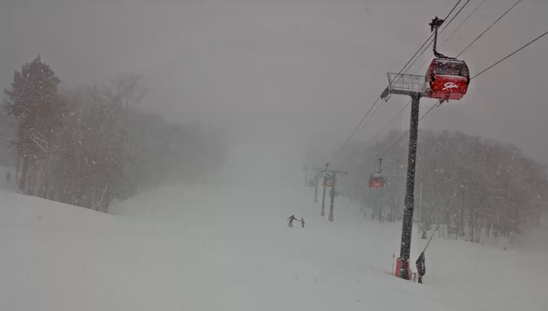
Upslope band is cranking. Just ripping snow on the mountains. Over 5" so far for the event.

-
Enhanced risk with up to 10% cig one hatched risk and wind risk is maintained at 45% cig 1 and now has a 15-5% cig 1 hail risk .
-
I can see localized 18" amounts for the Twin Cities. Meanwhile Green Bay may have their biggest snowstorm on record.
-
DVN issued a blizzard warning for their entire area. The snow forecast is 4-8", which seems a bit high, plus wind up to 60 mph.
-
Pacific is kinda crap but that's a legit NAO Rex Block as advertised. In late March, that could work.
-
You're in for an epic storm. If i didn't have work Monday I would definitely venture north to document this.
-
I was gonna suspend the WB account yesterday but I didn't want to rely on WW for maps just in case something unusual happens lol.
-
APX just issued an advisory here in Alpena,MI for 5" then maybe just plain rain Sunday night and Rogers city a warning for 8" and .50" of ice. Only 25 miles difference,so can definitely change. They aren't confident at all,but admitted it. Now cast it is!
-
Hubcapsgone Mass
-

Central PA Spring 2026 Discussion/Obs Thread
anotherman replied to Voyager's topic in Upstate New York/Pennsylvania
-
I obviously think the probability is low for a high end snow, but I’m still keeping my eye on that period. It’ll be the last one for this area until next season. It’s intriguing to say the least.
-
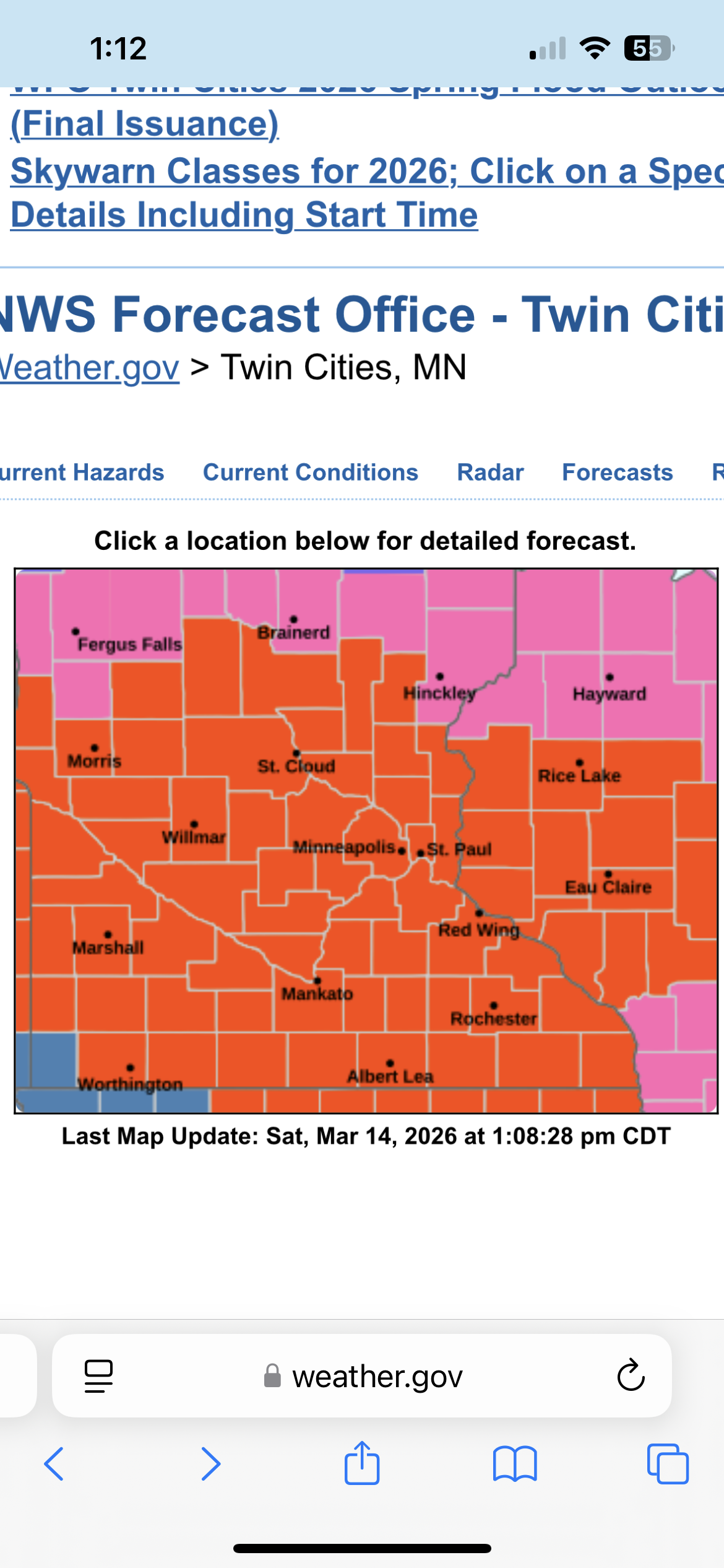
There it is. The entire MPX CWA is under a blizzard warning. That might be a first. .

-
That’s not true. This subforum is amazing at wind, heat, CAD, and failure
-
The Chill WDI remains favorable.
-

Central PA Spring 2026 Discussion/Obs Thread
canderson replied to Voyager's topic in Upstate New York/Pennsylvania
NAM has an incredibly nasty QLCS rush hour ish Monday. It’d cause significant issues.