All Activity
- Past hour
-
If you could only choose one option, what would you take? Option 1: Dec 2018 redo but the remainder of winter has above average temps. Option 2: Three snowfall events with varying amounts and a seasonal total of 10”. Wall to wall cold.
-
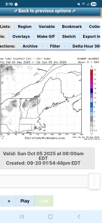
First snow for some showing up in clown range
-

2025 Lawns & Gardens Thread. Making Lawns Great Again
tamarack replied to Damage In Tolland's topic in New England
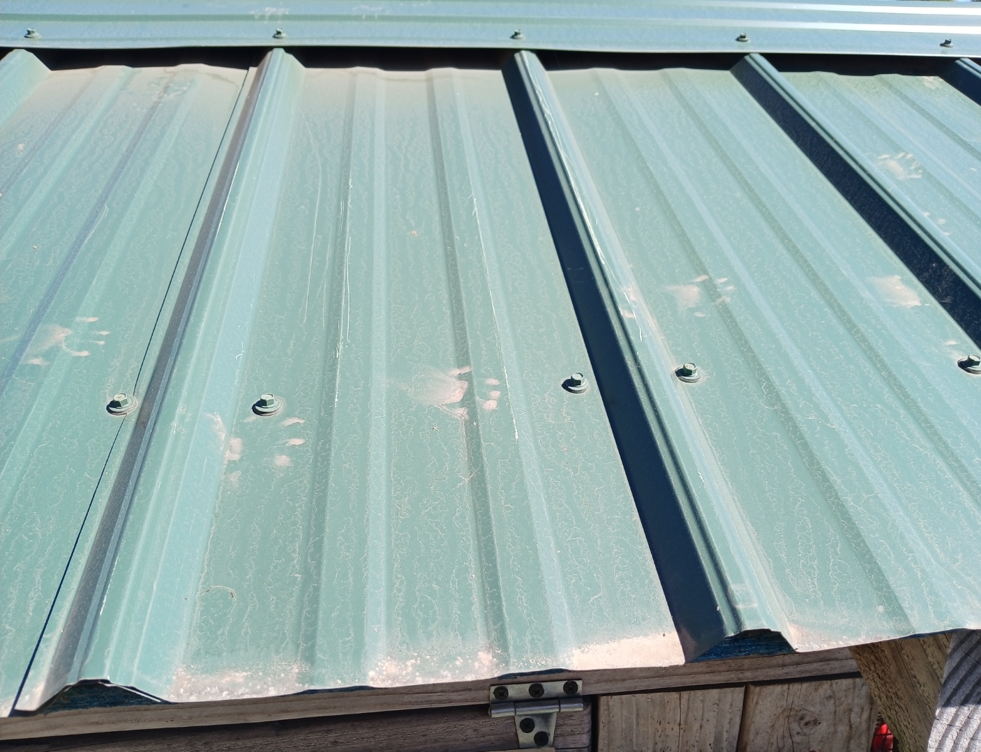
Those nearly round prints make me think raccoon. -

September 2025 OBS-Discussion centered NYC subforum
anthonymm replied to wdrag's topic in New York City Metro
Extremely unsettled pattern ahead next week. Very high humidity, low diurnal temperature difference, high dews from all the moisture. -
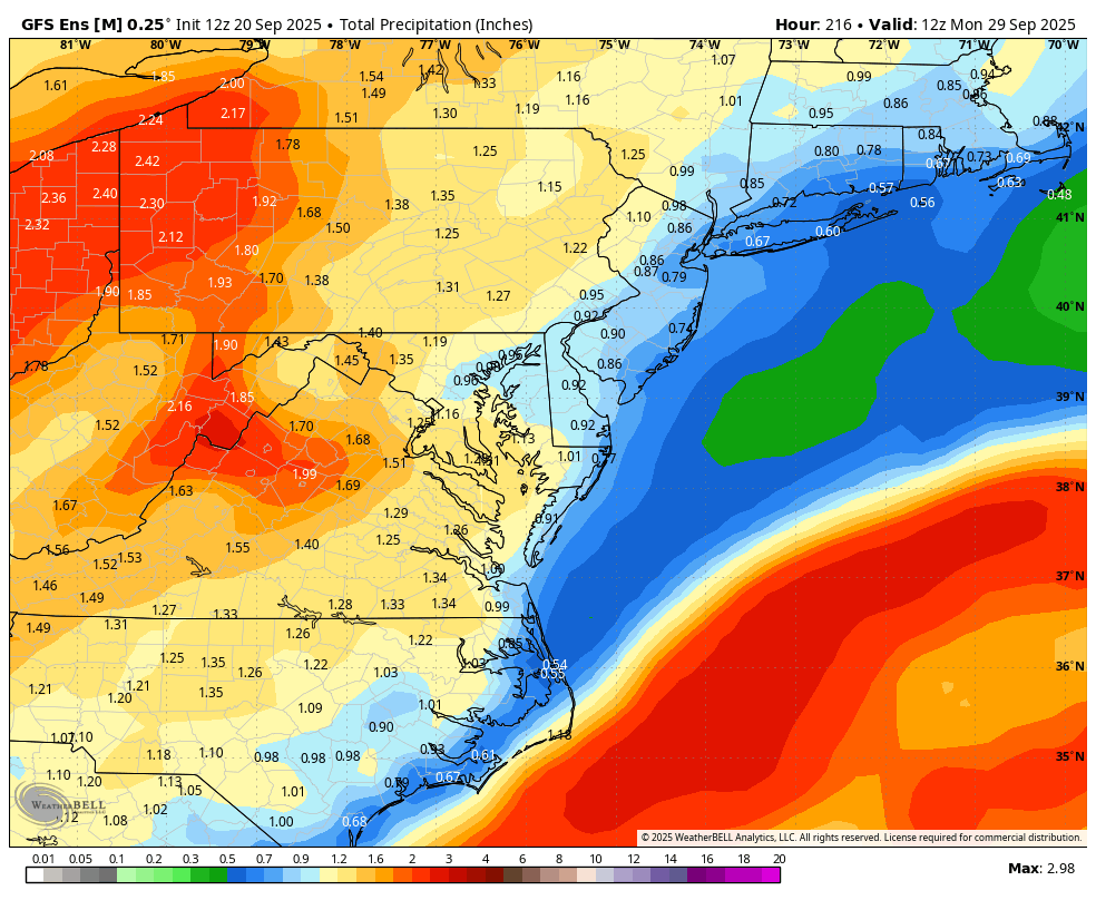
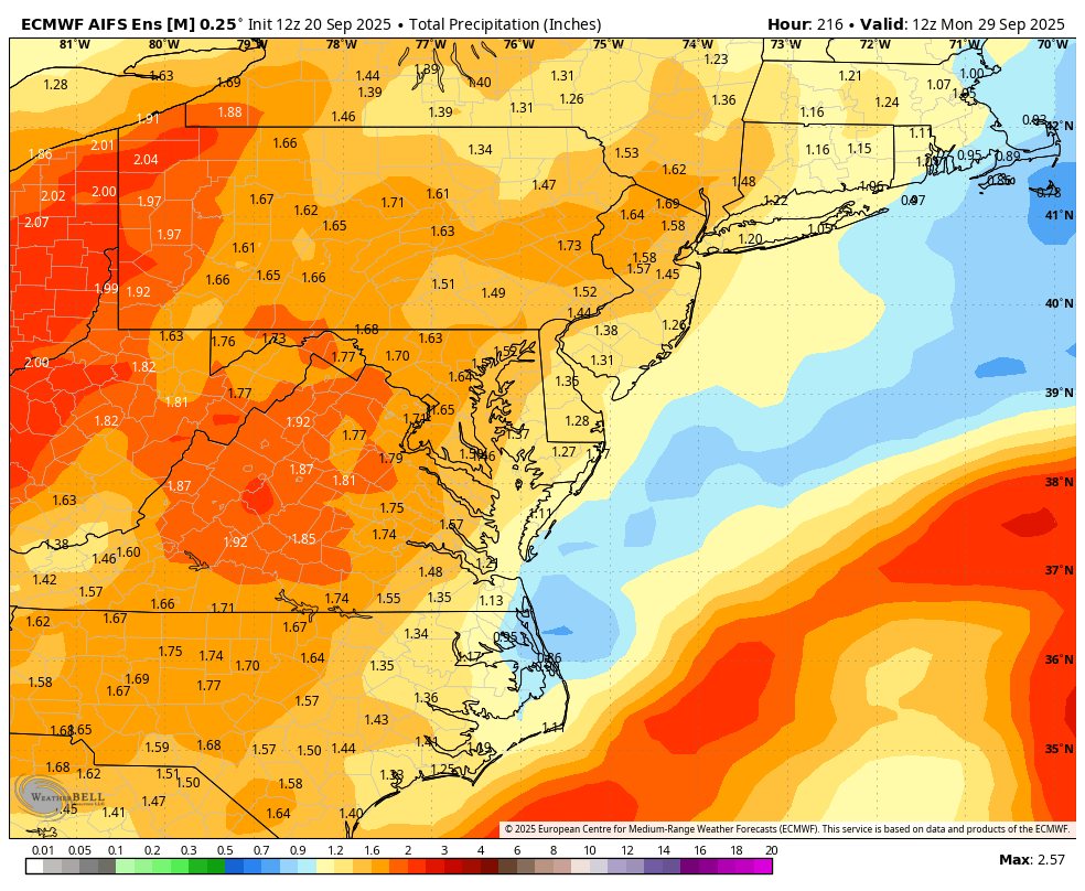
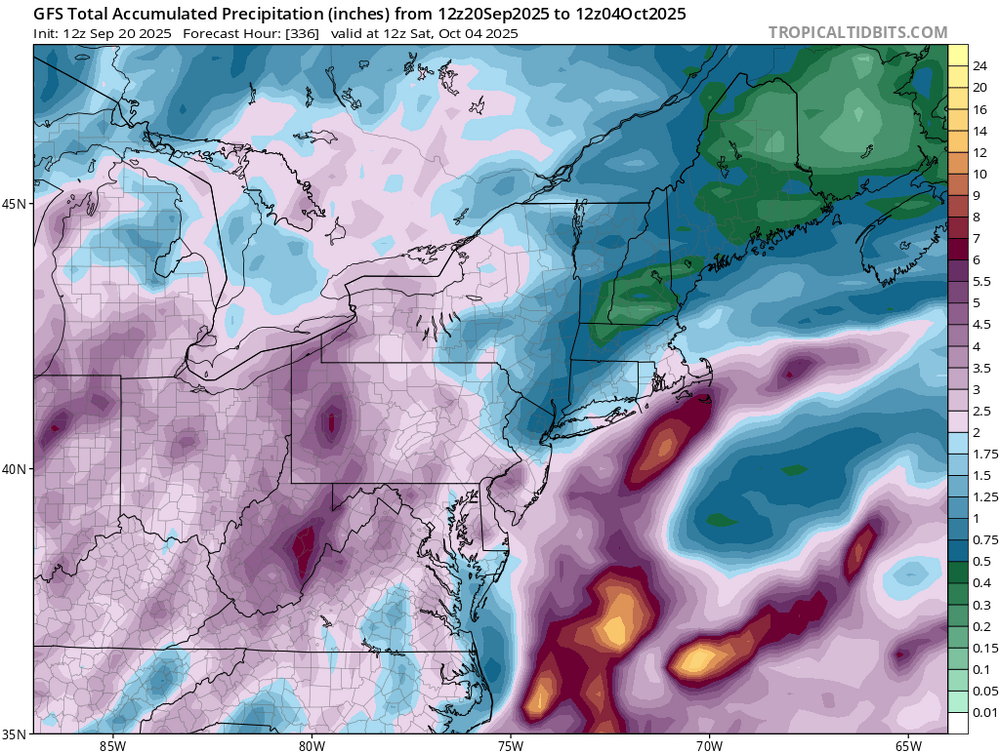
WB 12Z ensemble rain totals through Day 9. More welcome rain still looking like a good bet.
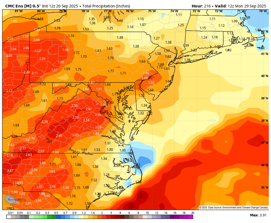
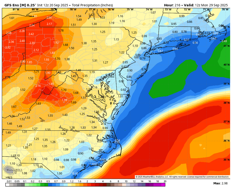

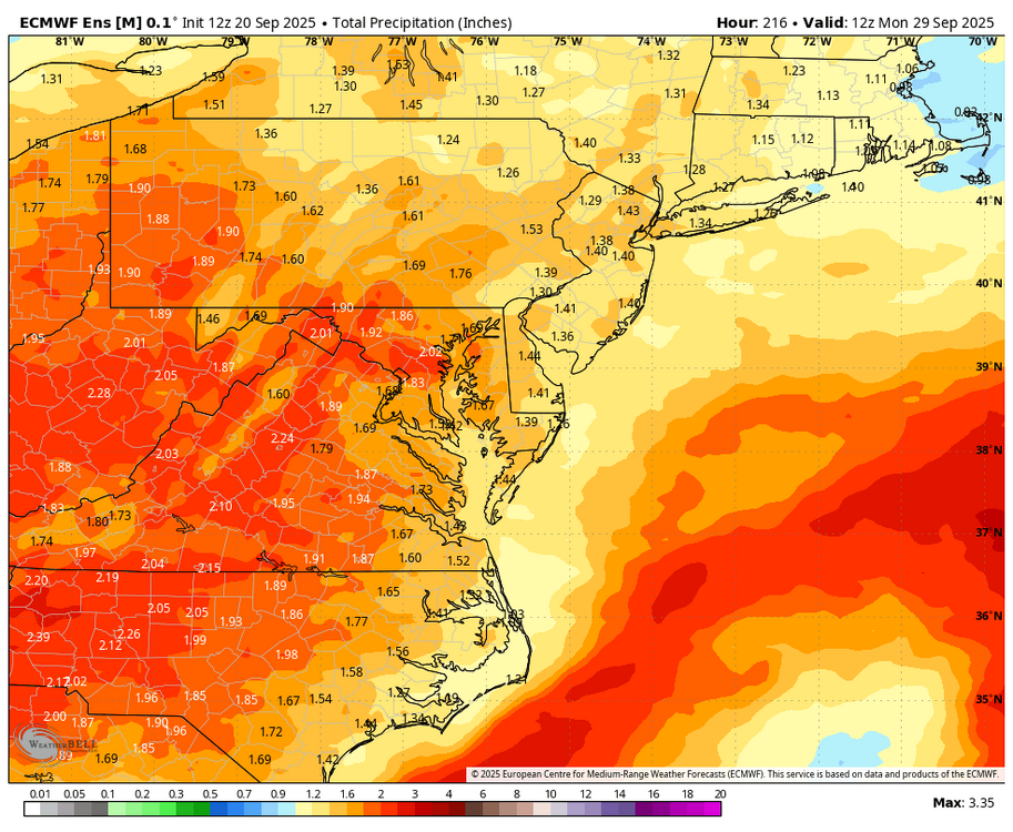
-
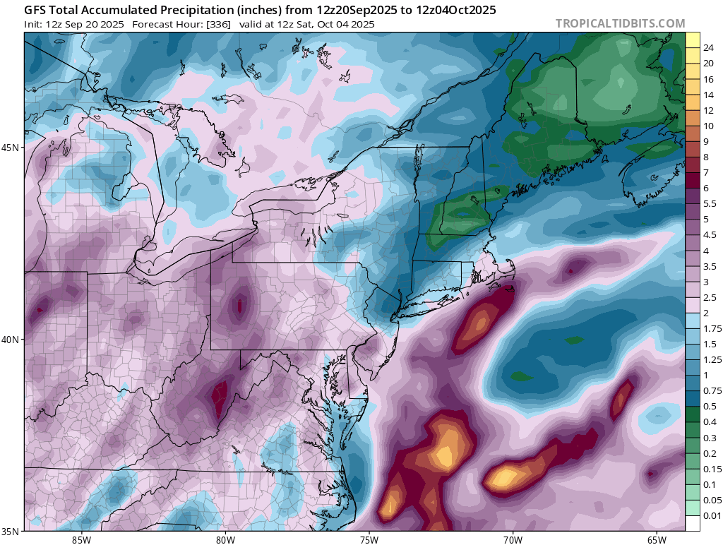
Emphasis on "a little".... Large-scale feature placement still argue against it... Just one of those years to date. Still time to get something threatening but certainly nothing obvious at this time. Maybe once (if) fall pattern grows more amplified we might get a Gulf or Caribbean system to pop and get get yanked northward?
-
This is what someone said: According to the TCPOD the NOAA planes (all three of them, the gulfstream is out too) are doing a research mission, apparently involving drones they're dropping in. The AF are on a normal fix mission, IDK the exact motivation. I guess in case of any effects to bermuda? Or it could just be practice/nothing else to do.
-
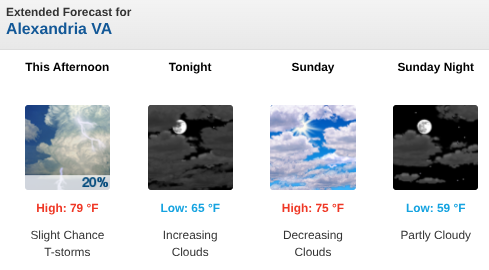
To your point, LWX has suddenly and retroactively changed their tune (though not necessarily in the PM disco update): I appreciate your observation...and honestly, your personal inputs here over the years. And please believe, I defend your profession more than you know....I only approach this from a hobbyist standpoint, but twice already this afternoon, I've had two neighbors ping me -- "yo, man...IT WASN'T SUPPOSED TO RAIN THIS AFTERNOON, WTF??" I got nuthin. Who knows...maybe we may have a microclimate thing going on here? This is anecdotal, but I'd say we've had exactly this kind of "blow-up" very localized shower/storm over the Hayfield/Kingstowne/Franconia area several times over the past two years, where almost no other locales in the close-in-NoVA burbs had nothing. And it's like it blows up...and rains/storms like hell...and then dissipates very quickly. That happened this afternoon, and at least a few times over the past two years. I (along with a couple neighbors) were astounded when the sky opened up about two hours ago. It didn't even LOOK that showery/stormy if you looked to the west/NW (unless you looked at radar) but boy-howdy...did we get a good gully-washer for about an hour.
-
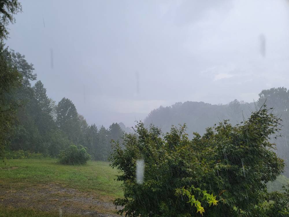
Managed to get a pretty decent little boomer out here last night. Tiny cell that just happed to go right over me at the right time. Was an absolute downpour for about 10 minutes and some decent c2c lightning with great rolling thunder. That should keep my bitching suppressed for a few days. A nice surprise and a good watering for the grass and plants. I am happy (for now).
-
Next 2 weeks on the goofus
-
It does say "a few showers making it as far east as Southern MD". 90% of the area is dry. They probably should have put a 20% POP in, though..
-
I'm curious to know why we have three recon planes flying all the way out to a tropical storm in the middle of the ocean, which isn't going to affect any land.
-

September 2025 OBS-Discussion centered NYC subforum
Sundog replied to wdrag's topic in New York City Metro
The EURO, EURO AI and GGEM all have a big rain event from Thursday into Friday next week. -
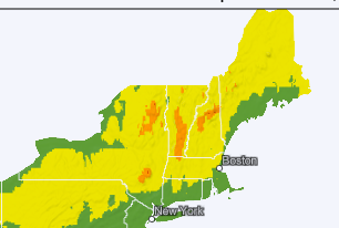
This made me want to see fall foliage currently and forecast. I went to this Web site: https://www.explorefall.com/fall-foliage-map It's pretty cool, with the slider at the bottom for forecast foliage. I have been to other sites on previous years, but have not yet seen this one. And cropped New England, kinda small, but I find this useful!
-
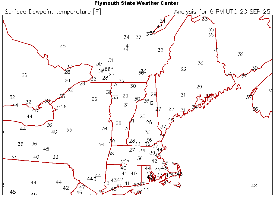
Yeah, there’s no surface moisture to try to offset these mixed down dews this evening. The NNE pits will radiate really well.
-
000 WTNT62 KNHC 201753 TCUAT2 Tropical Storm Gabrielle Tropical Cyclone Update NWS National Hurricane Center Miami FL AL072025 200 PM AST Sat Sep 20 2025 ...HURRICANE HUNTER AIRCRAFT REPORT THAT GABRIELLE IS FARTHER EAST AND A LITTLE STRONGER THAN INDICATED IN THE PREVIOUS ADVISORY... Reports from NOAA and Air Force Reserve hurricane hunter aircraft data show that the center of Gabrielle is located about 30 miles farther east than indicated in the previous advisory. The maximum sustained winds have increased to near 65 mph (105 km/h). The next full advisory will be issued at 500 PM AST (2100 UTC). SUMMARY OF 200 PM AST...1800 UTC...INFORMATION --------------------------------------------------- LOCATION...25.2N 58.7W ABOUT 595 MI...960 KM NNE OF THE NORTHERN LEEWARD ISLANDS ABOUT 615 MI...990 KM SE OF BERMUDA MAXIMUM SUSTAINED WINDS...65 MPH...105 KM/H PRESENT MOVEMENT...NW OR 325 DEGREES AT 13 MPH...20 KM/H MINIMUM CENTRAL PRESSURE...996 MB...29.41 INCHES $$ Forecaster Beven
-
Welp, planned to mow the front lawn early-mid afternoon, started getting Rain Alarm alerts almost an hour ago. I scoffed at them...because I sometimes get false-positives from that particular app (e.g., fog, low lying clouds, etc.) plus, it's supposed to be gorgeous this afternoon, and has been all morning and (up until) the past hour: Get about two passes in on the front lawn...and the sky opens up, heavy downpour, can't hardly see across the street. That started about 40 min ago. Call me a cynic, but I didn't see this reflected above, nor in the morning disco, at least not for close-in NoVA burbs: These are the kind of whiffs in forecasting that really piss me off. Can I mow tomorrow, or early next week? Yeah, I can likely fit it in with all of the other life crap. But c'mon...can we get at least a bit more of a heads-up in the disco (which is usually what *I* pay attention to)?? Yeah, precip might not happen (and THAT'S usually in hard winter around here)...but this is annoying. Ironically, we had a small picnic planned for our back patio/yard for midday today but had to cancel last-minute...thank God we did, or it would've been one helluva fire drill. P.S. -- it's STILL raining almost an hour later.
-

2025 Lawns & Gardens Thread. Making Lawns Great Again
dendrite replied to Damage In Tolland's topic in New England
Man I don’t know. Obviously it had dirty feet, but I’m not sure how that would necessarily translate to the flat roof panels. How tall is your coop? What’s the length apart on those raised ridges on them? 8-9”? Are there any prints on the ground? It could be one and there just wasn’t enough pressure to make a mark with the entirety of the toes. Those rear paw pads look to be about 1.5-2” wide? Other option…maybe a fisher? - Today
-
Tonight is going to be crisp. If yesterday was 67/38 and we hit 32F... this afternoon is 61/28. Afternoon dew points are a decent barometer for potential here and we are upper 20s right now. We should have no problem decoupling solidly into the 20s tonight. If afternoon dews are sub-freezing, it’s going low tonight.
-
It is now, at 2pm, 68 degrees with a dewpoint of 40 degrees. It is cool and refreshing in the shade and downright hot in the sun. It's my favorite fall weather! Well, except for fall cold fronts with heavy rain, but this is kind of almost late summer/very early fall. Oh well...
-
We COC!
-
12z a little interesting
-

2025 Lawns & Gardens Thread. Making Lawns Great Again
tunafish replied to Damage In Tolland's topic in New England
@dendrite Had a critter snooping on the roof of my coop overnight. Probably raccoon?
-
I had over an inch of rain yesterday and I'm getting hammered again. Sent from my SM-G998U using Tapatalk
-
Gabrielle is getting its act together today. Recon shows the pressure down to 997 mb. The wind has not caught up, yet.