All Activity
- Past hour
-
And the storm over Middlesex-Union county is just shrinking and going away - next 2 days should be interesting...
-
 Found it.
 -
 What happens after that? No way there’s zero rain further east. Edit: Whoops, should’ve read the next few posts, ha. Folks have it covered.
 -
“It’s coming, this year.” Too lazy to actually find the post, sorry.
-
Intro to weeny posting on AMWX: Only one rule really… Only post models, maps, tweets, and/or links that fit your agenda! That’s it. Enjoy your stay.
-
 Were you expecting a hurricane?
 -
Chicago and Cedar Rapids sure seem to reel them in don't they? Made it to 97 here today with a peak dew of 82. MLI tagged 96 for the hottest temp of the year so far.
-
Have to watch outflow from that north cell, development could end up occurring into the city or north Queens over the next hour
-
New hobby, or you still looking into relocating?
-
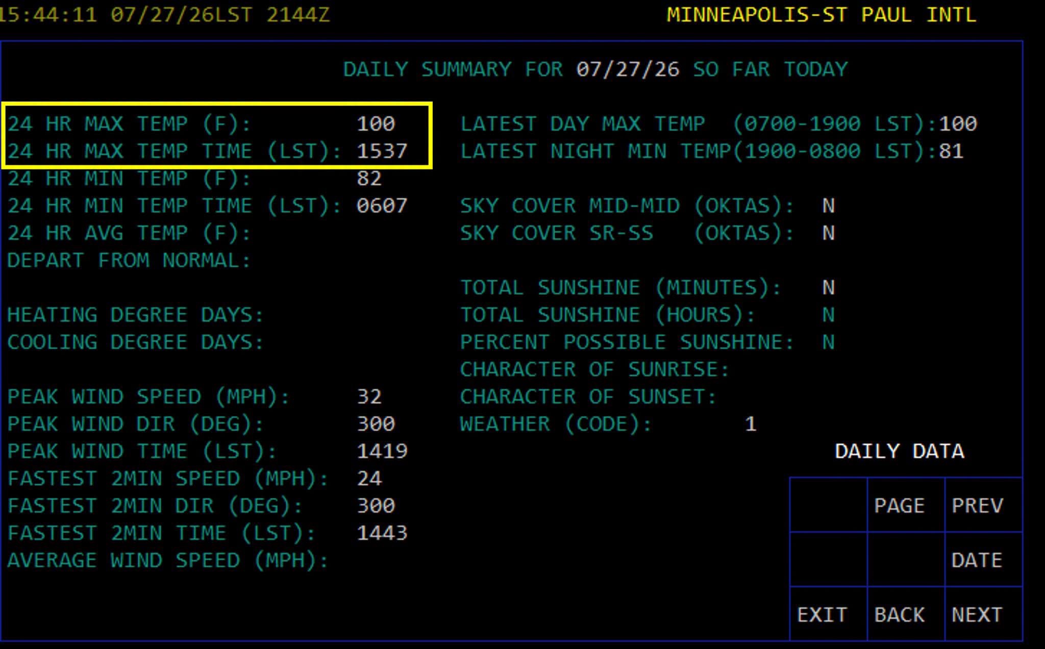
Triple digits in the Twin Cities! First 100 temp since 2022, every 4 years right on the climo norm
-

Central PA Summer 2026 Discussion/Obs Thread
Voyager replied to Voyager's topic in Upstate New York/Pennsylvania
So far every developing storm has missed Tamaqua. One popped just south oh Hazleton and looked good to get us, then took a sudden left turn and is getting Carbon County. I can hear the thunder, but it all east. A second potential popped south of Berwick, but that "looks" to skate by just to our west. I feel like I'm dead center of the goalpost, but the field goal kickers suck...lol -
Yeah I think South Plainfield must be close to 3 inches of rain. I'm close to the border of South Plainfield so this heavy just barely missed me a few miles to the east.
-
The heavy rain area is just sitting over North Edison to South Plainfield - Flash Flood Warning FFW from KPHI
-
Yeah just some very slow odd movement with these storms in our area. If I was just a few miles to the east I would have gotten a lot of rain. Still it was just enough to give things a watering here.
-

2026-2027 Super El Nino
bluewave replied to Stormchaserchuck1's topic in Weather Forecasting and Discussion
We may not start to get a better idea about things until the Northern Hemisphere mid-latitude 500 mb pattern actually couples with the El Niño. This continues to be a strong -PDO 500 mb pattern which has translated into the drop in the SST PDO and the near record ridge north of Hawaii. Have never seen the Southern Hemisphere so fully coupled with the El Niño standing wave while the Northern Hemisphere mid-latitudes are so out of sync. I will compare the VP charts for July in early August against previous super events when JMA posts them. My only guess is that the standing wave appears to be centered more to the south of the equator than usual. But not really sure since we haven’t seen this disparity with the summers of 2023, 2015, 1997, 1982, and 1972. Perhaps the pattern will slowly begin to shift in the Northern Hemisphere to more of a standard Nino look in the next few months. -
Yep and I was consistently on the western edge of it so not too much rain here. Starting to see some sun in the western sky. A quarter inch is about going to do it here.
-
 Another boring event . A narrow zone may get 3-6” and a few cars get stuck for an hour . Riveting
 -
Yes. Some close one’s.
-
yes and the cells over Raritan to Bridgewater just dissipated and looked like on radar the cell over you grabbed all the energy to reform over northern middlesex
-
It just drifted north over me. Suns out but still torrential downpour
-
CTG lightning ??
-
That cell popped up almost on top of me, but I was on the western edge of it. So not too bad here -- mostly moderate rain with some low end heavy rain for a little while. I saw a few lightning strikes a few miles to my east. 0.20" here so far. Still some moderate rain coming down but it's almost over. Looking forward to see a lot more rain tomorrow.
-
Ripping here in rockland. Heavy rain and loud thunder.
-
Just dumping rain. Briefly had some 50 mph gusts
-

2026 Mid-Atlantic Severe Storm General Discussion
high risk replied to Kmlwx's topic in Mid Atlantic
It was not an obvious tornado day either, and in fairness to the forecast, that appears to be the only high-end tornado event today. (Yes, there was more widespread wind damage). It unfortunately got its act together in a very populated area.