All Activity
- Past hour
-
I still hear them falling.
-
Ours are all down after the weekend of 50+ gusts.
-
 sildenafil online: Silden Direct - Cheap generic Viagra
 -
They typically mature too quickly and we get leftover banded mess. Not all, but I prefer Miller Bs here. That’s our bread and butter.
-
Heavy patches of fog on the field across the street from my house. Looks great with the fall colors popping behind it.
-
This WPC map updates every time a WPC revision is released. Yesterday afternoon the WPC predicted 1.00" for Augusta, now drops to .50". A 5 model blend drops from .91" yesterday to .73" this morning. The physics GFS predicts 1.02" while AI GFS predicts .50". AI is notorious for being light on cumulative multi day totals. It all depends on where the front stalls, will it be Danville or Columbia S.C.. ??
-
it was too wet to mow this week; hope we can get that done today, lawn's getting super long with all the rain and ideal growing conditions
-
What a torch today. Get out there and sweat/enjoy. We uninstall this weekend.
-
2026-2027 Record-breaking El Nino
EastonSN+ replied to Stormchaserchuck1's topic in Weather Forecasting and Discussion
Will be very warm. However even 97/98 had snow. Receiving 0 accumulating snow is almost like predicting no thunderstorms for the year. At least one ingredient, precipitation, will be in abundance. History has shown 2 great examples of well timed historic snowfalls in super ninos so I am all in for rolling the dice on a super nino. Our biggest risk for a shutout would be a season like 01/02. -
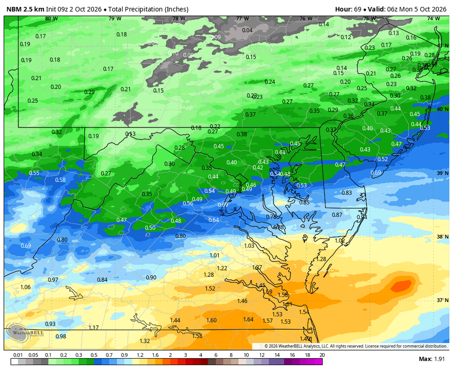
I was hoping this annoying shower fest this weekend would stay to the south. It looks like just enough to wet the ground and make the hiking trails slimy and delay my current projects.
-
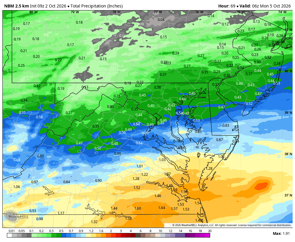
WB 9Z NBM for the weekend. (Most of the light precip. falls on Sunday.)
-
WGAL News 8 Storm Team · 19 hours ago · OCTOBER PREVIEW 2026 is flying by as we begin the final 3 months of the year! As we continue to lose daylight and the colder weather prepares to move in, here is a look at the average number for October. Our average high temperature will drop from 72° in the beginning of the month to 60° by Halloween. At night, we say goodbye to the 50s and drop to the low 40s. For precipitation, we usually receive about 3.81" of rainfall. October also begins our series of average snowfall totals. On average, we receive 0.2" of snow in October. Don't get too excited snow-lovers, the last time we had measurable snowfall in the month of October was on October 29, 2011 during the Halloween nor'easter. The average first measurable snowfall for a majority of the Susquehanna Valley isn't until around or after Thanksgiving. Below are the temperature and precipitation outlooks from the Climate Prediction Center. These maps show where the pattern favors above or below average temperatures & precipitation. Both maps give south central Pennsylvania an equal chance for either outcome, meaning the overall pattern doesn't lean one way or the other. Overall, a "typical" October is expected in both categories.
-
It was a great elevation snowstorm. Even in CT the higher elevators received a lot.
-
I hear acorns falling on my roof, can you send your neighbor over for a cleanup?
-
time to update that location friend
- Today
-
-
Sunday trended dry thankfully
-
This is the mid atl thread bro. lol
-
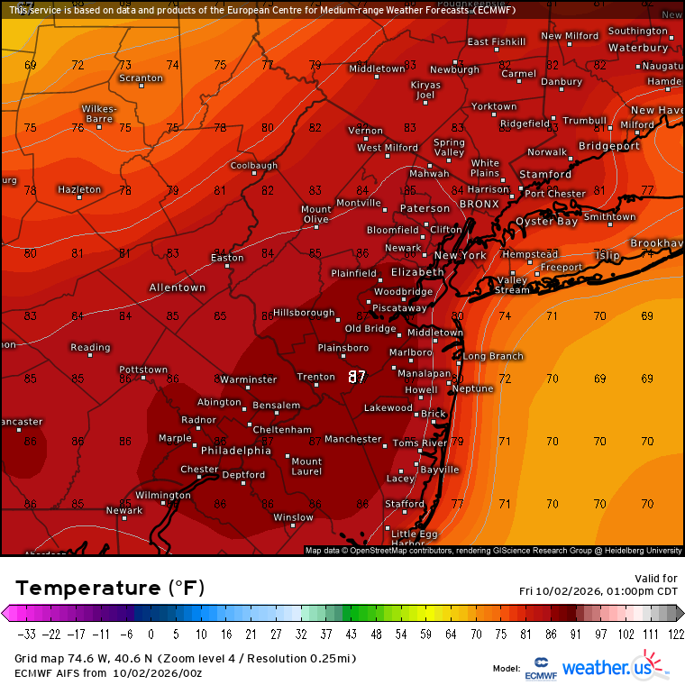
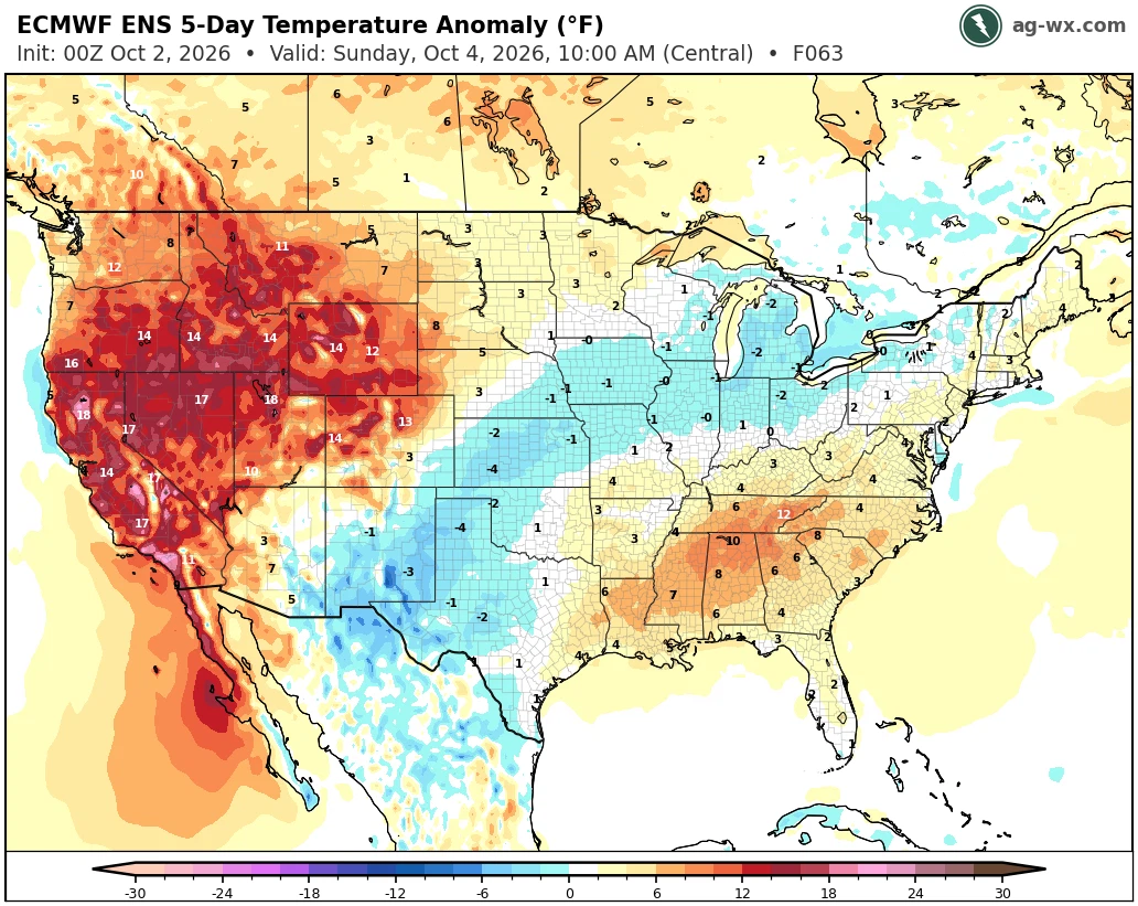
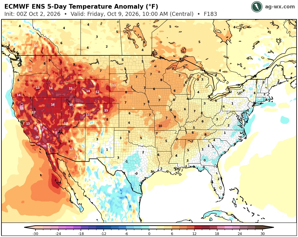
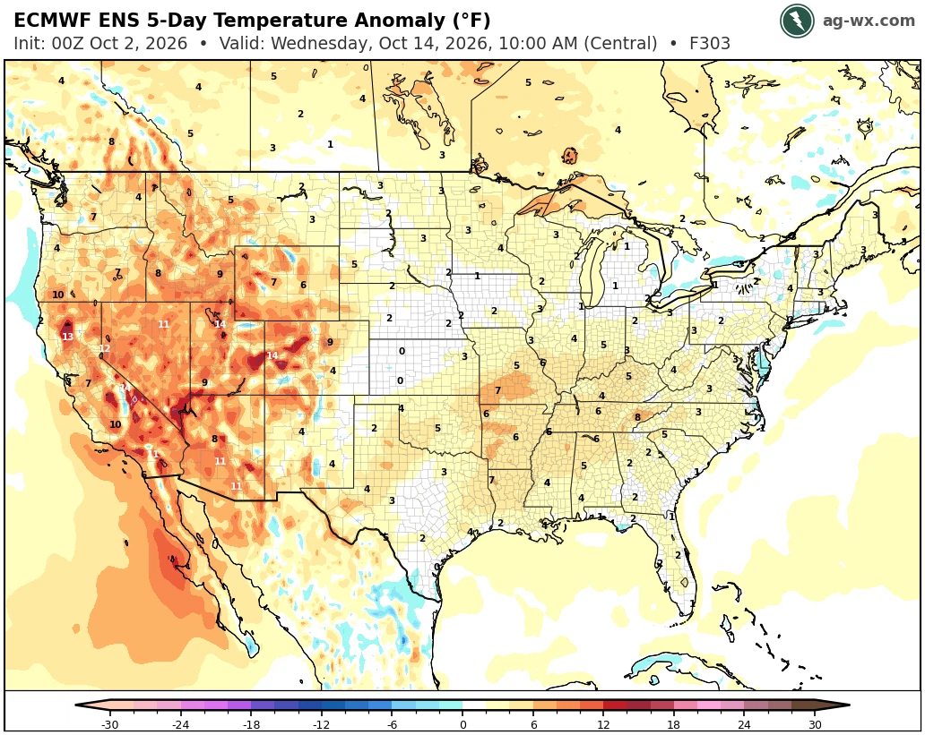
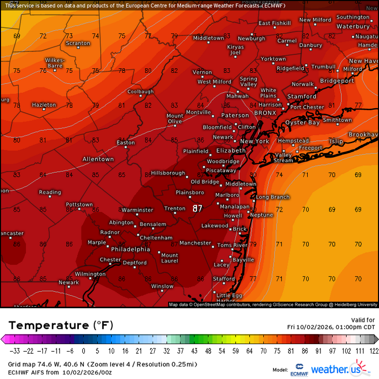
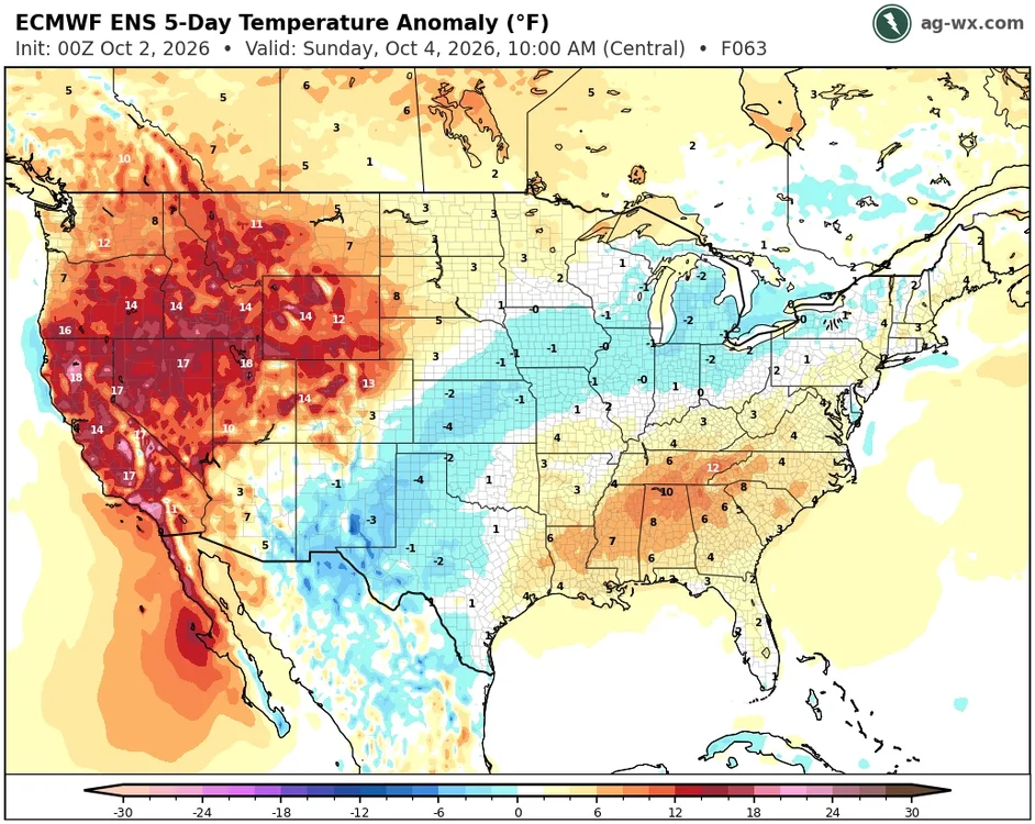
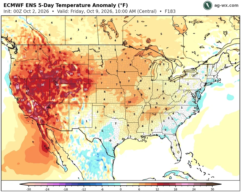
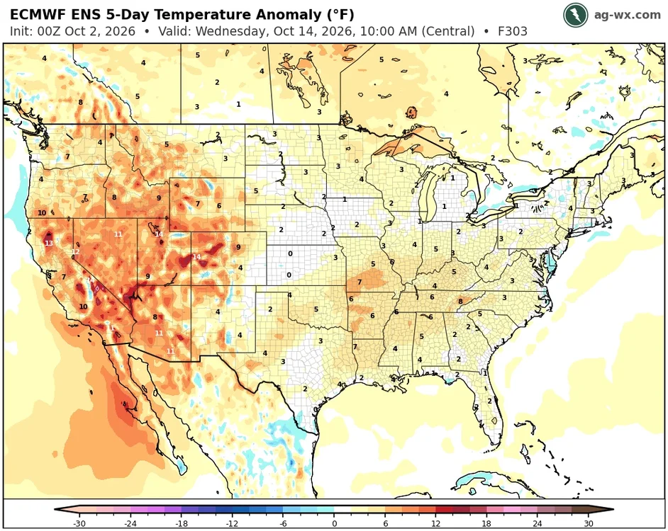
Warm spots from Philly to Newark could be closer to the AI in the mid to upper 80s with enough sun today. It’s possible some of the locally cooler spots across the region could dip under 40° next week with some frost. But looks like a quick warm up a few days later. Not much cold to work with so much warmth across the CONUS.
-
Only took a week for things to finally clear out.
-
60 degrees this morning and it sure is foggy out.
-
66/65 time for the humidity to vacate......waiting for a brisk wind later.
-
Well... we all remember January 2016, so, if we're using 2015-2016 as an analog... not bad.
-
https://sildendirect.com/# generic sildenafil
-

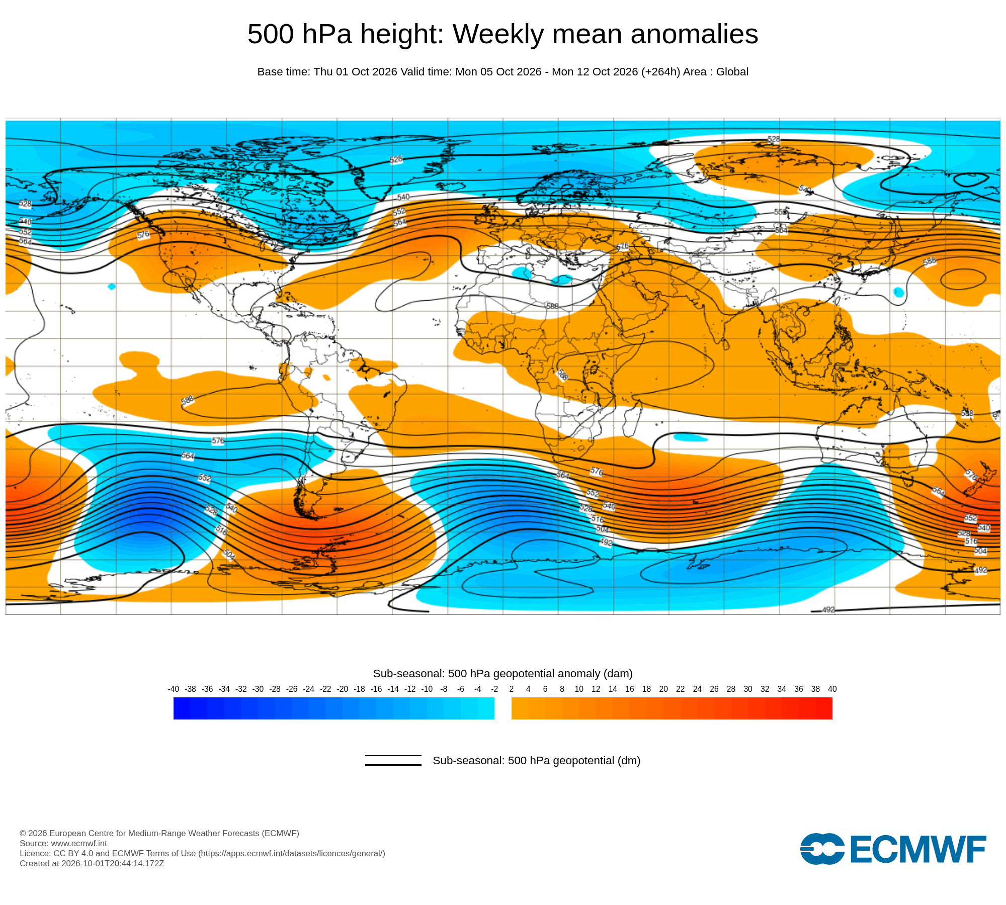
2026-2027 Record-breaking El Nino
bluewave replied to Stormchaserchuck1's topic in Weather Forecasting and Discussion
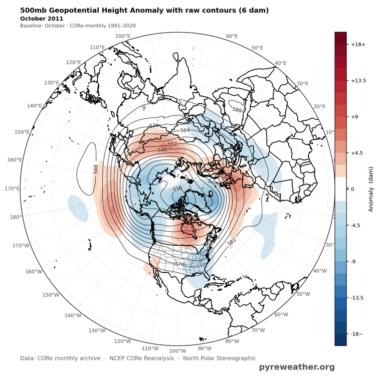
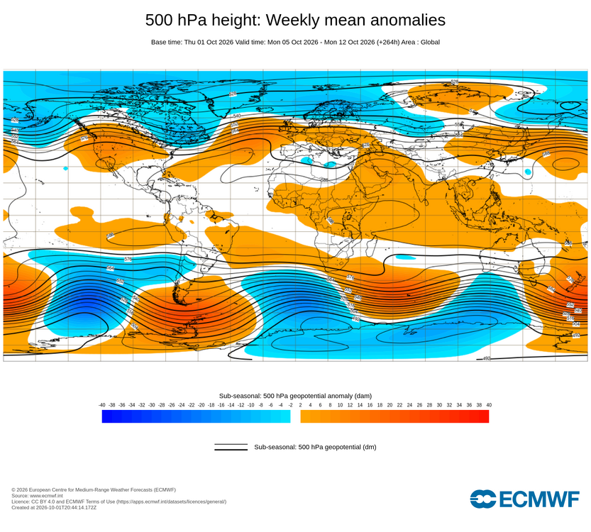
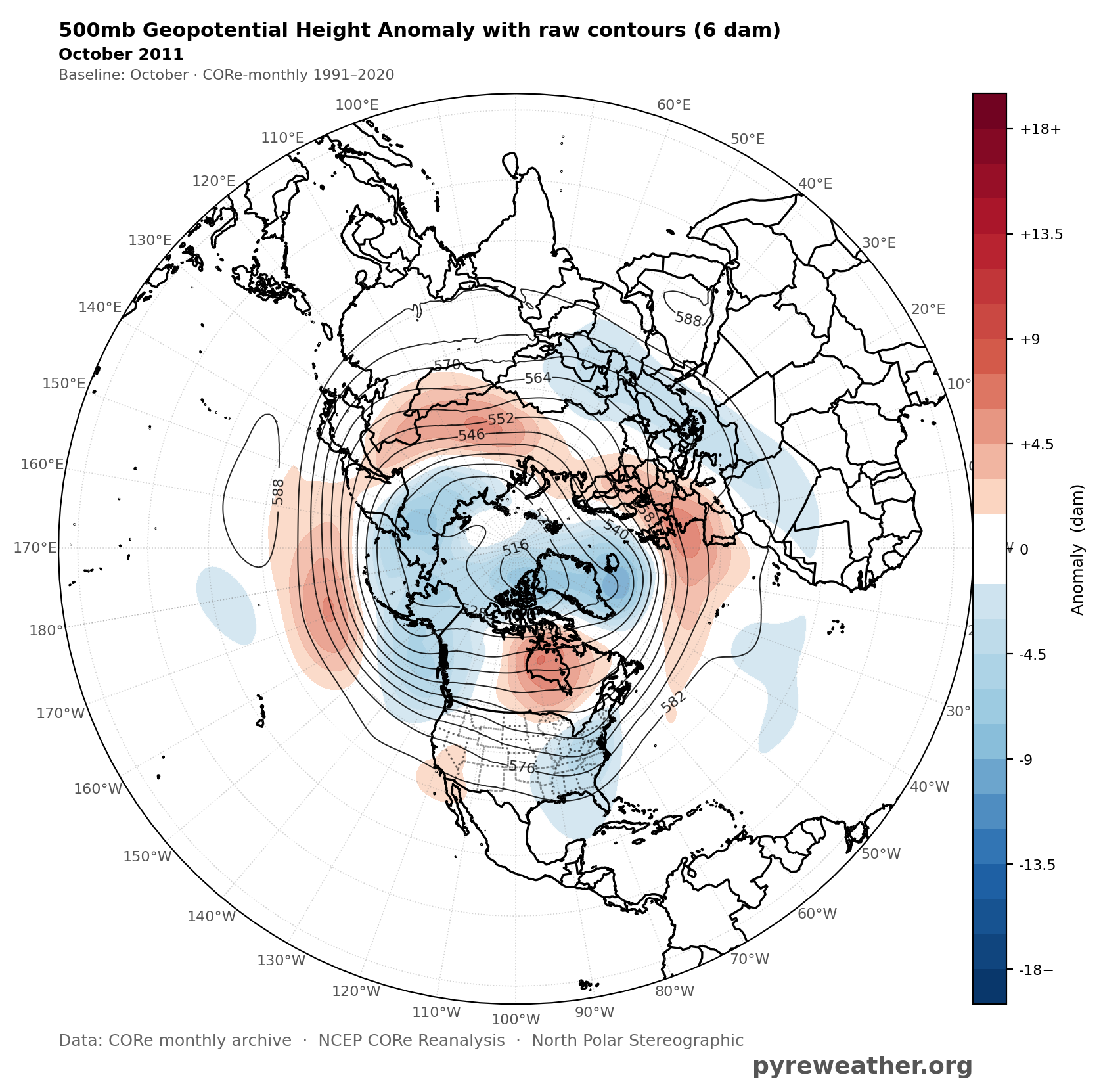
It was a+2.1 event up until a few years ago before the CPC dropped it to +1.8. So until very recently it was rated as a lower end super. In any event, it’s rare to get a +AO +EPO +WPO pattern in October regardless of the ENSO. We haven’t since this October combination since the 2011 La Niña. But this time around we are getting a stronger mid-latitude ridge across the CONUS than 2011 had. Unusual to get such a strong TPV this early in the season.