All Activity
- Past hour
-
Prismshine Productions started following First Winter Storm to kickoff 2025-26 Winter season
-

First Winter Storm to kickoff 2025-26 Winter season
Prismshine Productions replied to Baroclinic Zone's topic in New England
Who the fuck gave Ineedsnow the spiked eggnog Sent from my SM-S166V using Tapatalk -

First Winter Storm to kickoff 2025-26 Winter season
Ginx snewx replied to Baroclinic Zone's topic in New England
-
First Winter Storm to kickoff 2025-26 Winter season
dryslot replied to Baroclinic Zone's topic in New England
I don't think anyone bought the GFS being that far west or the euro being that far east. -
Agree with these numbers. At the moment I’m putting O/U for MBY around 0.3-0.5”. We’ll see where things sit tomorrow morning.
-

First Winter Storm to kickoff 2025-26 Winter season
CoastalWx replied to Baroclinic Zone's topic in New England
A great meme for it and also one of my favorite Metallica songs. -

First Winter Storm to kickoff 2025-26 Winter season
Ginx snewx replied to Baroclinic Zone's topic in New England
QPF lol dude it got bigger with its spatial area. The thermals are locked. I encourage everyone to do soundings for your area. Man what a paste bomb here. Power issues after 8 inches of heavy paste. -

First Winter Storm to kickoff 2025-26 Winter season
CoastalWx replied to Baroclinic Zone's topic in New England
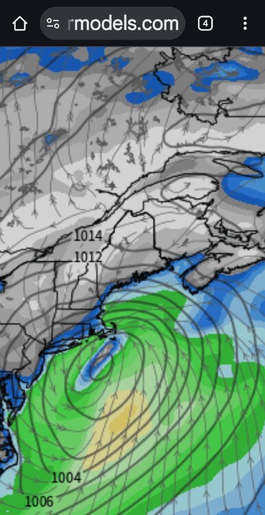
I think the typical GFS euro compromise has worked. GFS bumped quite a bit south over the last 18 hours. -

Nov 28-30th Post Turkey Day Winter Storm
Chicago Storm replied to Chicago Storm's topic in Lakes/Ohio Valley
Final storm snowfall total of 8.7" at ORD. 8.8" at RFD. -

First Winter Storm to kickoff 2025-26 Winter season
dendrite replied to Baroclinic Zone's topic in New England
If it wins this we can put the crown back on it, but there’s a reason we’ve posted the King Nothing vid numerous times the past few years. -
First Winter Storm to kickoff 2025-26 Winter season
dryslot replied to Baroclinic Zone's topic in New England
Sorry, But id did, It barely had any precip up here, Its .55" now , It caved. -
Probably our best bet for first accumulations of the season
-
Euro has some Friday night
-

First Winter Storm to kickoff 2025-26 Winter season
ineedsnow replied to Baroclinic Zone's topic in New England
That looks like a pretty good bump.. I thought the op would have moved more like that -
This mirrors my thoughts as well. I'm ready to get you some honey mustard dipping sauce for your shoe if things break our way.
-

E PA/NJ/DE Winter 2025-26 Obs/Discussion
LVblizzard replied to LVblizzard's topic in Philadelphia Region
I went 1-3” on my page with the higher end of that range likely north of route 22. My concern remains the WAA push being stronger than modeled which often happens with events like this. Not as strong as the NAM, which is way overdoing it, but it wouldn’t shock me at all to see just 2-3 hours of snow. I think the R/S line makes it to around Blue Mountain or slightly north of there in the end. -
Yup. Sloatsburg, Tuxedo Park From my years of commuting home that way every day, I agree. Stole my thunder about watches most likely going up this evening for my area.
-
Looks like models have finally converged on a most likely outcome. A weak strung out wave with marginal in-situ cold air mass for I-95 west. East of the fall line can expect all rain, maybe a bit of sleet at onset. West of I-95 to rt 15 south of I-70, perhaps a coating to an inch with some mix before changing over to rain. West of 15 and north of 70 are in a good spot for 2-3” maybe even more at the higher elevations. PSU, mitchnick, and TSSN should be excited for this one. Maybe Weather Will and clskinsfan sees a couple of inches. Now for the most important question… Will I eat my shoe? Appears unlikely, but the “shoetastic” dish is definitely not off the table yet.
-

First Winter Storm to kickoff 2025-26 Winter season
Ginx snewx replied to Baroclinic Zone's topic in New England
Did not cave. I mean its about as locked in as it can. Ignore if you must but the excuses to toss are piling up as to why. -
wxtylerb started following Mid to long range discussion- 2025
-
Snow Friday?
-

Nov 28-30th Post Turkey Day Winter Storm
nwohweather replied to Chicago Storm's topic in Lakes/Ohio Valley
Same. Nice storm overall, good lead into winter -
Just finally registered with me that AI gets this started at like lunch time Friday! And it’s cold powder too…
-

First Winter Storm to kickoff 2025-26 Winter season
WinterWolf replied to Baroclinic Zone's topic in New England
can you post.


