All Activity
- Past hour
-
When the hell did you move down to the south coast? Must’ve been when I was on vacation from here all summer.
-
lol. Probably NoP 495. Anyways just fodder at this point. At least it’s something to watch.
-

December 2025 regional war/obs/disco thread
moneypitmike replied to Torch Tiger's topic in New England
Buzzard's Bay 495 look? -

November 2025 general discussions and probable topic derailings ...
kdxken replied to Typhoon Tip's topic in New England
Link? -
Currently 45.7/26.6 at 7 pm after a 61.7 high earlier. Winds started really blowing about 3 hours ago into the upper 30's. Currently NW at 16 gusting 31 mph.
-

December 2025 Short/Medium Range Forecast Thread
Carvers Gap replied to John1122's topic in Tennessee Valley
The Euro Weeklies control run is frigid. The ensembles is obviously smoothed but seasonably cold. @John1122, the late December/early Jan cold snap is evident. -
E PA/NJ/DE Autumn 2025 Obs/Discussion
simbasad2 replied to PhiEaglesfan712's topic in Philadelphia Region
New to Americanwx so I'm still trying to figure things out here. How far usually 'til a storm thread is made? -
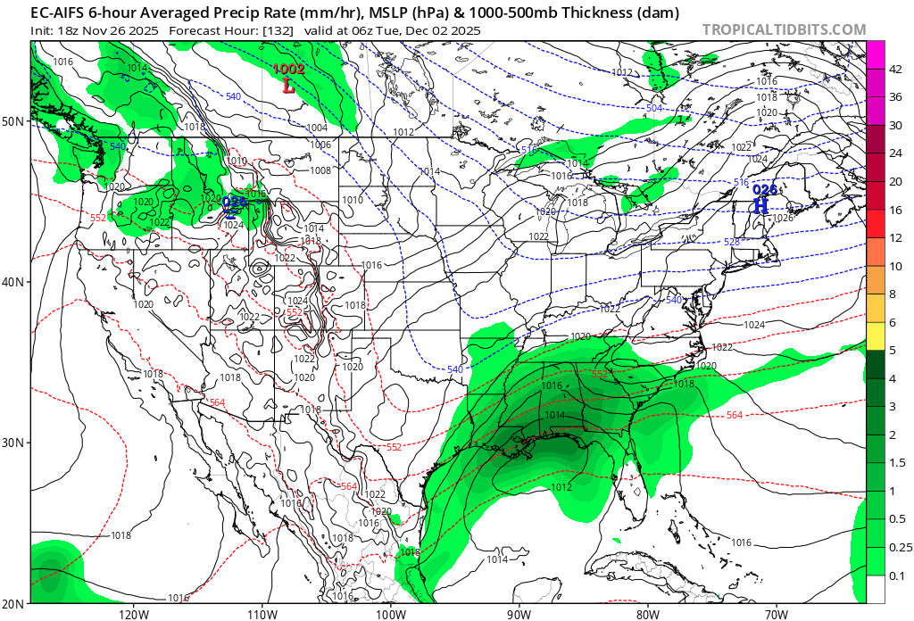
Definitely a 495 look. Which is not a surprise on 12/2.
-

Nov 28-30th Post Turkey Day Wintry Potential
Baum replied to Chicago Storm's topic in Lakes/Ohio Valley
Pretty much expected: ALTHOUGH, WE ARE NOT COMPLETELY SOLD ON WHAT THE EURO GUIDANCE IS SHOWING, AS IT IS LARGELY AN OUTLIER. THE GFS/GEFS AND THE CANADIAN SUITE OF GUIDANCE ARE NOT AS HIGH WITH TOTALS, BUT STILL BRING IMPACTFUL SNOWFALL. QC -
We’re due for another good old classic 495 storm. The high is actually starting in a decent spot at the onset. It retreats but even coast might get a good front ender if that antecedent airmass is good.
-
Just an op run but 18z GFS is a much better H5 look for frozen on the 6th for the corridor and points east for early Dec. At the surface- broad area of HP to the north, instead of a High sliding off the NE coast for the Dec 2-3 storm. All subject to change ofc.
- Yesterday
-

Nov 28-30th Post Turkey Day Wintry Potential
homedis replied to Chicago Storm's topic in Lakes/Ohio Valley
Seems more reasonable tbh, track still looks good & I’d be very happy with a widespread 6-8”. -
H7is by dendrite. Definitely more SWFE looking aloft.
-
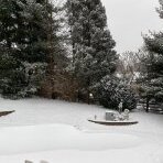
Pouring
-
 Steelwagon bank blow ups still might make Ray and some other central Eastern and Northern folk happy.
 -
Those were some warning criteria winds today. Several locations well over 55mph multiple times. Cedar Rapids hit 64mph, Iowa City hit 63mph. MLI/DVN hit 57/56mph.
-

Nov 28-30th Post Turkey Day Wintry Potential
cyclone77 replied to Chicago Storm's topic in Lakes/Ohio Valley
Guessing the cat is the Euro. -
December 2025 regional war/obs/disco thread
moneypitmike replied to Torch Tiger's topic in New England
Where's Prismshine? -
 Torchy day. Think some breached 60F.
 -
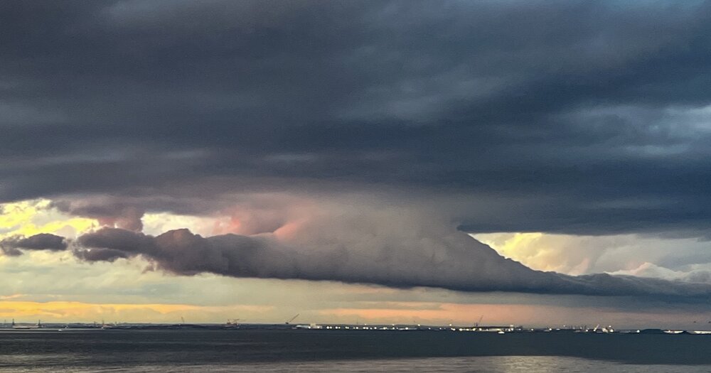
Neat sky at sunset tonight.
-
Well Randy u might wanna cross ur fingers bro just in case..... And a prayer wouldn't hurt lol
-
December 2025 regional war/obs/disco thread
Baroclinic Zone replied to Torch Tiger's topic in New England
Lots to sort out. Wave that pushes through around the 1st is key. What does that do to baroclinic zone. 2nd is intensity of the trailing shortwave and how quickly that intensifies. Could still be a sheared out mess or amped up inland. we watch. We baste the turkey. We come back Friday. -
Having one now. Bourbon + a little Fireball.
-
Not bad at all considers is 6 days out
-
Euro AIFS