All Activity
- Past hour
-
Love it. Better embrace it as summer expands.
-
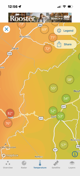
Its typical here
-

Pittsburgh/Western PA WINTER ‘25/‘26
meatwad replied to Burghblizz's topic in Upstate New York/Pennsylvania
URGENT - IMMEDIATE BROADCAST REQUESTED Tornado Watch Number 25 NWS Storm Prediction Center Norman OK 125 PM EST Sat Mar 7 2026 The NWS Storm Prediction Center has issued a * Tornado Watch for portions of Western New York Eastern and Southern Ohio Western Pennsylvania Northern West Virginia * Effective this Saturday afternoon and evening from 125 PM until 800 PM EST. * Primary threats include... A few tornadoes possible Scattered damaging wind gusts to 70 mph likely Isolated large hail events to 1.5 inches in diameter possible SUMMARY...Storms are expected to develop and intensify this afternoon across the region, with conditions supportive of supercells and fast-moving severe storms capable of damaging winds and tornadoes. The tornado watch area is approximately along and 65 statute miles east and west of a line from 30 miles south of Athens OH to 30 miles north of Bradford PA. For a complete depiction of the watch see the associated watch outline update (WOUS64 KWNS WOU5). PRECAUTIONARY/PREPAREDNESS ACTIONS... REMEMBER...A Tornado Watch means conditions are favorable for tornadoes and severe thunderstorms in and close to the watch area. Persons in these areas should be on the lookout for threatening weather conditions and listen for later statements and possible warnings. && OTHER WATCH INFORMATION...CONTINUE...WW 23...WW 24... AVIATION...Tornadoes and a few severe thunderstorms with hail surface and aloft to 1.5 inches. Extreme turbulence and surface wind gusts to 60 knots. A few cumulonimbi with maximum tops to 450. Mean storm motion vector 25040. ...Guyer -
It's a beautiful day out here. Currently up to 75.4 and everyone is coming out of hibernation.
-
anything could happen, the truth is we won't know not much snow left here.
-
Agree Swamp ass weather
-
It’s horrific
-
its all about the direction of the wind away from the coast next week in our region we will reach 70 BUT some areas of the Jersey coast and Long Island will be under 60 or under 50 and I bet some person here will mention the extra hour of daylight helping the high temp
-
75 in Buffalo and 46 here. Horrific
-

2026 Severe Wx - General Thread
HillsdaleMIWeather replied to largetornado's topic in Lakes/Ohio Valley
Just got a preliminary EF3 rating for Union City, and that's with the caveat that the nws could only access a small area of damage today due to most areas still being impassable. -
It is the equivalent of watching paint peel off the side of a house...
-
Big snow storms in March are not unusual for New York | FOX 5 New York
-
Finished with 1.41" after another 0.31" overnight.
-

Central PA Spring 2026 Discussion/Obs Thread
Blizzard of 93 replied to Voyager's topic in Upstate New York/Pennsylvania
Sorry to hear about your accident. Wave on your way through Marysville! Happy to hear that you & your wife are ok. -
Euro has nothing but alot of waves in this pattern .
-
Your last line actually makes sense (this is not the mlb forum ). It would be interesting to see who are just snow lovers, who are winter lovers, and who are both. Because there absolutely are three groups. In the Lakes subforum I know who's who but dont call em out. Im all 3. It can snow to the end of April but thats not winter. I generally think of winter as mid november to mid March. Even though march averages more snow than November, November absolutely seems like the more wintry month here lately.
-
I don't think most prefer December 1989.
-
-
I don't think so.....once we hit solar min and flip the Pacific we will get a good stretch around the turn of the decade. Some are getting carried away with the CC/addiction analogies and such.
-

Central PA Spring 2026 Discussion/Obs Thread
canderson replied to Voyager's topic in Upstate New York/Pennsylvania
That sucks. Glad you’re all OK. -

Pittsburgh/Western PA WINTER ‘25/‘26
Mailman replied to Burghblizz's topic in Upstate New York/Pennsylvania
Mesoscale Discussion 0167 NWS Storm Prediction Center Norman OK 1157 AM CST Sat Mar 07 2026 Areas affected...eastern Ohio...northwestern West Virginia...western Pennsylvania...southwestern New York Concerning...Severe potential...Watch likely Valid 071757Z - 072000Z Probability of Watch Issuance...80 percent SUMMARY...Intensifying thunderstorm development may become capable of producing marginally severe hail, increasing risk for damaging wind gusts and perhaps accompanied by potential for a couple of tornadoes by 3-5 PM EST. DISCUSSION...Boundary-layer layer moisture return across the upper Ohio Valley into lower Great Lakes region is ongoing, but remains somewhat modest with surface dew points increasing through the mid/upper 50s. However warming and mixing with continuing insolation is contributing to steepening low-level lapse rates and thermodynamic profiles with weak to modest CAPE increasing in excess of 500 J/kg, beneath southwesterly deep-layer mean ambient flow increasing to near 50 kt. Deepening convective development now appears underway along and discretely ahead of a convectively generated pre-cold frontal surface boundary now advancing across central into eastern Ohio. As this continues into the Allegheny Plateau through 21-22Z, developing thunderstorm activity appears likely to intensify and organize. This may include a few evolving supercell structures within and ahead of an evolving line, accompanied by a risk for severe hail and damaging wind gusts. With surface winds generally veered to a fairly prominent westerly component, the degree to which low-level hodographs will become supportive of tornadic potential remains unclear, particularly given the still sizable boundary-layer temperature/dew point spreads. However, as 850 mb winds strengthen to 50+ kt across eastern Ohio into western Pennsylvania, various model derived output suggests that profiles could become locally conducive to a supercell tornado threat by late afternoon. ..Kerr/Guyer.. 03/07/2026 -

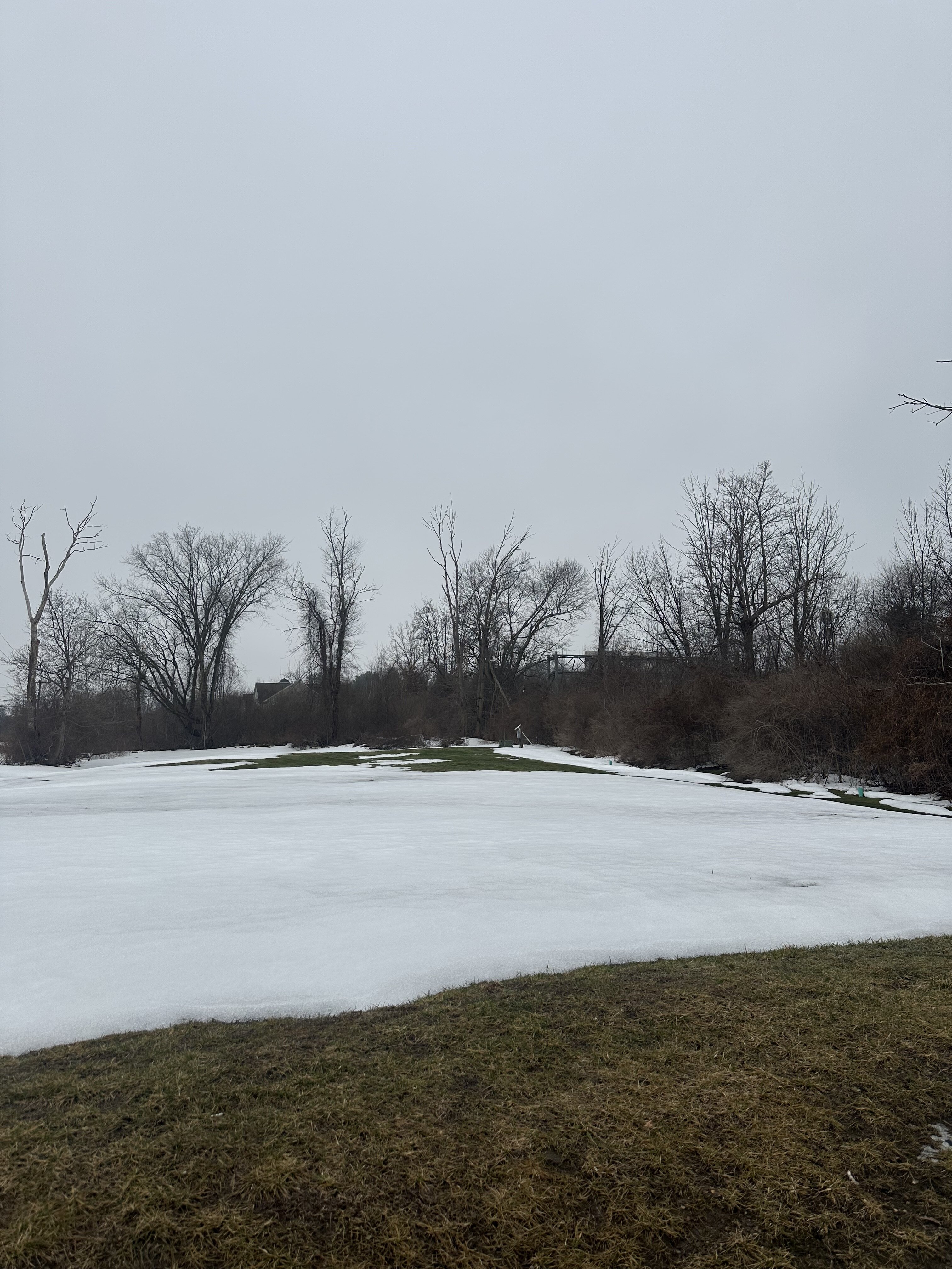
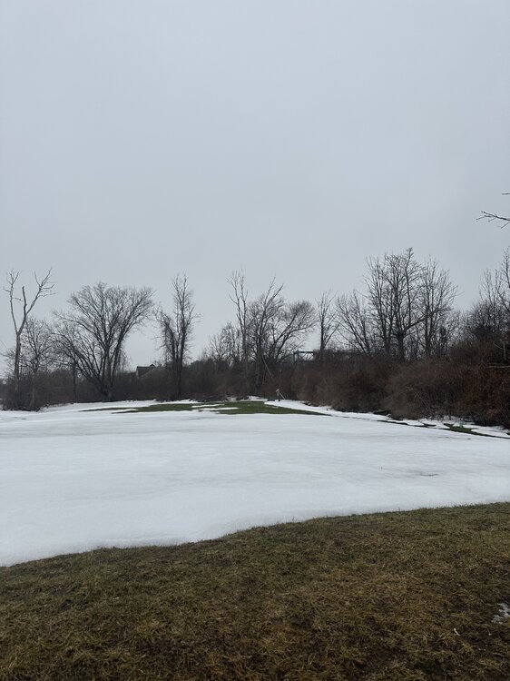
E PA/NJ/DE Spring 2026 Obs/Discussion
RedSky replied to PhiEaglesfan712's topic in Philadelphia Region
One last north facing white holdout -
This...I declared the season over in mid February last season, as I had always expected a mild March...not this time.
-
Brutal weather.
-
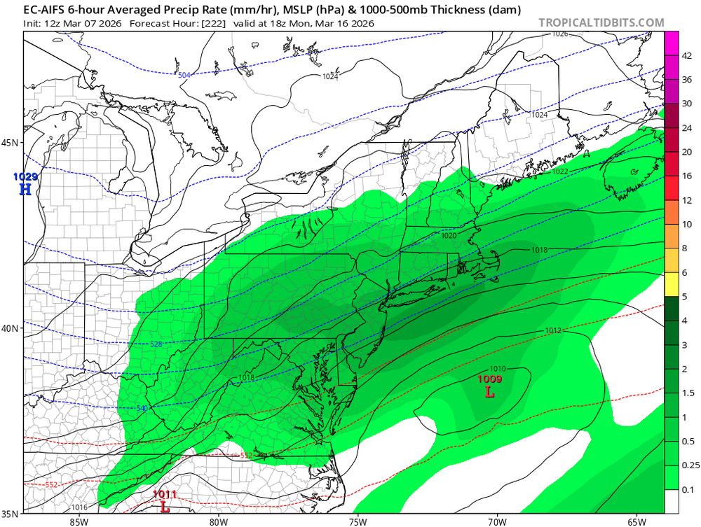
Gotta get one to go underneath us, not the barrage of FROPAs modeling has


.thumb.JPG.418e8a9a2902ae687ec35ff4bc0e038e.JPG)