All Activity
- Past hour
-
While the region waits as the nor'easter's rain spreads north and westward into the region, Phoenix has been having an incredibly wet day. It has seen hourly rainfall as high as 0.63" and has picked up 1.83" so far, today. Today is the fourth wettest October day on record there.
-

E PA/NJ/DE Autumn 2025 Obs/Discussion
JTA66 replied to PhiEaglesfan712's topic in Philadelphia Region
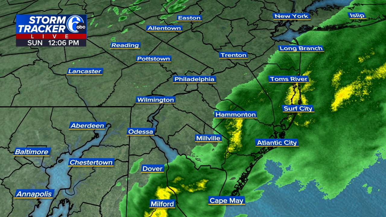
I’m counting on wrap-around rains to save the day -
 They are "professionals," but I still try to keep people like this at arm's length. Hey, it's a free country, but I cant promise my response will be timely if they find themselves in a precarious/dangerous situation.
-
 Hopefully, the flooding won't be so bad that it would affect the unraised homes.
- 389 replies
-
- 1
-

-
- heavy rain
- damaging wind
- (and 2 more)
-
They are way more common in the UK. I always thought they were rather fun lol.
-

E PA/NJ/DE Autumn 2025 Obs/Discussion
Birds~69 replied to PhiEaglesfan712's topic in Philadelphia Region
Shore special. Not really budging West...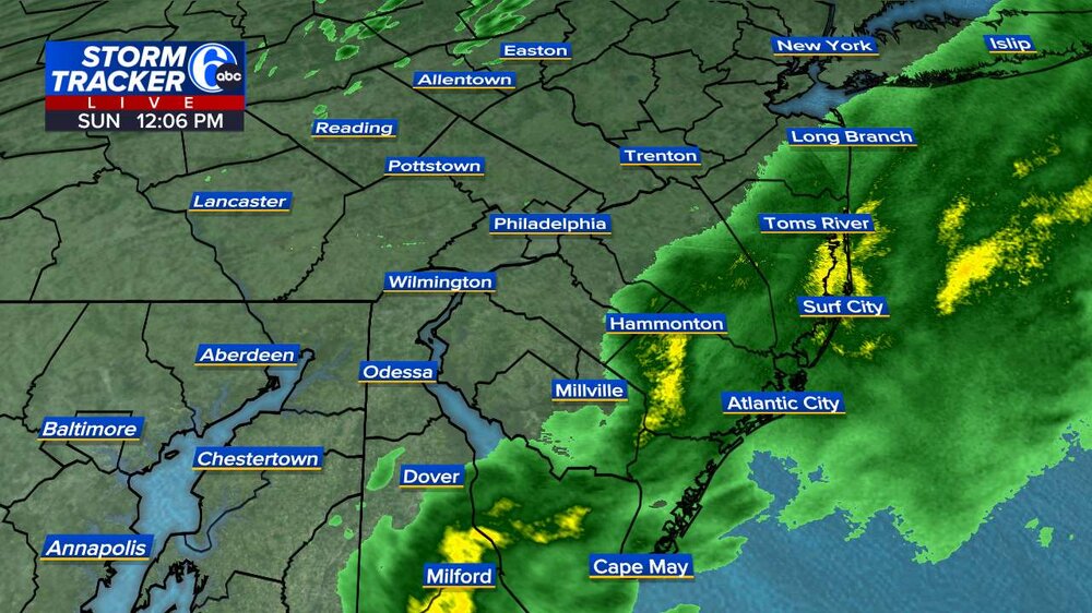
-
3 hours til high tide on my part of barnegat bay. Lower roads are already all caving quickly. This may overperform. Im getting consistent gusts to 45 now in this band. If this intensity is consistent until tomorrow's high around 4PM, we may have significant flooding damage in the 2nd flood zone tier for our town. This would affect nearly 400 homes that were not raised after Sandy.
- 389 replies
-
- 1
-
-
- heavy rain
- damaging wind
- (and 2 more)
-
2005: On this date through the 14th, on its way to setting a local record for the month, Central Park in New York City received 8.5 inches of rain over the 3-day period. 16.73 inches fell during October to eclipse a 102-year record. (Ref. Wilson Weather History) The heaviest rain actually fell to the east of the city with 7-8 straight days of rain and over 20 inches to 2 feet for the entire month!!
-
lol I pictured a dust storm initially with a hot wind and dry hot conditions. That would be absolutely amazing to see so far north and so late in the season! damn there was a star burst meteor shower too the Draconids, good timing being early in the evening rather than late at night and visible even with the full moon
-

The return of the elusive Nor'easter. Drought buster or bust?
87storms replied to dailylurker's topic in Mid Atlantic
ECMWF has the weather forecasting game on lock. -

-
 very much like December 1992
 -
Yes, like January 2016, Boxing Day, PD2, January 1996 and February 1983 the big ones usually take time for the precip to move in but once it does it goes hard and heavy for a long time.
-

Central PA Fall Discussions and Obs
Voyager replied to ChescoWx's topic in Upstate New York/Pennsylvania
Wow!!! What a storm... So far I'm up to 0.01" and recorded a peak wind gust of 6.8 mph. What a far cry from all the social media doomsday posts as well as what the models were sometimes showing a few days ago -
 I’d say 48hrs, at least Tuesday winds start to subside and hopefully we get some sun before the day ends.
- 389 replies
-
- 2
-
-
- heavy rain
- damaging wind
- (and 2 more)
-
 Looks like a snowstorm radar. Let’s do this again in January
- 389 replies
-
- 2
-
-
- heavy rain
- damaging wind
- (and 2 more)
-
to be fair, noreasters, like hurricanes, are usually graded on windspeeds and duration not rainfall or snowfall amounts. It's why October 1991 ranks so highly.
-
The return of the elusive Nor'easter. Drought buster or bust?
87storms replied to dailylurker's topic in Mid Atlantic
Beautiful dry breeze in Frederick. Just got a road bike sesh in…pavement is mostly dry as well. That drought monitor is gonna start looking colorful soon. -
Excellent .
-

E PA/NJ/DE Autumn 2025 Obs/Discussion
Ralph Wiggum replied to PhiEaglesfan712's topic in Philadelphia Region
Beautiful Noreaster....sunscreen is out in Telford, gentle breeze.....beautiful fall football weather -
it's not raining here Walt, but it's very windy.
-
E PA/NJ/DE Autumn 2025 Obs/Discussion
Birds~69 replied to PhiEaglesfan712's topic in Philadelphia Region
Just ready to say this. Yeah, it brightened up out there...still gusty though. -
I'm posting this in the banter thread, since I don't want to downplay any warnings. The main coastal low that was forecast to cause most of the damage appears to be stationary near the coast of South Carolina. Some models predicted a secondary to develop along the Delmarva coastal area. Is this the precipitation that is affecting southeast NJ now and is being shunted southward away from Northeast NJ? It looks like some of this rain will graze Union County NJ and then be shunted further east? Will the upper level low over northern NY state add to any precipitation? I am thinking not much rain in northeast Jersey until maybe later tonight and tomorrow, if the low over South Carolina ever gets moving? I think the main concern is coastal flooding due to the long period of winds driving water towards the shore. Some breezes in Garwood NJ (central Union County), but otherwise just cloudy. Should have moved my garage sale from yesterday (showers) to today, but previous forecasts did not advise it...