All Activity
- Past hour
-

Central PA Summer 2026 Discussion/Obs Thread
Itstrainingtime replied to Voyager's topic in Upstate New York/Pennsylvania
101 here in Maytown. -

E PA/NJ/DE Summer 2026 Obs/Discussion
Eskimo Joe replied to PhiEaglesfan712's topic in Philadelphia Region
Pottstown (PTW) hits 100° -
100/74 is murder good lord - heat index of 112
-
100 in huntington station. The seabreeze, which has been modeled perfectly by the HRRR, is crossing the northern state.
-
And tomorrow is supposed to be hotter
-
E PA/NJ/DE Summer 2026 Obs/Discussion
Eskimo Joe replied to PhiEaglesfan712's topic in Philadelphia Region
Oh man, looks like warning criteria. Upgrade soon, yes? -
 Saw a 103 in Medford Mass in the nws obs.. 101 here in Seymour at lower elevation
 -
103
-

E PA/NJ/DE Summer 2026 Obs/Discussion
MGorse replied to PhiEaglesfan712's topic in Philadelphia Region
Oh cool, so by evening it should look like this outside here?
-
100 in Muttontown finally. 99.5 for Syosset so far.
-
So thats who runs that weather station I kept seeing on Spruce Knob. Love that I get this data now when I'm wondering what its like up there. Currently they just hit 80 degrees.
-
103/71 here highest its been since 2012 here sheesh
-
Central PA Summer 2026 Discussion/Obs Thread
Eskimo Joe replied to Voyager's topic in Upstate New York/Pennsylvania
Even Allentown (ABE), Ft. Indiantown (MUI), and Wilkes-Barre (AVP) are making a run at 100°. EDIT: Ft. Indiantown (MUI) just reported 101° on the 6hr ob! -
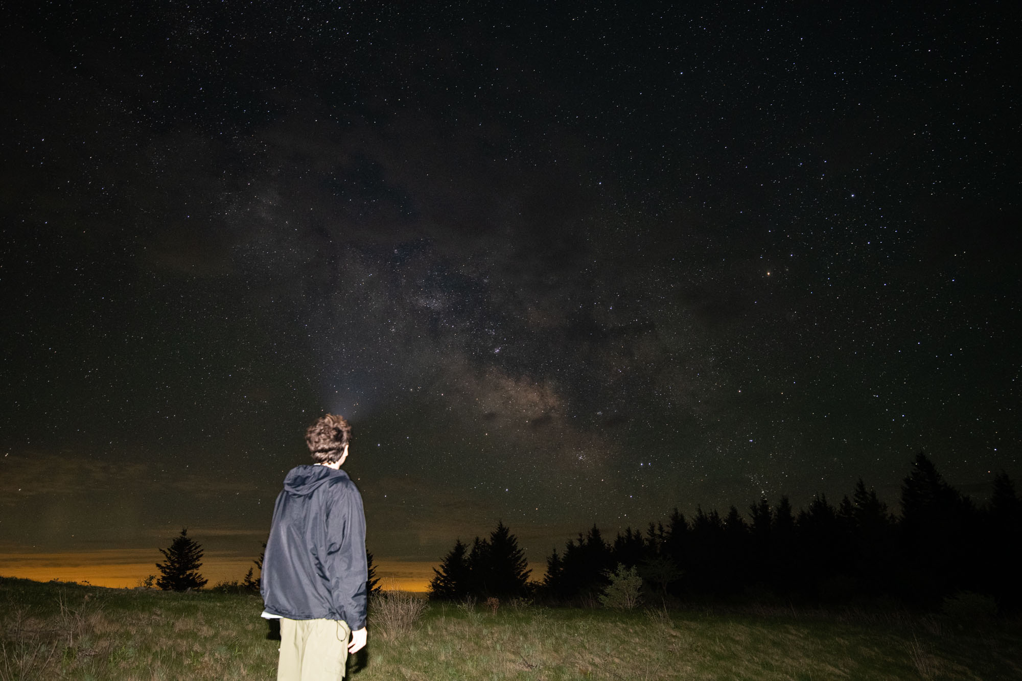
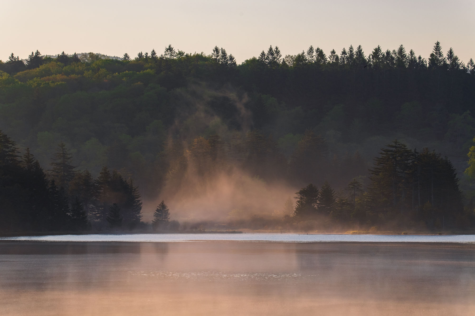
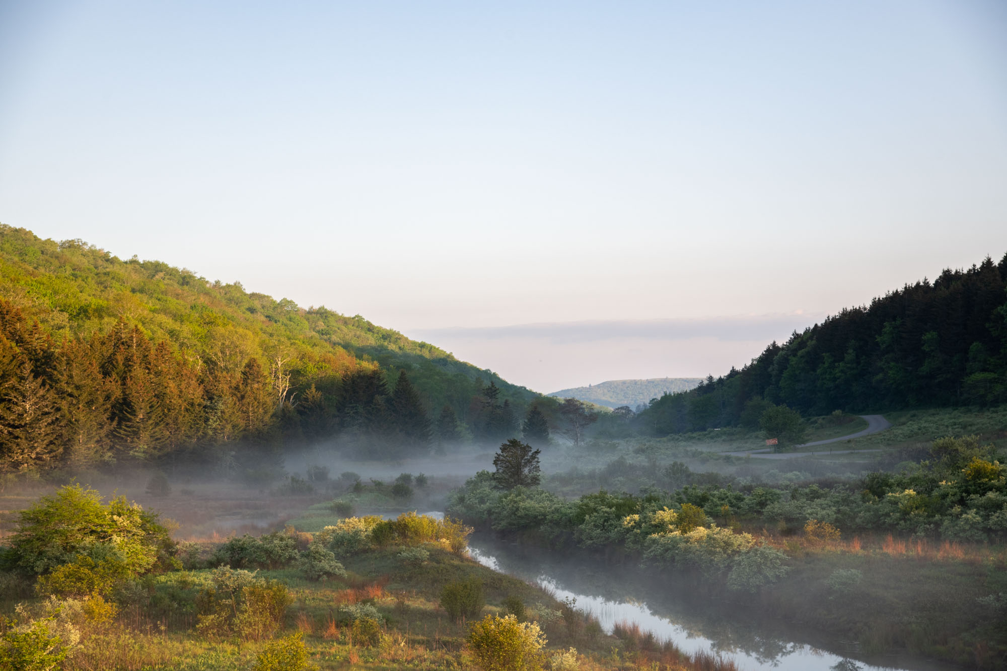
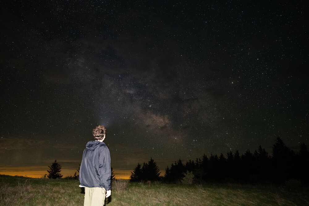
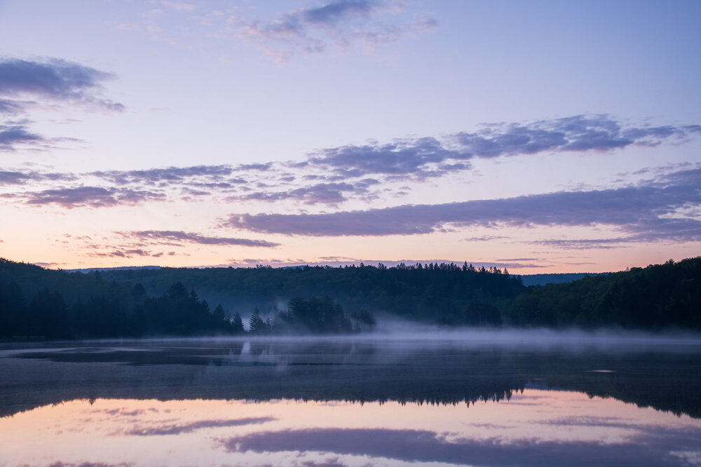
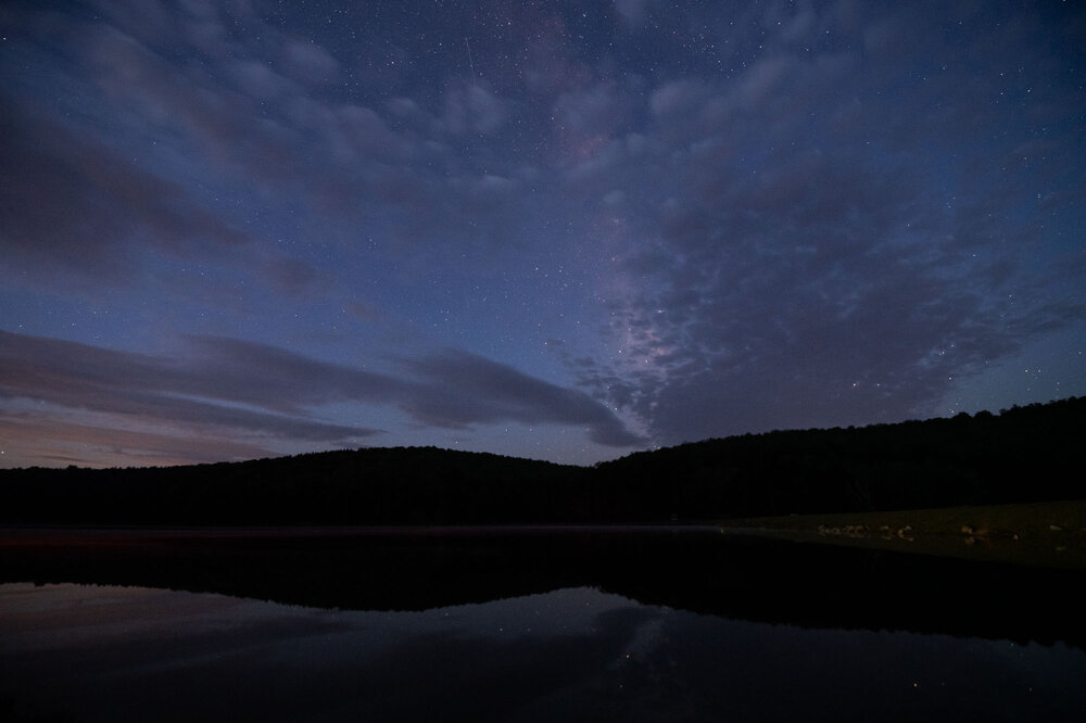
If you really want to escape the heat you've got to head up to the mountains of WV. For example, Spruce Knob, the highest point in WV, at 4800ft is experiencing a pleasant week of weather with no highs reaching above the mid-80s and dews stuck at 60 degrees. Lapse rate is around 1 degree C 100 meters so the temperature difference follows. Though, that elevation is a double-edged sword as I've gone there a couple times in the past year for hiking and stargazing and seen snow over in late April. The whole peaks of WV are an entirely different world with their geography and climatology! Wish I could head out there again but am tied up coaching. Hope these pictures from my latest visit in Mid-May to both the summit (top picture) and its nearby lake encourage someone to go out there!


-
Magical
-
Newark: 104° (old record: 103°, 1901)
-
 Logan 99
 -
 I would have to think something pops too. At least in the case of tomorrow, we have pretty decent height falls into the evening and overnight and lapse rates are pretty respectable for these parts. Shear is pretty solid too, although llvl flow being more westerly may limit convergence? Instability will be there. This is hitting a nice area for wind potential tomorrow and this corridor lines up well with where the best ingredients overlap
 -
DCA 100
-

Central PA Summer 2026 Discussion/Obs Thread
canderson replied to Voyager's topic in Upstate New York/Pennsylvania
102 at the house -
E PA/NJ/DE Summer 2026 Obs/Discussion
Eskimo Joe replied to PhiEaglesfan712's topic in Philadelphia Region
Don't worry. Once the rates kick in you should wet bulb. -
101.5. Holy moly
-
The South Shore beaches in the upper 70s are the place to be on days like these. FW3143 West Gilgo Observation Time: 07/02/26 @ 14:05 EDT 18:05 UTC Elevation: 6 ft OK Weather Conditions Temperature: 78 °F Dew Point: 71 °F Humidity: 80 % Wind: SE at 10 MPH Peak Gust: 15 MPH 24 Hour Max/Min Events Max Temperature: 78 °F Min Temperature: 69 °F Max RH: 91 % Min RH: 80 % Max Dew Point: 72 °F Min Dew Point: 66 °F Max Gust: 29 MPH
-
101 / 40% humidity HI 110
-
E PA/NJ/DE Summer 2026 Obs/Discussion
MGorse replied to PhiEaglesfan712's topic in Philadelphia Region
99 here with a heat index of 108. Lovely!