All Activity
- Past hour
-

October 2026 General Discussion
hawkeye_wx replied to SchaumburgStormer's topic in Lakes/Ohio Valley
The big Wednesday night rain event trended well nw, so much of my area didn't get much... only a few tenths here. More light showers are popping now, so my 2+day total may end up close to 2". -
 https://sildendirect.com/# Viagra tablet online
 -
online ed treatments: ApexMen Meds - ed prescriptions online
-
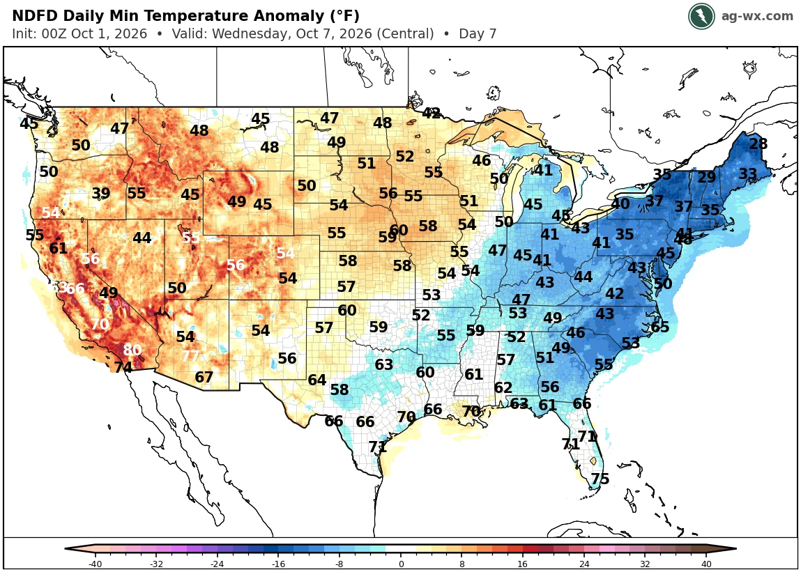
You know we’ve turned the corner into predominate fall weather when it still gets down into the 50s as lows despite being in a warm pattern.
-
70/59… feels warm out there. Saw some sun this morning but now clouded over again. Foliage on fire.
-
 DCA: +1.5 NYC: +1.0 BOS: +0.5 ORD: +2.0 ATL: +2.0 IAH: +2.7 DEN: +2.3 PHX: +2.5 SEA: +1.9
 -
aside from about 5 minutes yesterday, i haven't seen the sun since Thursday. this blows
-
As has been said countless times…forecasts change, so you never know…
-

2026-2027 Record-breaking El Nino
bluewave replied to Stormchaserchuck1's topic in Weather Forecasting and Discussion
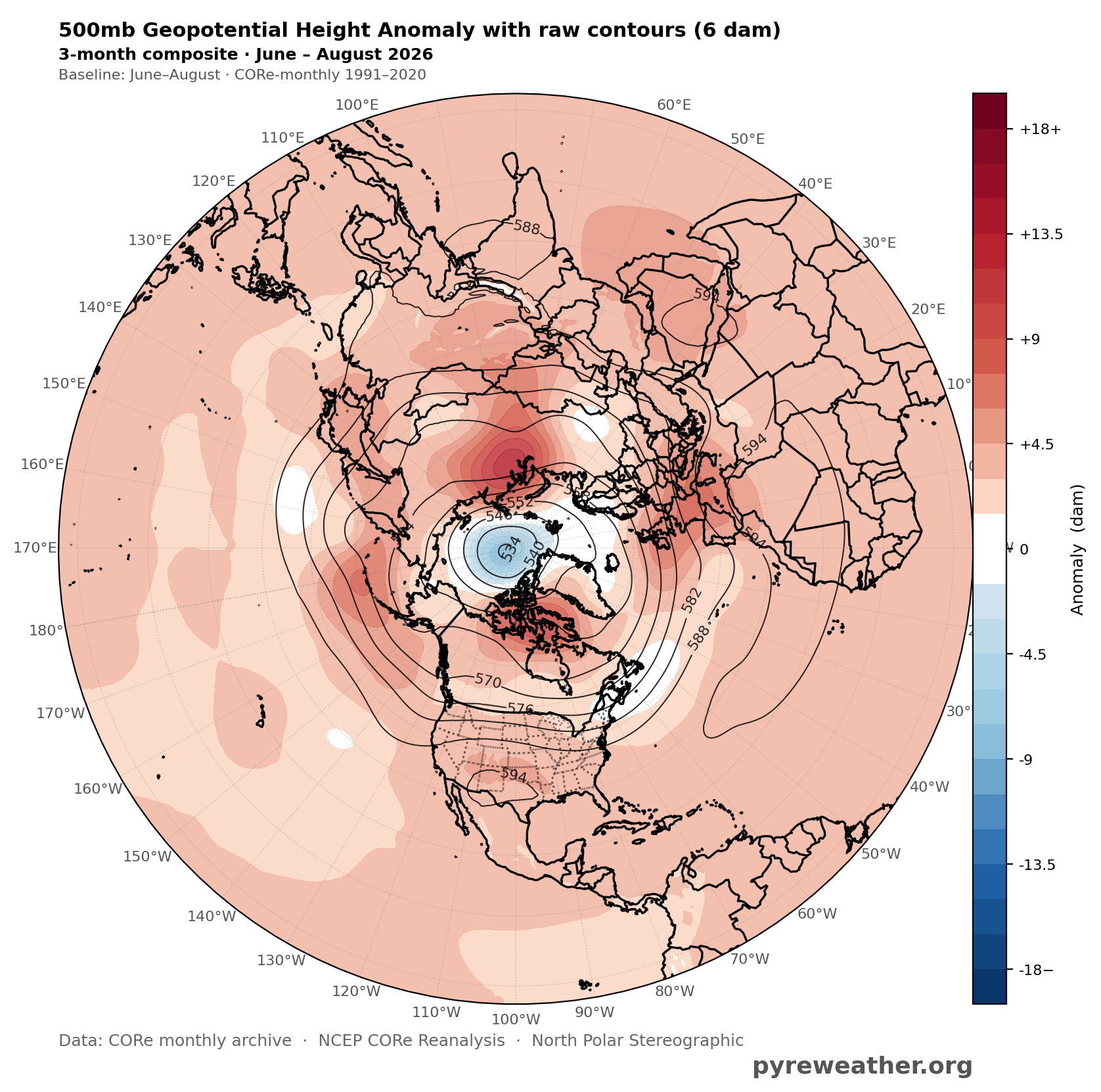
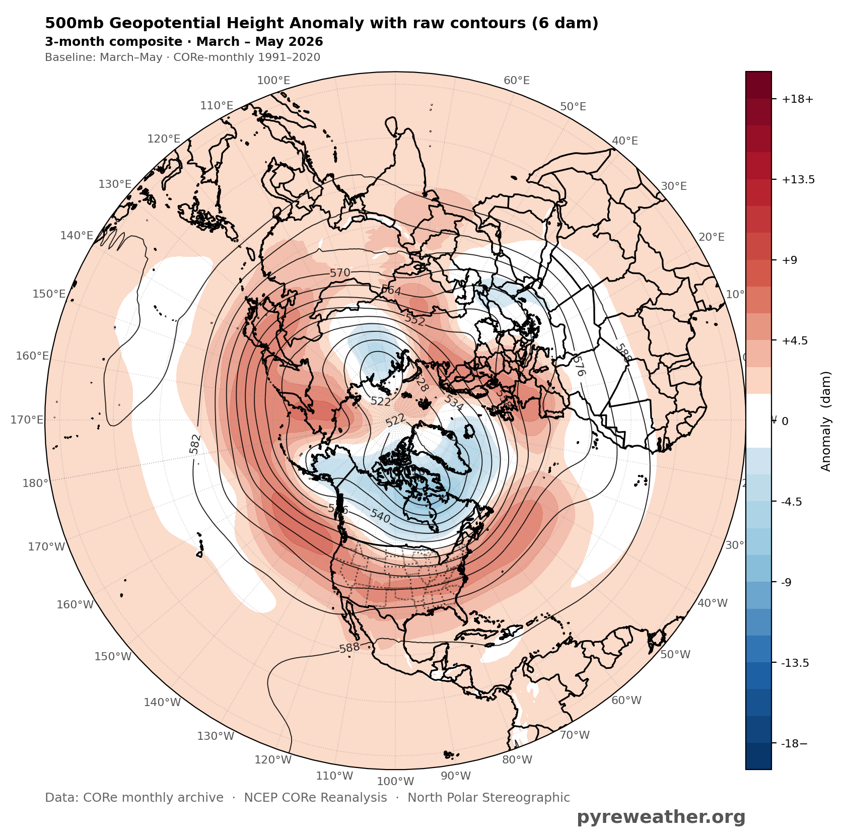
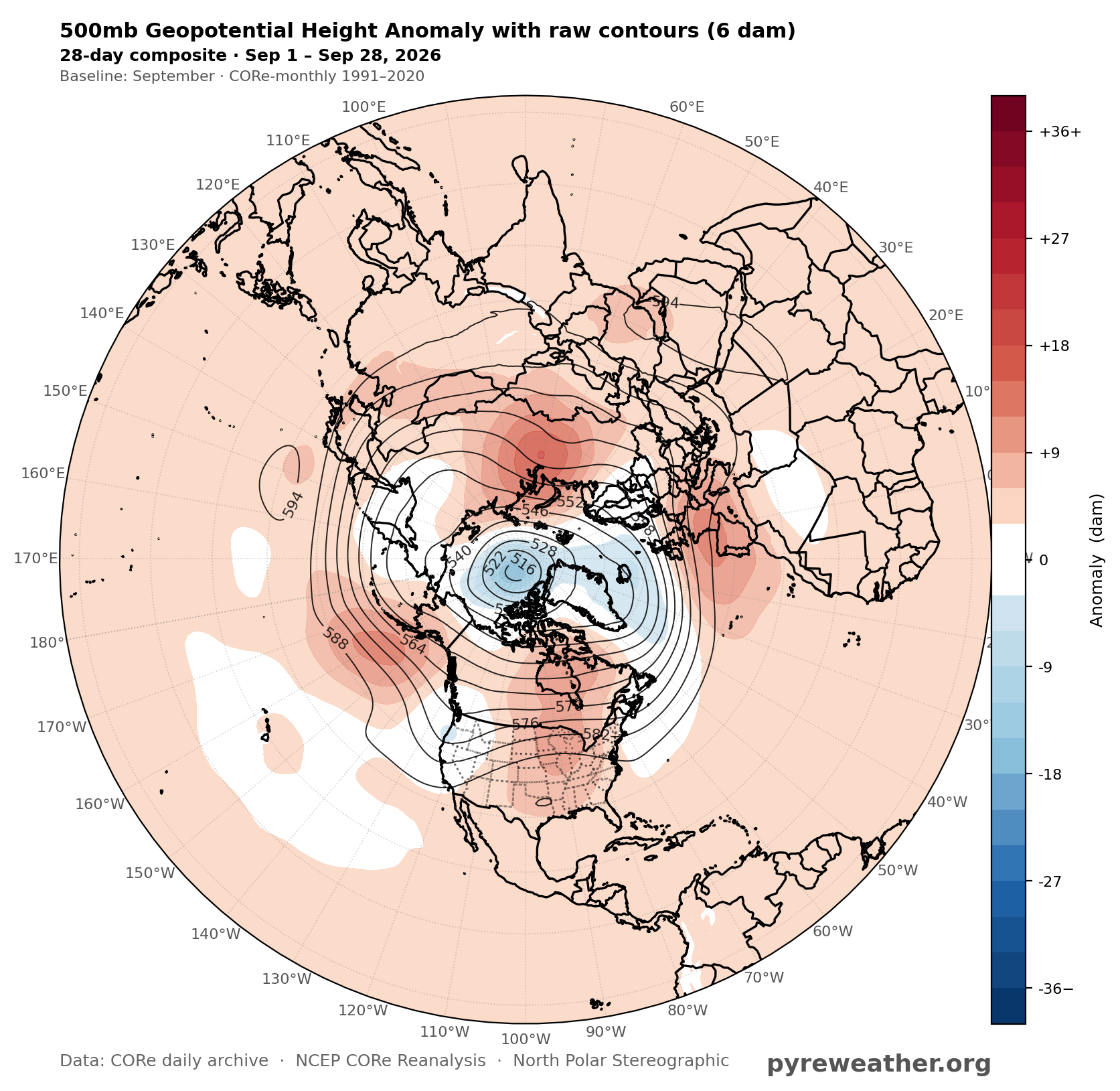
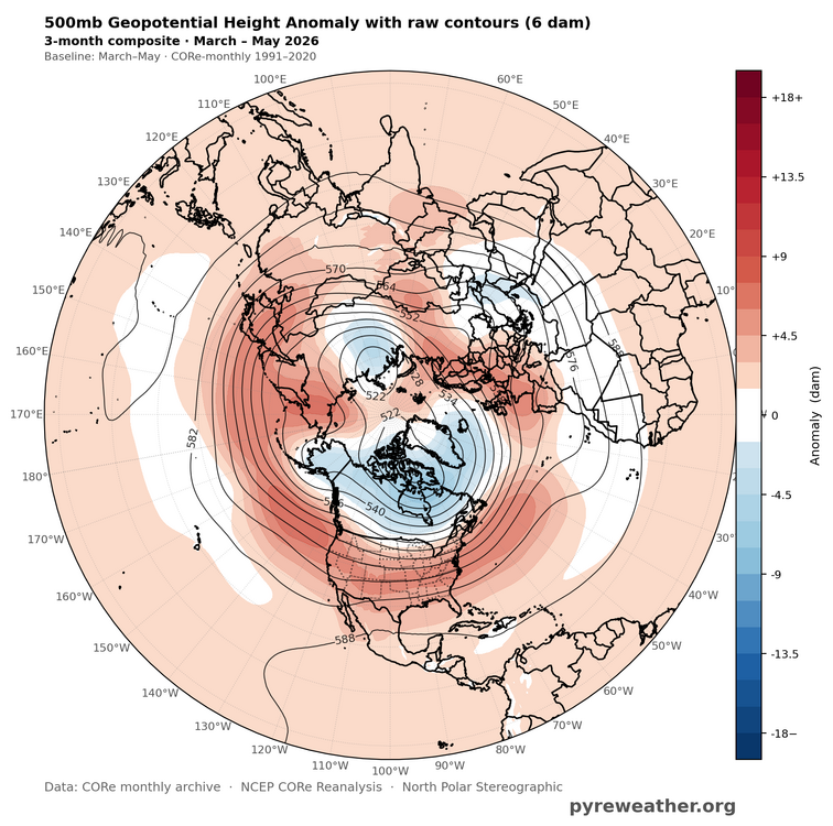
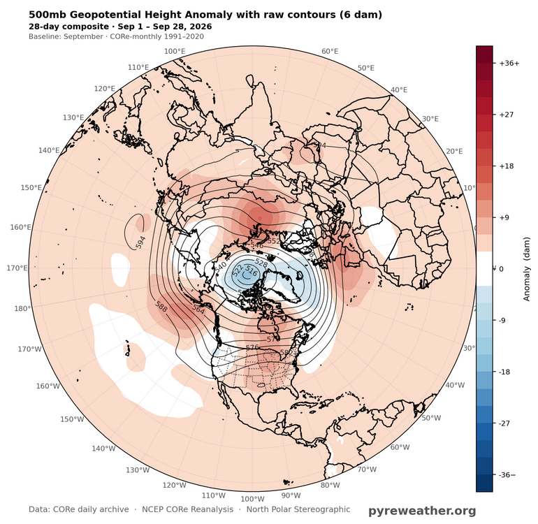
There has been a deep upper low across the Arctic since the spring with record 500 mb ridging across the mid-latitudes. So this looks like a continuation of the same theme. Both the AO and NAO have been mostly positive over this period. Almost looks like some type of rebound following the strong winter blocking with the early SSW back in November. The last time we had a +AO October with a super El Niño was 1972. But even October 1972 managed to get the more common -EPO.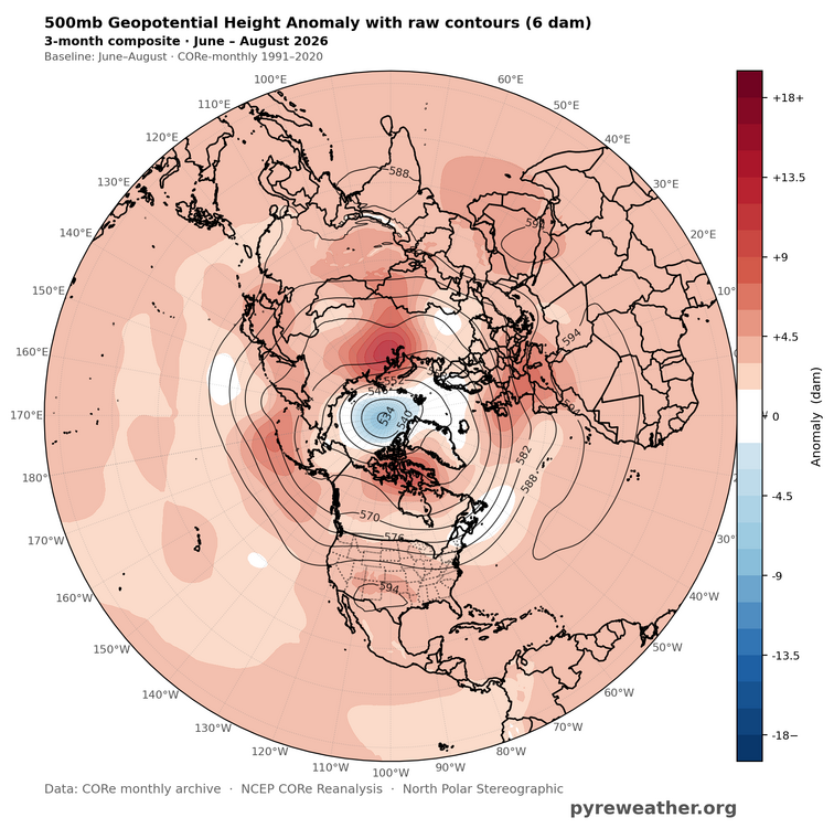
-

2026-2027 Record-breaking El Nino
FPizz replied to Stormchaserchuck1's topic in Weather Forecasting and Discussion
I always like that too. This year 102.3 for my high and -5.4 for my low. One of the larger spreads that I can remember. -

Winter 2026-2027 Speculation
Prismshine Productions replied to 40/70 Benchmark's topic in New England
I made this call back on May 4th and it still feels comfortable Sent from my SM-S176V using Tapatalk -
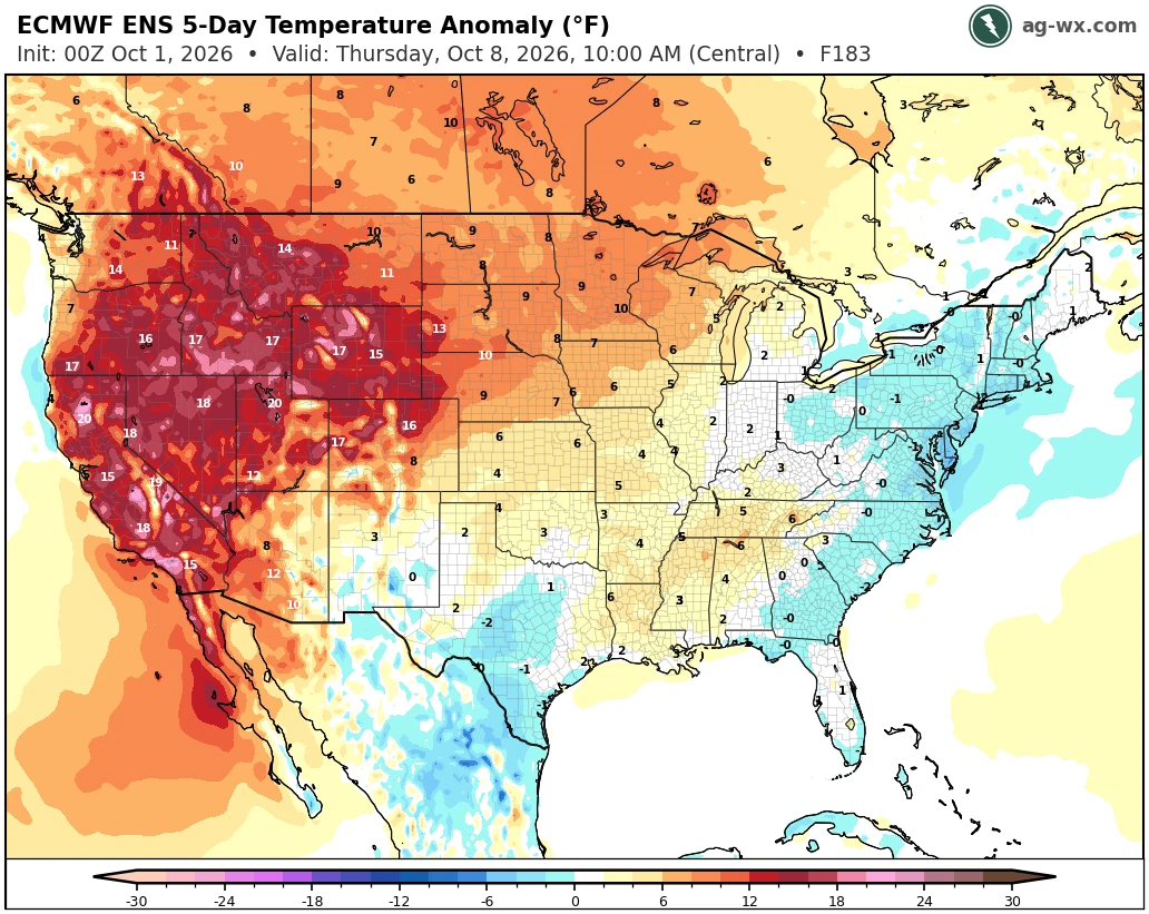
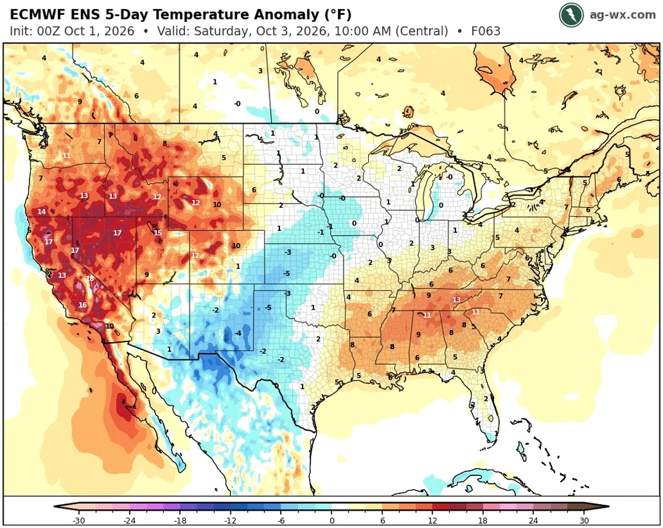
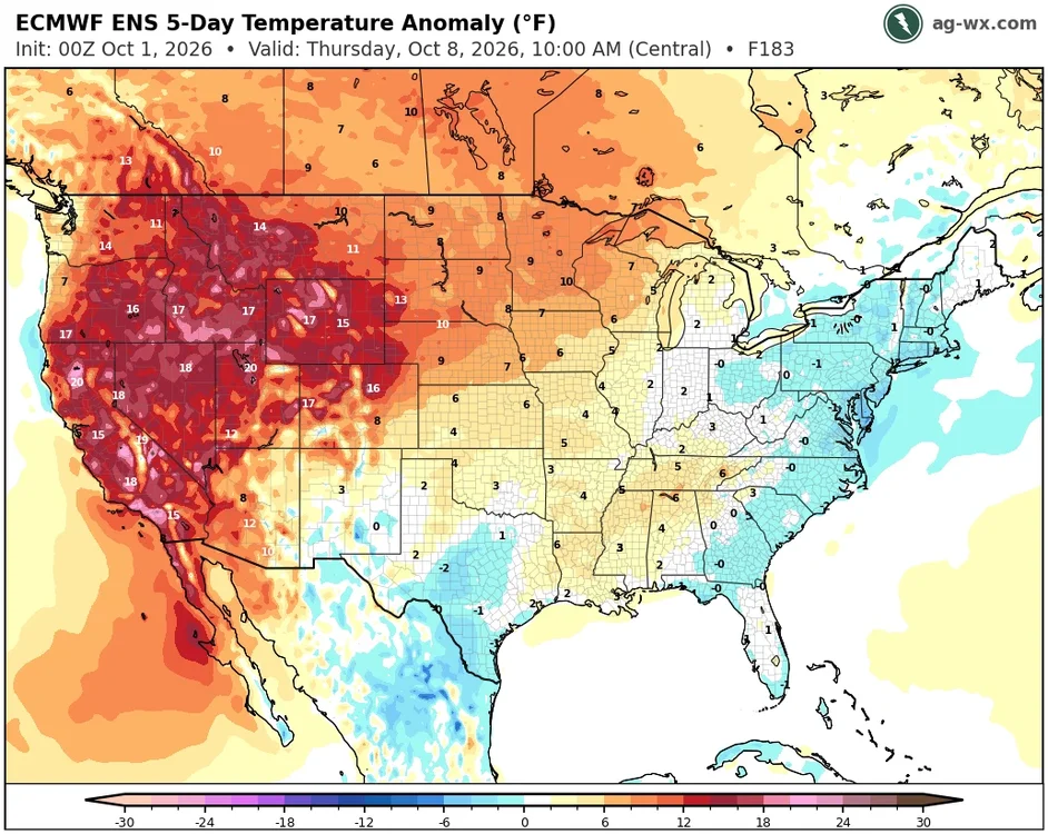
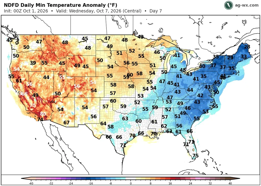
Yeah, they could reach 80° today with enough sun ahead of the main warm push tomorrow. So a warmer start to the month before we cool down next week. The interior areas have a shot at their first frost next Tuesday into Wednesday.
-
I feel like the trend on seasonal guidance is at least as, if not more important than the absolute data and CANSIPS keeps trending warmer and further south with that ridge...this is why February is now no longer above average precip for us, but if you look back at the 9/1 and especially 8/1 run, precip was way above average.
-
That's what I'm afraid of lots of heavy wet snow this winter with borderline temps. Just wow you still have a hummingbird around, I didn't see one since the 24th of September here.
-
Generic Tadalafil 20mg price [url=http://tadastreamrx.com/#]TadaStreamRx[/url] Cialis 20mg price in USA
- Today
-
As you cloud up it’s breaking up in SNE
-
And it’s warm already
-
Oh look Sunday now is a rainer after dry forecasts . Third one in a row . Something we should see a lot if this winter .. dry forecasts turning into warm and wet
-
Next Spring coming up quick...less than five months!
-
CANSIPS is unquestionably too cold.
-
 Torch Tiger changed their profile photo
 -

October 2026 General Discussion
michsnowfreak replied to SchaumburgStormer's topic in Lakes/Ohio Valley
Happy October! My favorite color! -
2026-2027 Record-breaking El Nino
michsnowfreak replied to Stormchaserchuck1's topic in Weather Forecasting and Discussion
The yearly max/min temp is always a fun one to watch. In 2026, the max at Detroit was 97F and the min -10F. Even with a mild winter we will likely still go below zero. The avg temp for summer here is 72.3F and winter 28.4F, a difference of about 44F. -
Winter 2026-2027 Speculation
Prismshine Productions replied to 40/70 Benchmark's topic in New England
+1.5 +1.5 +1 All three months +QPF... Honestly for the interior Rt.2 N that isn't a terrible look Sent from my SM-S176V using Tapatalk -
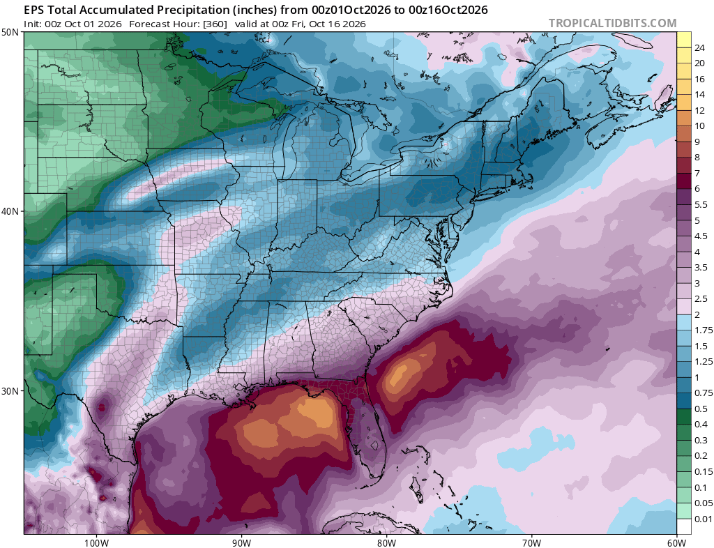
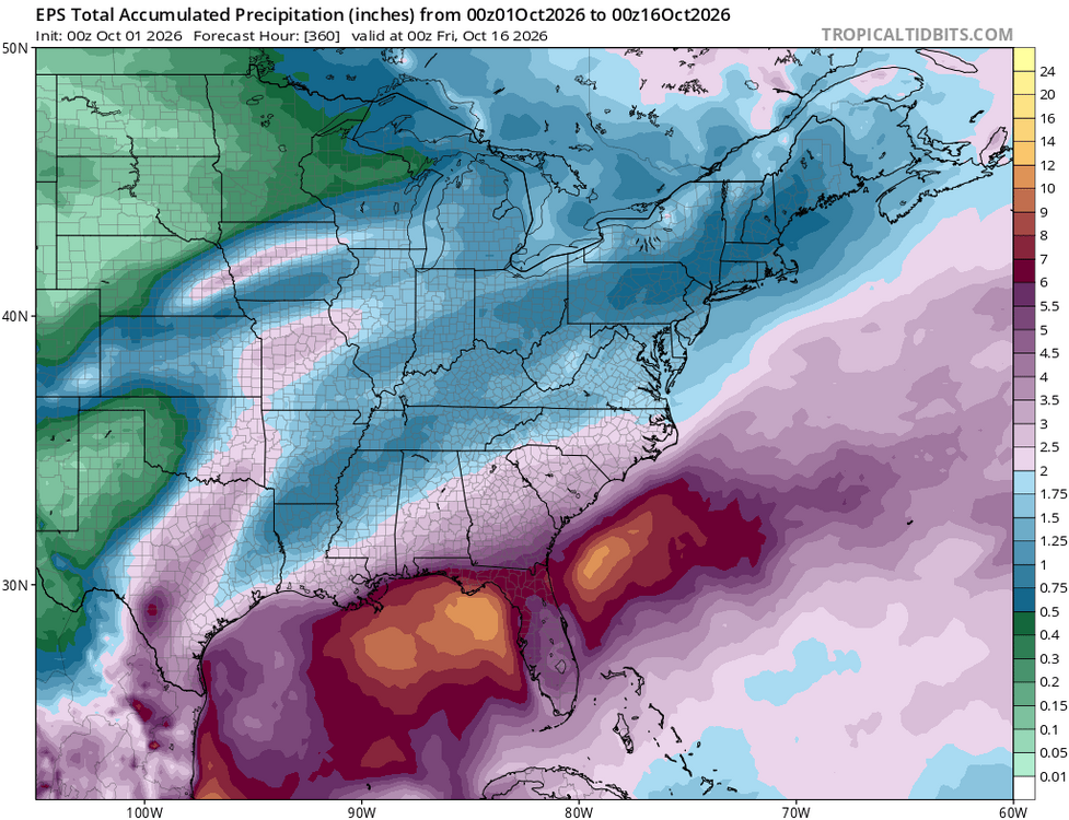
El nino already starting to push an active southern jet stream down your way over the next couple weeks.
-

2026-2027 Record-breaking El Nino
Terpeast replied to Stormchaserchuck1's topic in Weather Forecasting and Discussion
It looks like the strong +AO pushed the mid-high lat ridges further south