All Activity
- Past hour
-
Go to bed
-

Feb 22nd/23rd "There's no way..." Storm Thread
wasnow215 replied to Maestrobjwa's topic in Mid Atlantic
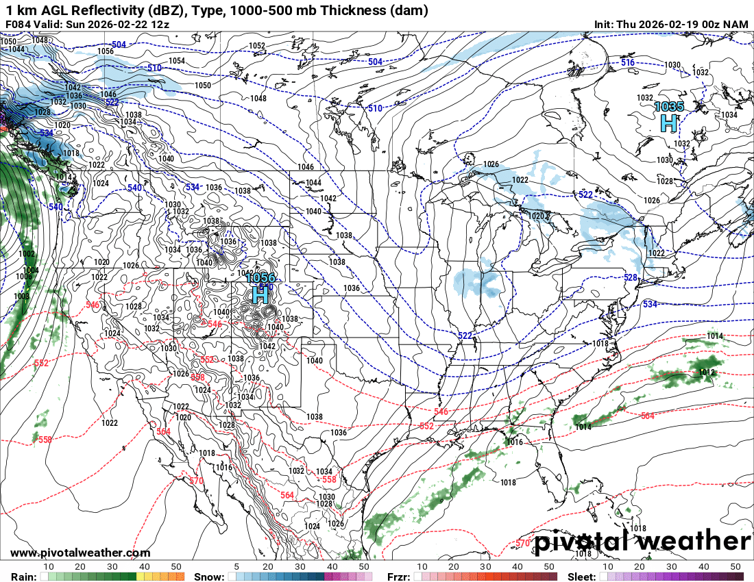
This-12K NAM pretty much useless at 24 hours- let alone 84 hours. -
I'd prefer today's weather over ZR, unless it's drizzle on top of snow that fell, I can't stand ice on roads or walks, just a nuisance... snow, sleet or nothing, just my opinion, I know some like it
-
More like 2-4"...yikes, take 'em down. Wouldn't that be funny....3 events starting us in the face, end up nothing-advisory event-cirrus.
-
You are off to a bad start. Why are you posting a short range model 84 hours out ?
-
Confluence to the NE of Maine and lower heights out ahead is a no bueno.
-

“Cory’s in NYC! Let’s HECS!” Feb. 22-24 Disco
RUNNAWAYICEBERG replied to TheSnowman's topic in New England
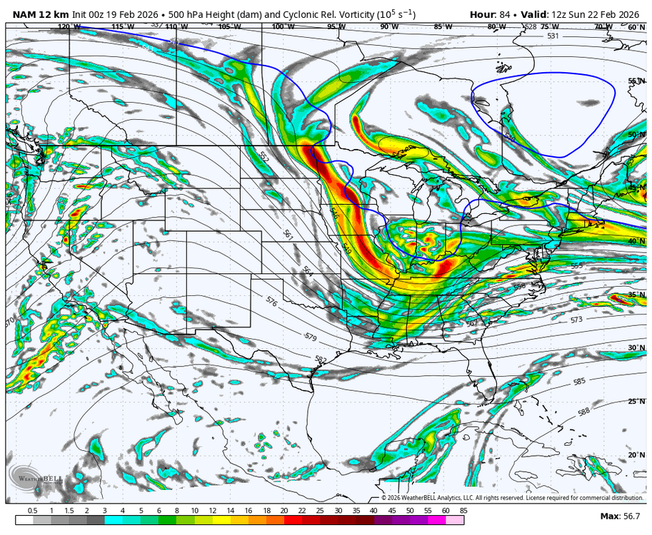
Looks pretty bad at h5. Focus on that first, surface is practically meaningless this far out. -

E PA/NJ/DE Winter 2025-26 Obs/Discussion
Ralph Wiggum replied to LVblizzard's topic in Philadelphia Region
Hurricane Schwartz a short while ago says we lost this one way south and wont curve fast enough to hit us. Claims there is virtually no model support at all for a high impact storm. All guidance is clustered Hatteras and south with the surface low. -
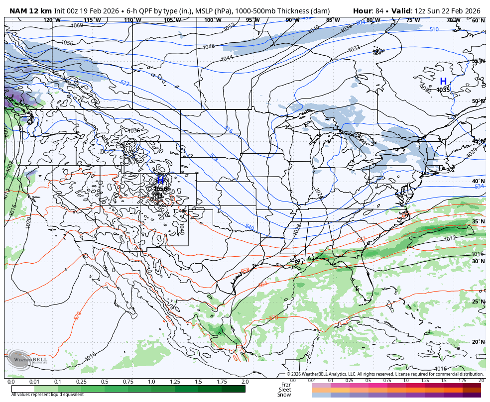
NAM would be pretty significant impact for RT 2 corridor. 4”-6” thump followed by freezing rain:
-
Yup just one of the models
-

“Cory’s in NYC! Let’s HECS!” Feb. 22-24 Disco
EastonSN+ replied to TheSnowman's topic in New England
NAM first up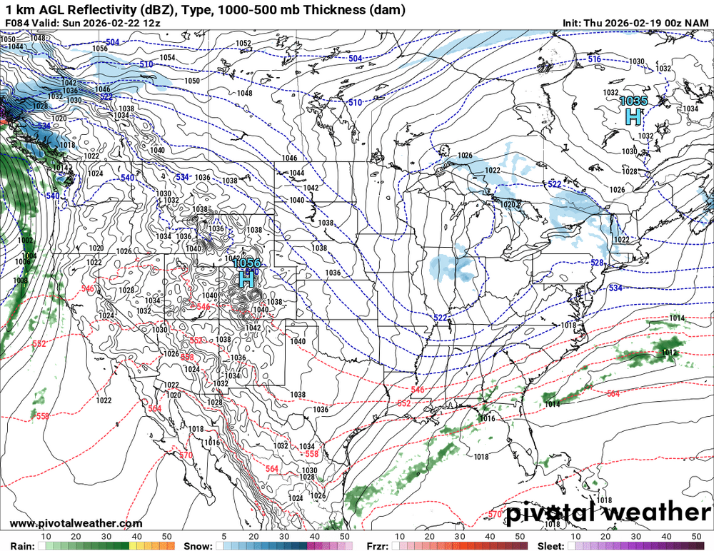
-
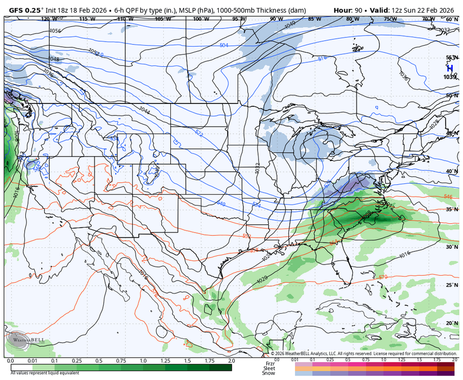
Compares to the GFS at the same range its much flatter or slower.
-
It's the long range nam doesn't mean anything yet.
-
There are going to be some Low CAPE/high shear showers and thunderstorms for N. Illinois to N. Ohio. The SPC has a slight risk of tornadoes for the lower Ohio Valley, which is south of the areas just mentioned. Convection-allowing models vary on coverage and placement of rain showers.
-

“Cory’s in NYC! Let’s HECS!” Feb. 22-24 Disco
TauntonBlizzard2013 replied to TheSnowman's topic in New England
-
Fridays rain should put a big dent in it
-
First up NAM end of run.

-
A bald man in Tolland stirs in his sleep…
-
Praying for good 0z
-

Feb 22nd/23rd "There's no way..." Storm Thread
Weather Will replied to Maestrobjwa's topic in Mid Atlantic
Off to a bad start...WB 12K NAM at 7am Sunday is a dud; nothing like the GFS at 18Z.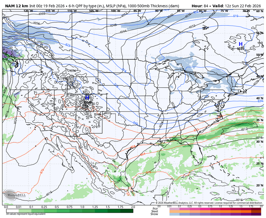
-
Nam warmest of all guidance but some nice hang back snows Saturday.
-
Yikes

-
If only the storms would happen in the mid term it would be spot on, But alas.
-

“Cory’s in NYC! Let’s HECS!” Feb. 22-24 Disco
40/70 Benchmark replied to TheSnowman's topic in New England
Not in tonight's (non) event. -
Feb 22nd/23rd "There's no way..." Storm Thread
Weather Will replied to Maestrobjwa's topic in Mid Atlantic
I will stay up for the EURO if the early 0Z suites continue to improve...agree writing on the wall if the ICON/GFS/CMC fizzle at 0Z.


.thumb.png.4150b06c63a21f61052e47a612bf1818.png)