All Activity
- Past hour
-
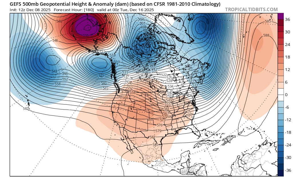
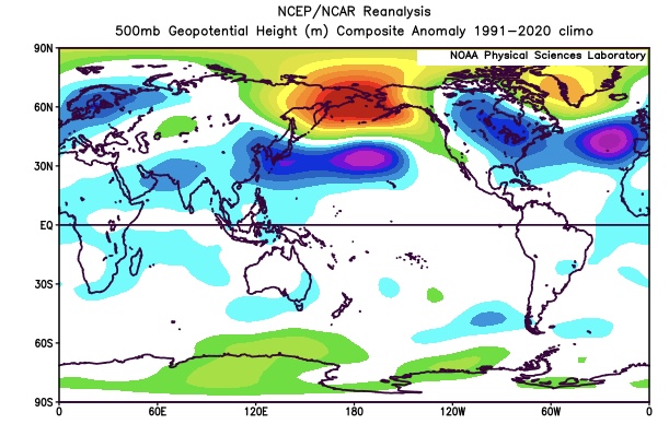
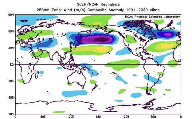
I suspect that the issues the models have been having long range are related to the much faster Northern Stream of the Pacifc Jet which continues. It’s not typical to get a strong -WPO +EPO couplet the same time. So the shortwaves in the fast Pacific flow are lowering heights over eastern Alaska while the -WPO ridge stands firm. At least into mid December the +EPO and stronger Pacific are trying to have the ridge roll out into the Plains while the -WPO would have the ridge axis more in the West. So a tug of war between two competing influences that we normally don’t see at the same time. My guess is that the ridge eventually comes east at some point during the 2nd half of December as the Pacific Jet eventually wins out in these situations. Notice how the 10 year December strong -WPO composite features a more -EPO and a relaxed Pacific Jet. Much stronger Pacific Jet and unusual +EPO in mid-December for a very strong -WPO block Past 10 strongest December 500 mb -WPO blocks disnt have to compete with such a strong Pacific Jet and +EPO
-
Is this RIC or ORF?
-

December 2025 Short/Medium Range Forecast Thread
Carvers Gap replied to John1122's topic in Tennessee Valley
Interestingly, the Euro Weeklies control and ensemble are exactly opposite again. Last time, the control won that battle. The control is 30 day strong trough. As for the MJO, there is some activity in 7-8-1-2. This morning it began the anticipated loop/stall in 8. I have little doubt the convection forecast for 1-2 will eventually propagate into 6. It looks to me like that will happen sometime in the third or fourth week of December. It could be earlier. Currently the MJO plot is in 8 and the atmosphere reflects that with an eastern trough in place and eastern troughs forecast through roughly Dec 20. Again, it is early December. This is not snow climo for valley locations. -
Eps totally screwed mby with the snow to rain threat last week with 5" 4+ days out, 3" the day before and 2"+ on the 6z run the morning of the event v only to get close to 3/4" snow and sleet. I guess it's me, but the Eps are always wrong with accumulations imby.
-
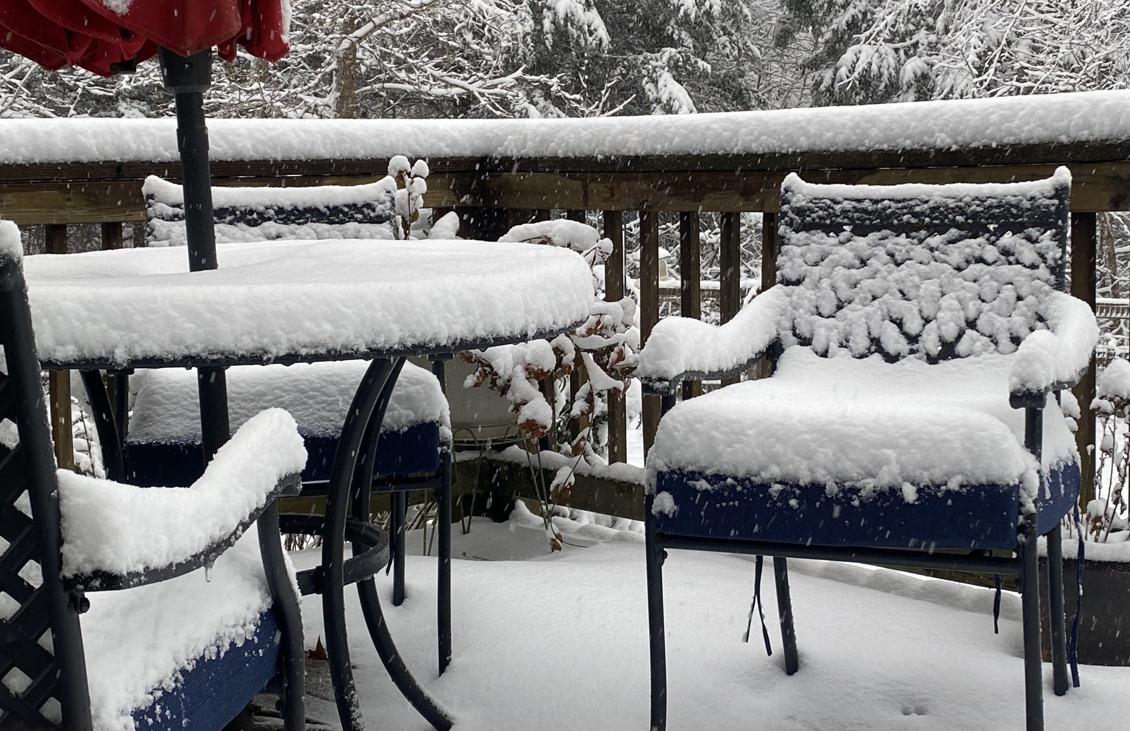
Temps dropping and moderate snow... that's the dream combo!
-
-

Richmond Metro/Hampton Roads Area Discussion
chris624wx replied to RIC Airport's topic in Mid Atlantic
Nothing crazy, but should be a little as the low pulls away -

Richmond Metro/Hampton Roads Area Discussion
EverythingisEverything replied to RIC Airport's topic in Mid Atlantic
Va. Beach was a mix, but hard to see flakes at the moment. -
-
Richmond Metro/Hampton Roads Area Discussion
snowchill replied to RIC Airport's topic in Mid Atlantic
4” Powhatan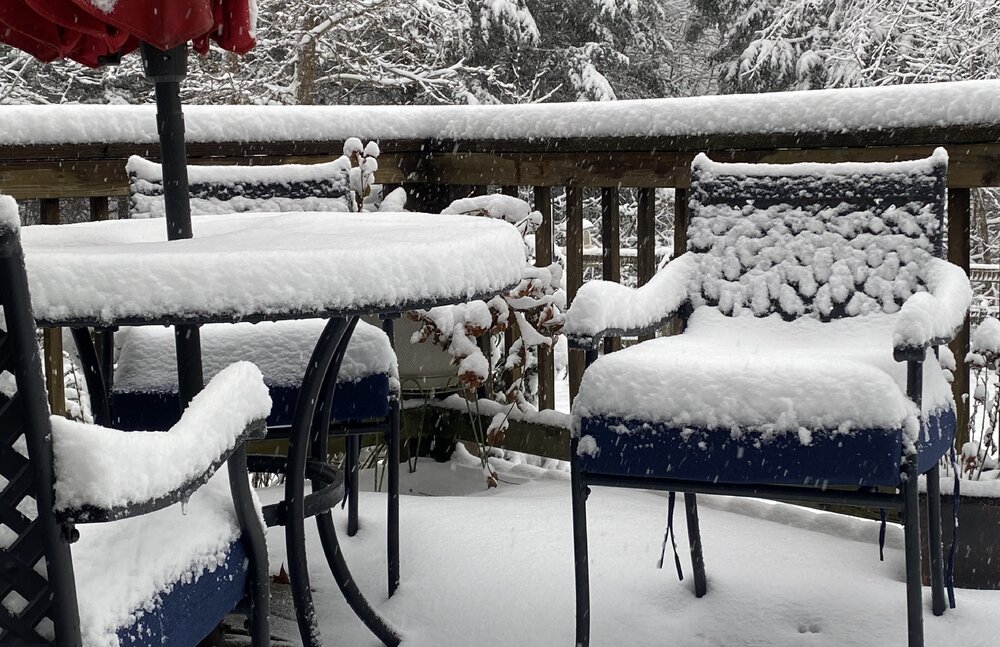
-
Are the models showing some good enhancement?
-
Newport news
-
High here was 26.6° after midnight…afternoon high 16.7°. It’s already down to 14.8°…chilly late afternoon.
-
5-6” by NWS AKQ when all is said in done I think. 4” now. Just tip your cap.
-
Where are you located again? .
-
what is a "tone" of snow "- ??? i don't think we'll worry about mid unless we are overhead " -- what are you talking about ????
-
CAB
-
And i thought i was old.
-
Thank you for learning from me and contributing meaningfully, we greatly appreciate that.
-
Richmond Metro/Hampton Roads Area Discussion
chris624wx replied to RIC Airport's topic in Mid Atlantic
ORF is saturated at 33.8F. We're going to need the low to deepen to draw down some drier air from the north so we can wet bulb down to freezing. Hopefully that corresponds to the coastal enhancement shown on the models for later this afternoon/evening. -
3 pm numbers. 3.3 inches OTG, temp dropping, down to 27.9/25.0. Decent moderate snow falling now.
-
Down to 31
-
A bit more than an inch here. Enough left to get to 2.5
-

December 2025 regional war/obs/disco thread
DavisStraight replied to Torch Tiger's topic in New England
Maybe, the cold did come in over night. -
Really? Maybe it was referring to midnight high? Because we had one.