All Activity
- Past hour
-

October Comes Early: Late September Multi-Hazard Hybrid Storm
TheBudMan replied to WxWatcher007's topic in New England
3 months from today - easy forecast. Partly sunny mid/upper 50s enjoy its all we get. -
I'm actually drinking cold pressed strawberry lemonade right now from fresh market. Paired with some live sugar hash by District Cannabis. Fantastic combination on a beautiful fall evening.
-

Septorcher 2026 Discussion - Endless Summer
powderfreak replied to Damage In Tolland's topic in New England
Awesome day… 36F to 76F in the valley, still low 70s up at the mountain here.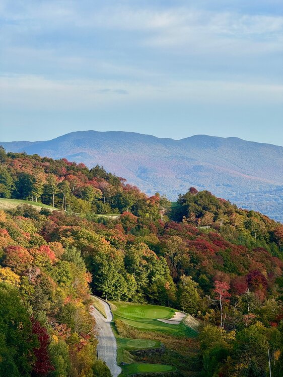
-

October Comes Early: Late September Multi-Hazard Hybrid Storm
CTWeatherFreak replied to WxWatcher007's topic in New England
Bring this back in 3 months please. -
 Getting some nice gusts moving thru now 35-40
 -
October Comes Early: Late September Multi-Hazard Hybrid Storm
mahk_webstah replied to WxWatcher007's topic in New England
This is very good practice for the winter season. I commend you. -
 best mexican pharmacy online: reliable mexican pharmacies - mexico pharmacy order online
 -
Lemonade right?
-

October Comes Early: Late September Multi-Hazard Hybrid Storm
VivaManchVegas replied to WxWatcher007's topic in New England
Looks like LI might have some fun times. What's keeping those 70 bangers so far of shore? -

Strong Nor'Easter/Hybrid Storm Late September 2026
NJwx85 replied to Rjay's topic in New York City Metro
The AC/DC concert at MetLife tonight has been postponed -
Just sat down at a Mexican restaurant in Milton so I’m going with a margarita with a half salted glass.
-
Strong Nor'Easter/Hybrid Storm Late September 2026
NJwx85 replied to Rjay's topic in New York City Metro
Just gusted over 30mph here in Rockland lol -
Strong Nor'Easter/Hybrid Storm Late September 2026
NJwx85 replied to Rjay's topic in New York City Metro
Okay 4” in Morristown isn’t a drencher? -
http://geninduspharma.com/# online drugstore
-

Strong Nor'Easter/Hybrid Storm Late September 2026
mob1 replied to Rjay's topic in New York City Metro
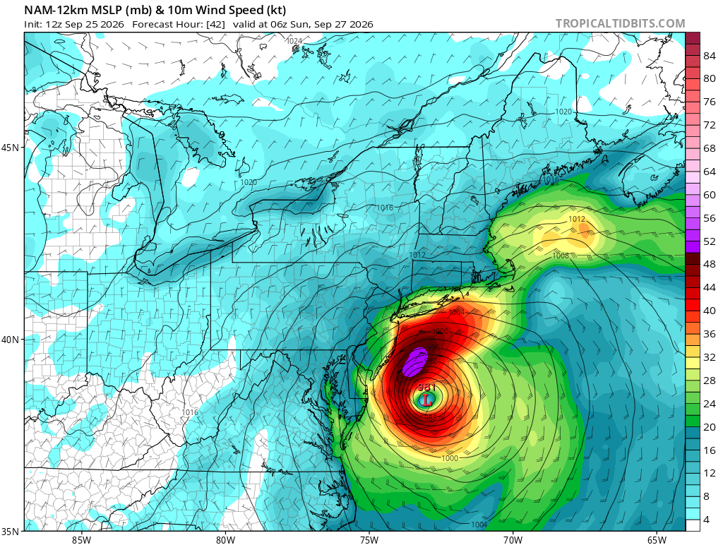
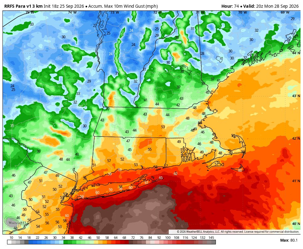
There's an obvious tradeoff with both a southern and northern track, I just personally enjoy the wind aspect more. Was hoping to get some of the more extreme outcomes depicted by some morning runs, though verbatim this was likely very overdone.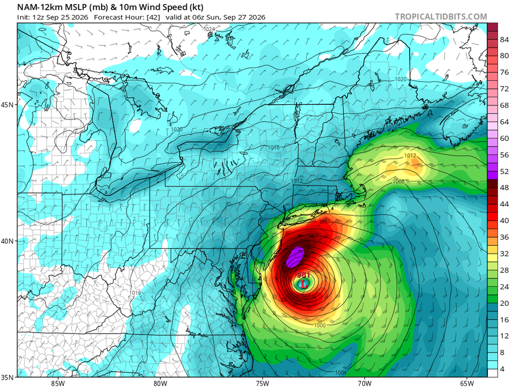
-
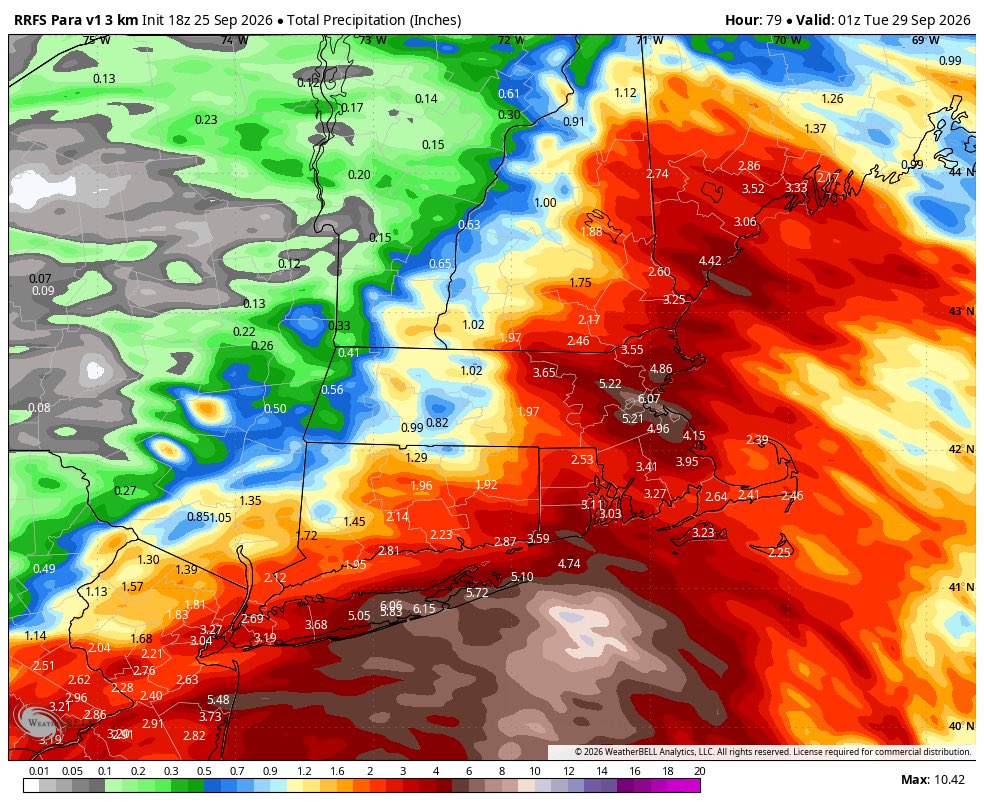
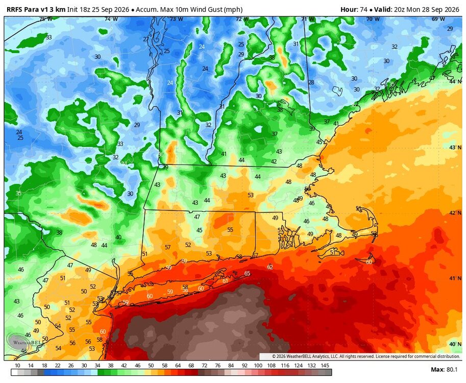
18z RRFS
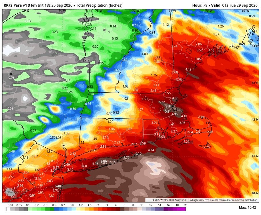
-

October Comes Early: Late September Multi-Hazard Hybrid Storm
TalcottWx replied to WxWatcher007's topic in New England
Montauk 57mph gust -
On my way home from the office now, can’t wait to sit on the patio with a drink.
-

Strong Nor'Easter/Hybrid Storm Late September 2026
TriPol replied to Rjay's topic in New York City Metro
State of Emergency declared for NYC, Nassau and Suffolk. -
What a fabulous day today, wish we had more days like this
-
Looks like Sunday morning at Bethel Woods is gonna be pretty wet for the Harvest Festival. I hate when we have to prepay the vendor fee for a rain or shine event and it turns out to be a washout
-

Strong Nor'Easter/Hybrid Storm Late September 2026
EasternLI replied to Rjay's topic in New York City Metro
Yeah, efficient mixing was what caught my eye on that sounding. That's going to be problematic. And I'm already getting gusts around 40mph here right now currently. We're looking at tomorrow night on that. Yikes. -
Periods of wind-driven rain, some of which could be heavy are likely tonight through the weekend. New York City and nearby areas will likely see a storm total 1"-3" with locally higher amounts. Parts of Long Island will likely see 3"-5" of rain with locally higher amounts. Coastal erosion and flooding at high tide are likely. Winds could gust past 50 mph in the region. Temperatures will remain unseasonably cool through the weekend with highs mainly in the lower and middle 60s. The ENSO Region 1+2 anomaly was +4.6°C and the Region 3.4 anomaly was +3.0°C for the week centered around September 16. For the past six weeks, the ENSO Region 1+2 anomaly has averaged +4.33°C and the ENSO Region 3.4 anomaly has averaged +2.73°C. Both ENSO regions have tied their all-time warmest anomalies. The ongoing strong El Niño, will continue to strengthen through the mid-fall. The SOI was -14.62 today. The preliminary Arctic Oscillation (AO) was +0.471 today. Based on sensitivity analysis applied to the latest guidance, there is an implied near 69% probability that New York City will have a cooler than normal September (1991-2020 normal). September will likely finish with a mean temperature near 68.7° (0.5° below normal). Supplemental Information: The projected mean would be 0.7° above the 1981-2010 normal monthly value.
-
October Comes Early: Late September Multi-Hazard Hybrid Storm
VivaManchVegas replied to WxWatcher007's topic in New England
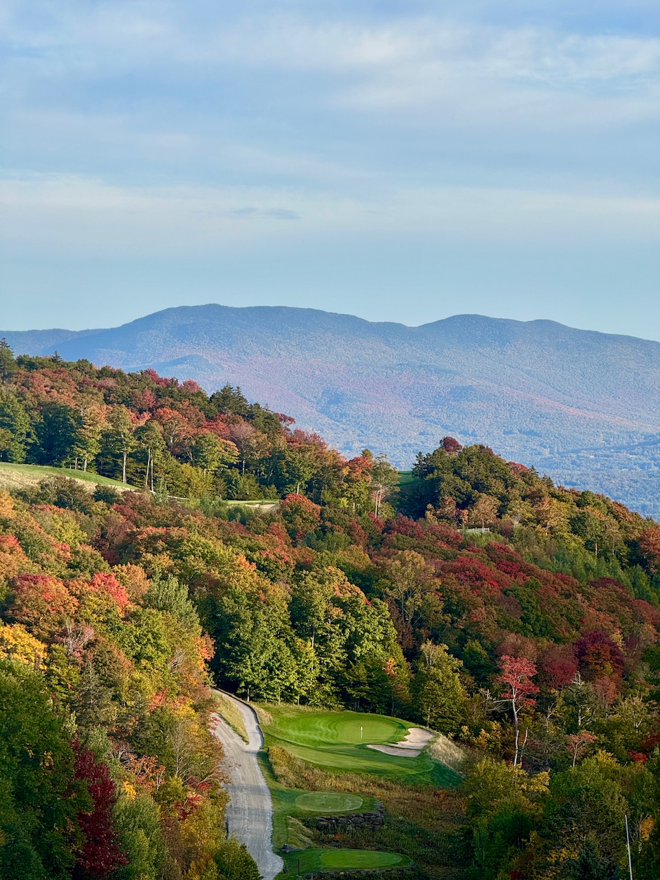
Winds are always over done where I am at. One of these times maybe it will over perform. Looks like moderate minds are calling for 2" in my area. That could over perform as it did with the last storm we had. But with it being so spread out, as stated before, just a good excuse to watch football on Sunday. We got to 70 today. It was a nice day. The leaves have not turned here, just a bit, so this should not ruin the fall colors. -

Strong Nor'Easter/Hybrid Storm Late September 2026
SnoSki14 replied to Rjay's topic in New York City Metro
This will increase rain totals as largest totals are on SW side of retro low. This could lead to more tree damage as you get the rains plus winds. Fully leafed out trees too.