All Activity
- Past hour
-

July 2025 Obs/Disco ... possible historic month for heat
Torch Tiger replied to Typhoon Tip's topic in New England
Storm E of ASH looking good, I'm watching it from my porch. Little overshooting top on it -
I wish I could say all the cedar came off our tract but probably less than a third of it. We don't have a lot of cedar in the mix and few were in the way of the land clearing plan so I bartered with a small mill in Fincastle VA. Traded 2:1 with white oak boards. Had a lot of white oak come down so I milled that off and got cedar in return. Cedar is twice as valuable so it was a lot of work milling the boards lol. Around 150 10' 1x6s lol for 75 cedars. I wish you can preserve the deep purple heart wood of cedar. It's crazy looking when you mill it but it oxidizes quickly to brown. I did seal it all with a whey based food safe sealant from a company called Vermont Natural Coatings so the grain color should remain as is in the pic for years to come. Otherwise it turns silver/grey which is cool if you like the antique look. Wife and I decided to keep the natural red/brown color and we're glad we did. Came out better than we expected and the sealant is expensive. I think it was $350 for 5 gallons yikes lol
-
 Oh boy
-

July 2025 Discussion-OBS - seasonable summer variability
LibertyBell replied to wdrag's topic in New York City Metro
Yep, but it's just one month. We'll see how the rest of the summer plays out and if it ranks with the all time greats. It has to continue on the trajectory of 2010 for it to do so. Otherwise it's just a one month blip. I have very high standards when it comes to summer heat. -

July 2025 Discussion-OBS - seasonable summer variability
donsutherland1 replied to wdrag's topic in New York City Metro
Much of the region saw temperatures again reach 90° or above. Parts of the region will experience some heavy thunderstorms this evening and tonight. Generally warm weather will prevail through Saturday. New York City will see highs in the middle to perhaps upper 80s during this stretch. Excessive heat does not appear likely to return through at least the first week of July. However, there is somewhat less certainty than yesterday. There remains some potential for a shot of more significant heat during the July 6-8 period. The ENSO Region 1+2 anomaly was +1.0°C and the Region 3.4 anomaly was 0.2°C for the week centered around June 18. For the past six weeks, the ENSO Region 1+2 anomaly has averaged +0.47°C and the ENSO Region 3.4 anomaly has averaged -0.03°C. Neutral ENSO conditions will likely continue through at least late summer. The SOI was +2.65 today. The preliminary Arctic Oscillation (AO) was +1.127 today. -
No backbuilding .
-
tornado warning at Oley and Bechtelsville
-
Yes indeed. Even the stuff west of us is weakening as it moves east. Perhaps I shouldn't have abandoned my first thought...we'll see.
-
July 2025 Obs/Disco ... possible historic month for heat
Torch Tiger replied to Typhoon Tip's topic in New England
at least there are a few storms, though looks like crap. -
TOR warning just E of Reading
-
.5” - it’s all cleared outfor the commute home and unless something pops about done aside from some light showers maybe.
-
July 2025 Discussion-OBS - seasonable summer variability
donsutherland1 replied to wdrag's topic in New York City Metro
Today became just the third day during the common recordkeeping period where Newark reached 95°, JFK and LaGuardia both reached 90°, but Central Park fell short of 90°. 2025 is the first year with two such days.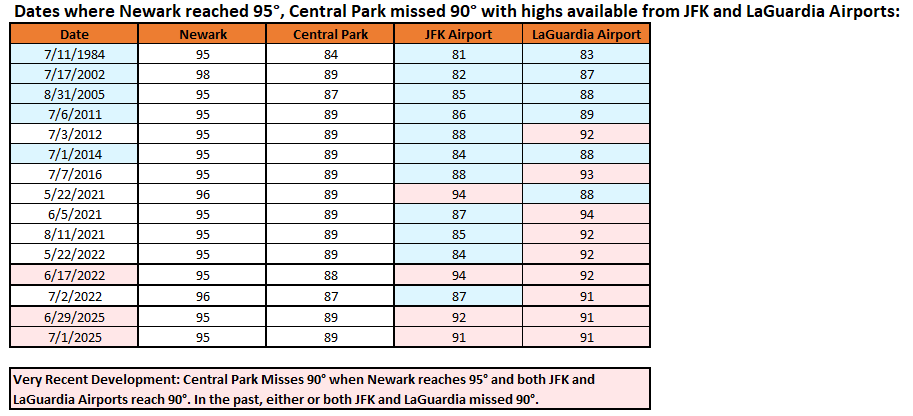
-

Central PA Summer 2025
Mount Joy Snowman replied to Voyager's topic in Upstate New York/Pennsylvania
I don’t want to jinx it but things seem to be moving through swiftly and collapsing at a good rate. Looking like we may avoid a repeat of last night. About to exit the train in Mount Joy. -

July 2025 Discussion-OBS - seasonable summer variability
winterwarlock replied to wdrag's topic in New York City Metro
t storms look like they will slide to my south..at least the initial batch -

July 2025 Discussion-OBS - seasonable summer variability
Dark Star replied to wdrag's topic in New York City Metro
June 2025 was hot. Newark was 2.5 degrees warmer than "normal" (the new norm), and had days over 100 degrees. That is hot... -
Columbia imby 1.21” so far today (4:45pm)
-

E PA/NJ/DE Summer 2025 Obs/Discussion
JTA66 replied to Hurricane Agnes's topic in Philadelphia Region
Got to 89F today before some showers came through dropping me down to 78F. Wonder if that will have any effect when the main line approaches in the next few hours. -

July 2025 Obs/Disco ... possible historic month for heat
weatherwiz replied to Typhoon Tip's topic in New England
Also looks like some dewpoint pooling ongoing with a theta-e ridge overhead. MLCAPE ~2000 not bad given the poor mid-level lapse rates. Any severe risk though should be extremely localized. DCAPE is meh with pretty poor 2-6km lapse rates and llvl shear is not much. So just going to be some torrential rain (poor drainage flooding risk) and maybe some good CGs -

2025 Spring/Summer Mountain Thread
WxKnurd replied to Maggie Valley Steve's topic in Southeastern States
Wicked lightning in Marion with this storm creeping in from the north. -
July 2025 Obs/Disco ... possible historic month for heat
weatherwiz replied to Typhoon Tip's topic in New England
It is! Seems to be evolving nicely. Satellite shows great upscale growth with cooling cloud tops. Might even be a weak sea breeze front which aids in development within south-central CT. -
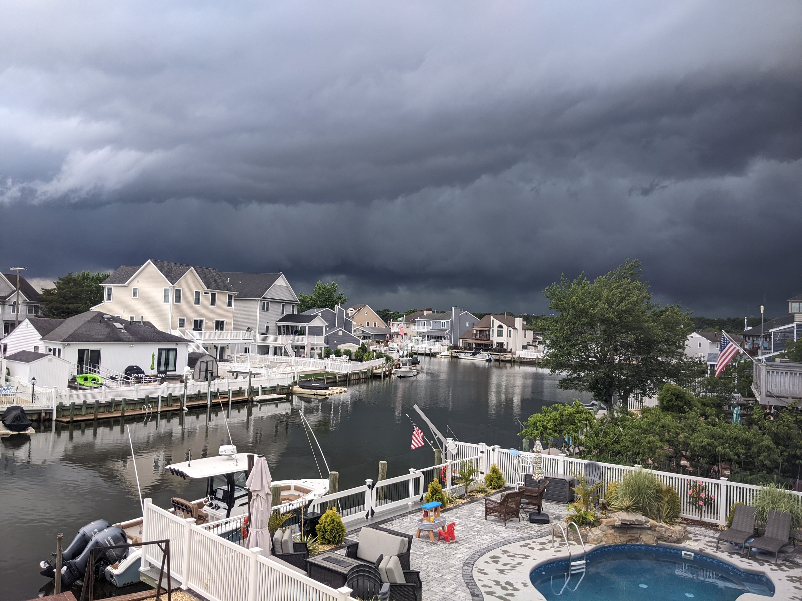
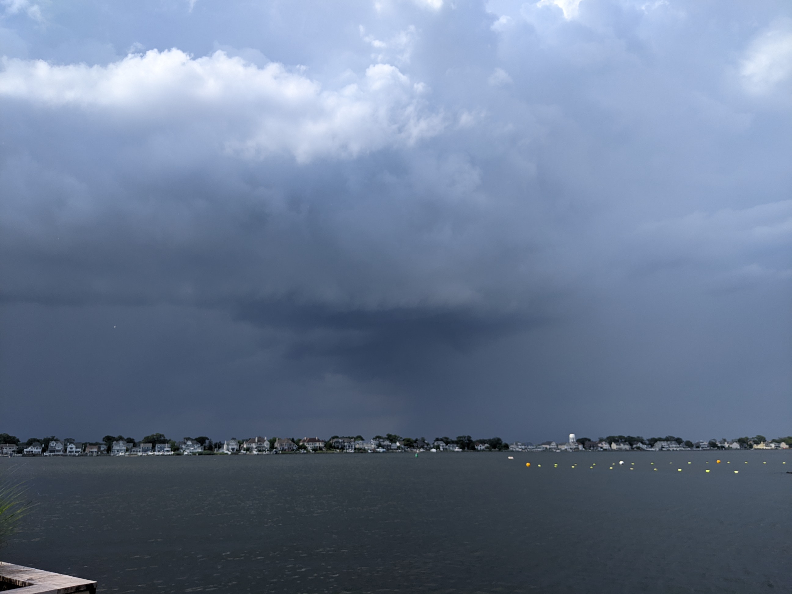
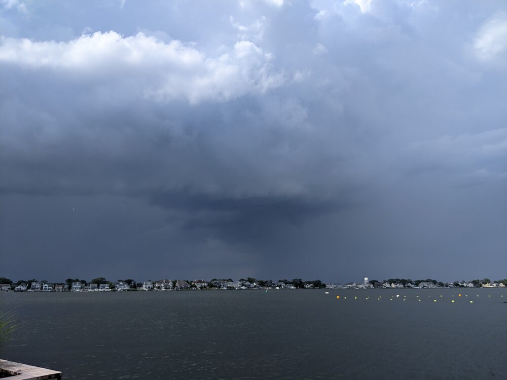
Made it back from cycling before getting walloped down here in Brick.
-

July 2025 Obs/Disco ... possible historic month for heat
Damage In Tolland replied to Typhoon Tip's topic in New England
Please make this happen -
July 2025 Obs/Disco ... possible historic month for heat
Damage In Tolland replied to Typhoon Tip's topic in New England
Better get used to it . Long next 3 months for you if not -
 Eastern PA and Western NJ looking good. Wish we could get in on the action.
 -
.