All Activity
- Past hour
-
 I was doing some digging last week and some of the extended guidance seemed to want and relax wind shear across the MDR a bit, however, I wasn't particularly sold and was wondering if that was a product of guidance in the extended favoring climo and wanting to decrease shear as we get closer to peak climo. Waters in the MDR are also pretty meh. Will continue to be a focus for home brew, especially as we start getting more active with fronts.
 -
Water temperatures are way too cold once you quickly get north of NC and there will be a lot of upwelling early next week. You would need probably a high end 3 or 4 approaching the Carolina coast and rapidly accelerate northward to get a cane hit here. Otherwise any system is would transition to extra-tropical or sub-tropical extremely quickly.
-
Rains developing around me in Kearny, nj. Had some heavy mist. 75 degrees out.
-
 Something will pop in the subtropics eventually, but this ain’t it. Today was actually the first day I started thinking about my annual peak season forecast. It’ll be a dead basin this season, but how dead is TBD.
 -

2026-2027 Super El Nino
George001 replied to Stormchaserchuck1's topic in Weather Forecasting and Discussion
Imo the following winter is the one to watch for northern areas, not this upcoming one. I don’t see the roaring STJ dying off quickly especially if the El Niño lingers into the spring before collapsing into La Niña. When you combine the lingering STJ with a La Niña, big things can happen for northern areas. When it comes to sustained cold in an El Niño this powerful, I need to see it to believe it. Historical precedence for these super ninos is a warm east. -
Yeah all day basically with an occasional burst of a moderate shower. Today is a more dreary, wetter, cooler day than yday. Yday was fairly nice for the most part.
-
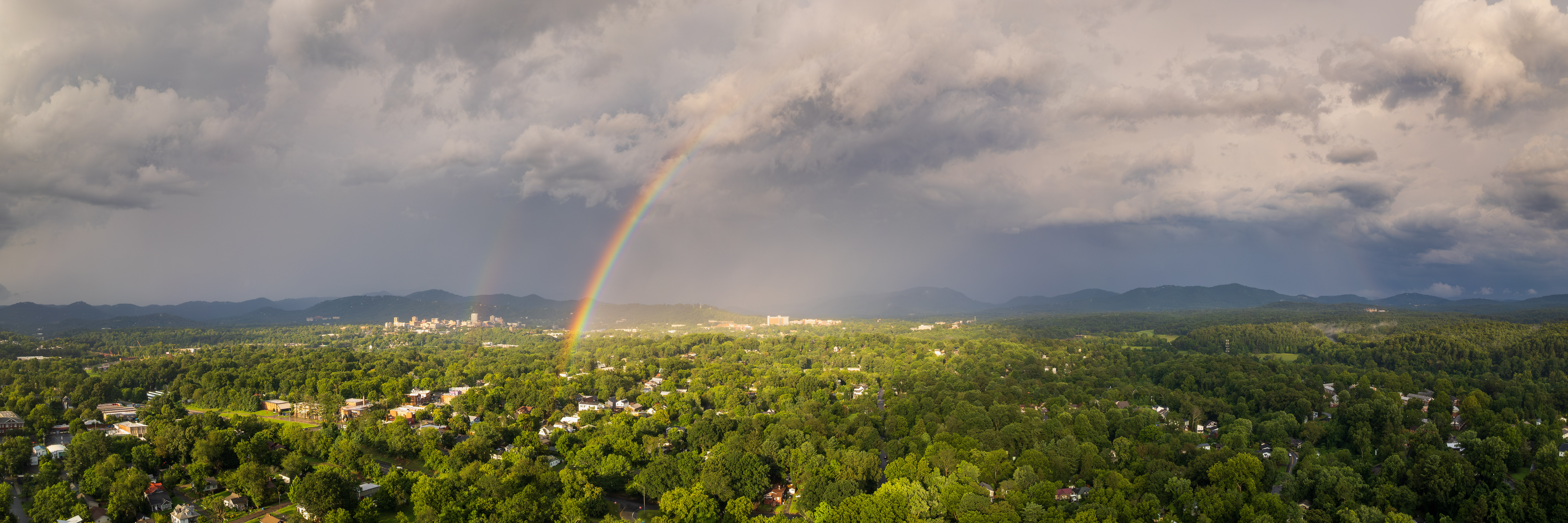
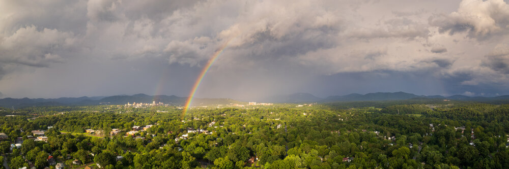
And here's a rainbow that appeared for a few minutes after the storm passed. Both shots were from my DJI Air2S drone.
-
It's not showing up on radar but there is random drizzle or showers in and around the city currently.
-
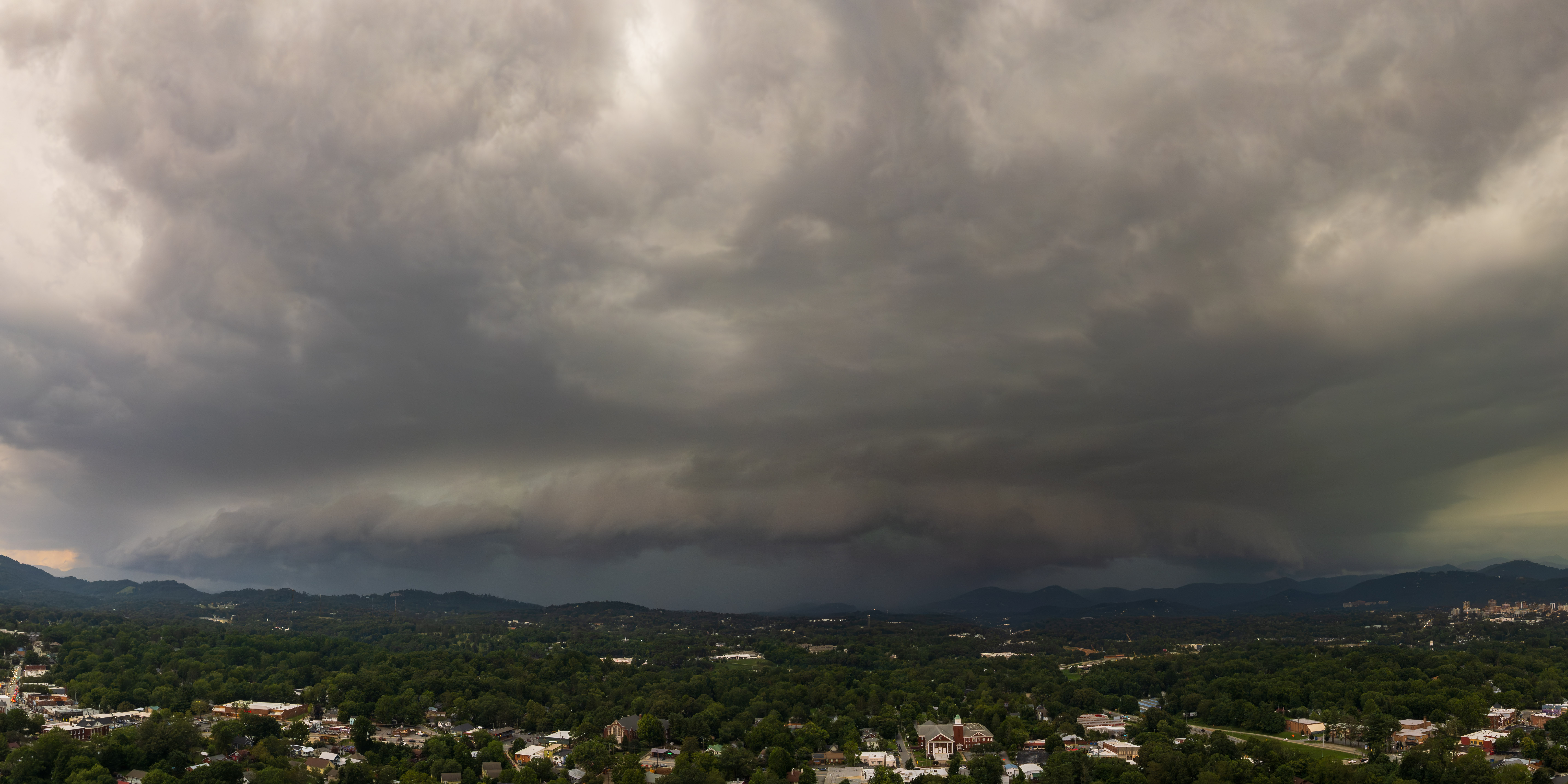
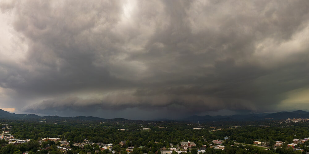
Late to the party, but here's a drone shot of the storm that hit Asheville.
-
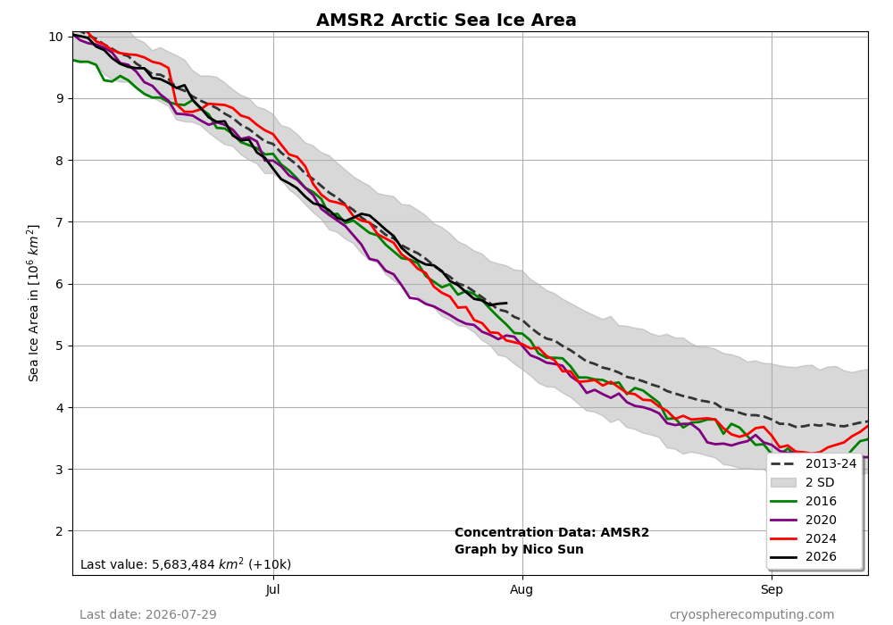
Arctic ice area currently isn’t doing bad at all vs the avg for 2013-24, perhaps helped by the relatively cold 80N+:
-
Yep, midlands low country and SE NC keep repetitively missing the rains
-

2026-2027 Super El Nino
GaWx replied to Stormchaserchuck1's topic in Weather Forecasting and Discussion
Arctic ice area currently isn’t doing bad at all vs the avg for 2013-24, perhaps helped by the relatively cold 80N+: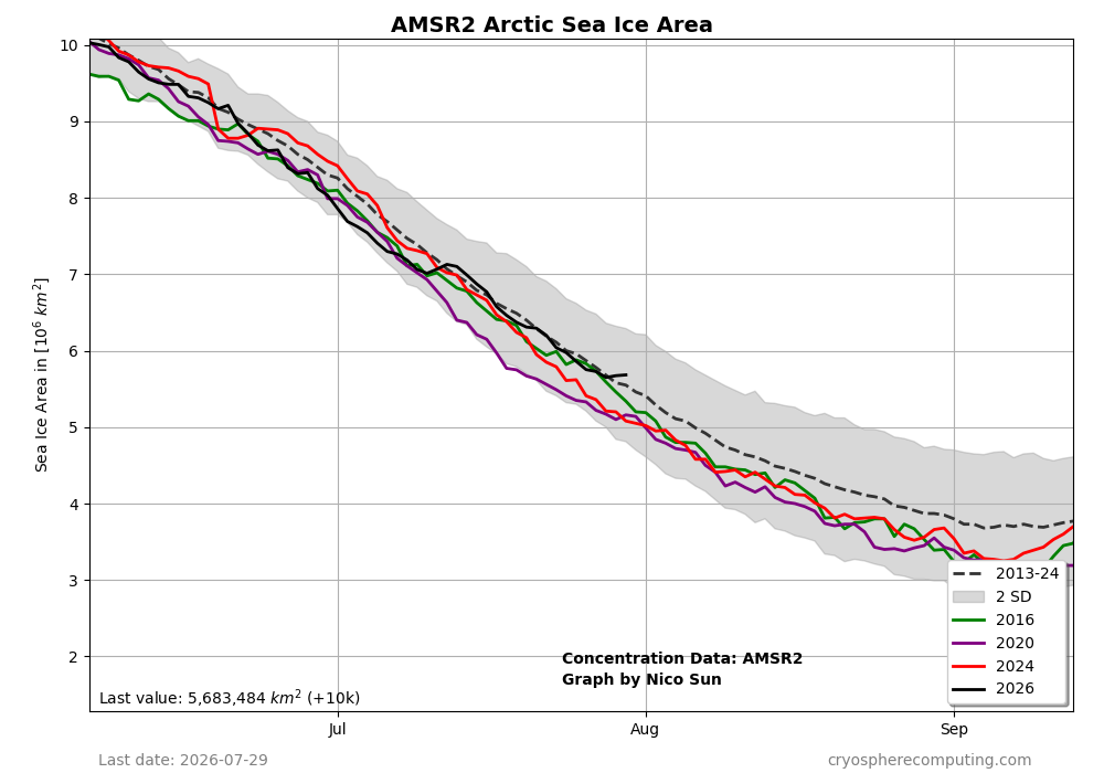
-
 IDK some models have hints of it besides the GFS.. would be OTS anyways but I'm going on a 3 hour fishing trip out of Seabrook NH next Saturday so would be rough
 -
I can’t wait to hear again how we’re in a big drought after the area received 10 inches of rain this month
-

Central PA Summer 2026 Discussion/Obs Thread
canderson replied to Voyager's topic in Upstate New York/Pennsylvania
Halifax is a great city. The maritime museum, the garden, the fort and great great restaurants. -
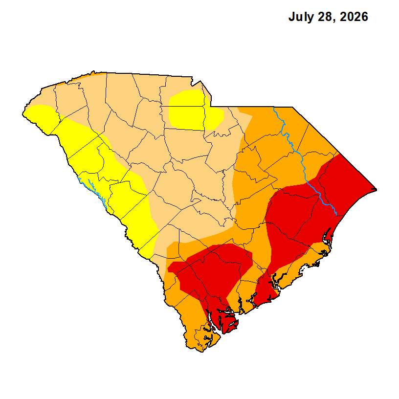
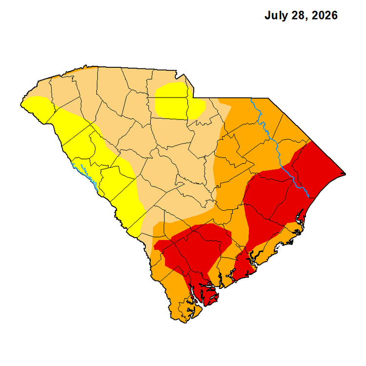
Indeed, much of NC improved. But SE SC still is in pretty bad shape for now as they hardly changed:
- Today
-
 There won't be a cane.
 -
never fails
-
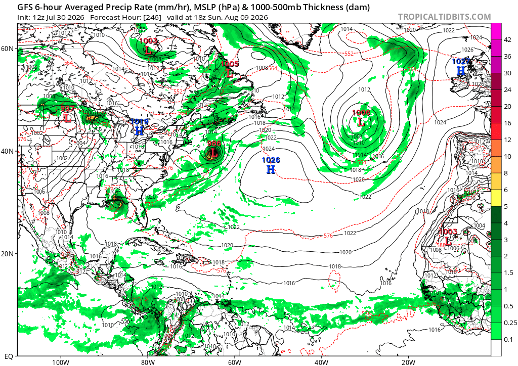
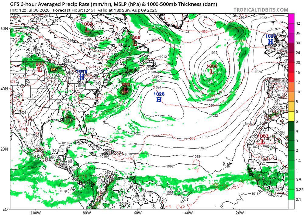
sucks its not a cane pattern.. 12zGFS scoots that cat 1 OTS
-
 lol, northern ME was frcst to get a trace-0.1" and they'll probably get more than we got (.016").
 -
.thumb.gif.f92b16c631a1d15d405ed77b33f0710d.gif) Yeah turned p sunny, a bit of a swampy dew day
Yeah turned p sunny, a bit of a swampy dew day -
Yeah talk about flipping a switch on. Not just for yall but for a good portion of the state from the mountains East have made a remarkable recovery just the past 30 days and like you said it looks like the faucet is set on for a good portion of August hopefully.
-
 Totally kidding! This place has a big, nice property too. Just kinda creepy and a questionable history
 -
13 NC counties now have at least part of the county excluded from any drought. Also in Raleigh, watering restrictions end on Monday. While still in a long-term moderate drought, all short term impacts have been erased. Lake levels continue to improve and hopefully given current trends and outlooks will be almost fully recovered by the fall. What an impressive month for the state. Raleigh is .20” from its all-time wettest July and, according to WRAL, is enjoying its wettest meteorological summer-to-date ever. 14.49” make this the wettest month ever at my location in 8 years of recording and more than 3” more than nearest other month. Some areas in the county just north of my location likely have seen 16-18” of rainfall based on monthly radar estimates, making this easily one of the wettest months ever for some areas of the county especially considering none of this rain was from a tropical event, or all at once
-
Really cool looking at all the early valley fog burning off from eastern kentucky through central west virginia