All Activity
- Past hour
-
- 803 replies
-
- 1
-

-
- severe
- thunderstorms
- (and 2 more)
-
Darkness has warshed over this dude. Darker'n a black steer's tuchus on a moonless prairie night.
-
The sun is back !! It's just here for 30 minutes gone for 30 minutes and back again.
-
Tornado Watch up for i81 corridor for now
- 803 replies
-
- 1
-

-
- severe
- thunderstorms
- (and 2 more)
-
We whistle
-
16z HRRR looks to bring in a line of supercells through the i95 corridor between 6pm and 9pm... then rotates in a complex of heavy rain after midnight for N VA/DC/MD
- 803 replies
-
- 1
-
-
- severe
- thunderstorms
- (and 2 more)
-
Up to 76 here but still mainly cloudy skies with some breaks the clearing to full sunshine is looking less likely. Could push 80 in the warm spots
-
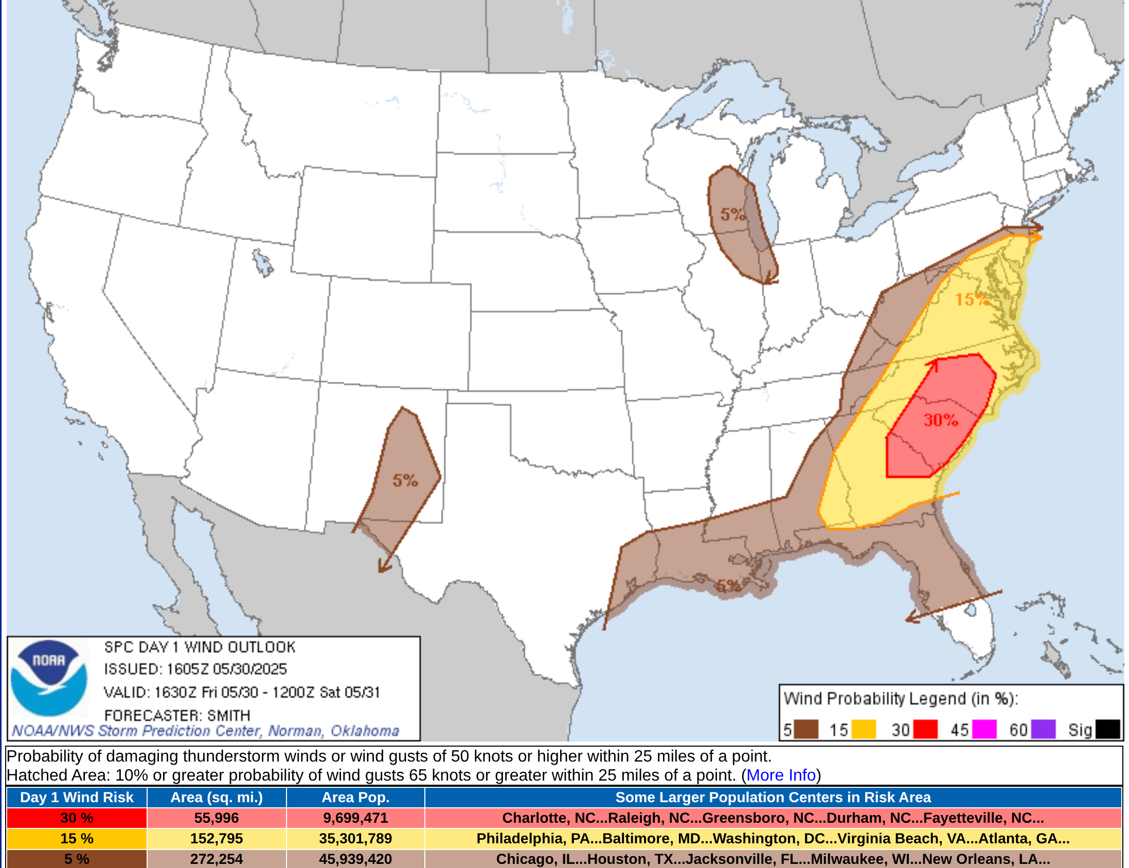
Charlotte, Raleigh/Durham, Greensboro, Columbia, Augusta, Savannah have an enhanced damaging wind threat today.
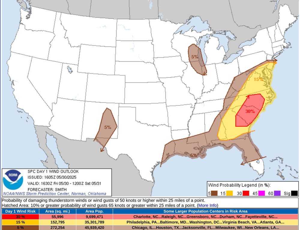
-
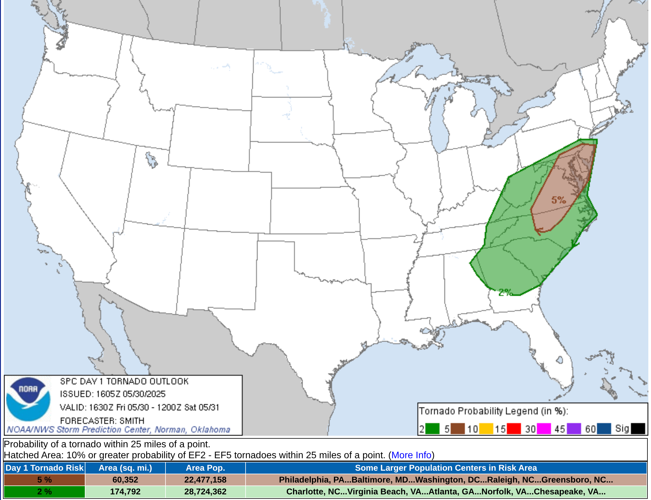
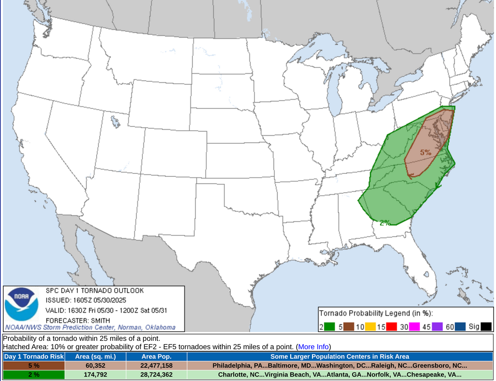
Raleigh/Durham, Richmond, Washington, and Baltimore might see more of threat of tornadic supercells or QLCS tornadic development
-
- 803 replies
-
- 2
-
-
-
- severe
- thunderstorms
- (and 2 more)
-
Tornado Watch coming soon for western part of the CWA
- 803 replies
-
- 1
-
-
- severe
- thunderstorms
- (and 2 more)
-
Looking back at this, I'm not sure there was ever much support for such a feature really and not sure it synoptically made sense.
-
It’s definitely worth watching. Once the trough axis passes, winds just above the surface shift to northwest, and the speeds rocket up (50+ kt) just above the ground. The question always is whether those speeds can be mixed downward. Some of the guidance shows an additional round of showers after midnight with some very weak low-level instability. Can that get it done? Not sure, but it could.
-
yeah it's coming and going lol
-
Seems to be the case,yup.
-
Second half of the week is shaping up to be on the hot/humid side. The signal for that cut-off low is fading and we are going to turn the flow WSW or SW with the front approaching and eventually stalling somewhere within the region. Going to be lots of mid-to-upper 80's to lower 90's in the torch spots if we mix fully.
-
If they did, my kid missed the bus lol I received nothing to suggest an early dismissal
-
Not much sun here at all and yesterday it was out for maybe 2 hours with lots of clouds around.
-
Ukmet's a 90 Wed-Thur
-
that whole climatic transition zone up there is gonna continues to burn and creep north each summer huh
- Today
-
First round of showers just pushed through, about 1/2 way there....
-
yikes...looks like a brown recluse or some cousin of it
-
Warmer Tues+ on these GFS/CMC runs
-
Around an inch.
-
Tornado Warnings starting from RLX in S WV