All Activity
- Past hour
-

Fall 2025 Medium/Long Range Discussion
A-L-E-K replied to Chicago Storm's topic in Lakes/Ohio Valley
This is our moment -

Fall 2025 Medium/Long Range Discussion
Chicago Storm replied to Chicago Storm's topic in Lakes/Ohio Valley
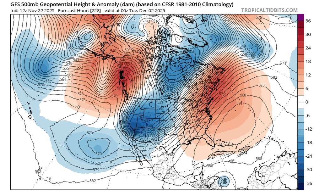
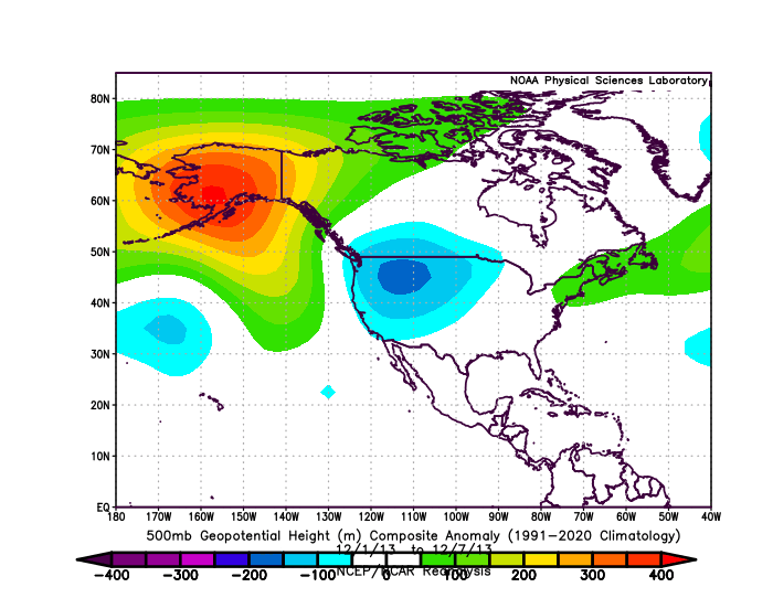
Short and sweet for now… 2013. This is the best looking pattern on paper I can recall when heading into December since then. -
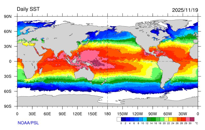
Eric Webb @webberweather The current global SSTa pattern is very favorable for the -EPO/+TNH pattern w/ the warmest water on the entire planet ~160E in the South Eq Pacific. The MJO is obviously giving it a huge boost here too. Eric Webb @webberweather · 16m I definitely underestimated how quickly this winter would dip into the ‘ol well of -EPO/+TNH we’ve seen so frequently the last 10-15 years. This pattern is only going to get stronger later in winter when the polar vortex intensifies& the warm pool starts zonally advecting east.
-

November 2025 general discussions and probable topic derailings ...
SJonesWX replied to Typhoon Tip's topic in New England
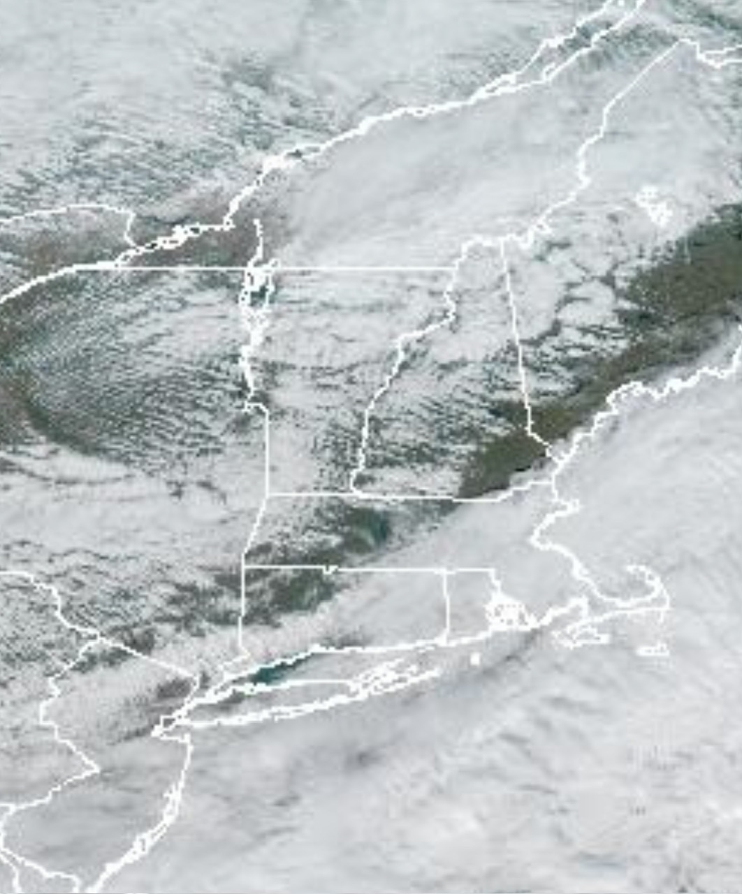
0.0” here, not even a drop. Last fall cleanup completed this morning -
12z suites showing a big cold dump in rockies, great plains & midwest with a pattern very early DEC 2013 looking. The pattern produced some ice & snow in the MW & OV as well back in 2013. Below you can click the link & watch the 2m Temp progression over that week. Underneath image you will click on "Go Forward one day": https://psl.noaa.gov/cgi-bin/data/composites/comp.day.pl?var=2m+Air+Temperature&level=Surface&iy[1]=&im[1]=&id[1]=&iy[2]=&im[2]=&id[2]=&iy[3]=&im[3]=&id[3]=&iy[4]=&im[4]=&id[4]=&iy[5]=&im[5]=&id[5]=&iy[6]=&im[6]=&id[6]=&iy[7]=&im[7]=&id[7]=&iy[8]=&im[8]=&id[8]=&iy[9]=&im[9]=&id[9]=&iy[10]=&im[10]=&id[10]=&iy[11]=&im[11]=&id[11]=&iy[12]=&im[12]=&id[12]=&iy[13]=&im[13]=&id[13]=&iy[14]=&im[14]=&id[14]=&iy[15]=&im[15]=&id[15]=&iy[16]=&im[16]=&id[16]=&iy[17]=&im[17]=&id[17]=&iy[18]=&im[18]=&id[18]=&iy[19]=&im[19]=&id[19]=&iy[20]=&im[20]=&id[20]=&monr1=12&dayr1=1&monr2=12&dayr2=1&iyr[1]=2013&filenamein=&plotlabel=&lag=0&labelc=Color&labels=Shaded&type=2&scale=&label=0&skip_vector=&cint=&lowr=&highr=&istate=0&proj=North+America&xlat1=&xlat2=&xlon1=&xlon2=&custproj=Cylindrical+Equidistant&level1=1000mb&level2=10mb&Submit=Create+Plot
-
There was another one a few years ago in December I believe, great pattern, didn’t produce. Not being a Debbie Downer, just looking at the facts.
-
and even a great pattern doesn't always produce. Look at last February.
-

November 2025 general discussions and probable topic derailings ...
CoastalWx replied to Typhoon Tip's topic in New England
Some of those spots to the south had over .4”. About .29 here. -
November 2025 general discussions and probable topic derailings ...
CoastalWx replied to Typhoon Tip's topic in New England
Brightening up here too now. Let’s go. -
November 2025 general discussions and probable topic derailings ...
CoastalWx replied to Typhoon Tip's topic in New England
These cold dumps will rip up parakeets from South America. Kevin better get ready for those plum smugglers. -

November 2025 general discussions and probable topic derailings ...
WinterWolf replied to Typhoon Tip's topic in New England
Starting to clear now..sun popping out. -
Lots of words that said nothing. People that are addicted to a certain something will attack to defend it. You protected your models well . Your sociological commentary was funny
-

2025-2026 ENSO
TheClimateChanger replied to 40/70 Benchmark's topic in Weather Forecasting and Discussion
Interesting look here. 10 warmest Novembers, minus 2009-2010 (significant ENSO mismatch) and 1913-1914 (age). Rather similar to CPC's outlook, except they are a bit more robust with the cold extension to the southeast. -
Agree that what the models show are not facts. Hopefully this year breaks favorably for us but I learned years ago not to count on the chickens too soon.
-
As a matter of fact, I received an additional 2.5 inches of snow on Feb.1 Additional 1 inch on Feb. 2 with a high of 30. The next 5 days were cold with low to mid 30's for highs. A thaw in week 2 with temps. creeping into the low 40's. Another 10 inches of snow on Feb. 24 with a high of 27. 1966 was a snowy year with 76 inches recorded.
-
CAB and vacillating at its worse
-
 Drip drip drip
 -
.thumb.png.4150b06c63a21f61052e47a612bf1818.png)
November 2025 general discussions and probable topic derailings ...
HIPPYVALLEY replied to Typhoon Tip's topic in New England
West is best today.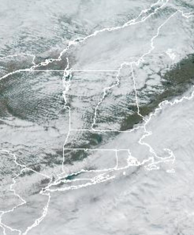
-
Its not facts at all. We are going into a favorable pattern .
-

December 2025 regional war/obs/disco thread
40/70 Benchmark replied to Torch Tiger's topic in New England
I'm pretty confident on an above average snowfall month north of the pike, at least. Here is my analysis from a couple of weeks ago, which is largely on track IMO...but the risk is colder. Expect this sale style of deviation from the MC forcing during the early portion of the season. December 2017-January 2018: December 2024-January 2025: An official SSW as defined by the reversal of the mean H85mb zonal westerly winds is unlikely, however, there is a low probability of one as suggested both by the minority of guidance, and the December 4, 1981 analog. Should there be a reversal of the H85mb zonal winds, December 4th is a good estimation of the when the PV will reach its weakest point before the split, and subsequent recovery begins. As per the expectation of a significantly weakened vortex resulting from bonafide warming that will fall short of a full zonal wind reversal, the December 2000 event is the preferred analog. This is appropriate since 2000-2001 is also the top analog from the seasonal composite. Accordingly, the polar vortex should have consolidated back to at least something approaching climatological levels prior to Christmas (18th-24th). It will then continue to strengthen with moderating temperatures in the east, per research conducted Lee et al (2019), which indicates that the arctic high regime is favored for less than 20 days following a weak PV. This is also consistent with the onset of a reflection event on December 21,1981, just over two weeks after the December 4th SSW. There is a slight chance of Ku event between the first and 15th of the month. The PNA should average negative during what will be active month, with numerous SWFE and overrunning events commencing by approximately the 10th. The probability for a White Christmas is above climatological levels given the active pattern and at least seasonable cold throughout the first half of the month, but it remains dubious for the coastal plane given the milder turn prior to the holidays. In fact, the proverbial "Grinch Storm" is more likely than not. A Pacific trough should begin to evolve towards the end of the month in conjunction with a rather stout PV, as a mild pattern ensues to ring in 2026. The month of December will average anywhere near normal, anywhere to -1F to +2F, except near normal to +2F across the middle Atlantic. -
Would be nice if this mid range look doesn't go poof
-

Central PA Fall Discussions and Obs
Voyager replied to ChescoWx's topic in Upstate New York/Pennsylvania
More and more I wish I'd have stayed in Arizona. -
November 2025 general discussions and probable topic derailings ...
WinterWolf replied to Typhoon Tip's topic in New England
Blows here…damp drizzly and raw-44 degrees. Doesn’t get much worse. -
November 2025 general discussions and probable topic derailings ...
WinterWolf replied to Typhoon Tip's topic in New England
Oh wasn’t meaning they can’t do it, just that they won’t next week. -
November 2025 general discussions and probable topic derailings ...
WinterWolf replied to Typhoon Tip's topic in New England
Yes, but 9 days out lol…that’ll probably cool some(but still be mild) as we close in.