All Activity
- Past hour
-
Mmm
-
Ukie euro and cmc are all pretty widespread 1-3"+ amounts. RRFS and HRRR pretty wet as well. Gfs is the only one not showing much
-
 North Trust Pharmacy [url=http://northtrustpharmacy.com/#]canada rx pharmacy[/url] pet meds without vet prescription canada
 -
I’m not saying she didn’t do the act. I think he was there encouraging it. His story and timeline does not make sense and has been contradicted by LE and witnesses. He kept an entire bag of no longer used medication in his truck and those medications were in her toxicology report? i think he kept feeding her all of these meds knowing this was the easiest way out of the marriage and the kids. he was already seeing a women on the side, he wanted out. He is the mastermind behind it all, used her as a puppet imo.
-
Slight risk added for basically 95 and points east for tomorrow
- 1,999 replies
-
- 1
-

-
- severe
- thunderstorms
- (and 7 more)
-

Augdewst 2026: Summer's Last Stand
WxWatcher007 replied to Prismshine Productions's topic in New England
-
Certainly has felt like that. This time there seems to be some synoptic differences driving the variance. Stormier solutions seem farther south with the low.
-

Augdewst 2026: Summer's Last Stand
Damage In Tolland replied to Prismshine Productions's topic in New England
Yeah can’t rule out a couple showers scattered but the heavy stuff stays south -

Augdewst 2026: Summer's Last Stand
weatherwiz replied to Prismshine Productions's topic in New England
The dry air is relative to the track and placement of the front. The overall heaviest of rain and thunderstorms is south (NJ/LI)...maybe CT coast but I think the llvl warm front is north enough to where we get precip to build inland. -
Can we please salvage a beach day this weekend..yuck
-

Augdewst 2026: Summer's Last Stand
vortex95 replied to Prismshine Productions's topic in New England
What does BN mean? Barnes & Noble? -
Augdewst 2026: Summer's Last Stand
Damage In Tolland replied to Prismshine Productions's topic in New England
S coast south and west . Lots of mid level dry air inland -
my canadian pharmacy and cheap canadian pharmacy online best canadian online pharmacy https://buscador.recolecta.fecyt.es/dnet-web-generic/redirect.action?docId=d3241445-e9af-41f8-ba10-01dd6d74856c_UmVwb3NpdG9yeVNlcnZpY2VSZXNvdXJjZXMvUmVwb3NpdG9yeVNlcnZpY2VSZXNvdXJjZVR5cGU=::oai:www.ucm.es:20035&url=http://northtrustpharmacy.com recommended canadian pharmacies and http://georgiantheatre.ge/user/syjdtorgvj/ canadian pharmacy 24h com safe [url=https://www.google.cf/url?q=https://northtrustpharmacy.com]buy drugs from canada[/url] canadian drugs and [url=http://www.1gmoli.com/home.php?mod=space&uid=990475]northern pharmacy canada[/url] canadian discount pharmacy
-
Augdewst 2026: Summer's Last Stand
weatherwiz replied to Prismshine Productions's topic in New England
I do think we see a solid precip shield of showers moving through later tomorrow afternoon and evening. -
Not saying this hasn't been the case in prior years - but this year seemingly has been significant in terms of distance between CAM solutions even up to the morning of events.
-

Augdewst 2026: Summer's Last Stand
dendrite replied to Prismshine Productions's topic in New England
It mixed out a bit, but I don’t think of this as a traditional chamber airmass even though it’s a beautiful day. Dews will be back in the mid 60s there this evening into tomorrow. There’s a larger airmass change tomorrow into Friday in NNE, but the front will be hung up way down there. Next week we may see more of a backbreaker. -

Augdewst 2026: Summer's Last Stand
Brewbeer replied to Prismshine Productions's topic in New England
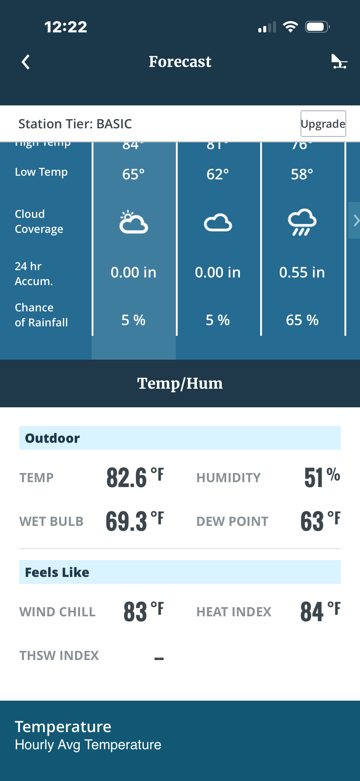
82/63, dews were low enough to finishing mowing -
-
Augdewst 2026: Summer's Last Stand
Damage In Tolland replied to Prismshine Productions's topic in New England
NAM 3k which is dry vs RRFS which has a squalline . I wonder which one wins - Today
-
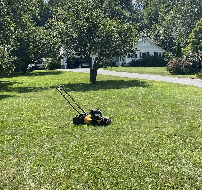
took care of the yellow jacket nest last night after dark and taking advantage of the lower dews I finished this masterpiece today: l lawn hasn't looked this good since June
-
Joe Bastardi brings something up that I think merits further study. The contrast in temps between the tropics and Arctic has dropped significantly since 1999 because the Arctic has warmed ~2C while the tropics have warmed significantly less. GW has been most concentrated in the Arctic. “A reduced equator-to-pole temperature gradient lowers zonal available potential energy (ZAPE) and surface baroclinicity. Baroclinic instability is the primary energy source for extratropical cyclones (the large-scale mid-latitude storms that form along the jet stream and frontal zones). With less available energy to draw from: Models (including coordinated experiments focused on Arctic sea-ice loss and amplification) generally show fewer individual cyclones each season across the northern mid-latitudes and Arctic. The remaining storms tend to be, on average, somewhat weaker, slower-moving, and longer-lived.” Individual events can still be intense or produce more extreme rainfall because of thermodynamic changes. Because of the distortion of warming, it leads to some things opposite of what is portrayed in the general sense. Your point is that this differential warming can produce effects that run counter to the simple ‘warmer world = more of everything extreme’ narrative, especially for baroclinic storm frequency and intensity. The thought experiment cleanly highlights how the pattern of warming, not just global-mean temperature, controls the dynamical response.”
-
Augdewst 2026: Summer's Last Stand
Damage In Tolland replied to Prismshine Productions's topic in New England
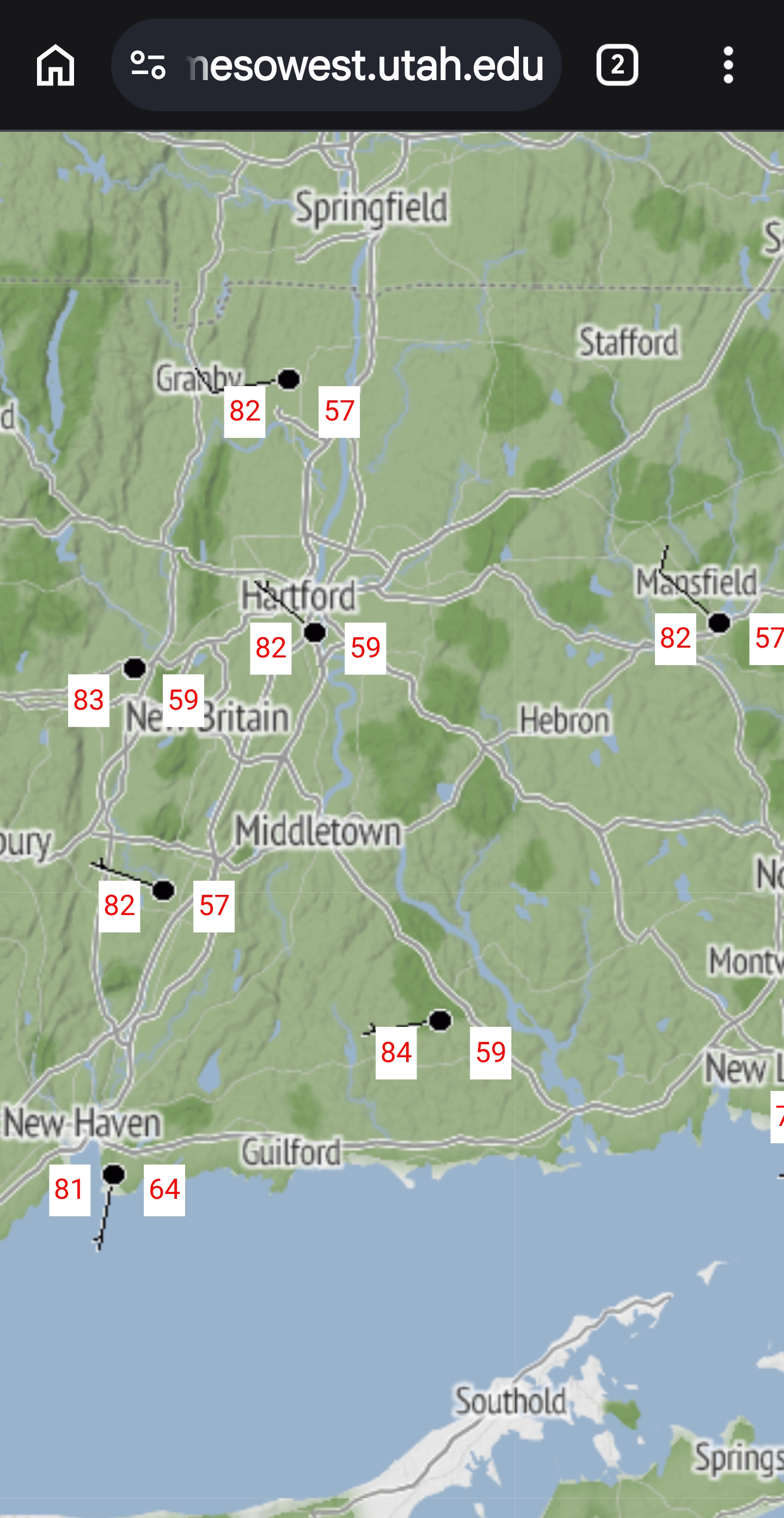
This is your dew right now . Not a Coc k
-
Augdewst 2026: Summer's Last Stand
vortex95 replied to Prismshine Productions's topic in New England
Synoptically there is light NW flow at 925 mb over FL still tdy, so that makes such events more likely, but as we saw ydy, the mesoscale details were everything. It all lined up perfectly for 2-3 hr. Law of averages and large numbers say this will happen at times! And this time, it just happened to be at a long-term climate site. Also, when one extreme occurs, another one like it in the short-term is often much more likely. Similar patterns breed similar sensible wx. How about that period Jan-Feb 2015? Probably one of the most spectacular examples for New England, and it was so localized, confined to ern MA/RI and Downeast ME, but it was @CoastalWx "VIOLENTLY RELENTLESS! " It used to be thought heat bursts were rare, but once the NWS and FAA installed ASOS/AWOS in the 90s w/ so many more locations and 1-min obs 24/7, we found they are a lot more common than we thought. -

Augdewst 2026: Summer's Last Stand
Ginx snewx replied to Prismshine Productions's topic in New England
Your brain is beer fried if you think 82/57 isn't COC in mid August.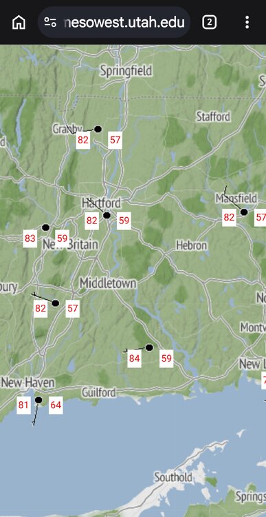
-
NAM and Canadian mesos are bullish. Hrrr has a few storms. FV3 says maybe some breeze and clouds?