All Activity
- Past hour
-
Eyeballing, I'd say 3" up here. I went to bed at around 1:30 and the local Wunderground stations were 32 or 33, so that didn't help with accumulations. Already the snow on the grassy areas has that mogul look from melting, though it's now 30 with temps dropping so that was from the middle of the night. All in all, a great and unexpected event. Best of luck to everyone else still ripping snow.
-
Heading out shortly to verify but eyeballing 4”; clearly more than I expected. Cheers all.
-
Snow continues. 27.0 Took two quick measurements on my driveway. 5.5" so far.
-

December 14th - Snow showers or Plowable snow?
Ginx snewx replied to Sey-Mour Snow's topic in New England
.5 just barely in better snow growth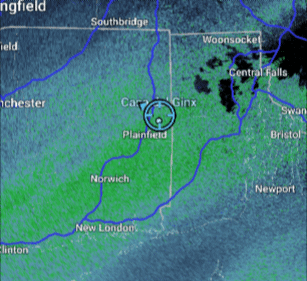
-

Saturday night/Sunday 12/13-12/14 Jawn
Kevin Reilly replied to Ralph Wiggum's topic in Philadelphia Region
Moderate to heavy snow huge flakes. 32f humidity 96% dew point 32f closing in on 5” trees are absolutely loaded wires sagging. You cannot see through the trees walls of white. -

December 14th - Snow showers or Plowable snow?
Kitz Craver replied to Sey-Mour Snow's topic in New England
Looking like an inch maybe… no way I hit anywhere close to 4” -
Same for Columbia. Between about 2-4am we were between bands. It’s been coming down well since, but we missed out on probably at least 1” because of that lull.
-
6:00AM snow was wrapping up. I had 4.5" here.
-

December 2025 regional war/obs/disco thread
mahk_webstah replied to Torch Tiger's topic in New England
Doesn’t look that warm for very long. A decent pack will soak it up and solidify it. -

Central PA Winter 25/26 Discussion and Obs
Boreal replied to MAG5035's topic in Upstate New York/Pennsylvania
Bangor PA. 29° Moderate Snow. Back edge approaching up here. Over 5” now. -
There’s not even an inch on my deck as I wake up. Just a coating. We got screwed between bands. I had that feeling we’d end up in a bad spot and of course, it found a way for Baltimore, as always.
-
I had no doubt it was coming even up here, right now looks like the weenie 1 inch QPF band will be directly over our heads, hopefully we can trend that down to 0.5 inches and our pack will be intact come Saturday.
-
Am hoping it makes up to Annapolis could be close .
-

December 14th - Snow showers or Plowable snow?
TauntonBlizzard2013 replied to Sey-Mour Snow's topic in New England
Prob about a half inch. Figured we’d have more by now -
Channel 7 saying the storms slowed down now so if that's the case, we all still good. Ending about 1 pm nyc area and 3 or 4 pm eastern areas
-
December 2025 regional war/obs/disco thread
mahk_webstah replied to Torch Tiger's topic in New England
Good. Let’s get it out of the way. -
December 14th - Snow showers or Plowable snow?
mahk_webstah replied to Sey-Mour Snow's topic in New England
Steady but light snow. Very small flakes. Perhaps a half inch. -
A 3.8” report from Northern Nassau and 2.9” in Plainfield, NJ.
-
BWI with thundersnow at 5am: METAR-KBWI 140946Z 29003KT 1/2SM R15R/4500V5500FT TSSN FG FEW004 OVC010CB 00/00 A2994 RMK AO2 PLE24 TSB26 OCNL LTGCC NE TS NE MOV SE P0005 T00000000
-
Dang, that LaPlata band looks legit
-

12/14: Sunday funday? Will the south win again?
Stormchaserchuck1 replied to TSSN+'s topic in Mid Atlantic
This is my biggest storm since 2018 Snowing moderately again. In 02-03 I had like 10 of these lol -

December 14th - Snow showers or Plowable snow?
Baroclinic Zone replied to Sey-Mour Snow's topic in New England
Only 1/2” so far, eyeballing. -
lol recent Ninos have not been good here. Nina baby!
-

Saturday night/Sunday 12/13-12/14 Jawn
Newman replied to Ralph Wiggum's topic in Philadelphia Region
Wow! I just checked the radar loop and your area has been under the best banding all night. Love it. -
I recently complied the data in more detail after getting some comments on exactly where the cutoff may be. This is what I posted in the NYC metro forum a few days ago and I will update when this month is complete. It seems to be that 4 to maybe 5 inches is where the cutoff level is. But the main takeaway is that the average to above average seasons went 6”+ in December. The snowfall data below is what I post each December for La Niña conditions using the newer RONI definition due to the warming of the global oceans. The December to seasonal snowfall relationship has worked 14 out of the last 15 times. My guess is the reason for the reliability as an early seasonal marker for below and normal to above average snowfall across the entire season is related to the La Niña seasonal progression. They tend to be more frontloaded in nature so their seasonal snowfall pattern is usually revealed early on in December. Plus in our warmer climate we have been noticing more repeating patterns perhaps related to non linear convective thresholds being met in tropical oceans driving the forcing. The relationship holds for NYC, EWR, and LGA. I will post the data for NYC below which is similar to the other two stations. For the sake of this discussion I have been using 4” of snow in December as the cutoff. But it’s possible that it could actually be a little higher around 5” inches based on the available data. So it’s fine if someone else wants to use a 4-5” snowfall range for December snowfall as the cutoff line for below and normal to above normal seasonal snowfall. I am not making the argument that the December snowfall is causing the outcome of the rest of the season to change. Just that it serves as a marker of what expect the rest of the season. Sometimes two data points can be related due to other underlying variables that may not yet be fully sampled by our current scientific understanding. I will update this post once we have the complete December snowfall data. NYC December to seasonal snowfall during the most recent 15 La Niña seasons as defined by RONI in either the fall into winter https://www.cpc.ncep.noaa.gov/data/indices/RONI.ascii.txt 24-25….2.8”….12.9” 22-23….T……….2.3” 21-22…..0.2”……17.9” 20-21…..10.5”….38.6” 17-18……7.7”……40.9” 16-17……3.2”……30.2” the one case in the last 30 years that didn’t work out 11-12……0.0”…..7.4” 10-11…..20.1”…..61.9” 08-09…..6.0”…..27.6” 07-08……2.9”…..11.9” 05-06…..9.7”…..40.0” 00-01…..13.4”…..35.0” 99-00…..T……….16.3” 98-99……2.0”…..12.7” 95-96…..11.5”……75.6”


