All Activity
- Past hour
-
45° and dry for the moment. Looks like a DTR of about 3° today.
-
0.90" for this event and approaching 9" for the month.
-
.73 so far here in 21057. Respectable
-
Columbia east side: 0.55” from 8:30am Wed to 5:30am Thurs Total for event so far 0.94”
-
Days and days....
- Today
-
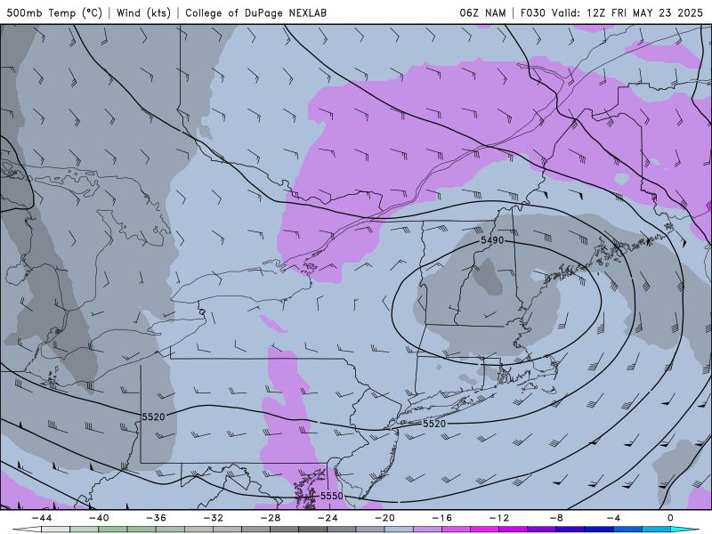
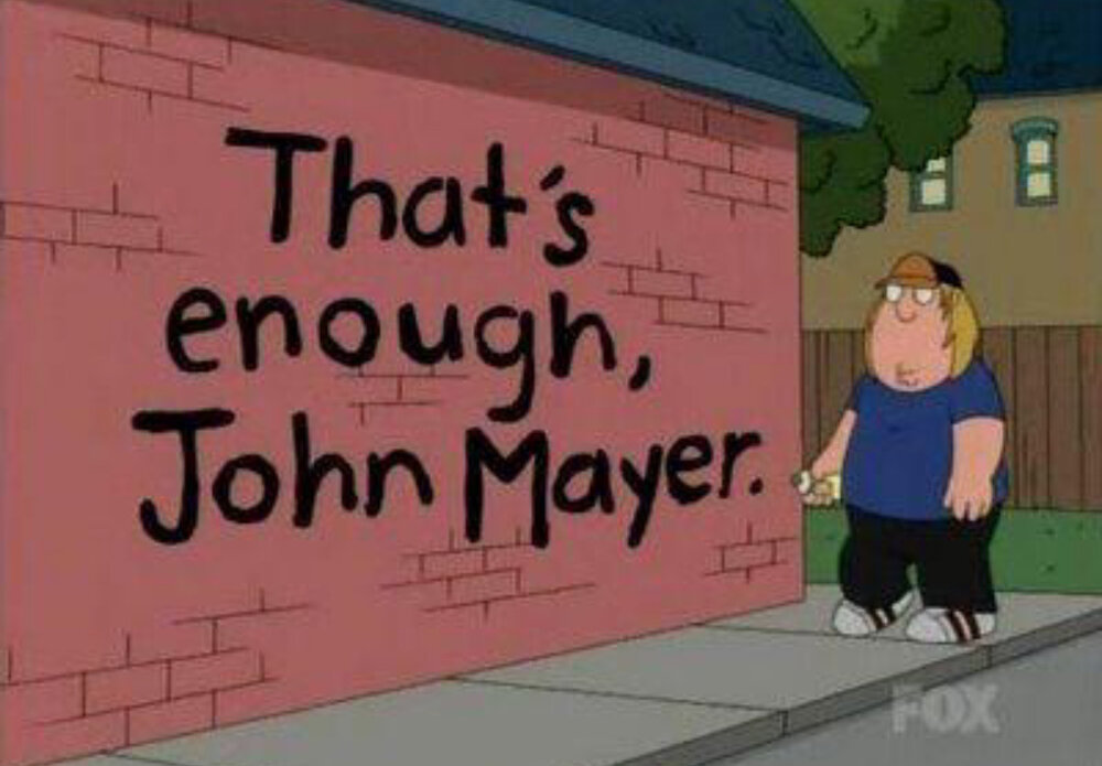
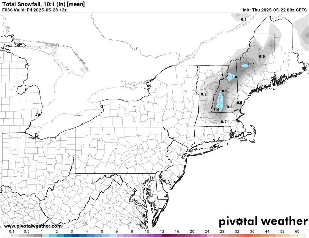
As CoastalWx has already lamented I bet, "why couldn't we get this 3 months ago!!!" Set up synoptically is ideal for a big snowstorm, but can't fight that it is late May. Still, I bet there will be some S+ surprises in ME/NH/VT. Excellent comma head and low track w/ max dynamical cooling aloft as 500 low passes right over the region. S/w swings around the base of the mean trough and does 90 deg negative tilt w/ a W-E elliptical, oval-sharped, closed 500 low -- about as classic as it can get for "backlash."
-
Yes it looks depressing next week...again! LONG TERM /SUNDAY THROUGH WEDNESDAY/... If you squint really hard at the upper air charts for Sunday, you might be able to convince yourself that upper level flow is becoming slightly less trough-y, but that`s probably just wishful thinking. We are growing less optimistic to see any marked improvement before Monday. The recent blocking pattern has proven to be rather persistent and in no hurry to unravel. The cyclonic flow and cool temps aloft should translate into a good deal of cloud cover with POPs peaking during the afternoon hours coincident with diurnal heating. Precip probs should bottom on Monday before ramping higher into Tuesday-Wednesday. Models are coming into better agreement in tracking the southern stream wave farther to the north. There are even signs that the briefly split-stream flow will try to close off into another upper low in the Great Lakes/Ohio Valley region by the middle of next week. So it appears the cool and wet pattern will continue into the end of the month with no signs of summer weather on the horizon (meteorological summer begins on June 1).
-
It has to have changed. I'm sitting at 9.69" for the month so far. Next weeks forecast that I showed above is just depressing. I just watched WNEP's Joe Snedeker, as the wife has it on in the morning when she's getting ready for work, and he showed the map with the trough and ULL feature....again. When will it end? Will it EVER end?????
-
-
If nothing else, I make sure our stuff works. Most people would have abandoned most of this by now... with broken things that are never fixed. This is was a 24 hour fix. I hope you all appreciated it.
-
By the way the Knicks choked =\
-
I have steam heat and it's set at 62 and turned itself on today. I have a space heater for my bedroom that I turn on, everything else is on automatic.
-
lol I know.... there are regulations for first and last day of heat, I just don't remember them off the top of my head. I think the heating period is October 1st to May 31th and landlords and supers are required to keep the heat in apartments at 68 during the day and 60 at night if the high temperature is lower than 55 and/or the low temperature is lower than 40. I'm not sure if it's "and" or "or" though.
-
Yeah I can literally feel the wind and the doors open and shut every time the wind picks up.
-
this was what I used to do back when we had colder Octobers (in the 90s) I didn't cook anything though I just turned on the stove.
-
I mean, I hope that somebody that wants to see snow, legit sees snow in the next two days. I am a diehard winter lover, but I am ready for warmer weather and a healthy garden.. I want low 80s and dew points in the 30s.
-
-

E PA/NJ/DE Spring 2025 Obs/Discussion
RedSky replied to PhiEaglesfan712's topic in Philadelphia Region
.60" -
-
GEFS
-
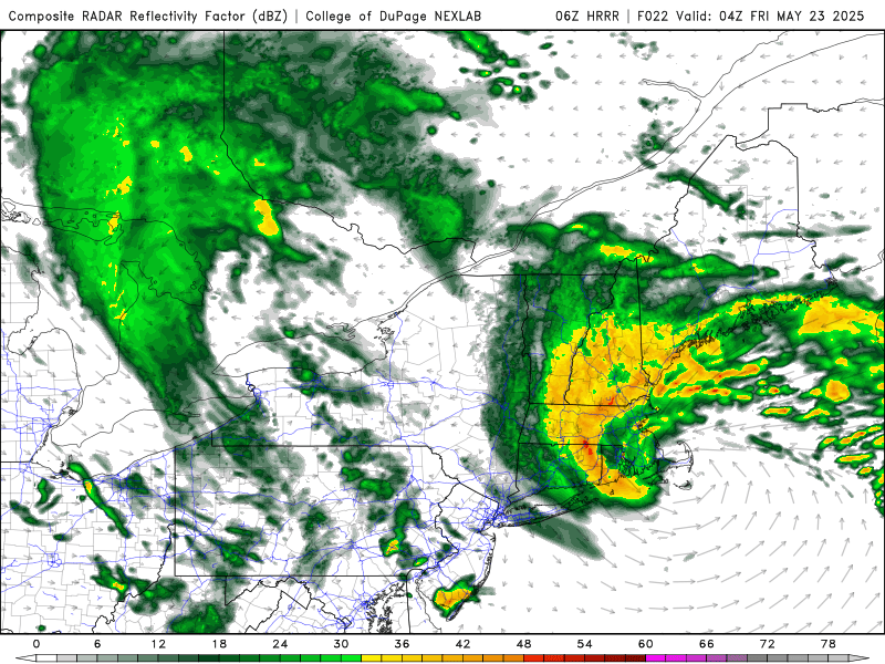
Nice trends towards a bit less precip here. Tomorrow will be as bad as it can gets, with regard to late May raw in SNE.
-
44 here, rain rates picking up. FYI, I was overruled (primarily due to the baby’s room), and the heat is now on.
-
GFS!!!!!
.thumb.png.50b325cb60e49babbb6b79b43ba2f43a.png)
-
This batch of rain saved the day here. Made the forecast respectable. 0.82".
-
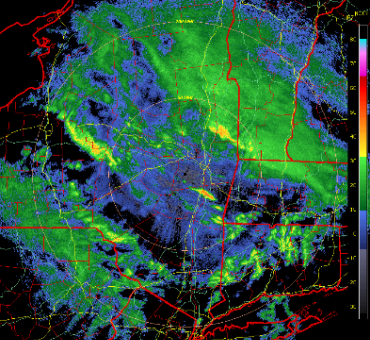
Yet we can’t buy these early deformation bands along RT 2 in winter.


.thumb.png.4150b06c63a21f61052e47a612bf1818.png)


.png.faf8818c835e38ff488d080f4f2eabed.png)