All Activity
- Past hour
-
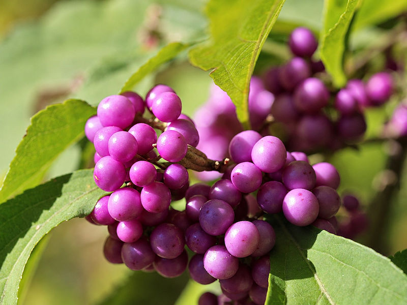
Some photos from the New York Botanical Garden on a sunny but chilly October day. The hummingbird migration appears to be completed.




-
Latest Euro extended fwiw. Could look a lot worse than this heading into Met winter.
-
 Cheap Cialis [url=https://weekendtabrx.com/#]buy cialis pill[/url] cialis for sale
-
Need to stop focusing on it. It isnt the end all. What we need to overcome it is a -EPO, and an AO that isnt absurdly positive. We have had multiple snowstorms since 2015 with a less than favorable PDO, and in most of those cases there was an EPO ridge and a non hostile AO state.
-
cialis for sale: Cialis 20mg price - cialis for sale
-
I know you asked Chuck, but my answer would be that the marine heat wave off Japan either has to dissipate or migrate east to just off the western North America coast. Problem is, the marine heat wave runs deep about 100-200m not just at the surface, so its harder to mix that out.
-
What do you think will be necessary for the PDO to switch back to a positive phase?
- Yesterday
-

2026-2027 Fall/Winter Mountain Thread
Met1985 replied to BlueRidgeFolklore's topic in Southeastern States
Temp down to 46 degrees. -

October 2026 OBS
WinstonSalemArlington replied to WinstonSalemArlington's topic in Southeastern States
-
Lamar needs to play this week. His ankle sprain is mild. I doubt Mahomes would have missed any time. He needs to be willing to play less than 100%. Get yo ass out there and practice, and play on gameday. Stop with the contract BS. You will get paid. Go effing play.
-
October 2026 OBS
WinstonSalemArlington replied to WinstonSalemArlington's topic in Southeastern States
-
N. Pacific low is not necessarily bad. Our biggest snowstorms come from that composite. Give me +PDO/Super east-based Nino 50 times and I bet it will be good 30 times vs recent averages. The problem is -PDO is completely overwhelming the N. Pacific pattern right now. You see this on models for the next 15 days.
-
Gotta wonder what they're gonna do with him. The misses from 40-49 are consistent enough to wonder if it's something mechanical as opposed to simply choking under pressure. If mechanical maybe it's fixable? But we can't keep doing this all season.
-
It was stunning this morning when I walked the dog. Totally still and silent other than the leaves hitting the ground
-
https://sildenrxexpress.shop/# sildenafil 50 mg price
-

2026-2027 Fall/Winter Mountain Thread
franklin NCwx replied to BlueRidgeFolklore's topic in Southeastern States
Had a high of 66 and a low of 30. Heading to Florida early AM for a week. Going to miss a perfect October week here! -
Quite a few frosted roofs in the neighborhood this morning; I was surprised. My low 37 on a DP of 31. Burning first fire now. (Happy wife)
-
This is the kind of validation I need more of in my life lol
-
To be fair to the other guys I might be as big a “thunder weenie” as they are lol
-
23.2F here this morning.
-
Beautiful, but dry wx. Highs in the low-mid 60's the last couple days. Lows in the 40's.
-
Bottomed out at 30.0 even here. First freeze will officially be October 17 as midnight temp was 32.2.
-
This morning was the coolest morning so far this season. Parts of the regiono experienced freezes and frost. Lows included: AlbanY: 29° Allentown: 31° Atlantic City: 36° Binghamton: 29° Boston: 37° Bridgeport: 38° Danbury: 29° Hartford: 28° Islip: 40° New York City: 41° Newark: 38° Philadelphia: 41° Poughkeepsie: 28° Providence: 31° Trenton: 36° Westhampton: 42° White Plains: 36° Temperatures will begin to moderate starting tomorrow. Most of this week will see highs in the lower 60s. A strong storm will stay too offshore to bring rain to the region this week. Some elevated high tides are possible. The ENSO Region 1+2 anomaly was +5.2°C and the Region 3.4 anomaly was +3.3°C for the week centered around October 7. For the past six weeks, the ENSO Region 1+2 anomaly has averaged +4.73°C and the ENSO Region 3.4 anomaly has averaged +3.03°C. ENSO Region 3.4 has set a new all-time record. The ongoing strong El Niño, will continue to strengthen through the mid-fall. The SOI was -32.94 today. The preliminary Arctic Oscillation (AO) was +2.460 today. Based on sensitivity analysis applied to the latest guidance, there is an implied near 63% probability that New York City will have a warmer than normal October (1991-2020 normal). October will likely finish with a mean temperature near 58.6° (0.7° above normal). Supplemental Information: The projected mean would be 1.7° above the 1981-2010 normal monthly value.
-
Low of 36