All Activity
- Past hour
-
-
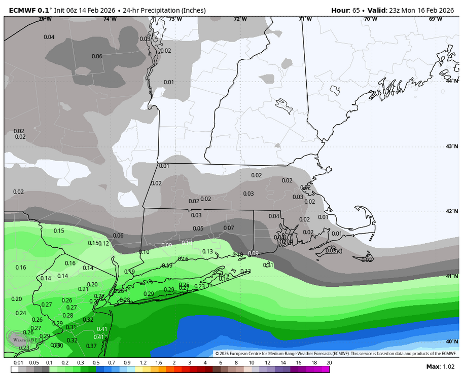
Not much to say on this one. Just a place for the 5 of us that might see some snow to discuss without pissing everyone else off in the main thread. Has a chance to be the biggest Feb snowfall for this area. Main thing we want is for the northern stream to slow down to allow earlier phasing closer to the coast. The trend has been to bring meaningful precip to just south of 84 on most guidance. Here’s the latest 6z guidance another tic north on euro, as well as all other guidance, euro AIFS did tic back south however.
-

Anyone having trouble paying the subscription?
CentralNC replied to MN Transplant's topic in Forum Information & Help
Yes, I have tried every card I have and sent a message in the support link but nobody ever answered me. I have tried multiple browsers as well. -
This thing is gone. Christ can’t wait to get to Tuesday.
-

Presidents' day Snow potential
Big Jims Videos replied to WeatherGeek2025's topic in New York City Metro
Im not getting 9 inches here Sunday but I am intrigued. Thanks GFS for the morning chuckle. -
imby/Columbia: Overnight Fri/Sat a.m. low 20.9 6am temp 22.9
-
Looks like some of you played some drinking games last night.
-

Central PA Winter 25/26 Discussion and Obs
mahantango#1 replied to MAG5035's topic in Upstate New York/Pennsylvania
After a bitter cold stretch from late January through early February, who doesn't love a welcomed warmup for #ValentinesDay and the days following? Asking for a friend. #PAwx -
 https://x.com/nwsburlington/status/2021912422211366936?s=46&t=m4Eqkekadb-JCXTm7k-Txg
 -
Central PA Winter 25/26 Discussion and Obs
mahantango#1 replied to MAG5035's topic in Upstate New York/Pennsylvania
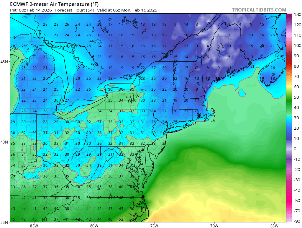
from NWS this morning: The other tricky aspects of the fcst include: relatively warm boundary layer/road temps, precip rates/banding, onset timing, elevation, and wet bulb effects. Without going to far into the weeds, the key takeaway for this cycle is that odds have increased on the margin for accumulating wet snowfall across south central and particularly southeast PA Sunday afternoon into Sunday night. The largest % chance increase is for areas to the east of I-81 with WPC, RRFS, and NBM showing low to moderate chances (30-50%) of snowfall totals >1 inch. The official NDFD fcst initialized off of the 14/01Z NBM is likely a bit too low at this point and would anticipate/front-run an uptick in POPs and snow amounts to be more in the C-1" range with the next cycle. There is the potential for additional changes to this forecast in the next 12-24 hours so continue to monitor especially for possible early Monday morning commute impacts. -
.thumb.jpg.6a4895b2a43f87359e4e7d04a6fa0d14.jpg)
Central PA Winter 25/26 Discussion and Obs
Yardstickgozinya replied to MAG5035's topic in Upstate New York/Pennsylvania
Just had a brief a grauple shower here. -
Let me rephrase. Of course we will continue to solve problems. The ones that will be difficult to solve will: be complex, need a political solution, have vested interests that hinder a solution, and which are beyond the experience or understanding of most people, i.e., subject to misinformation.
- Today
-
 PNA has a NAO correlation in late Feb/March, so it seems more neutralized than it really is if there is no NAO help.
 -
The phase happens in the ocean. Just need it to phase further west. Its not far off.
-
Dont care what your opinion is. But dont post bs.

-
No it’s not
-
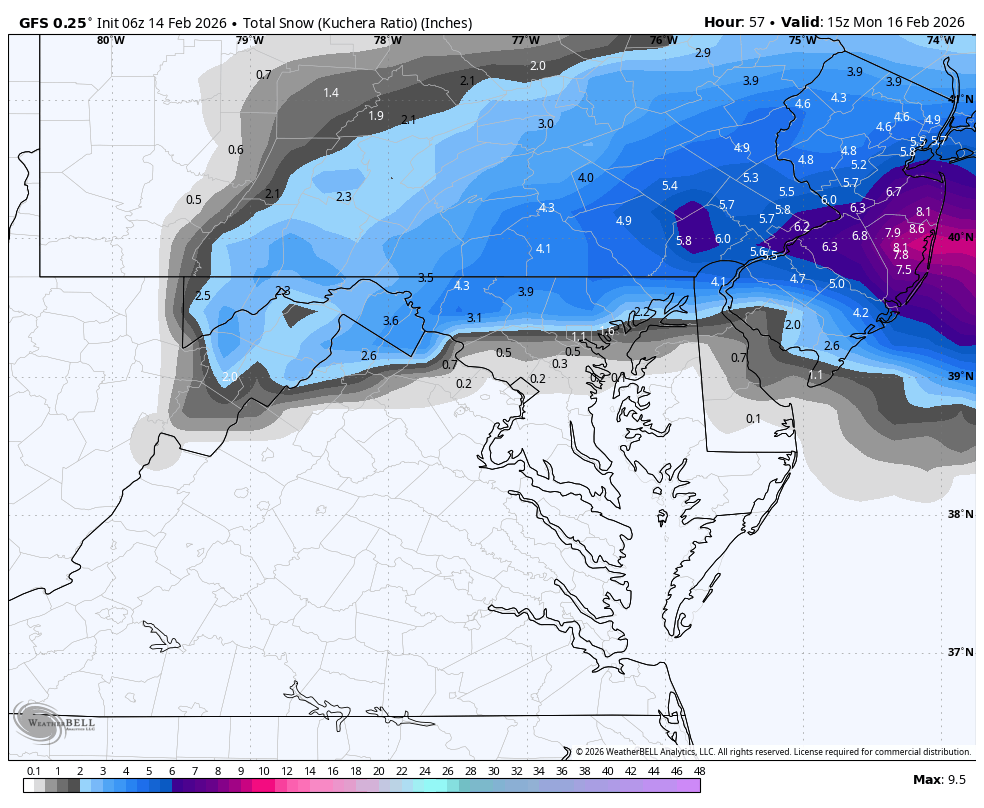
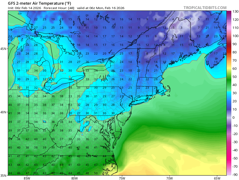
Gfs
.thumb.png.a475fca6936abbd1cf927892e0ee19f8.png)
-
WB 6Z GFS


-
Yup that was 8 days with high temperatures in the 10s we just had! It snowed south of Tampa. It used to rain all the time mid Winter in the 1960s and 70s.
-
Something is wrong with AI models
-
NYC will not see an inch out of this storm. That's my forecast.
-
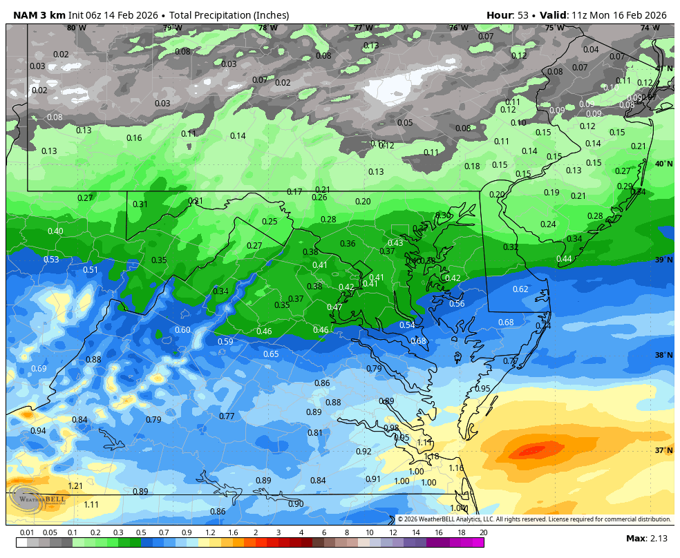
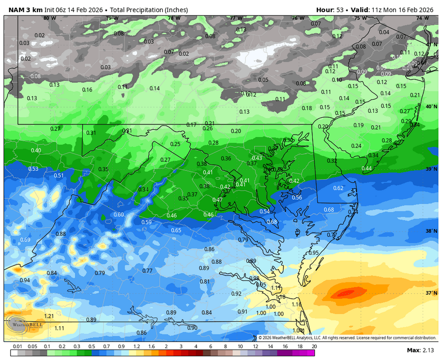
WB 6Z 3K NAM: at least enough rain to wash away some salt and grime.
-
Do you know how to read and interpret a computer model?
-
Sun angle?
-
Sun angle and also it's 40 degrees.


.png.2662e91a9f8eefeed80ae5dd20e00a5b.png)