All Activity
- Past hour
-
in all seriousness though I would love for the whole summer to be like today.. 67 low humidity and barely a cloud in the sky.
-
we year without a Summer Wednesday A slight chance of showers after 2pm. Mostly cloudy, with a high near 69. Calm wind becoming southeast 5 to 8 mph in the afternoon. Chance of precipitation is 20%. Wednesday Night A chance of showers, mainly after 7pm. Mostly cloudy, with a low around 55. Southeast wind around 5 mph becoming calm in the evening. Chance of precipitation is 50%. Thursday A chance of showers. Mostly cloudy, with a high near 68. Calm wind becoming east around 5 mph in the afternoon. Chance of precipitation is 40%. Thursday Night A chance of showers before 10pm. Mostly cloudy, with a low around 58. Calm wind. Chance of precipitation is 30%. Friday A chance of showers after 2pm. Mostly cloudy, with a high near 76. Calm wind becoming south 5 to 7 mph in the afternoon. Chance of precipitation is 30%. Friday Night Showers likely, mainly between 10pm and midnight. Mostly cloudy, with a low around 54. South wind around 5 mph becoming calm in the evening. Chance of precipitation is 60%. Saturday A chance of showers. Partly sunny, with a high near 73. South wind 3 to 8 mph. Chance of precipitation is 50%. Saturday Night Showers likely. Mostly cloudy, with a low around 51. South wind around 7 mph becoming west after midnight. Chance of precipitation is 70%. Sunday Showers likely. Partly sunny, with a high near 67. West wind 6 to 9 mph. Chance of precipitation is 60%.
-
It really doesn't matter. We use all historical data for the minimum/maximum records for any specific date, but only use the previous 20-30 year average for the day's average temperatures? When people hear heat index temperatures, or wind chill, they think that is the actual temperature, so, it really doesn't matter,because all the really good looking girls would still go out with the guys from Mohawk cause they've got all the money!
-
There's an underlying/not well realized forcing that is somehow by physical cause being suppressed in the operational runs. The -PNA, with an out-of-season EPO, along with a flat/and/or E limb NAO, are all demonstrative in the numerical values from all three major ensemble systems, EPS/GEFs/GEPs... Basically a -2 SD PNA, with nominal fluctions +/- wrt the other indices. Without any intervening forcing, that should layout out eastern N/A ridging. This numerical teleconnector spread/outlook has been in the cast for over a week's worth of daily mass-field computations. Yet these operational member versions just refuse to ever map a pattern in their respective mid and extended range charts that fully occupies what the spread description above says they should be... - this I am convinced is to enable Ineedsnow to torment Kevin, all the while ... he doesn't realize that in having all that numerical basis for heat, being suppressed by the operational versions ... is both highly unstable and probably just a matter of time before there's a ridge blossom. Or not... it is true that sometimes these telecons will divorce from the operational runs and vice versa. When that happens, given time they will tend to converge. The question is, do they converge into this year without a summer game interminably until we finally get hot for one week in early September? Or, do we suddenly explode hot.
-

2025 Lawns & Gardens Thread. Making Lawns Great Again
SJonesWX replied to Damage In Tolland's topic in New England
same. parts of mine were a bit tall, but nothing crazy thankfully -
The increased water vapor has really jacked up our average dewpoint which is like a natural cap to very high temps. One of these years we are going to get strong, dry westerly winds in a heatwave and we are going to set very high temperature records.
-
12z CMC is a deluge... 3 to 5"... everybody over 2" except DE
-
Models seem to be showing about an inch of rain this week particularly nyc on south and west which would give areas that still need some rain a good soaking
-
12z GFS looks like 1.5" to 2.5" for many through 84
-
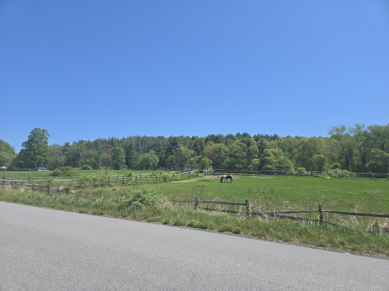
We Harvard/Boxborough

-
it's a nuanced argument that can presented many different ways. of course it's warming but.... 1) winters are warming much more quickly than summers are 2) summer high temps are capped by the planet self regulating the excess heat by dumping it into the ocean, thus we're not getting the higher number of 90 degree days that we used to. 3) if you go by averages it does not matter either way, since mins are going up much faster than the maxes are. 4) the way I define heat as in number of 90 and 100 degree days and length of heat waves is only going up for areas well inland.
-
1991 and 1993 were two of our hottest summers on record so it's not a surprise to see we had many more 90 degree days back then.
-
That was one of our hottest summers on record, which more of them happened in the 90s than any other decade.
-
Id also look into TTN seeming to have a cooler bias of late (last 4-5 years or so)
-
Every 6 hour the updated intra hour between the hour maxes and minimums update. JFK missed yesterday afternoons It happened alot last year too. https://forecast.weather.gov/data/obhistory/KJFK.html
- Today
-
that's nuts
-
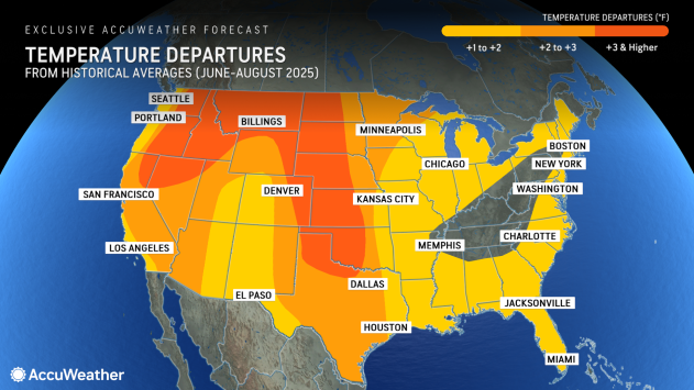
https://www.accuweather.com/en/us/templeton/01468/may-weather/2250886?year=2025
-
This gets more nuts the more I watch it.
-
I could do without that 84. I suppose with the low dew points they won't be too bad.
-
Bear could not defeat my military grade bird feeder, so he took it with him along with all the hooks and accessories he'll need to hang it in his den.
-
I have had snow on Memorial Day weekend twice in the past 12 or 13 years. I have had snow every month but July and August. Granted the Brattleboro climate is much less harsh than here and at my prior home in Peacham but the traditional "safe date" for planting out tender plants is the end of May. I am not saying that it will snow this Memorial Day this year, just that it has recently done so.
-
Ain't gonna lie, the Spartman posts for Memorial Day have me spooked. We're due for an ugly one.
-
Below shows the clear impact of the introduced altered NCEI adjustments to the below May actual average temperatures for Chester County PA. To put a fine point on the below analysis. Incredibly NCEI chose to chill 73 of the first 76 years or 96% of all May months in the years from 1895 through 1970! They have now over the last 54 years 1971 through 2024 chosen to warm the data in 40 of those 54 years or 74% of these years. This is a textbook example of how altering the data helps give the desired answer to assist the many Cyclical Climate Deniers. That blue actual average temperature line is actually cooling while the red altered data is clearly warming.....

-
How much and who do I have to pay for my Accuweather 90 day forecast to verify.... ? warmest temp 84 though August 11th and most days are in the 70s.. And yes I know this wont verify but it would be my dream summer
-
He brought up a temp from app. No one cares about an arbitrary # that the weather community uses. If it is 89 or 90, not a single person in the world would change anything in their lives including you. No one also cares if it 35 or 33 on an app.