All Activity
- Past hour
-
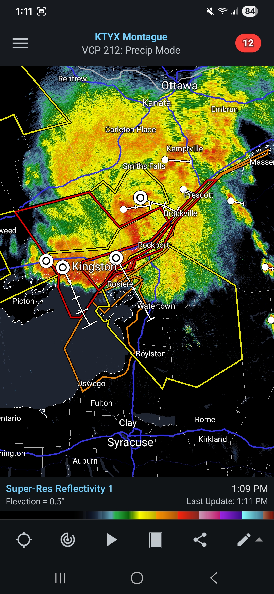
Not sure why models are weakening this but sure does look good.. lots of tornado and severe warnings with it

-
 Maybe I lied…close but no cigar in 2024. I know it was modeled. But 98-99…similar deal.
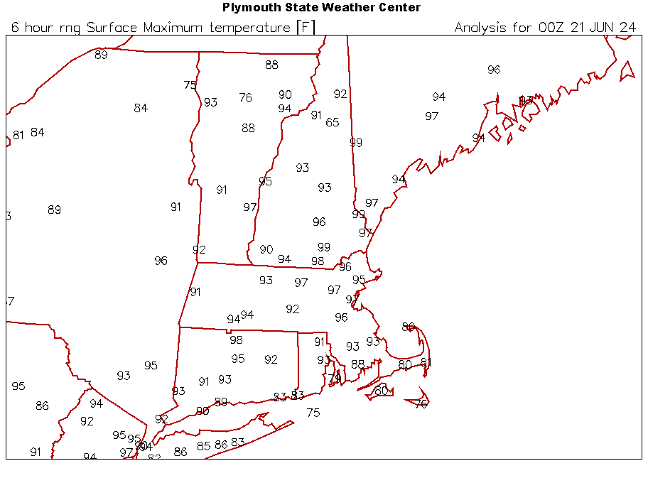
-

Junorch obs and discussion 2026
Damage In Tolland replied to Damage In Tolland's topic in New England
BDL at least 89. Probably 90 so day 1 should be in books -
Wait, you guys have running HVAC systems?

-
Showers into the HV maybe touching N-NJ otherwise clouds pushing south. 2nd 90 of the heatwave here
-
 It may be that we've been "playing with fire" ( n'yuk n'yuk ) in having missed this kind of multi-day integrated heat type. I mean seriously.
 -
This would be the 3rd straight summer pulling hundies.
-
I would think both as long as it doesn't pull any of the cooled air out-attics can get to 130+ easily
-
 How dare it get to 100F in summer
 -
Is it better to run an attic fan (with gables) and HVAC during the heatwave or just HVAC
-
I suspect the climate models aren’t good enough yet to detect all of the circulation changes that are resulting from warming the climate. So we get these repeated 500mb ridges which keep getting stuck in places for long durations leading to these increasing record heat extremes. It’s quite possible that the repeating omega block itself which is driving the record heat pattern in Europe is also related to the warming climate.
-
Dry ground doing the dirty work....
-

2026-2027 Super El Nino
csnavywx replied to Stormchaserchuck1's topic in Weather Forecasting and Discussion
This year was basically fine. Just need to keep it to a low simmer and slowly reconstitute the warm pool over time. Maybe throw in a cooler NATL spell that can reinforce trades and pop an actual CP Nino or two. We're at least very very likely to see some very strong Arctic warming into early winter '27-28 (response up there tends to lag lower latitudes quite a bit). -
If i sit outside long enough thur-sat, will my fat melt away?
-
Yesterday was supposed to be 83 and it got to 88
-
Dammit
-
If you mean Central Park highly doubt it. My guess at airport high for this event is EWR hits 105 on Friday. Central Park probably tops out at 98-99.
-
Yep, this winter I had go back over a year and delete tons of screenshots and pics so I could post any new ones.
-
well... "heat" is typical in summer - or supposed to be... heh. We've had some summers that were little torpid in that regard - certainly with respect and comparison to CC and the world. I mean it's been warmer than normal? it has.. no question. But we ware lagging ( or been so - ) over the rest of the world for bigger heat event frequency. As others et al have noted and we've discussed, we've accrued much of our CC through nocturnal/low temperatures. Otherwise, as Scott and Brian and I have explained, there's too many ways to discretely interfere with temp rising. Subtle. I mean discrete when using that word, because it is not always very obvious ... We can look identical in the entry to Des Moines IA, yet they're 104 while we're 95...etc.. For that, which is fairly objective ... a result like what this looks like ( currently ) it's capable of achieving, would have to be considered atypically hot. But there's also a couple of facets simultaneously true. Those numbers I described, by scalar AND their implication when combined, are both above normal, but also above "normal heat waves". Any heat wave here is an anomaly... but f we were to say a 90/90/90 three days is 1 standard deviation, this is well above a single Standard Deviation if it goes on that way
-
The Knicks win a championship, a top 5 blizzard and the first 100° temp since 2012 lol NYC winning
-

Late May/June 2026 Medium/Long Range
LordBaltimore replied to JenkinsJinkies's topic in Mid Atlantic
The inner harbor site is in a microscopic 2m wide triangle surrounded by cement pavers and 30 ft from the water. It is somewhat representative of street level conditions downtown but really, official measurements should be taken at riverside park if you want accuracy -

2026-2027 Super El Nino
GaWx replied to Stormchaserchuck1's topic in Weather Forecasting and Discussion
+QBO Nino Decembers: 1982 (warm temps), 1987 (warm), 1994 (warm), 2006 (warm), 2015 (warm), and 2018 (normal). I count 1997’s 0.78 as neutral QBO 2004’s +2.45 and falling is pretty neutral So, I agree on 6 Nino Dec +QBOs since 1980. And all but one were warm. 2018 was NN. Favors warmth in Dec for sure! And 1997/2004 (neutral QBO) weren’t warm. Edit: Dec of 1957 also had +QBO and was warm! But Dec of 1963 (moderate Nino) and Dec of 1969 (weak Nino) were cold despite +QBO. **Edit 2: If we stick to just high end moderate/strong/super Nino fall/winter peak with +QBO Dec, Dec was warm in all 5: 1957, 1982, 87, 94, 2015. Therefore, I think warm Dec is notably climo favored as of now. @PhiEaglesfan712 -
 So this isn't "typical" summer weather like some claim.
 -
Thanks Brain yeah... was just analyzing the grid. If this were not the case ^ than something is seriously wrong with the technology heh
-
Idiosyncratic notables about this NAM output continue... 6 consecutive periods of at or > 580 dm thickness. Usually even the hottest synoptics tickle 580 around 21z each afternoon and we settle back 576... But this is hanging around at that ungodly height. Trust me...I've paid close attention to these gridded guidance numbers for long years. Tomorrow's no picnic, either. 31C max at Logan is probably a 35 C walking down Cambridge Ave or out over the parking lots of of Natick. HFD and Lowell are cooking.