All Activity
- Past hour
-
That’s a post @jburns would have endorsed with enthusiasm!
-
I feel like this is going to be a special fall...warmth and humidity well through October. Will be able to watch football and hockey outside in shorts. With being to wear shorts with a hockey/football jersey it will look like you're not wearing pants.
-
 Lol I wouldn't go that far Dewpoint is a bit too high for that
 -
no...that fact that it covers a smaller geographical region. Most of that chart is early autumn. Barely servicing that warm side of the debate, would be a fairer impression of that chart. But again ... I don't trust that GFS solution anyway. Just sayn'
-

2025 Atlantic Hurricane Season
BarryStantonGBP replied to BarryStantonGBP's topic in Tropical Headquarters
How many NS are predicting for august chap? -
95+ skimpy lol
-
2025 Atlantic Hurricane Season
BarryStantonGBP replied to BarryStantonGBP's topic in Tropical Headquarters
SAINT LEZAK HAS SPOKEN Tropical Development Windows Are Approaching Two Key LRC Predictions Are Already in the Forecast The next three weeks mark a critical transition in the tropics. As Saharan dust slowly retreats and the thunderstorm activity increases over the open Atlantic, Gulf, and Caribbean Sea, we are forecasting a much more favorable environment for tropical development. In fact, two of our key LRC-based tropical windows—predicted months ago—are expected to show up soon. These are not random guesses. These are precise forecast targets based on storm energy identified last fallthat is now cycling back through the pattern. As you’ll see in the graphic below, the timing and placement of these systems align directly with the Weather 20/20 LRC predictions that have been part of our Tropical Outlook Guide since spring. We’ll continue to track these windows closely in our daily updates and highlight what’s coming next a week from now in our early August Tropical Update next Saturday. Conclusion: A Quiet Start, But a Pattern-Driven Storm Season Awaits While the hurricane season has begun on a quiet note, we are not fooled by the calm—and you shouldn’t be either. The Saharan dust outbreaks and persistent summer anticyclone have done their job suppressing early activity, but the LRC tells a deeper story. We’re entering a new phase now—one where multiple tropical windows, renewed storm energy, and shifting jet stream dynamics begin to align. As we’ve shown throughout this report, the pattern is right on schedule. https://weather2020.substack.com/p/tropics-stay-quiet-impacts-from-saharan -
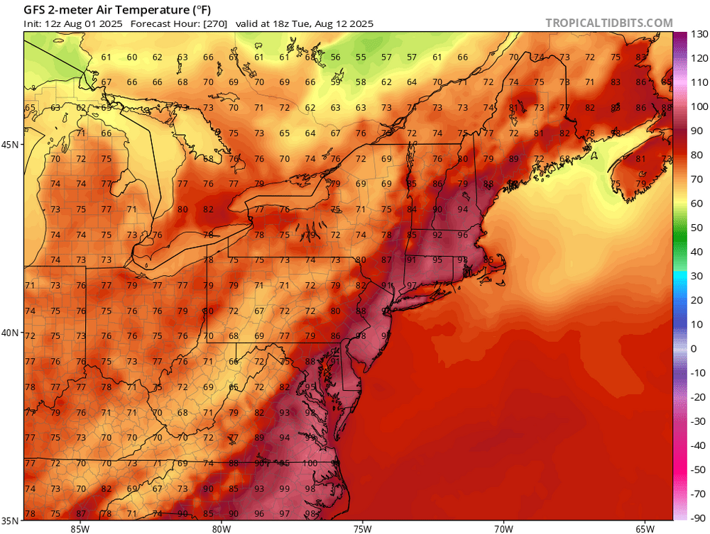
Based loosely on the 12Z Euro/UKMET/GEFS, the 6Z/0Z GEFS, the 0Z/12Z EPS, yesterday’s Euro Weeklies, and the forecasted MJO, it appears to me that there’s a somewhat enhanced chance of a TS/H threat around the NE Caribbean ~8/9-10, around the Bahamas/FL ~8/12-13, and either the US Gulf coast or the US E coast ~8/14-16. This isn’t an explicit forecast but rather just notable hints of what may be to come for those areas. It could easily look very different as early as tomorrow. 12Z EPS is somewhat ominous/more active for the Bahamas/CONUS vs the 0Z EPS during Aug 12-16. *Potential* mid August threat from NE Caribbean to CONUS as it appears now:
-
Well Liberty, only if we have and they can be filmed at a future forum get together. As always ….
-
Pretty amazing it is only 65 at peak heating. I saw some folks out and about in sweaters. Nice break.
-
2025 Atlantic Hurricane Season
BarryStantonGBP replied to BarryStantonGBP's topic in Tropical Headquarters
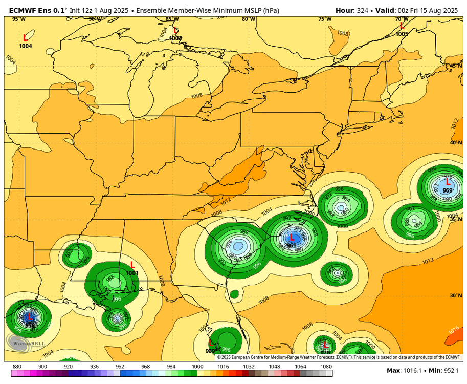
this possibly could be the E storm based on the ECMWF probability models -
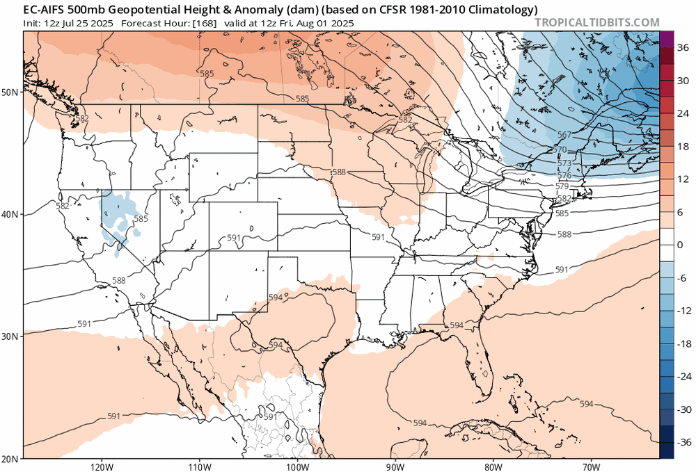
Ha ... pretty skimpy and petty. But I honestly don't know if the GFS run is very confident. The EPS and GEFs means are trending larger heights below 40 N across the continent in the time frame above... Meanwhile, both operational ECMWF and GFS are flip flopping - this 12z run flopped back cooler. Yet ...still the GFS gets a day with big numbers, no less. Flip flopping means limited skill so ens means are more useful. I don't think it's a cooler august. That much seems pretty evident. Question is whether it's mundanely AN or if it may host another heat wave or two.
-
my o my, acatt ruined
-
Same here. Actually feels pretty awesome lol, though I'll probably be done with this reset by tomorrow and ready for the return to seasonable weather.
-
It's not just the trough domain ...notice the heights in the west also inching polarward. Basically it's a problem plaguing the models, one that's gotten more obvious in the last 10 years, not going the other way with supposed upgrades. They have to add heights everywhere when moving from ext --> mids --> short term. I come up with sci fi idea. I can't help myself ... Like, they are trying to wholesale remove global warming from the ambience. Or it's a conspiracy to do so because MAGAt's have a mole in the modeling R&D offices at NCEP... heh 'Course, that myth gets immediately debunked when considering the zagnut scaled intellect of the MAGAtsphere: it could never produce an NCEP modeler, huh
-
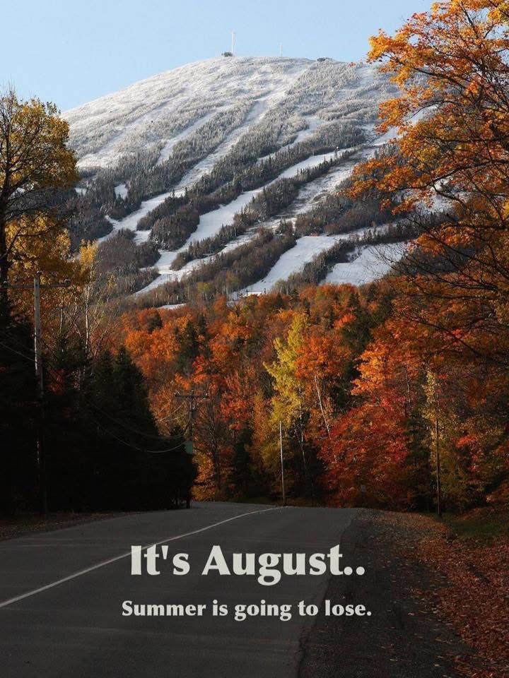
Even when they win.. they still lose
-
Another 3 plus inch rainstorm in Westfield, and that was at 10 last night. I can hear my lawn growing 15 miles away
-
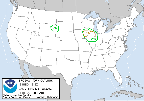
The 18th will be 20 years since Wisconsin's state-record tornado outbreak occurred on a day when the 1630 UTC tornado outlook looked like this: The most notable was the Stoughton F3, to my knowledge still the most recent killer tornado in the MKX CWA and the Madison media market. It missed the house where I was living with my parents at the time by about 1/3 mile to the north (the fatality occurred on the north end of our subdivision). Also still the most recent truly long-track, photogenic, Plains-tier high end tornado in southern Wisconsin.
-
It's a nice airmass, but *shocker* it modified from a week or so ago. The Euro AI backed off a little every run.
-
Skin cancer as well Sent from my SM-G970U1 using Tapatalk
-
An east west band of scattered thunderstorms, some heavy, has popped up from W of my area to offshore. I started hearing thunder a little while ago and now it is raining at varying intensities.
-
Even when I was little, I marveled at roofers in Texas. Granted, you'd hire them at the Lowes at 5 am and they'd be done by noon but still. That's a young man's job for sure.
-
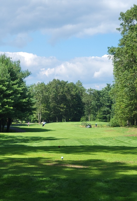
A Flock of roosters just ran across The fairway.
-
We are ready with our Killington full passes, Epic mid-week value passes and Indy passes. As always, the goal is 100 days riding lifts this winter. Bring on the cold and snow!
- Today
-
12z GFS looks a bit more interesting with low pressure off the SE coast that gets squeezed northwestward as a sprawling area of HP in eastern Canada shifts southeastward into the Gulf of Maine. Verbatim it's glancing blow for southeastern parts of our region.


.thumb.JPG.418e8a9a2902ae687ec35ff4bc0e038e.JPG)