All Activity
- Past hour
-
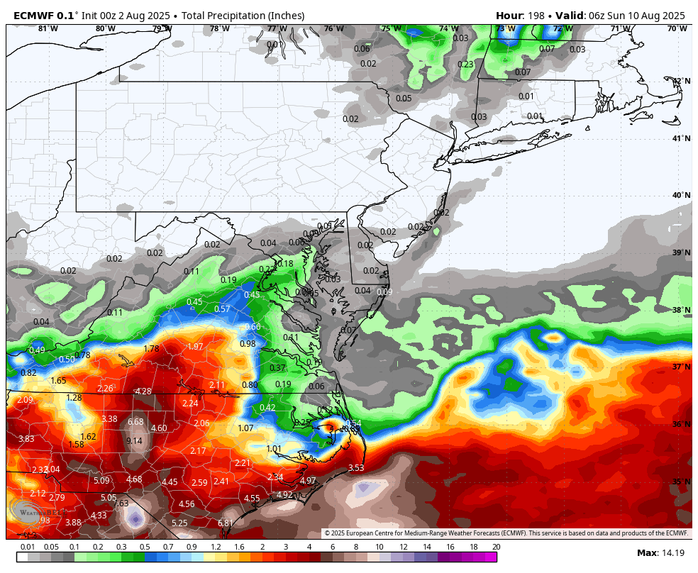
 We have seen this 2025 pattern in recent years during 2021 and 2017 when the highest temperatures of the year occurred in June. The most recent heatwave peaked several degrees lower. So based on past statistics, the warmest part of the summer is behind us. This doesn’t mean that we won’t see more heat potential in the 90s. But Newark hasn’t had any 100° days after August 15th since 1993. All the August 100° heat since then has occurred early in the month. None of the models have 100° heat in the next 10 days. So based on the 100° day statistics, chances are low from any 100° heat after August 15th. 1993 was the last time Newark reached 100° after August 15th Time Series Summary for NEWARK LIBERTY INTL AP, NJ Years with 100° days after August 15th Click column heading to sort ascending, click again to sort descending. 1 1953-10-31 105 0 2 1948-10-31 103 0 3 1881-10-31 101 2 4 1993-10-31 100 0 - 1973-10-31 100 0 Dates of all August 100° heat at Newark since 1994 8-1-24…100° 8-9-22..101° 8-3-06..101° 8-13-05…102° 8-13-02…100° 8-9-01…..105°
 -
49 for the low, dogs are happy what a nice morning for a walk.
-
 55 and feels like late September morn
 -
 56 out this way; bonfire in the works for tonight. Kids are pumped for smores.
 -
I'm sure these lower temps this morning will start to activate Blizz to soon release a premature snow map in 6 weeks.
-
Hush....not yet, although I have noticed the later sunrises already.
-
Euro monthlies come on the 5th of every month.
-
 58 and chilly morning in Paramus. WOW did that feel good.
 -
51F here.
-
 LB, the heat wave in 1933 ran from July 30 to Aug 2, 98 _ 102 _ 100 _ 98. June 8 and 9 of 1933 also set record highs (95, 97). In 1955 there were also two very hot days in July, 100F on 22nd and 99F on 23rd. Those were records at the time broken later (1957, then 2011). The max on Aug 20, 1983 at NYC was 96F, one below the 1955 date record. 1944 and 1948 were getting quite warm by late July but there were no additional 100F readings to add to those set in August.
 - Today
-
Yeah I think we gonna cane.
-
51 here, been awhile since it was this low. I guess were headed toward that dreaded season of winter.
-
COC!
-
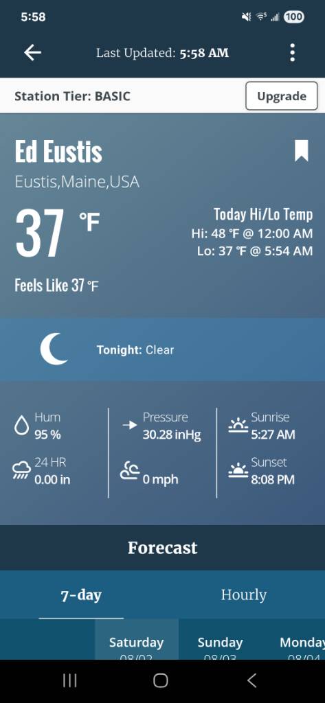
49.1° so far Looks like a warm week but not overly dewy…may have to wait until after next weekend for that.
-
Friends camp Sent from my SM-S921U using Tapatalk
-
Holy crap we mounted up last night. MVL 41/37 METAR KMVL 020940Z AUTO 21003KT 10SM BKN001 05/03 A3030 Local station 41/41.
-
Super refreshing morning 61/60
-
53 this morning here.
-
48.9 woo hoo!!
-
GEFS gone wild! Eps looks good also!

-

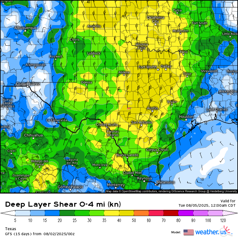
Texas 2025 Discussion/Observations
Stx_Thunder replied to Stx_Thunder's topic in Central/Western States
Sunday - Monday looks to be the most convectively interesting the next few days with a potential MCS or at least a few MCCs. Both Euro & GFS holding fairly strong on a formidable mid-upper northerly flow and some unusually decent DL shear this time of year (possibly over 40 knots) over a good chunk of the state on the eastern side of the furnace High moving off to the west. Steering some stout mid-level shortwave energy south through the state. Especially on Monday. Euro has been a bit sketchy on shear value trends in most recent runs. But GFS has been staying mostly consistent the past few days.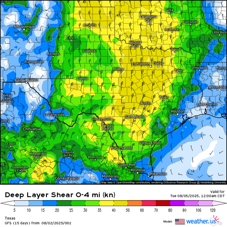
-
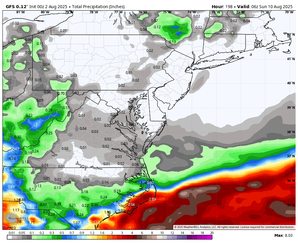
WB OZ GFS and EURO now both dry for the week ahead.

-

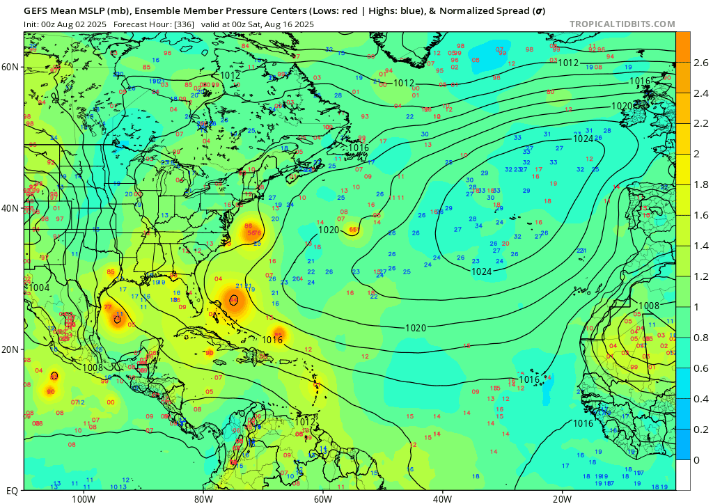
2025 Atlantic Hurricane Season
WxWatcher007 replied to BarryStantonGBP's topic in Tropical Headquarters
I still think 1-2 TCs before August 20, but I’m increasingly bullish for my peak season forecast (again). -
He’s not wrong about the general steering potential. A US landfall pattern has been there much of the summer, just haven’t had the activity. Don’t need Webb to see it. Once tropical waves start surviving the trek across the more stable tropical Atlantic and reach the SW Atlantic, there will be landfalls.
-
 Totally forgot DCA _ NYC _ BOS ___ ORD _ ATL _ IAH ___ DEN _ PHX _ SEA +1 +.8 +1 +.9 +.6 +.5 +1.5 +1.8 +1.6