All Activity
- Past hour
-

2026-2027 Record-breaking El Nino
GaWx replied to Stormchaserchuck1's topic in Weather Forecasting and Discussion
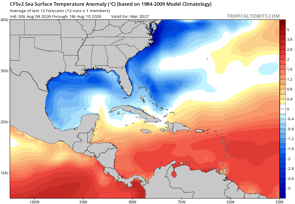
It’s very likely overdone, which is why I say it is more like a dream. But IF it were to actually have an inkling of what’s to come, we could be in store for an exciting or possibly even fab Feb. It is essentially going for another Feb of 1958, one of the greatest Febs on record in the E US and this with Feb RONI way up at +1.84! The CFS RONI prog for Feb ‘27 is for a rapid collapse down to +1.5. So, is it likely? No. But is it doable? Yes.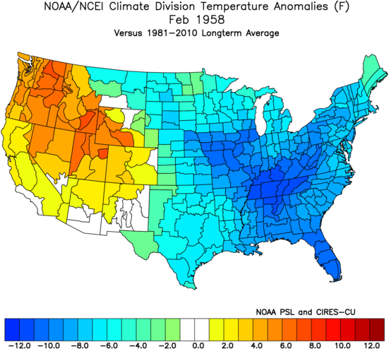
-
A lot of rainfall after these storms.
-

Spring/Summer 2026 Pattern Discussion Thread
John1122 replied to Carvers Gap's topic in Tennessee Valley
It's been absolutely pouring down here for the last hour or so. The light show is amazing. Not anything severe so far here. -
 https://mexisaferx.com/# online pharmacy in mexico
 -
 ^Just Fwiw, the last 2 years a few runs the CFS has shown -38F anomalies in the NW, US for the month of Dec both times. It didn't happen lol
 -
Big rains appear to be incoming. Heavy stuff first and then a lot of light stuff for a while afterwards. The NWS forecast this morning barely mentioned any rainfall threat, and now we are about to have our second round of significant rainfall today.
-
2026-2027 Record-breaking El Nino
GaWx replied to Stormchaserchuck1's topic in Weather Forecasting and Discussion
Due to the extreme cold anomalies progged by the CFSv2, look how cold the progged CFSv2 March ‘27 SST anomalies are off the E coast and in the N Gulf! Some areas are -5C/-9F even vs the slightly colder 1984-2009 climo!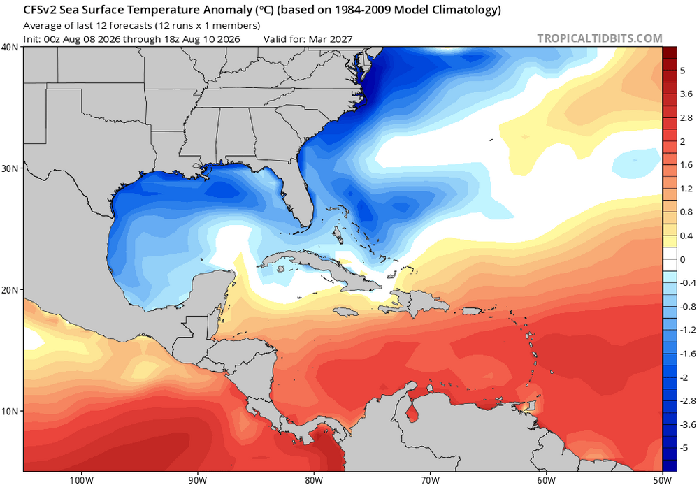
-
Big storms and lots of rainfall coming for most of yall.
-
http://mapletrustrx.com/# best canadian pharmacy to order from
-
Buncombe NC-Haywood NC-Madison NC- 955 PM EDT Tue Aug 11 2026 ...A STRONG THUNDERSTORM WILL IMPACT SOUTHERN MADISON...EAST CENTRAL HAYWOOD AND BUNCOMBE COUNTIES THROUGH 1045 PM EDT... At 955 PM EDT, Doppler radar was tracking a strong thunderstorm near Marshall, moving south at 25 mph. HAZARD...Wind gusts up to 40 mph and pea size hail. SOURCE...Radar indicated. IMPACT...Gusty winds could knock down tree limbs and blow around unsecured objects. Minor hail damage to outdoor objects is possible.
-
Oh, ok. Fwiw, I kind of saw it coming.
-

E PA/NJ/DE Summer 2026 Obs/Discussion
Kevin Reilly replied to PhiEaglesfan712's topic in Philadelphia Region
There was wildfire smoke today. Not a lot but you could clearly see the milky white mixed in with the scattered clouds today. I am going to guess this wildfire smoke is coming from Washington and Montana and southern Canada as our flow is originating in Washington to Montana to the Dakotas upper mid-west then to us. Fairly zonal flow northern tier before the peel off abruptly to the southeast to our southwest. -
Looks like some big time cells are firing along this boundary dropped along WNC.
-
88 today. Was uncomfortable round of golf
-

2026-2027 Record-breaking El Nino
mitchnick replied to Stormchaserchuck1's topic in Weather Forecasting and Discussion
I thought it was this year and was surprised it wasn't showing more than just a broad brush look. - Today
-
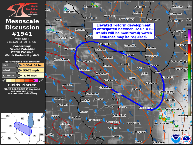
Here we go again
-

2026-2027 Record-breaking El Nino
MJO812 replied to Stormchaserchuck1's topic in Weather Forecasting and Discussion
This would be awesome. Blocking plus strong stj -
I'll be watching my 9% eclipse IMBY tomorrow. There's a parallel universe where I'm in a hotel right now in Reykjavik cussing out the forecast for tomorrow.
-

Spring/Summer 2026 Pattern Discussion Thread
1234snow replied to Carvers Gap's topic in Tennessee Valley
Part of the line is now bowing to the southwest following the outflow boundary which is also going southwest from Morristown to Knoxville. I find that interesting. -
I'm not sure I understand your point? You think this year is different from the 2017-25 average because you had a localized thunderstorm?
-
https://mapletrustrx.shop/# canadian pharmacy king reviews
-
Yeah I’m not saying it couldn’t be historically bad… I’m just not going to brace mentally for the all-time bad outcome. I’d think 20-25% below normal could be a reasonable expectation, but I’m not ready to assume 50%+ or something like 2015-16.
-
prescription drugs canada buy online: Maple Trust Rx - legitimate canadian online pharmacies
-
. 72 here. I have mosquitoes the size of bald eagles. And they ain't bald!