All Activity
- Past hour
-
12z Euro significant shift NW. Waiting on the EPS
-

Nov 28-30th Post Turkey Day Winter Storm
tuanis replied to Chicago Storm's topic in Lakes/Ohio Valley
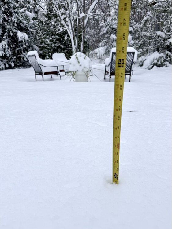
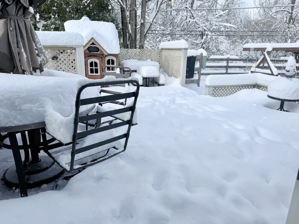
Somewhere around 11” here. An over-performing big dog. More photos to come once I get out there to clean up the driveway. -

2025-2026 ENSO
Stormchaserchuck1 replied to 40/70 Benchmark's topic in Weather Forecasting and Discussion
Natural Gas Futures are up near $5, making one heck of a run since August! I've been watching to see if it goes up, record low 500mb in the N. Hemisphere in August, low 500mb at different times in the Summer and Fall - all that is pretty strong in preceding a cold Winter. Since 2012, negative SLP 60-90N in the warm season correlates to Winter -AO at a high rate. I didn't trade the Futures, but I should have - they are trending toward the colder Winter idea (although $5.00 is about the middle mark - >$5 -NAO, <$5 +NAO) -
It likes next weekend.
-
First Winter Storm to kickoff 2025-26 Winter season
dryslot replied to Baroclinic Zone's topic in New England
12z Euro caving a bit this run. -
First Winter Storm to kickoff 2025-26 Winter season
Great Snow 1717 replied to Baroclinic Zone's topic in New England
just ignore the emojis lol.. -
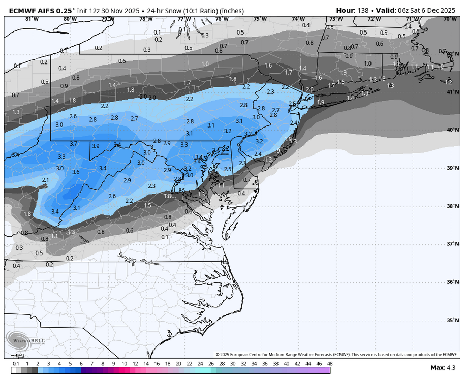
My weenie take is that I don’t think the EURO AI can handle tight details like p-type. Would also be why the ens have a snowy bias.
-
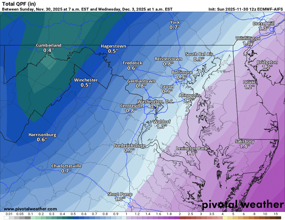
12z Euro is awful for DC, with a big NW shift. might be a cave
-

First Winter Storm to kickoff 2025-26 Winter season
WinterWolf replied to Baroclinic Zone's topic in New England
He sounds like all of us were in the 80’s…that’s so funny. He’s a snow weenie for sure. -

First Winter Storm to kickoff 2025-26 Winter season
40/70 Benchmark replied to Baroclinic Zone's topic in New England
Yea, if you out out crap products to start. I don't expect big changes to my Friday map. -
-
Snowing in leominster fat flakes.. looks like.a snow globe
-
euro looks colder at 850 at 14z on tuesday than 6z
-

First Winter Storm to kickoff 2025-26 Winter season
WinterWolf replied to Baroclinic Zone's topic in New England
It’s just pathetic. Enough said. You don’t have to agree. -
First Winter Storm to kickoff 2025-26 Winter season
Kitz Craver replied to Baroclinic Zone's topic in New England
For those on the edge it’s nice to see the GFS a more coherent low and stronger. Any flaccid rates are not going to get it done. -

First Winter Storm to kickoff 2025-26 Winter season
CoastalWx replied to Baroclinic Zone's topic in New England
Considering he just told me we live in a shitty snow spot probably not. Poor kid is exactly like how I was in the 80s or early 90s hearing the stories from my parents. -
-
-

First Winter Storm to kickoff 2025-26 Winter season
Damage In Tolland replied to Baroclinic Zone's topic in New England
Do we need to keep it clean in here with Jr. now a member? -

E PA/NJ/DE Winter 2025-26 Obs/Discussion
Newman replied to LVblizzard's topic in Philadelphia Region
Really tricky forecast for Tuesday across Berks, Lehigh, Northampton counties per usual. Expecting the R/S line to make it to the 78 corridor, but never know. How much snow falls in these areas will depend on how quickly/heavy the initial WAA snows come in and how quickly (or not) the warm nose aloft lifts north. Southern parts of these counties won't do as well as the northern parts. I'd expect sleet to mix in more than expected, but we'll have to see what the CAMs show the next few cycles. Regardless, small shifts will make a big difference in these counties and it'll probably be a nowcast to see where the R/S line is on CC radar. 2-5" is a good call, 2 being the low end and 5 the 75th percentile or so. Reasonable worst case scenario is probably 6 or 7 inches -
First Winter Storm to kickoff 2025-26 Winter season
Great Snow 1717 replied to Baroclinic Zone's topic in New England
Sure does seem like it is bothersome to some people lol -
Geez man, we all know why. You need a new hobby.
-

First Winter Storm to kickoff 2025-26 Winter season
CoastalWx replied to Baroclinic Zone's topic in New England
He’s already pissed off. -

First Winter Storm to kickoff 2025-26 Winter season
WinterWolf replied to Baroclinic Zone's topic in New England
It’s not that it’s bothersome…it’s just downright ridiculous and infantile. As was said, it doesn’t matter what is posted, and that’s the takeaway. But whatever. Just pointing it out.


.thumb.png.5713c27b888fee57c19360ecb68a6a03.png)


