All Activity
- Past hour
-
 WB 6Z AI EURO still has the storm but it ticked NW this run.
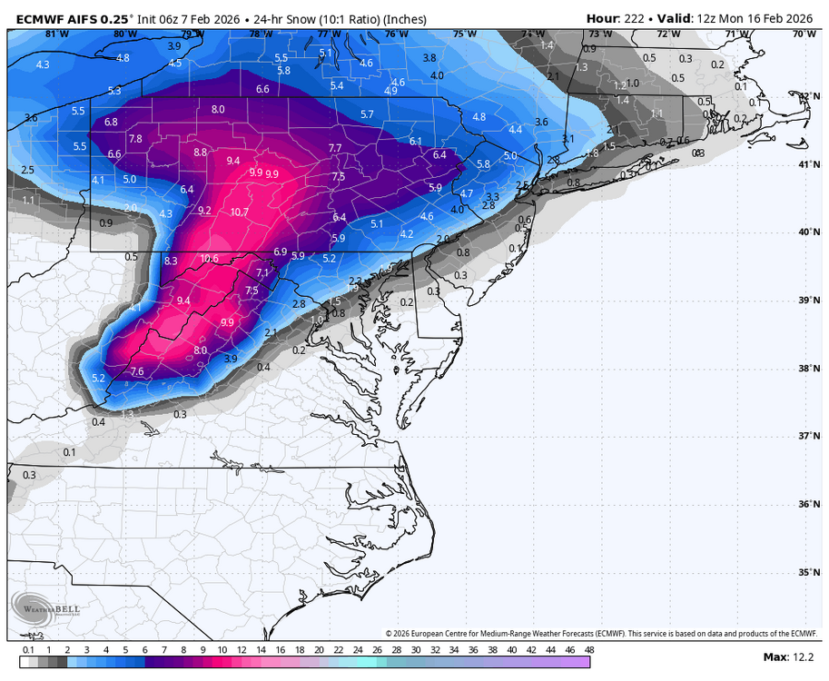
-

Friday February 6 FROPA / WINDEX small event
Sey-Mour Snow replied to HoarfrostHubb's topic in New England
1.0” here winds starting to crank at tree level -
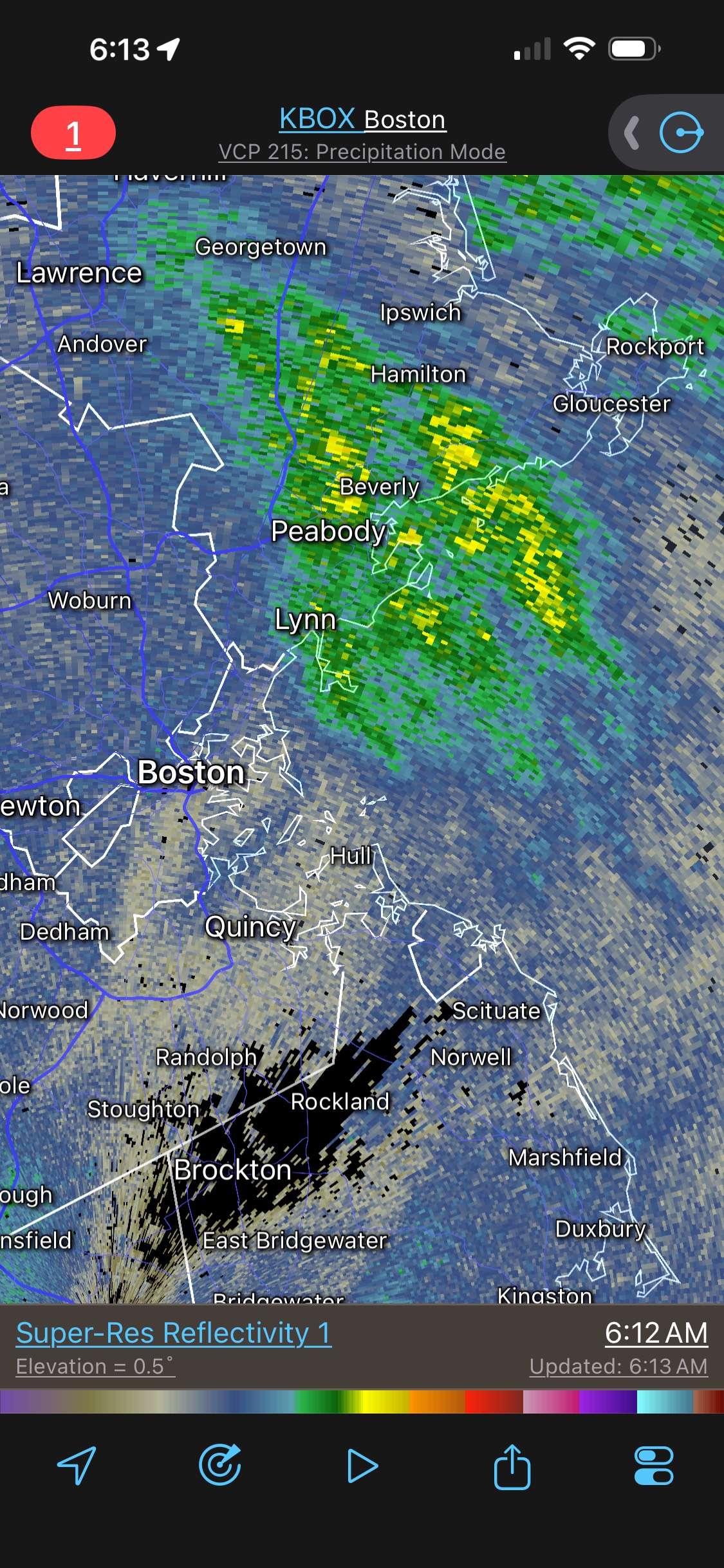
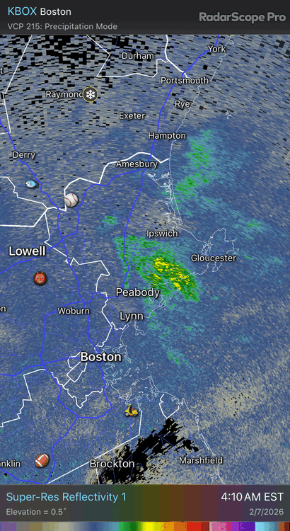
Someone between Peabody and Gloucester is about to get over a foot of snow.
-
PDII absolutely was historic here and the January storm was comparable to it in this region. And yes, an 18” storm is a very big deal and a high-end MECS at the very least. It’s been a good winter in the area including yours. Vodka cold for weeks on end following an 18” storm what more can you ask for without getting into fantasies?
-
So far kind of weak sauce with the winds.
-

Friday February 6 FROPA / WINDEX small event
dendrite replied to HoarfrostHubb's topic in New England
-

Friday February 6 FROPA / WINDEX small event
NorEastermass128 replied to HoarfrostHubb's topic in New England
Tough to tell without going outside. I’d say 3-4”. -

Friday February 6 FROPA / WINDEX small event
Ginx snewx replied to HoarfrostHubb's topic in New England
3 inches new .75 last hour
-

Friday February 6 FROPA / WINDEX small event
Baroclinic Zone replied to HoarfrostHubb's topic in New England
1/2” here. -
Snow shower here
-
Friday February 6 FROPA / WINDEX small event
Sey-Mour Snow replied to HoarfrostHubb's topic in New England
Arctic front just arrived. Puking snow wind picking up temperature starting to drop slowly let’s see if it actually tanks . Should get 1.5-2” here -

Friday February 6 FROPA / WINDEX small event
The 4 Seasons replied to HoarfrostHubb's topic in New England
i bet it is, lucky you, congrats. you got your own little private WSW up there, how much so far? -

Friday February 6 FROPA / WINDEX small event
vortex95 replied to HoarfrostHubb's topic in New England
For Weymouth/CoastalWx, "WE HOLE!"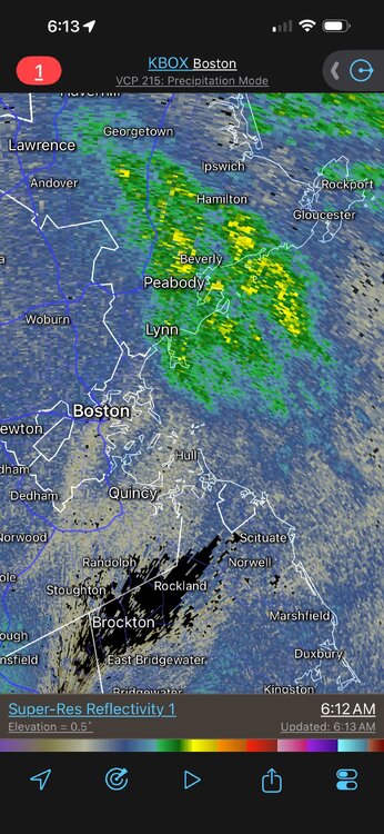
-
Friday February 6 FROPA / WINDEX small event
Ginx snewx replied to HoarfrostHubb's topic in New England
Dumpage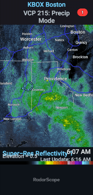
-
Friday February 6 FROPA / WINDEX small event
NorEastermass128 replied to HoarfrostHubb's topic in New England
Puking snow. -
Friday February 6 FROPA / WINDEX small event
The 4 Seasons replied to HoarfrostHubb's topic in New England
0.9 and steady light snow. nice refresher -
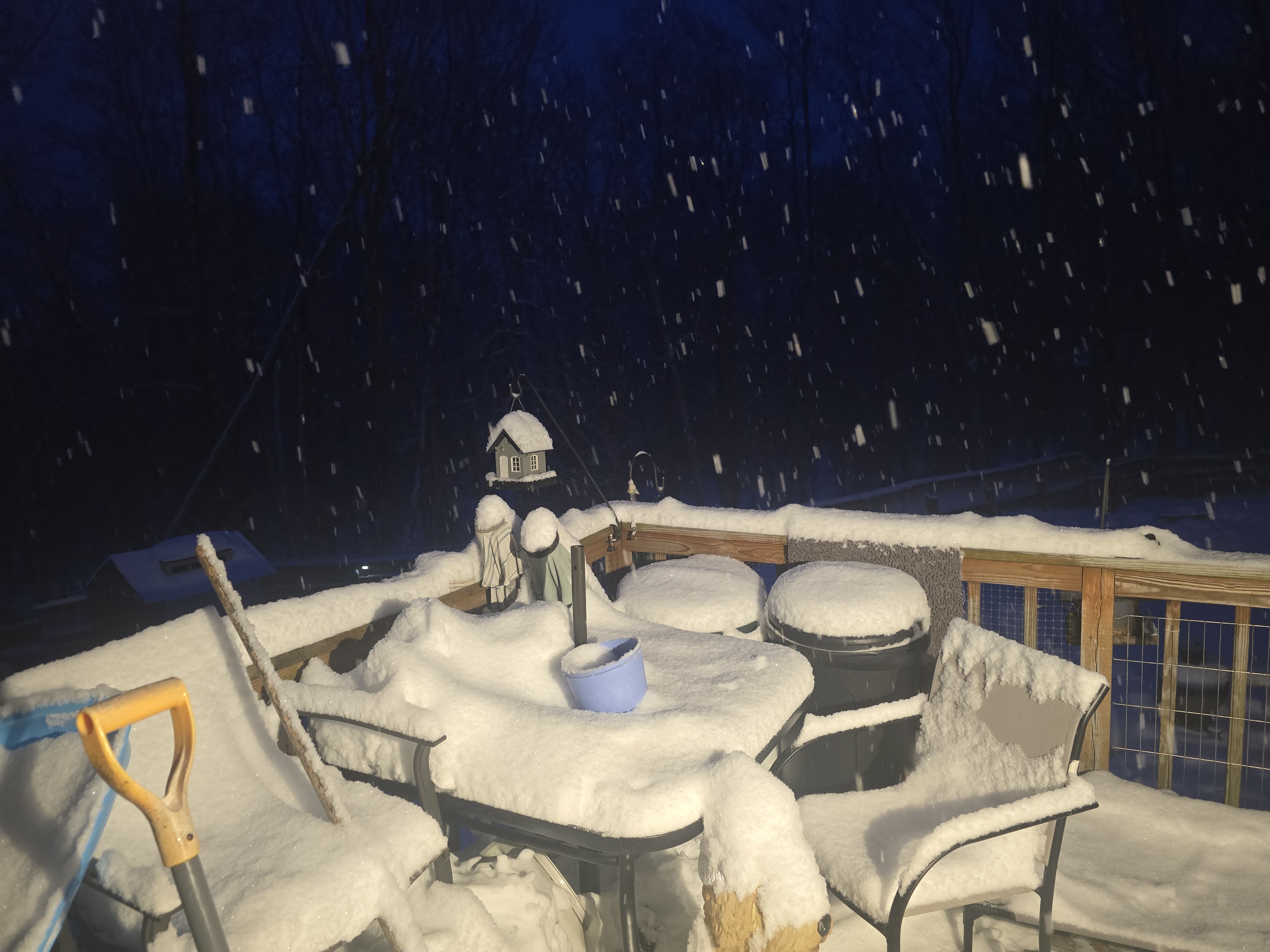
I haven't been out yet but it looks covered out there. It looks like an of snow where I had dug a patch through the pack. I got up and watched it come through. It came down real nice.
-
Looks like I got hit pretty flush with the snow along the Arctic front based on radar. But it’s all blown away…
-
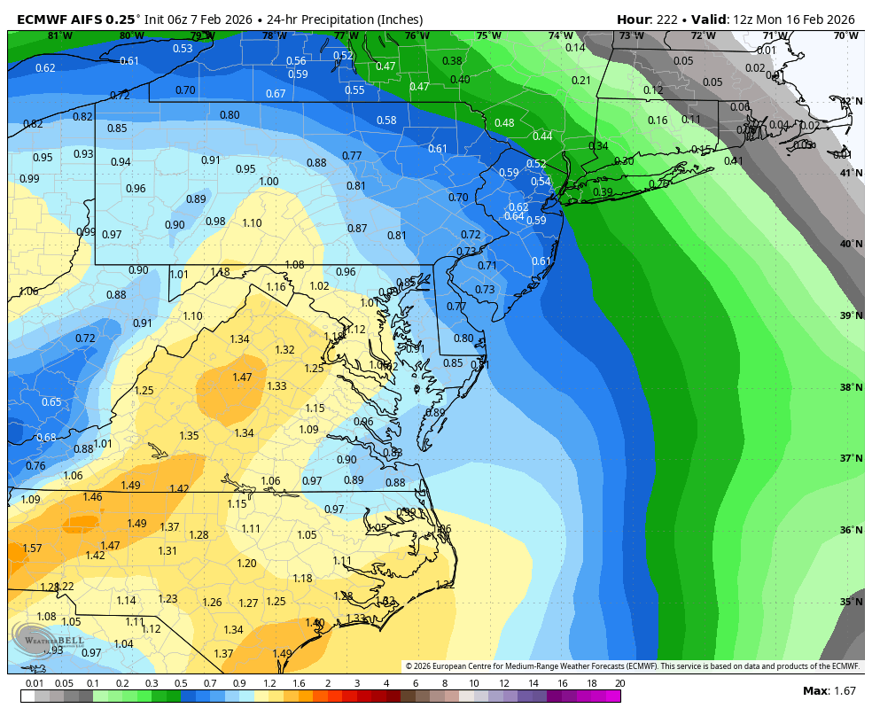
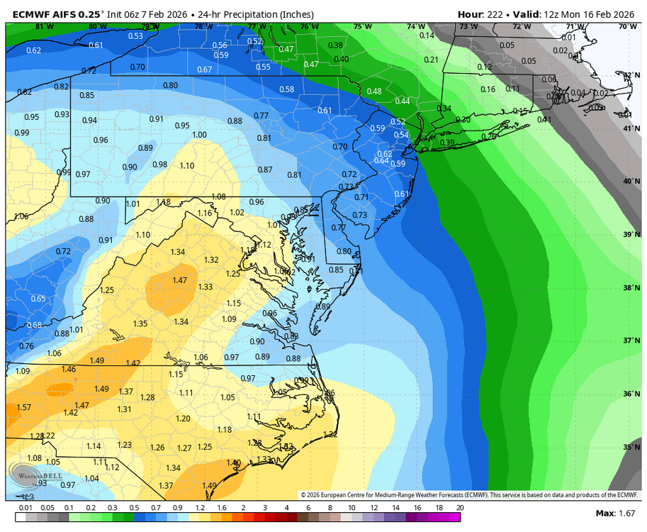
Euro ai and gfs ai like Presidents’ Day…. Little warm for nyc south big totals north and New England
-

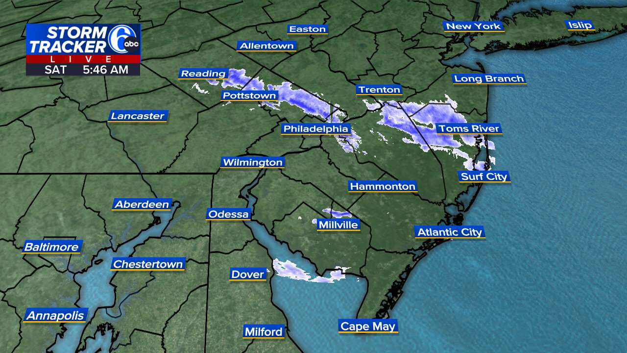
E PA/NJ/DE Winter 2025-26 Obs/Discussion
MickeyTim6533 replied to LVblizzard's topic in Philadelphia Region
6z GFS says what storms? -

Friday February 6 FROPA / WINDEX small event
TauntonBlizzard2013 replied to HoarfrostHubb's topic in New England
Very light dusting. Enjoy those getting the goods. We knew here -
Wow euro AI overnight looks like light snow 11-12, big storm 15-16, light or cutter 15-16, big storm 20-21
-
Holy SHIT! complete whiteout blizzard for 10 minutes! Had to gust to 50 MPH
-

E PA/NJ/DE Winter 2025-26 Obs/Discussion
Birds~69 replied to LVblizzard's topic in Philadelphia Region
Not sure how much but it’s whiter out there than before bed. Nice stream coming down over my area…NW-SE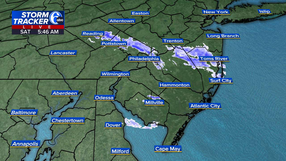
-
This is one of the more intense flow events I've seen in Boone/Blowing Rock, having lived here a bit over a decade now. Interesting considering we are much warmer and less windy than forecast. Guess the banding has set up right.