All Activity
- Past hour
-
0.72 today in Suffolk. In manhattan now getting drenched
-
Gonna need to analyze the lake Winni sediment core data to find the last decent weekend up here
-
Next week looks warm on the GFS but of course the following weekend is meh
-
Maybe late Saturday is good and Sunday doesn't look bad
-
Great
-
12z has your hurricane again
-
12z GFS has it
-
Finally some heavier rain here in this batch.
-
Trolling is so fun!
-
Hvy rain moved in here...61 degrees
-
Thanks, You were just added to the GTG back room beating list. Likely right after powderfreak gets his.
-
60% chance of a watch from I-64 and points south it appears.
-
yeah-something like that you need a lead time to reschedule vendors etc. It's never an easy call that's for sure. The models had bailed on the rains but it took another day for forecasts to catch up. Other things like a little league game you can wait til day of...
-
That’s exactly what I was getting at. They cancled the TOH car show at point lookout Saturday. People drove in from all over, and they were pissed. Getting some pretty steady moderate rain now.
-
The forecast was for an 80% chance of rain back on Thursday so alot of places had no choice but to cancel. Outdoor events that require planning for example
- Today
-
I can understand things being canceled Sunday, the Yankees game was played after a rain delay and it rained for much of the game, but Saturday was a mostly sunny day here and nothing should have been canceled that day.
-

E PA/NJ/DE Spring 2025 Obs/Discussion
RedSky replied to PhiEaglesfan712's topic in Philadelphia Region
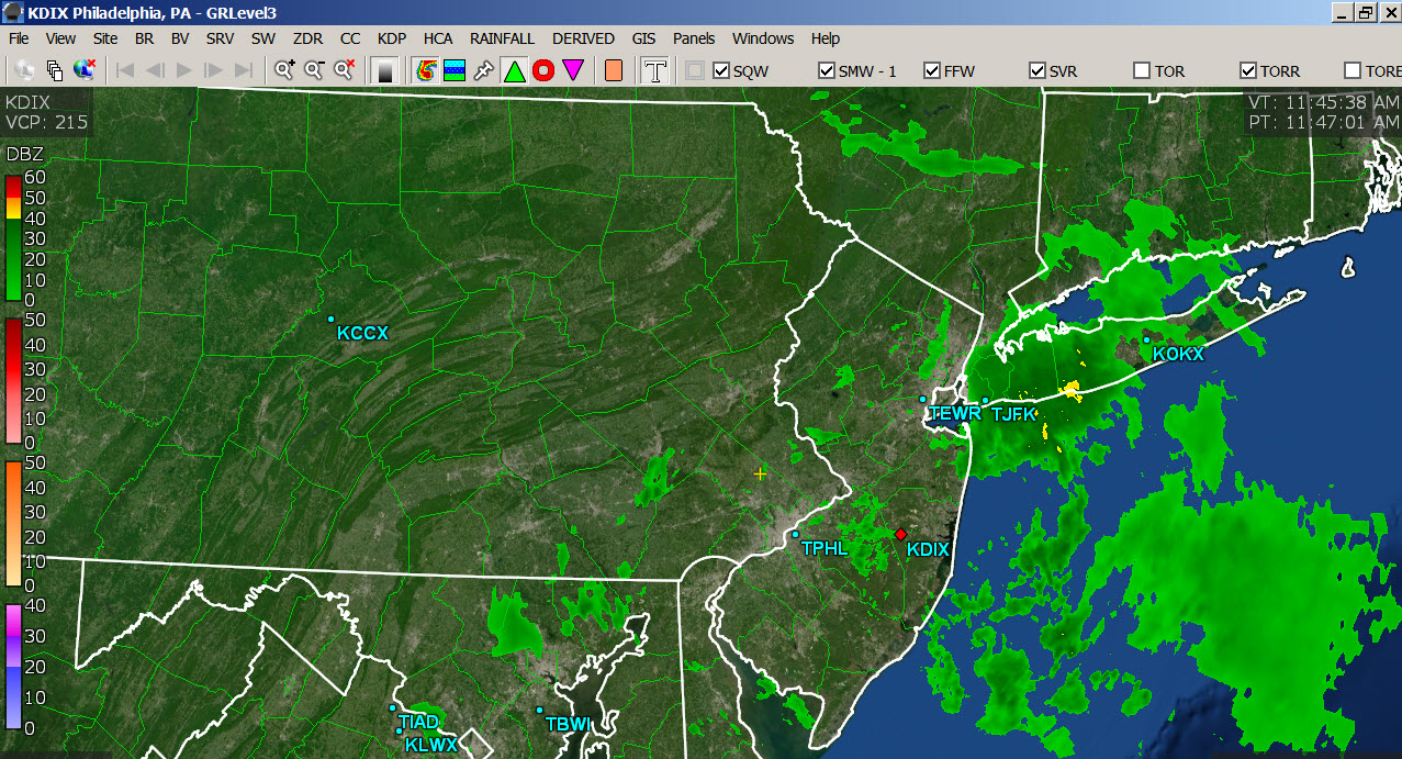
HRRR/NAM are a trace to .15" GFS with a robust .20" forecast -

2025 Lawns & Gardens Thread. Making Lawns Great Again
Lava Rock replied to Damage In Tolland's topic in New England
wasn't able to get 1st cut in the wknd. Lawn will be a field by next wk if there's no window to cut this wk. -
Do these weather apps have radar on them though? They really should not be canceling anything unless something is about to hit the area within the hour. It's been raining pretty hard here for the last 30 minutes or so.
-
Hazy sun, 72 working right by Mayflower beach in Dennis. Sunscreen needed
-
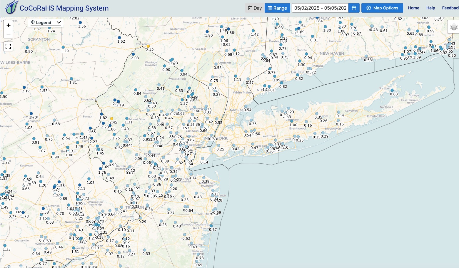
Rainfall totals so far over the last 3 days - click to enlarge. Received just .09" here yesterday for a 3 day event total so far of .60". As I mentioned yesterday the best totals so far have been over far NW NJ and radar yesterday was certainly confirming that yesterday afternoon. Radar echoes now rotating in from the southeast as opposed to last 3 days where things were moving NNE. Best / heaviest totals next 24 hours look to be from NE NJ on east and north. Lighter amounts elsewhere.

-
It was more about things being needlessly canceled because people use weather apps. We all saw that coming. Its super dark here right now!!!
-
Models always struggle with these cutoffs and the placement of the rains at a given hour
-
I thought we'd have most of our rain tonight, so this is a bit of a bonus.
-

E PA/NJ/DE Spring 2025 Obs/Discussion
Birds~69 replied to PhiEaglesfan712's topic in Philadelphia Region
Radar looks great, so robust with moisture... 63F/DP 62F