All Activity
- Past hour
-
Had .1" snow out this way overnight.
-
At least VA gets another snow.
-

December 2025 regional war/obs/disco thread
Damage In Tolland replied to Torch Tiger's topic in New England
It’s an insert every power tool in shed and turn on kind of pattern -
12/13-14 looks decent on EPS. That’s really our one hope in the next week. It’s too bad we somehow get a clipper to run into Ottawa next Wednesday despite a monster west based NAO block….thats the kind of stuff that’s been happening to us.
-

E PA/NJ/DE Winter 2025-26 Obs/Discussion
BBasile replied to LVblizzard's topic in Philadelphia Region
Currently have some freezing drizzle. Paved surfaces seem ok, but everything else has a coating of ice. 30.2F.thumb.jpg.c5c000ecf48db5cc4f1734c4a0566f9f.jpg)
-
Seems like it?
-
 via XMACIS below. Newark POR 1931. normal first day of measurable snow 12/8 LaGuardia POR 1940. normal first day of measurable snow 12/11
 -
Roads were actually kinda slick when I went to drop my girlfriend‘s son off for an early 5k.
-
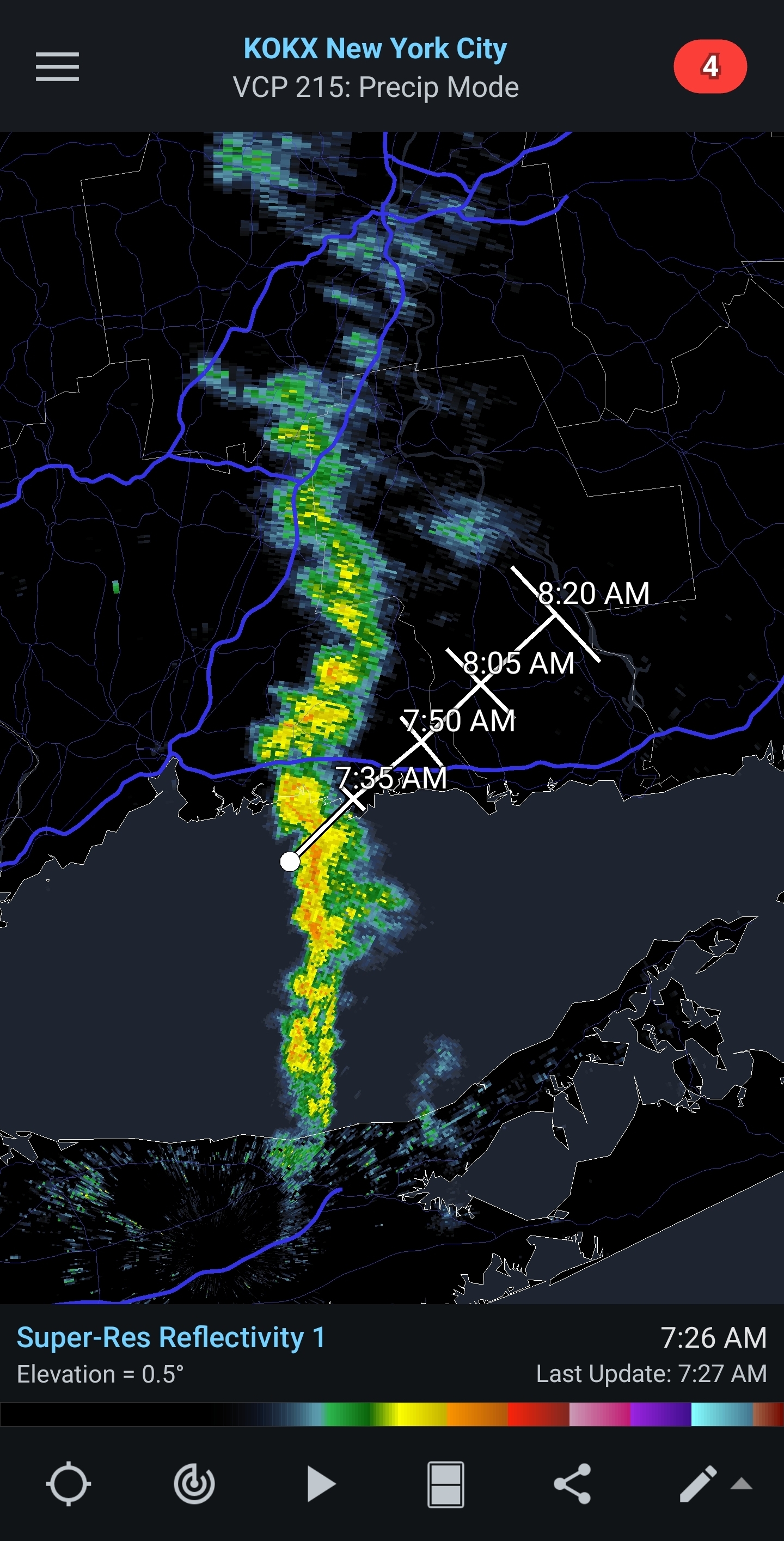
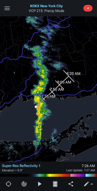
Snowing pretty hard on my drive home from Yonkers to Nanuet.
-
A tenth or two here. Pixie dust falling.
-
Similar obs to my new neighbor - holy crap it’s gorgeous up in Fallston - kinda legit light snow overnight that is lingering this AM - ground is mostly white - I’m gonna log this as accumulating snow in the seasonal obs.
-
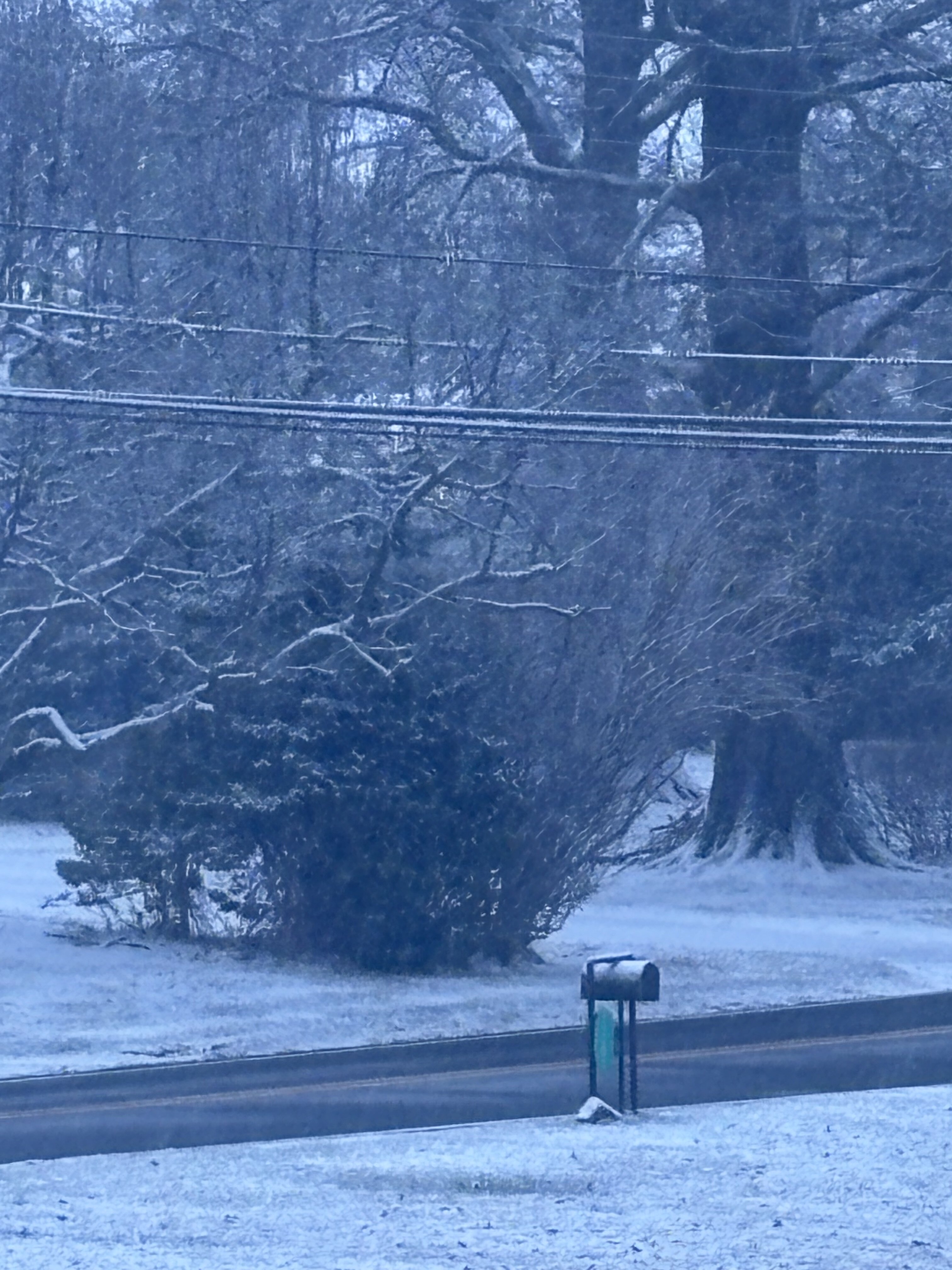
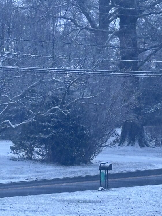
Nice solid coating of snow, about 1/3".
-
Was that birds taking off at sunrise on radar down there?
-
 Coming down with great snow growth
 -
We Norlun! Coming down really nice. Moderate at least
-
Nice burst of snow here in Branford. That line moving east seems to be strengthing.
-
KLGA and KEWR also measured this morning...both first of the season.
-
But the Mansfield stake….
-
Wantage NJ had 0.1" overnight. NYC CP XMACIS first last date of measurable. Median for the period off record dating back to 1869 is Dec 8. see below. CP did it a couple days early! Good call Don via stats a. few days ago.

-
Stay safe all
-

E PA/NJ/DE Winter 2025-26 Obs/Discussion
Physicsteve replied to LVblizzard's topic in Philadelphia Region
Got up at 5 and just missed getting to see snow falling, but enjoying the coating I got. Latest HRRR says maaaybe Ill get some mood flakes in a bit if that stuff currently around west chester can make it north enough as it goes. Here’s hoping we can get some good trends or an overperformer from at least 1 of the 2 disturbances mid week and next weekend. Now for a day of housework, outdoor xmas lights, and conference championships. Cheers -
December 2025 regional war/obs/disco thread
Damage In Tolland replied to Torch Tiger's topic in New England
When we’re getting our rocks off on 15 minute bursts of snows.. we know it’s as bad as it gets -
I didn’t think it was still supposed to be snowing.
-
Places like Marquette are the big snowfall winner with this overpowering Pacific Jet and trough over the Great Lakes and Northeast with cold air flowing over the record warm Lakes. https://www.wpr.org/news/great-lakes-seeing-near-record-warm-waters-this-fall The Great Lakes are seeing near-record warm water temperatures right now, which means there’s a higher chance for lake effect snow when the weather turns cold.As of Thursday, all five of the lakes were around 4 to 5.5 degrees Fahrenheit warmer than their long-term average for the last three decades. That’s according to data from the Great Lakes Environmental Research Lab operated by the National Oceanic and Atmospheric Administration, or NOAA.
-
 Looks christmasy outside. Ill take it.