All Activity
- Past hour
-
Down to 56F in E CT with fog…great day once the fog burns off
-
.thumb.jpg.6a4895b2a43f87359e4e7d04a6fa0d14.jpg)
Central PA Summer 2026 Discussion/Obs Thread
Yardstickgozinya replied to Voyager's topic in Upstate New York/Pennsylvania
...Northeast... A broad mid-level trough will continue to shift eastward toward the Northeast on Thursday. A weak surface low will move across Quebec with a cold front extending southward into the Northeast and eastern Great Lakes. Moderate instability is forecast ahead of the front with broad ascent supporting storm development both along and ahead of the cold front. Multicell clusters capable of damaging winds, and perhaps isolated large hail, are expected. A more focused region of greater potential may exist from central Pennsylvania into eastern New York. The potential for cloud cover across the region casts some uncertainty and therefore, confidence was not high enough for a Slight Risk at this time - Today
-
 https://northtrustpharm.com/# NorthTrust Pharm
 -
India MedOk: India MedOk - best india pharmacy
-

2026 Atlantic Hurricane Season
WxWatcher007 replied to Stormchaserchuck1's topic in Tropical Headquarters
Running out of runway. Probably good for my forecast though lol. -
70% now
-
http://mexisafepharm.com/# mail order pharmacies
-

Invest 96L — 40% 2 day and 60% seven day odds of development
GaWx replied to tiger_deF's topic in Tropical Headquarters
0Z UKMET: doesn’t quite get it to Dolly strength but still has it as a TD although this run then weakens it while moving rapidly WNW in the MDR followed by a reformation 2 days later moving W much more slowly toward the SE Bahamas:NEW TROPICAL CYCLONE FORECAST TO DEVELOP AFTER 48 HOURSFORECAST POSITION AT T+ 48 : 12.4N 33.9WLEAD CENTRAL MAXIMUM WINDVERIFYING TIME TIME POSITION PRESSURE (MB) SPEED (KNOTS)-------------- ---- -------- ------------- -------------0000UTC 27.08.2026 48 12.4N 33.9W 1010 281200UTC 27.08.2026 60 13.0N 37.8W 1009 300000UTC 28.08.2026 72 13.2N 42.0W 1009 311200UTC 28.08.2026 84 14.1N 46.7W 1010 320000UTC 29.08.2026 96 CEASED TRACKINGNEW TROPICAL CYCLONE FORECAST TO DEVELOP AFTER 150 HOURSFORECAST POSITION AT T+150 : 20.3N 67.0WLEAD CENTRAL MAXIMUM WINDVERIFYING TIME TIME POSITION PRESSURE (MB) SPEED (KNOTS)-------------- ---- -------- ------------- -------------1200UTC 31.08.2026 156 21.0N 68.4W 1010 340000UTC 01.09.2026 168 20.9N 70.6W 1009 32 -
 Honestly at this stage in my life I really do enjoy more urban areas. My go would be in NYC area, not quite the city but close enough.
 -
indian pharmacy paypal or indianpharmacy com buy medicines online in india https://www.google.ps/url?q=https://indiamedok.com reputable indian pharmaciesor https://act2day.eu/profile/jxpqshqqep/ reputable indian pharmacies [url=https://cse.google.cv/url?sa=t&url=https://indiamedok.com]reputable indian online pharmacy[/url] indian pharmacies safeand [url=https://hiresine.com/user/rilyjqypza/?um_action=edit]reputable indian pharmacies[/url] indian pharmacies safe
-
Maybe it'll clear out in time.
-
indian pharmacy paypal or indianpharmacy com buy medicines online in india https://www.google.ps/url?q=https://indiamedok.com reputable indian pharmaciesor https://act2day.eu/profile/jxpqshqqep/ reputable indian pharmacies [url=https://cse.google.cv/url?sa=t&url=https://indiamedok.com]reputable indian online pharmacy[/url] indian pharmacies safeand [url=https://hiresine.com/user/rilyjqypza/?um_action=edit]reputable indian pharmacies[/url] indian pharmacies safe
-
2026-2027 Record-breaking El Nino
GaWx replied to Stormchaserchuck1's topic in Weather Forecasting and Discussion
Thanks for pointing this out, Mitch. Very interesting for sure! Check this excellent video from met. Travis Roberts just out a few hours ago. Within it, he talks about the initial flattening out (RONI, the top of your 2 graphs) that wasn’t there before, the same thing you pointed out! Also, check out how flat Aug has been on CDAS since the 5th! I mean that’s almost flat as a pancake type flat. Keep in mind that several models had forecasted a record breaking warming for just one month (for any month) of ~1C in August!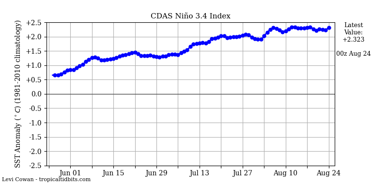
-
Early September heat is on. Huge ridge of high pressure.
-

Augdewst 2026: Summer's Last Stand
HIPPYVALLEY replied to Prismshine Productions's topic in New England
Who cares? Even our summer extremes have been boring as fuk in New England. -
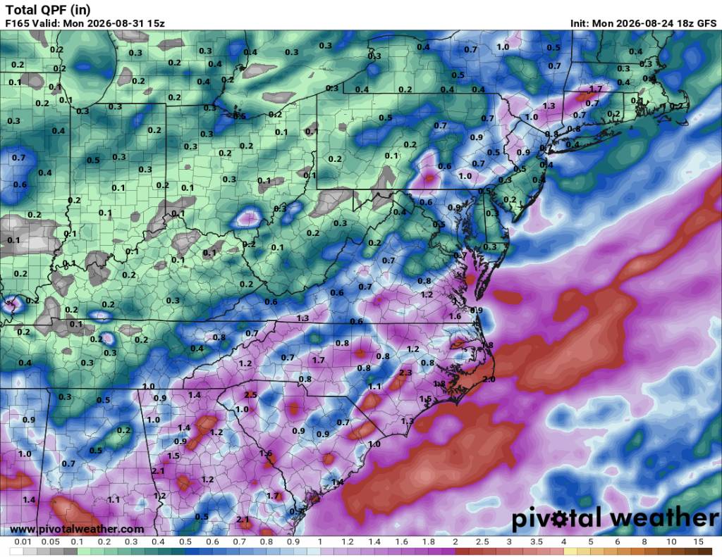
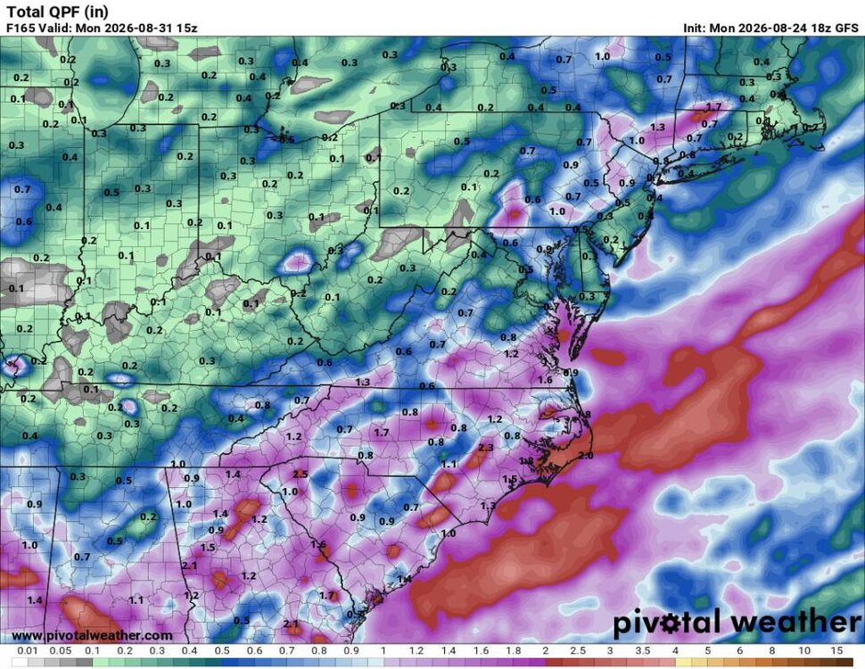
Steve it definitely looks like wetter times ahead after some early Fall weather. Sent from my SM-G998U using Tapatalk
-
https://mexisafepharm.shop/# farmacias mexicanas
-
Augdewst 2026: Summer's Last Stand
WxWatcher007 replied to Prismshine Productions's topic in New England
BDL climo is 82/60 on Friday. A high of 85° is not a torch lol. -

Augdewst 2026: Summer's Last Stand
Brian5671 replied to Prismshine Productions's topic in New England
64 here with nice cool air flowing in through the windows...great sleeping weather! -
.thumb.jpg.ad3a2e31d30aff035044689b311a0540.jpg) I don't think I'd mind living in really any state, but the southeast quarter of Wyoming really catches my eye... Winter wx, close to beautiful nature, tons of spring/summer supercells with big hail and tornadoes. Would def need a good windbreaker, though
I don't think I'd mind living in really any state, but the southeast quarter of Wyoming really catches my eye... Winter wx, close to beautiful nature, tons of spring/summer supercells with big hail and tornadoes. Would def need a good windbreaker, though -

Augdewst 2026: Summer's Last Stand
dendrite replied to Prismshine Productions's topic in New England
-
reputable indian online pharmacy: India MedOk - India MedOk
-
2026 Atlantic Hurricane Season
Boston Bulldog replied to Stormchaserchuck1's topic in Tropical Headquarters
95L needs to get it's act together fast if it wants steal a name -
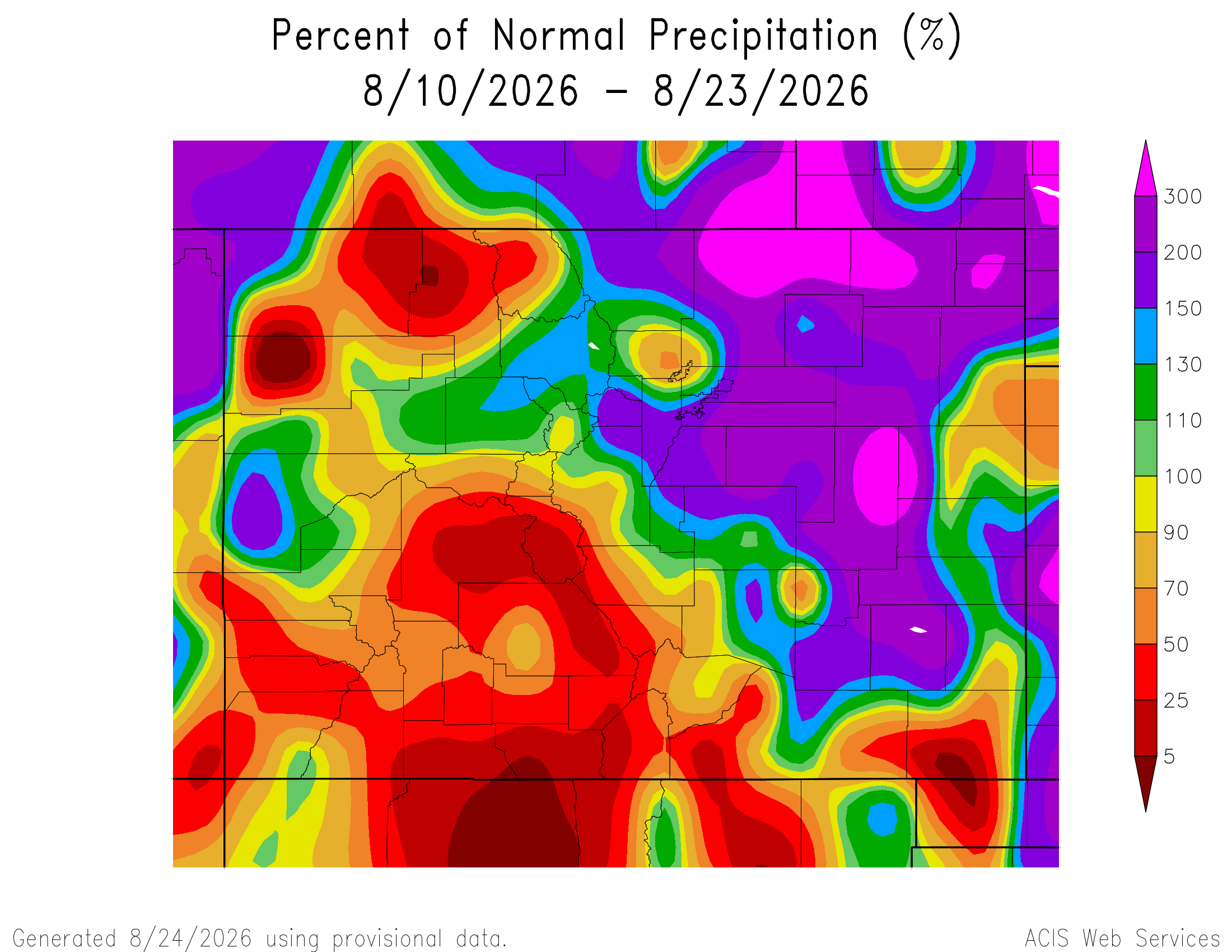
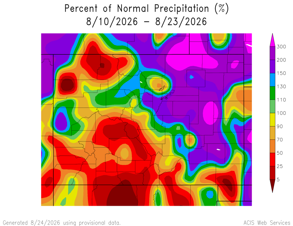
Pretty good stretch for the Front Range overall. That small area of below normal precip is likely just missing data.
-
(002).thumb.png.6e3d9d46bca5fe41aab7a74871dd8af8.png)
E PA/NJ/DE Summer 2026 Obs/Discussion
ChescoWx replied to PhiEaglesfan712's topic in Philadelphia Region
Hey Joe - I am using Claude which does not run locally so no air-gapped environment. Regarding snow I just started the model up 3 days ago so we will see when we get to winter.