All Activity
- Past hour
-
I had a similar thought about cold chasing moisture, especially east of the Apps and double especially east of the taller Apps down in my neck of the woods. Every model run in history overestimates how fast the cold gets over the mountains and frequently hallucinates phantom snow. Since the AIs are trained on historical data one would think that this bias should go poof on an AI model.
-

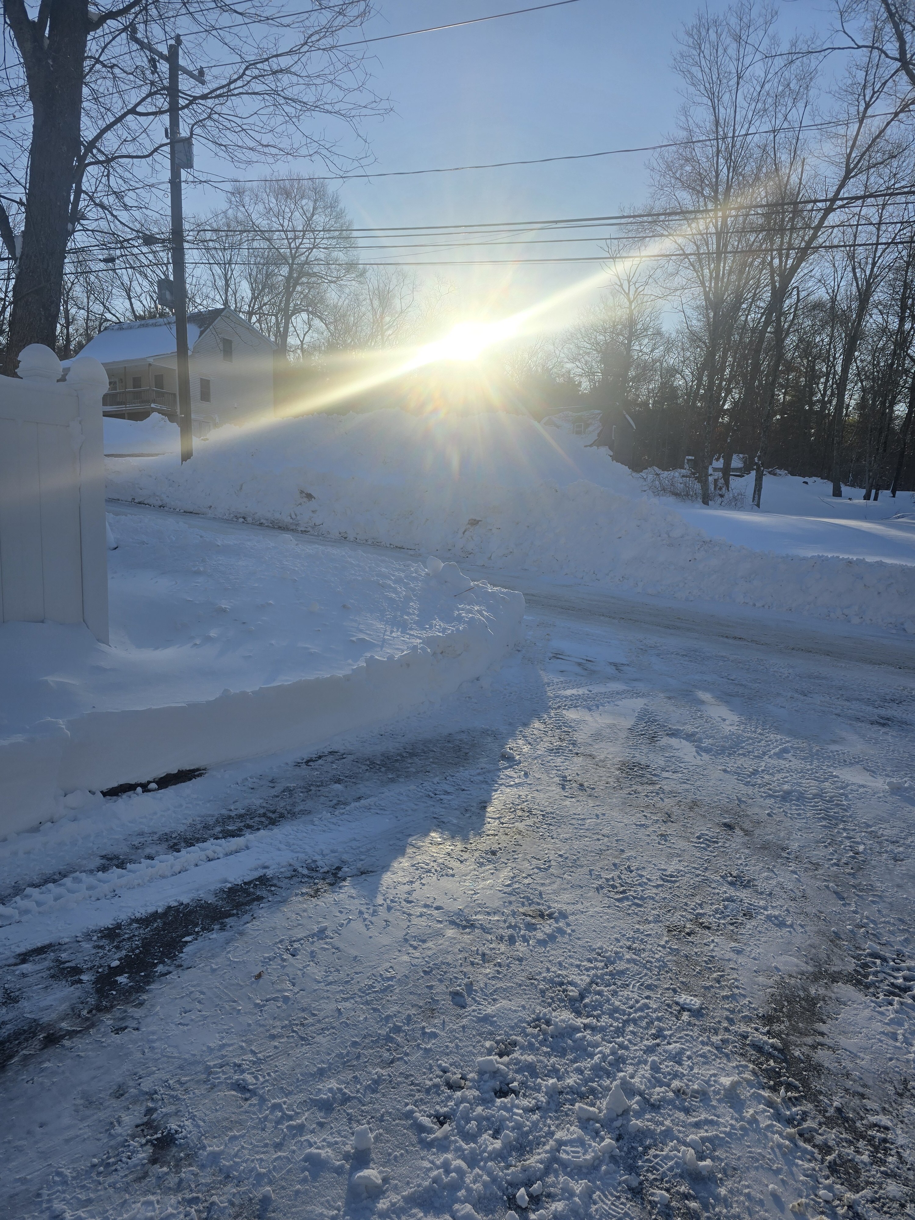
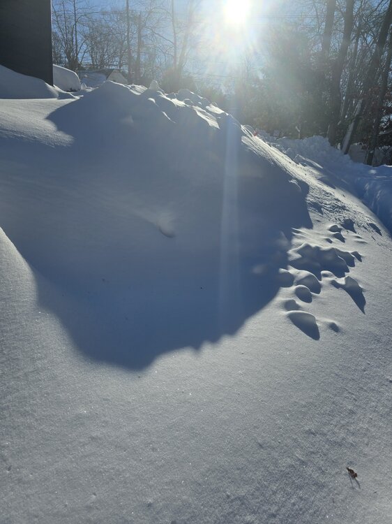
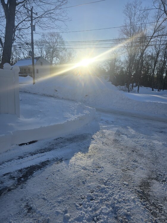
"Don’t do it" 2026 Blizzard obs, updates and pictures.
j24vt replied to Ginx snewx's topic in New England
Finally made it to the bottom of the thread. First, I want to reiterate that people clear the vents on the sides of their houses!!!! Our daughter goes to URI and lives in Matunuck. This is a photo of her car at 2:30 on Monday. She is guessing 30ish inches. We tried to convince her to 'evacuate' to Stowe on Sunday morning but she was worried about missing classes. Some random other thoughts: We are so lucky this storm was snow and not rain. Regarding the plows getting pulled off the streets: I saw a video of a stuck municipal plow spinning their tires and thought "They must be waiting for Amazon to deliver their tire chains." For the people who are annoyed about being 'missed' by the huge snowfall amounts: We are 6 miles from Stowe Mountain. I love when the mountain gets 10 inches overnight and we have maybe an inch in the driveway. Go help the people who are buried dig out. For the record, Stowe Vermont also received 0.0 inches from the storm "Snow without skiing is dumb."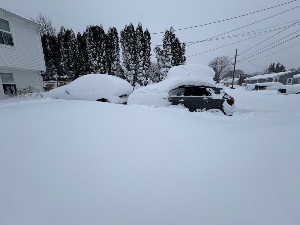
-
14-15 was hardly a nino and didn’t really fit the traditional standards of one (if it did then DCA would have had a far better season than BOS). the reason it was less of an analog IMO was because it had a warm pool spanning into Nino 4 and Nino 3.4 which really helps with late winter -epo development. just how i look at it, people can disagree here.
-

"Don’t do it" 2026 Blizzard obs, updates and pictures.
ChangeofSeasonsWX replied to Ginx snewx's topic in New England
Are you in a sheltered area by any chance? You said 22-28 inches depending on drifting and accounting for compaction and being in a sheltered area could also affect this. I'm not sure how big N Prov is....maybe it was a very sharp cutoff? Even downtown PVD had some 36" readings which is even more than what I got. -
Its a long shot and models still meh for the most part.. but Saturday has some potential I think. Euro also bumped north but has the storm forming off the Carolinas and heading out
-

Is we back? February discussion thread
40/70 Benchmark replied to mahk_webstah's topic in New England
I give this winter a solid "B" so far.....can't give it an "A" being at normal snowfall after getting boned on the '78 redux. Let's see what can. happen during the final stanza to move this up... -

"Don’t do it" 2026 Blizzard obs, updates and pictures.
dendrite replied to Ginx snewx's topic in New England
Good thing it was Cantore and not Bob Stokes -
I have seen some debate if this was a Miller A or B or hybrid or what (which is not unusual). I'm beginning to wonder if how useful those categories really are, but I was under the impression that one of the hallmarks of a B was a Ohio Valley low that transfers, and I didn't think that there was one of those in this case. In your perception, what made this storm more "B-ish"?
-

"Don’t do it" 2026 Blizzard obs, updates and pictures.
Ginx snewx replied to Ginx snewx's topic in New England

-

E PA/NJ/DE Winter 2025-26 Obs/Discussion
Duca892 replied to LVblizzard's topic in Philadelphia Region
And literally just like that the 12Z GFS shifted south into a weenie level end of season snow -
"Don’t do it" 2026 Blizzard obs, updates and pictures.
Ginx snewx replied to Ginx snewx's topic in New England

-
"Don’t do it" 2026 Blizzard obs, updates and pictures.
Ginx snewx replied to Ginx snewx's topic in New England
-

E PA/NJ/DE Winter 2025-26 Obs/Discussion
Birds~69 replied to LVblizzard's topic in Philadelphia Region
It's no more than a "A" winter in my book. The drought of snow from Jan 23/25th to Feb 23/25th (Peak winter) with all that cold in place is why it will never be a A+. That is like your All Star batter belting .340 during the season then batting .250 during the playoffs. (Peak time) Sorry winter "A+" is for the elite...not failing at peak times. 28F @ 1:05PM/ Winds cranking a bit, colder than expected and thank God the Liquor store is open... -
"Don’t do it" 2026 Blizzard obs, updates and pictures.
Ginx snewx replied to Ginx snewx's topic in New England
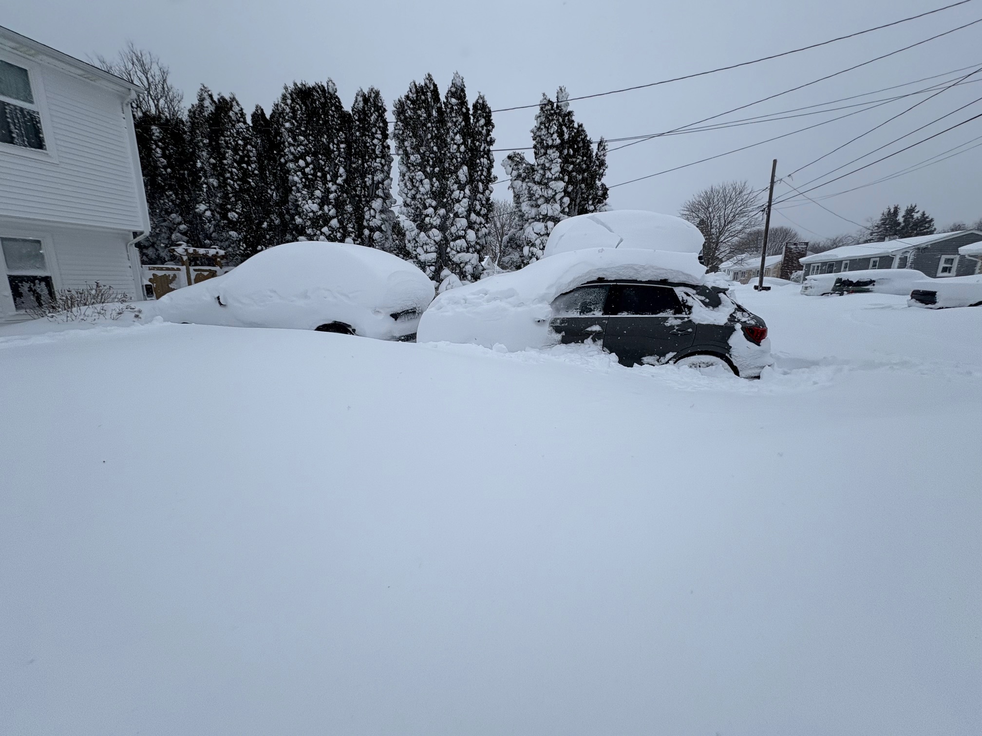
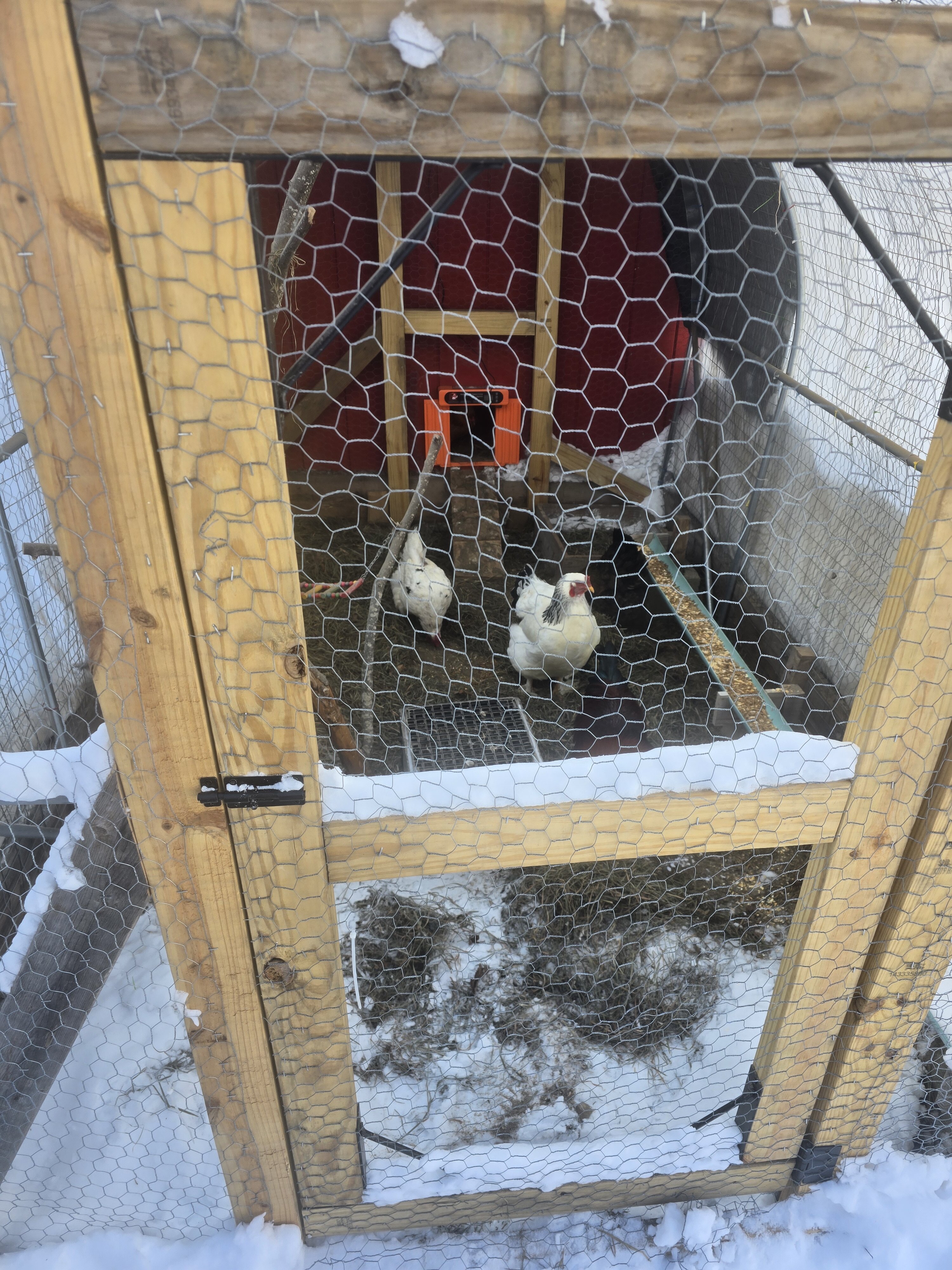
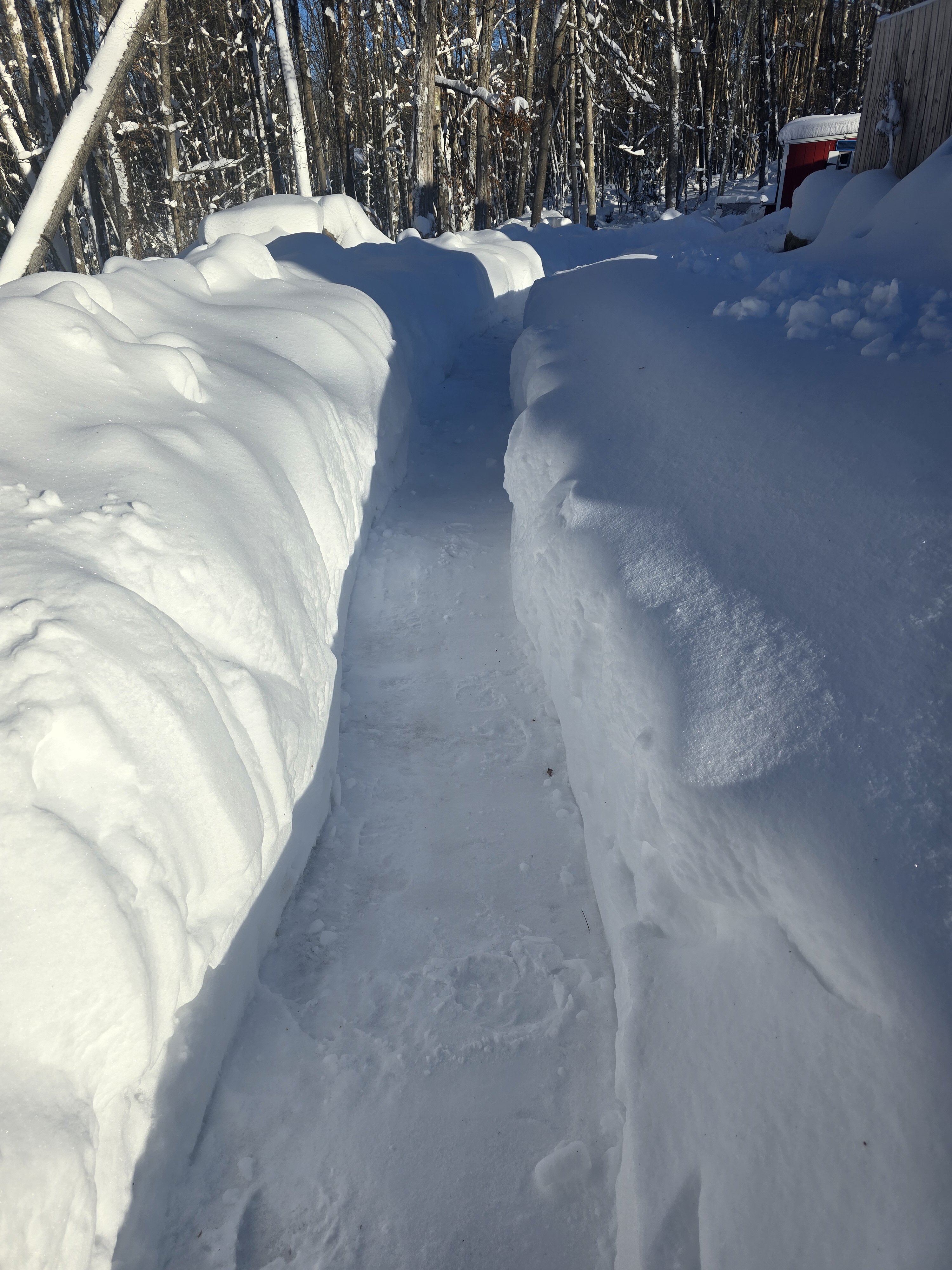
The 150 yd chicken trail was a bitch to shovel but the girls are happy
-

"Don’t do it" 2026 Blizzard obs, updates and pictures.
amarshall replied to Ginx snewx's topic in New England
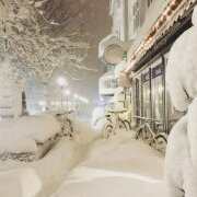
Drones eye view . Perfection. Looking like Duxbury VT not Duxbury MA . -
TWC just mentioned another big storm possible next week.
-
Yes, all hail the great JMA.
-
You would think that this is the exact type of thing the the AI models would address? At least where I am the euro AI never really loved the blizzard and while I'm happy with my 16.3" it was not the 2 feet shown on many non-AI models. In some respects outside the immediate coast up through NYC-BOS the euro AI was closer to reality.
-
2025-2026 ENSO
40/70 Benchmark replied to 40/70 Benchmark's topic in Weather Forecasting and Discussion
I didn't used 2014-2015 as a seasonal analog because of ENSO, but it was in my +TNH composite for latter January into February. -

Central PA Winter 25/26 Discussion and Obs
Jns2183 replied to MAG5035's topic in Upstate New York/Pennsylvania
We unfortunately just had a triple phaser with the Halloween snow awhile back. I doubt we get another one for another 20-30 years. Sent from my SM-S731U using Tapatalk -
"Don’t do it" 2026 Blizzard obs, updates and pictures.
acoolerclimate replied to Ginx snewx's topic in New England
Then how did I get only around 24 inches, also in North Providence? Wow, those bands can have such sharp cutoffs. -

Late February/Early March 2026 Mid-Long Range
Weather Will replied to WxUSAF's topic in Mid Atlantic
WB 12Z GEFS 1pm Monday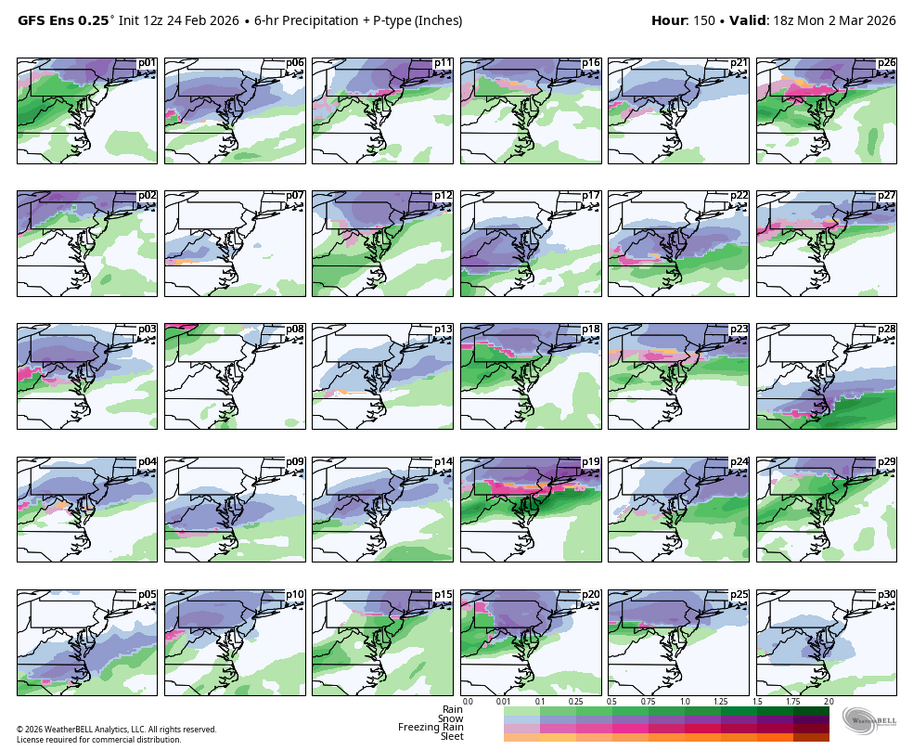
-
That event right before Christmas surprised me. Didn’t expect those amounts. With the exception of yesterdays event it’s been a season of overachievers
-

E PA/NJ/DE Winter 2025-26 Obs/Discussion
The Iceman replied to LVblizzard's topic in Philadelphia Region
Yesterday’s storm makes this seasons total 49.3” #3 in my lifetime(1990-1991 was my first winter) behind 2010 and 1996. Both are out of reach but still this winter’s snowfall ranks ahead of many greats like 17-18, 13-14, 10-11, 02-03 in Levittown. edit: actually if the gfs comes to fruition we’d make a run at 2009-2010 here. That winter finished with 63.2” here. -

"Don’t do it" 2026 Blizzard obs, updates and pictures.
wxsniss replied to Ginx snewx's topic in New England
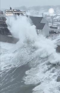
Drone video from Scituate at peak, really impressive... no wonder 100% without power: https://twitter.com/accuweather/status/2026316284682760389?s=20 > 200k in EMA still without power on Eversource