All Activity
- Past hour
-
 Because it's weak and ingested a lot of dry air!
 -
This weekend/early next week might actually bring you some organized widespread convection for a change.
-
 Highs: TEB: 92 EWR: 91 PHL: 91 LGA: 90 New Brnswck: 90 ISP: 89 NYC: 89 ACY: 88 BLM: 86 TTN: 86 * no intra hour highs or readings 1700- 1900 JFK: 85 * no intra hour highs again
 -
Heh...imagine that, 2nd heatwave of the year confirmed IMBY. 91, 93, 91 the past 3 days.
-
Awesome!
-

2025 Atlantic Hurricane Season
BarryStantonGBP replied to BarryStantonGBP's topic in Tropical Headquarters
MATE I SURVIVED OPHELIA AND LORENZO THEY WRECKED MY LOCAL ASDA -
No big rain in July on a Saturday, 7/8 was 1.13"
-
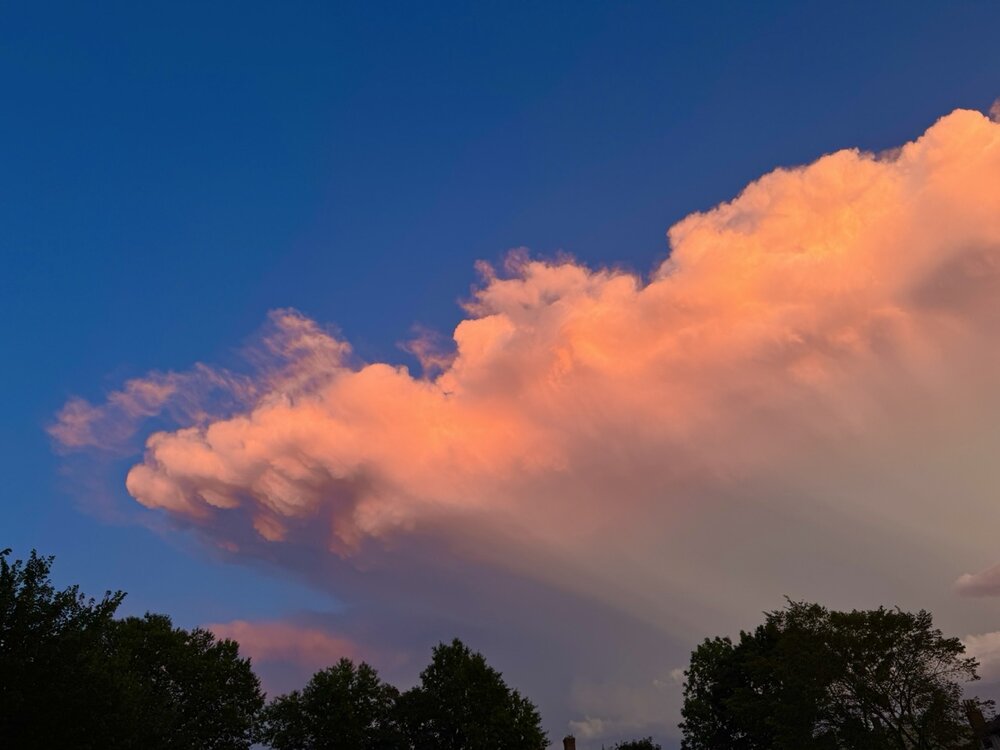
Man photos don’t do this justice and I wasn’t able to catch the best… Spectacular lightning with sunset colors

-
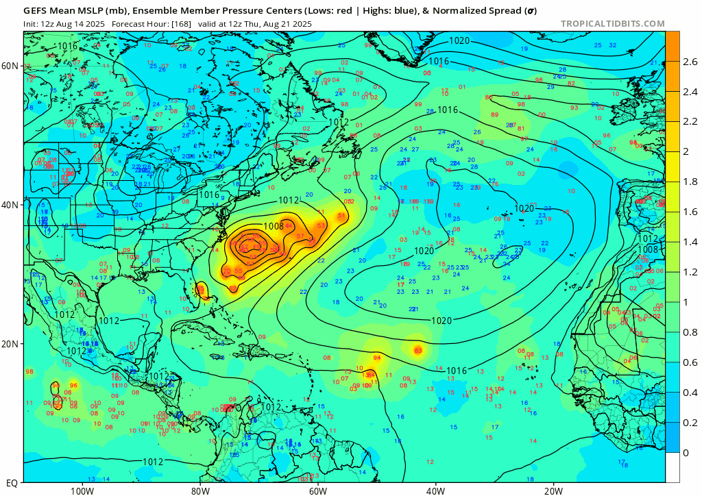
Southwestern Gulf (AL98): Recent geostationary and microwave satellite imagery indicates that shower and thunderstorm activity is showing some signs of organization with a small area of low pressure located over the southwestern Gulf. An earlier Air Force reconnaissance mission found that the system lacks a well-defined low-level circulation. The low is forecast to move west-northwestward to northwestward across the western Gulf during the next day or so, and environmental conditions appear generally favorable for further development. A tropical depression could form before this system moves inland over northeastern Mexico or southern Texas by late Friday. Regardless of development, locally heavy rainfall is possible along portions of northeastern Mexico and southern Texas over the next few days. Another Air Force Reserve Hurricane Hunter aircraft is scheduled to investigate the system Friday morning. Formation chance through 48 hours...medium...50 percent. Formation chance through 7 days...medium...50 percent.
-
WHY'S THE PRESSURE SO HIGH
-
I recall a Saturday where you had a big storm. Was most of that in one day?It was like a weird time and setup for a storm if i remember
-

Mountain West Discussion
donsutherland1 replied to mayjawintastawm's topic in Central/Western States
Denver reached 90° for the 40th time this year. Its warming climate has seen an explosion of years with a high number of 90° or above highs. The new regime of far more frequent 90° or above highs commenced in 2000. 2025 is on track for 50 or more such days. An Ed Hawkins-style warming stripes visualization of annual 90° days is below. Note: Both charts are for 1872-2024, as the 2025 total is not final. The outcome is consistent with Colorado's warming summers (0.2°F per decade over the historic climate period and 0.3°F/decade since 2000).


-
No, That was in June, 2.92" since July 1st.
-
Despite the IR appearance, it does look like 98L is organizing more now. Again, not a lot of time, but the NHC has upped the development odds given the trends we're starting to see.
-
From near the Longwood Medical area at about 7:45. Was seeing a nephew in a kids version of Newsies at a theatre there and heard the storm go overhead.

-
 I thought that too originally but I think it might be tilt rather than missing the center. Either way, the fix shows (at least right now) a motion just south of due west. Those fixes will be really important for short term modeling and the islands.
 -
we shift


-
 Second pass found 1001 according to the aircraft recon from Tropical Tidbits. I think they are missing the exact center. https://www.tropicaltidbits.com/recon/recon_NOAA3-0105A-ERIN.png
 -
This is a be careful what you wish for scenario. During the hurricane Bill swell in 09 almost every break on Long Island was washed out. As in, the waves were so big they started breaking so far out they just rolled through the break. Thursday looks to do just that. We do not have the bottom for 15’ at 17 seconds. There are a couple select spots in RI (Ruggles) and Montauk (Turtles) that can, but you better be on a gun and damn near a pro. For mortals Wednesday and Friday look to be the days.
-
But you rained every Saturday didn’t you?
-
Lot of stress tree color popping up or just going to brown leaves.
-
Heavy dose of meh, Bye bye 90's.
-
I made a new loop of the complete US surface analysis maps of Hurricane Sandy. (That is, after it got onto the US map.) https://great-lakes-salsite.web.app/Sandy_loop.html
-
1.52" this afternoon's storm.
-
we trend