All Activity
- Past hour
-
Beauty of a day here. Wife and I got almost the whole woodpile stacked but it got warm out there. No complaints!
-
 Based on old recon finding lots of sub 900 storms in that basin and this having that very high end look it likely was below 890. .
-
 Pressure data from a buoy on the edge of the eye sugguests sub-900mb pressure
-
The red oak sapling outside the window has a nice but not vibrant burgundy color but the 24"/90ft red oak 50 yards away is going toward brown. The only bright red oaks I see in this area are the pin oak street trees in Farmington - moderately common in the mid-Atlantic but not native to Maine. Jeff has a couple of them in his yard; haven't heard how they've colored this fall. Other than the oaks and some dark yellow understory beech, we're in stick season. Many of those beech leaves will turn tan and hang on until bud break in May. 22/25/27 lows the most recent 3 mornings.
-
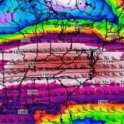 JTWC had this at 155kt this morning, and so that's an incredible situtation, it's much above the 137kt cutoff for Category 5.
-

2026-2027 Record-breaking El Nino
forkyfork replied to Stormchaserchuck1's topic in Weather Forecasting and Discussion
the center of the pac warm pool is east of the dateline!!! you would need this event to collapse to have any chance -

Yellow Medicine County, MN - Climate Fact or Climate Fiction?
Cobalt replied to Cobalt's topic in Climate Change
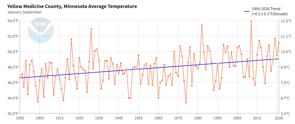
Yellow Medicine County is currently having its 7th warmest start to the year on record (1895-2026).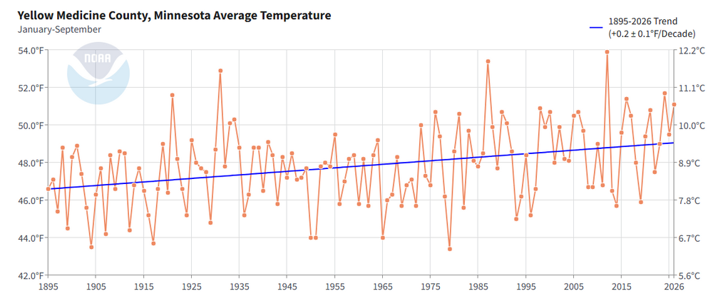
-

E PA/NJ/DE Autumn 2026 Obs/Discussion
ChescoWx replied to PhiEaglesfan712's topic in Philadelphia Region
I have added some additionals stations within 3 miles of the Chester County border to enhance our climate data. The support and rationale is included in our latest study on the website. Thanks! https://chescowx.com/chester-county-area-3-mile-rule/ -
Could not have foreseen this when I came out here last week: In addition to the heavy rainfall and flash flood threat, another threat to watch out for will be severe weather. Given the moderate levels of instability in place combined with strong 0-6 km vertical shear in excess of 50 kts, the thunderstorms that do develop will likely have some organization to them with the potential to acquire supercellular characteristics. In fact, the Storm Prediction Center has highlighted much of the higher terrain areas east of Phoenix in a slight risk (Level 2 out 5) for severe weather for Wednesday, with a marginal risk (Level 1 out 5) across the rest of south-central AZ, including the Phoenix metro area. The thunderstorms that do develop will be capable of producing damaging wind gusts, large hail, and even an isolated tornado given that there will be about 10-20 kts of low-level shear. The threat of severe weather will also exist into Thursday as well, especially Thursday morning, as the instability and shear parameters will still be sufficient.
-
I have added some additionals stations within 3 miles of the Chester County border to enhance our climate data. The support and rationale is included in our latest study on the website. Thanks! https://chescowx.com/chester-county-area-3-mile-rule/
-
I'm thinking about it
-
I don’t think we see a drop of rain for the rest of the month
-

2026-2027 Record-breaking El Nino
MJO812 replied to Stormchaserchuck1's topic in Weather Forecasting and Discussion
Eps shows the epo tanking next week before rebounding. -
 lopressor 25 mg tablet image: PulseGuardDirect - Lopressor oral solution
-
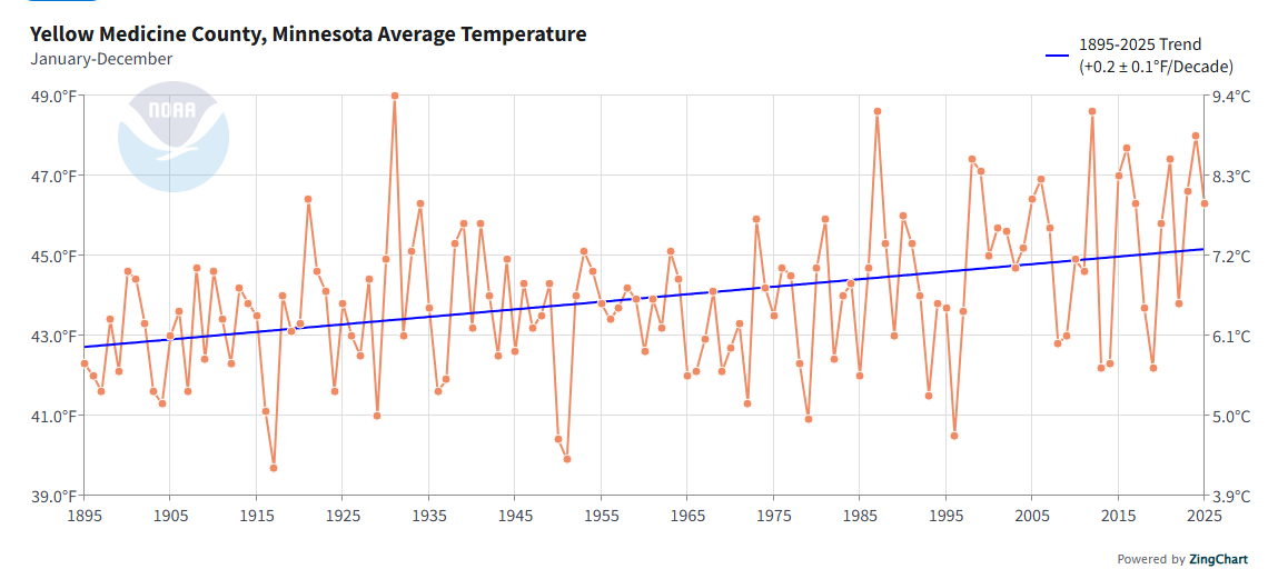
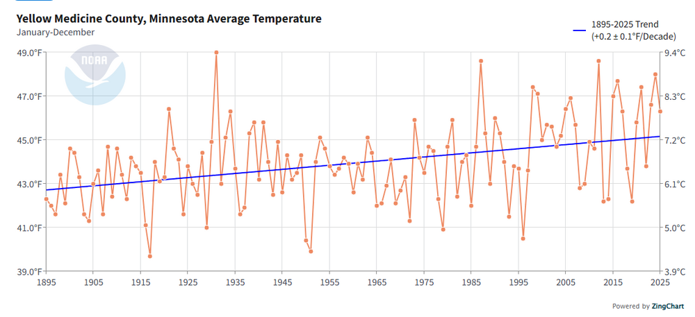
This is a thread dedicated to discussing and analyzing the temperature data available for Yellow Medicine County, MN (Population 9,477). it's warming.
- Today
-
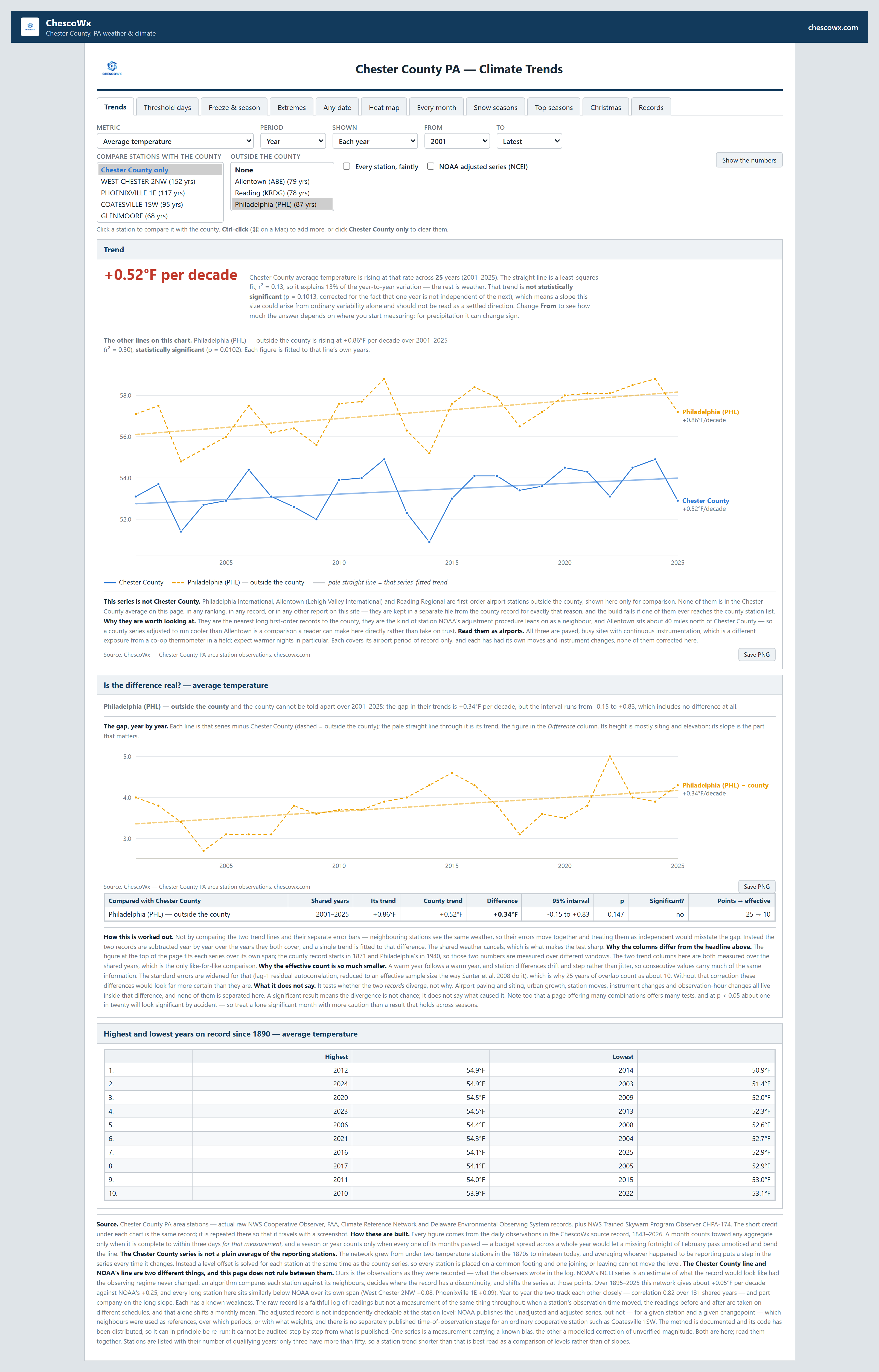
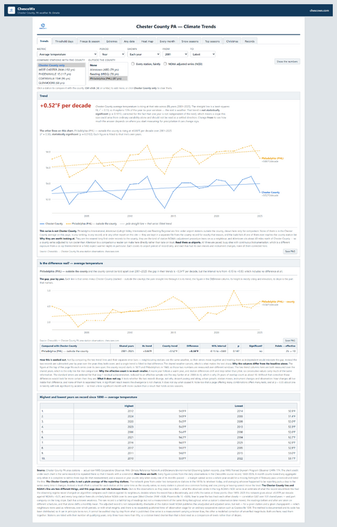
Over the last 25 years Chester County has shown minor but not significant warming....however PHL Airport is as always off to the races with warming.
-

2026-2027 Record-breaking El Nino
LakePaste25 replied to Stormchaserchuck1's topic in Weather Forecasting and Discussion
Just need a few pacific storms to take that sharp turn north out by Hawaii for cold air phasing, à la feb 1983. Tough when you have a massive warm pool of raging 30C convection to directly to the south but not impossible. -

2026-2027 Record-breaking El Nino
roardog replied to Stormchaserchuck1's topic in Weather Forecasting and Discussion
I swear they act like Canada is going to be filled with 50 degree air all winter so there won’t be air cold enough to be pulled down even briefly. Canada is likely to be a torch but a Canadian torch in the middle of winter is still cold enough for snow. -
No data is of course perfect but it is the best historical validated data we have from the time of record
-

2026-2027 Record-breaking El Nino
40/70 Benchmark replied to Stormchaserchuck1's topic in Weather Forecasting and Discussion
I would argue the guys speaking in absolutes that there won't be are crazy. -
2026-2027 Record-breaking El Nino
LakePaste25 replied to Stormchaserchuck1's topic in Weather Forecasting and Discussion
you guys are crazy trying to predict whether there’s going to be 1 big snow storm or not. There’s a reason I don’t do snow outlooks on a seasonal time scale. I rarely ever see anyone get those right. -
2026-2027 Record-breaking El Nino
40/70 Benchmark replied to Stormchaserchuck1's topic in Weather Forecasting and Discussion
Finally... -
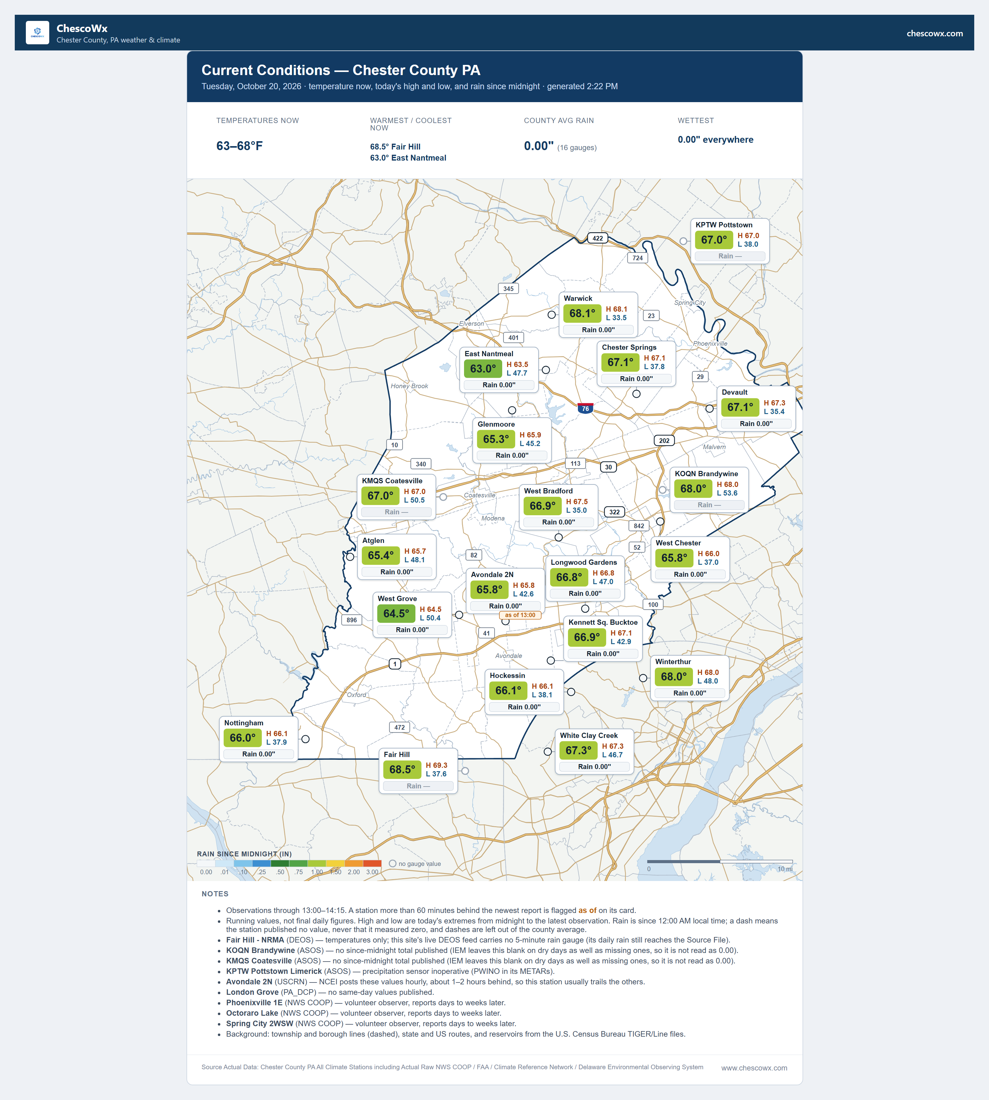
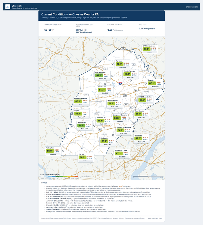
Almost a 20 degree spread in morning low temperatures today within just a few miles across the area this morning. Elevation and terrain impacts.
-
E PA/NJ/DE Autumn 2026 Obs/Discussion
ChescoWx replied to PhiEaglesfan712's topic in Philadelphia Region
Almost a 20 degree spread in morning low temperatures today within just a few miles across the area this morning. Elevation and terrain impacts.
-

2026-2027 Record-breaking El Nino
bluewave replied to Stormchaserchuck1's topic in Weather Forecasting and Discussion
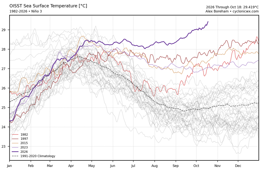
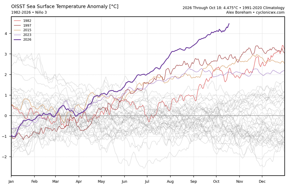
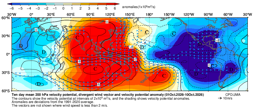
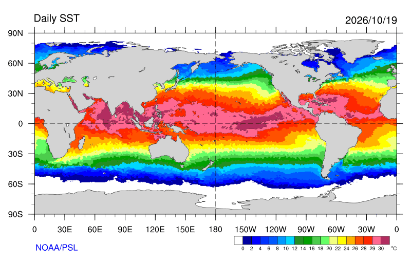
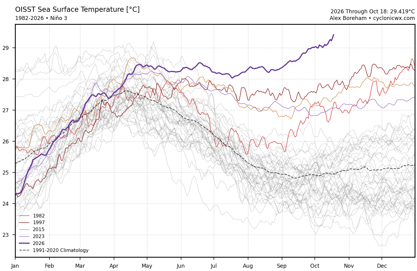
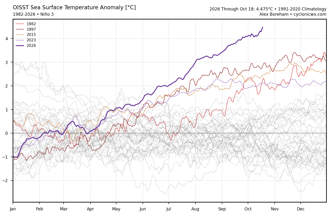
Centered right under Nino 3 at +4.47 now. Starting to see a +30C warm pool bridge develop from Nino 3.4 over to the coast of Central America. Matches up with the record east based forcing for so early in an event.