All Activity
- Past hour
-
Probably not a lot to hit where it's at right now
-
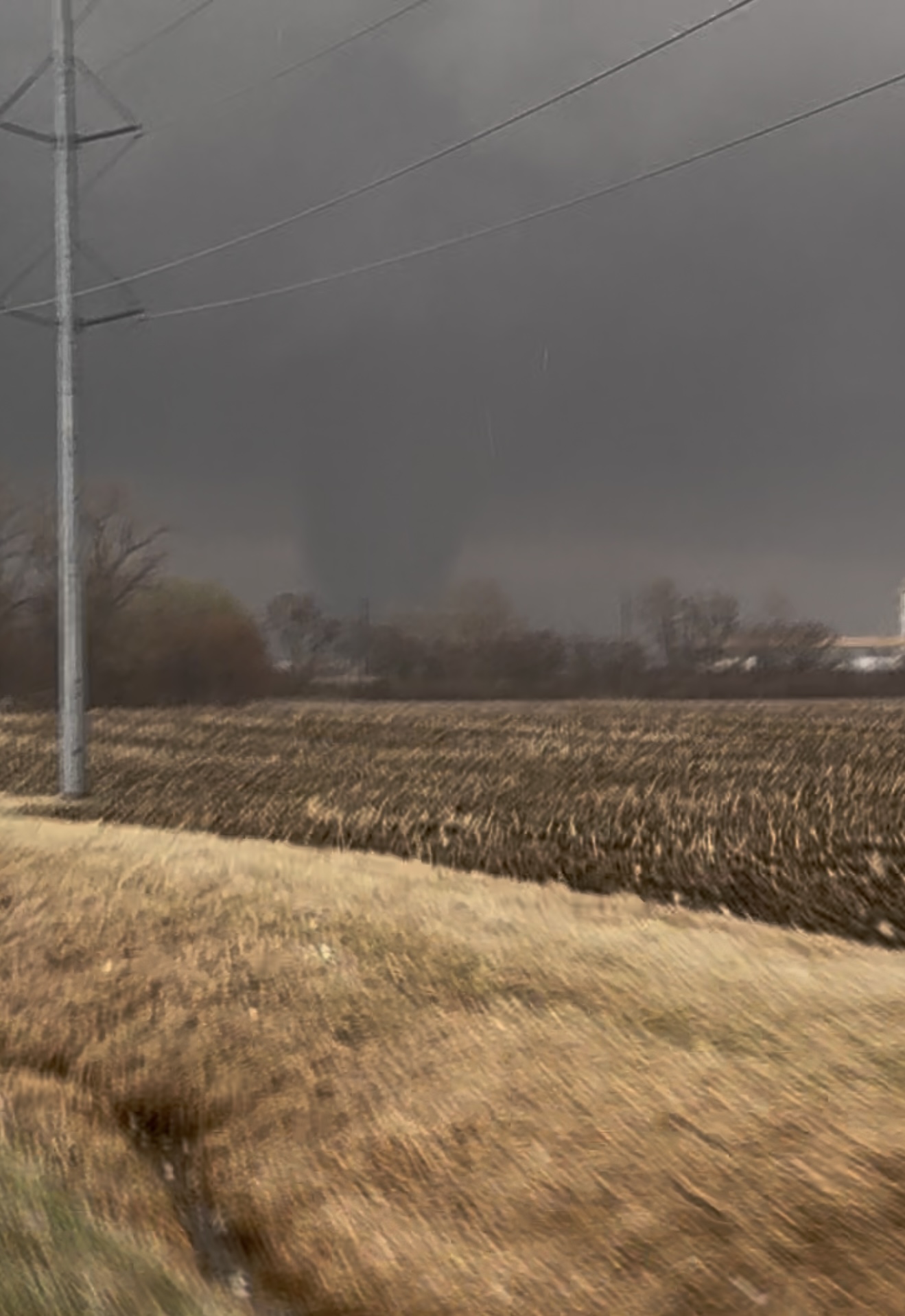
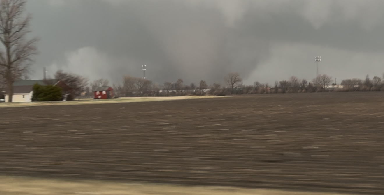
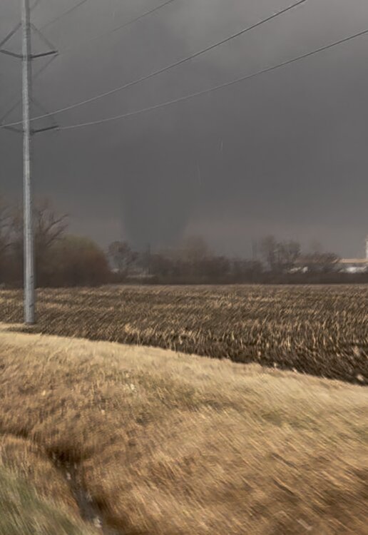
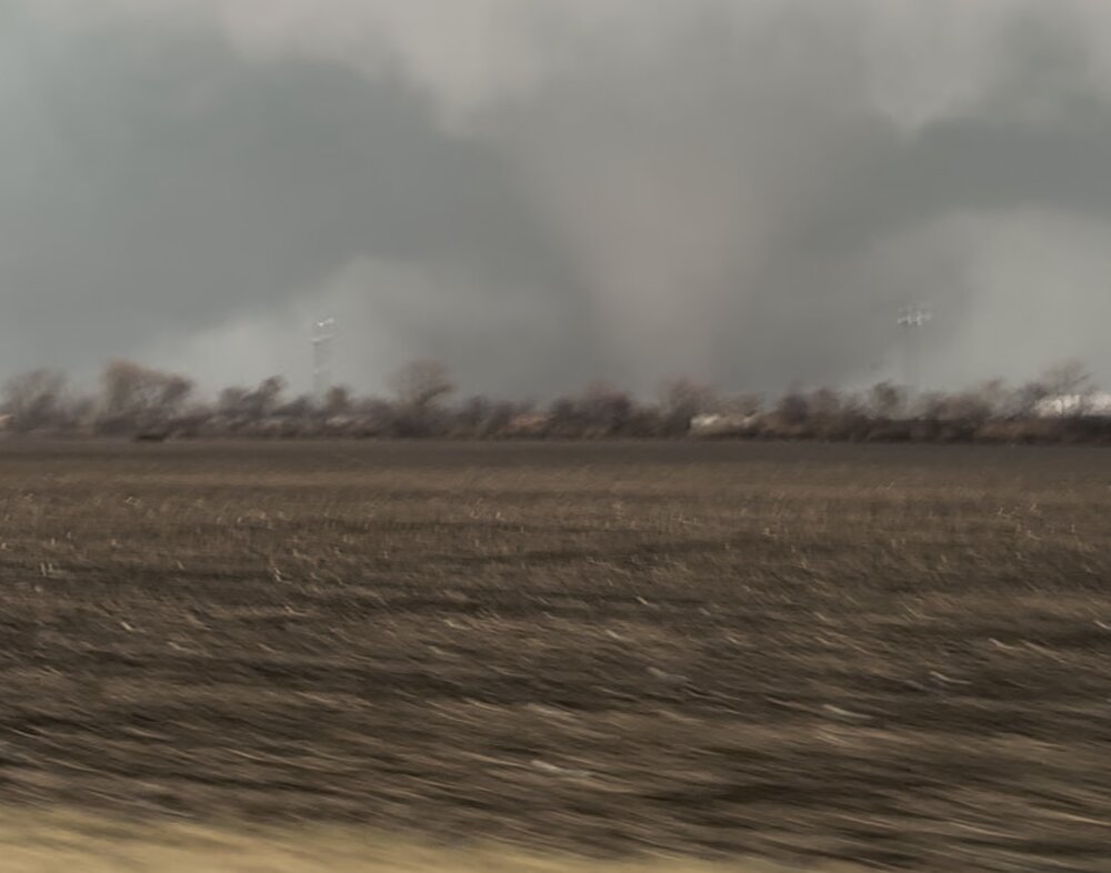
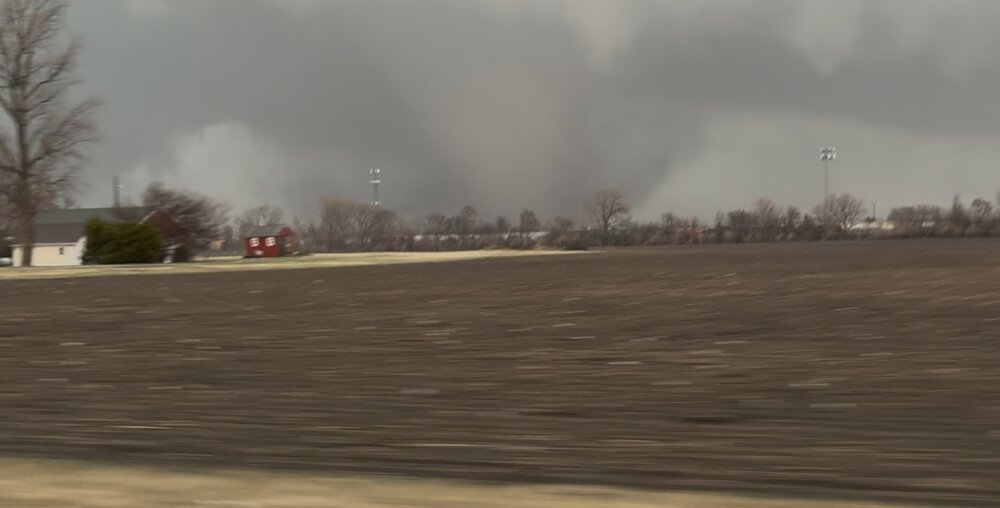
Video stills from Kankakee tornado by my son.
-
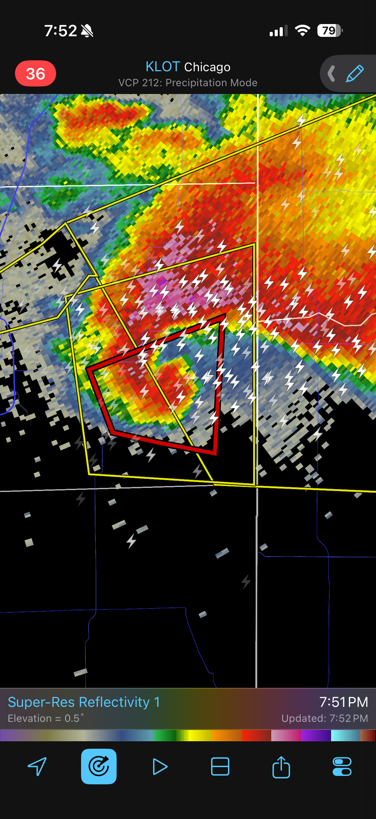
Some nutty stuff here
-
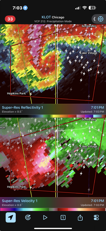
CC not quite as impressive as I would expect with that velocity. May be skipping along the ground a bit
-
FV has this line setting up directly over the city for a few hours Is this an anafront? Or just a weak wave riding the boundary?
-
Absolutely shocking. This is one of the largest hailstones east of the MS on record.
-
What a monster. Thats exactly what the SPC thinks from their latest discussion. Given the isolated nature of the supercell, strongly backed low-level flow/shear, tornadoes (strong to intense) along with very large hail appear likely over the next hour or two.
-
Did you guys see the 28/81 spread between the low and high out in Walpack?! There were two other 50 degree spreads on the Rutgers network. This is right there with locations out west that make wild swings.
-
Yeah the lightning show is incredible.
-
I think the lingering remnants of the Lake Michigan lake breeze helped steer it right. Hard to tell exactly, but the right turn really helped it blow up.
-
Mid to upper 30s verbatim where it snows as modeled.
-
Thanks. Based on my calling a -0.25 to +0.25 DJF averaged NAO “neutral”, I actually have 25-26 as neutral due to a -0.11 average. It was easily headed to sub -0.25 with a -0.4 winter to date avg. as of Feb 12th, but the strong +NAO of Feb 13-28 brought the avg. up to -0.11. Nevertheless, the -0.11 is the lowest NAO of a 35+ sunspot winter since 1997-8, quite a notable achievement with sunspots at 105. winter. One has to go all the way back to 1978-9 to find the last true -NAO DJF during an active sunspot winter.
-
-
-
One of the coolest storms. Not a lot of wind here but the lightning was crazy and the thunder super loud. Lots and lots of hail. Power on and off for the whole thing. Never felt uneasy. Looks like we got some good flooding going on and more storms to comes. Fun storm.
-
Best one I’ve seen around the area in a while
-
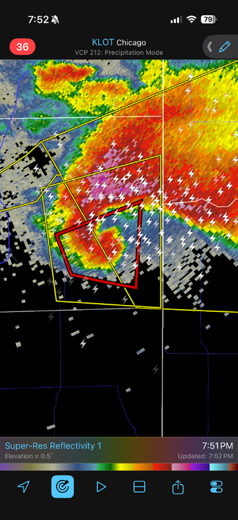
Kankakee cell riding the warm front with nothing around to slow it. Going to be riding for awhile.
-
Interestingly we already have sirens going off but not under any warning. Does look like we will at the very least get clipped
-
that other storm heading for Oklahoma City could drop a tornado looking better again
- Yesterday
-
Snow tv at the best. Surface temps will be torchy.
-
2014 2015 1978 1979 That's all I got Runner-up was 2003 and a decent 2004
-
Damn. Put this thing in a textbook.
-

E PA/NJ/DE Spring 2026 Obs/Discussion
RedSky replied to PhiEaglesfan712's topic in Philadelphia Region
Euro has 1" snow give or take Wiggum rule -
Snow starting here. Been trying to overcome some dry air the last 3 hrs. Looks like 1-2" again with WI getting a good hit over into the UP.
-
That’s awesome. Those days were fun as a kid.