All Activity
- Past hour
-
that outflow pushing into my area now, should see our first round of storms in the area later this evening
-
 2 severe warnings back to back days .03 .07 While Freak loses forests, gets 4” of rain , Sturbridge to RI get historic rains , and WOR washes away
 -
 Completely steined again last night. At this point, you just have to laugh.
 -
-
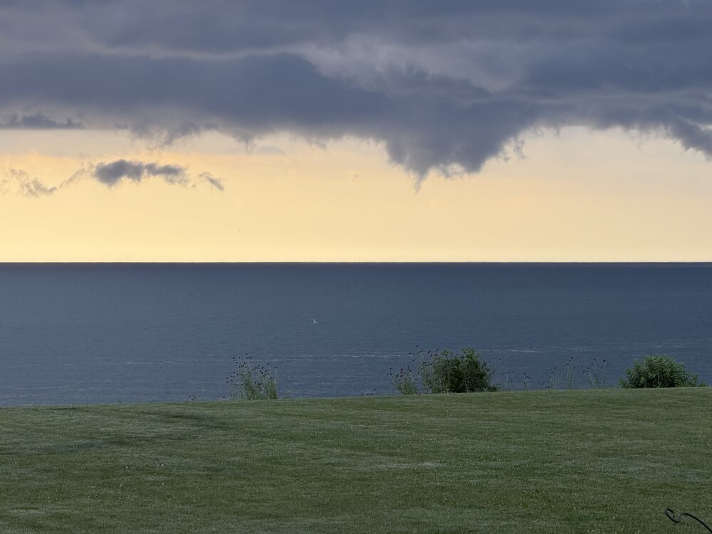
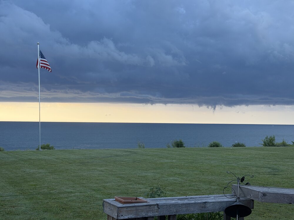
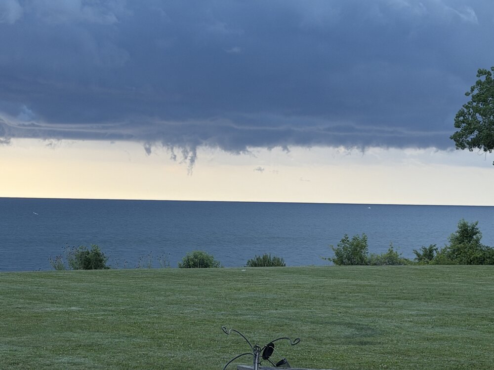
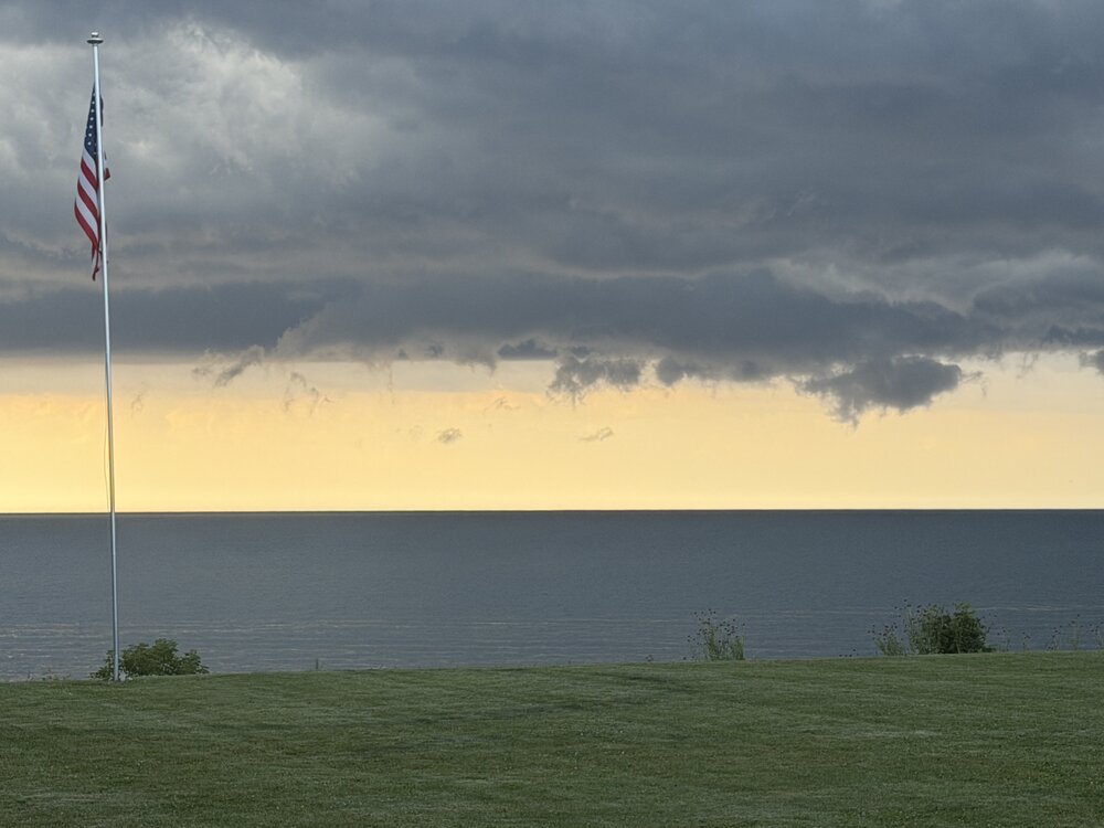
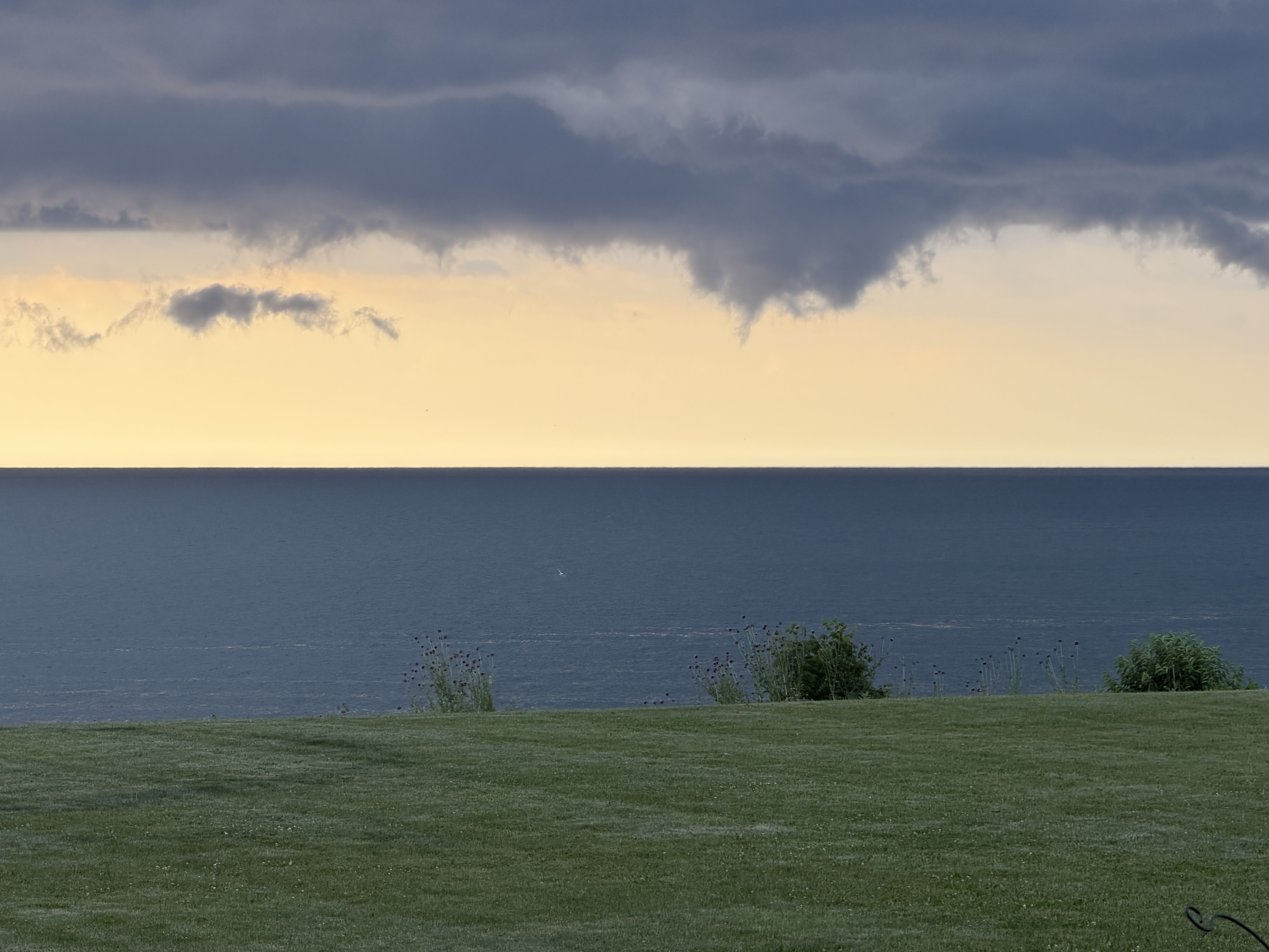
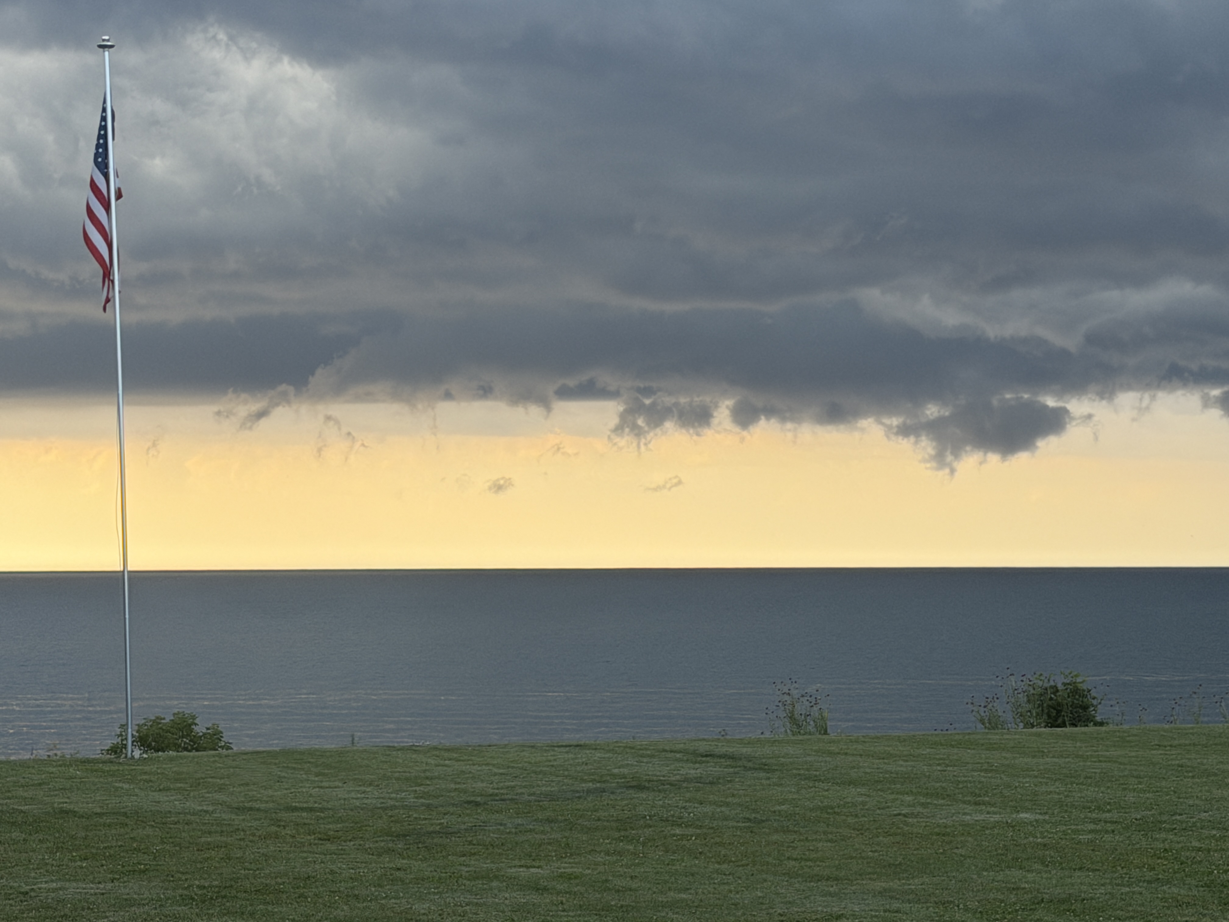
Some neat cloud formations over the lake this morning. No rotation. Just kinda cool
-
Next time below 80? Saturday night?
-

2026-2027 Super El Nino
40/70 Benchmark replied to Stormchaserchuck1's topic in Weather Forecasting and Discussion
Yes, I understand that...most winter seasonal considerations don't. I only do because it's a large part of the snowfall season around here...well, historically, anyway...not so much this decade. -
Using the ai feature on pws weather, it tells me that July of 2019 was my last 80° minimum temperature .
-
 Great light show. Very little thunder 0.22” of rain. Steamy this morning
 -
 Yeah quick downpour and light show but meh.
 -
and it's only july 2
-
7am 84/76/93. Keeping the third level of our TH cool in this is a challenge. Especially with solar panels on the front of it.
-
76/75 here. Sticky but we have seen worse. Good day to wrap up work early for the long weekend and head to the pool.
-
Just got out of the water. It's freezing. 4mm wetsuit, no boots. Water temp of 54 according to my watch, and that typically reads 1-2 degrees warmer. Sea breeze already in effect, should keep the beach in the low 80s again
-

Occasional Thoughts on Climate Change
donsutherland1 replied to donsutherland1's topic in Climate Change
For the U.S., one hasn't typically seen such heat domes during summers preceding strong/super El Niño events. Such events have been far more common in Europe and Asia. However, during 2015 (Pacific Northwest) and 2023 (July-August in the Southwest/South Central) such domes appeared. Whether these recent events suggest that things are changing in the warming climate (especially more expansive marine heatwaves) remains to be seen. A sample size of two is too small to draw firm conclusions. -
Very high launchpad with temps already 80-85F across the region. 105+ looks certain
-
78/75 @ 7am
-
69/67 here, 45 mins north west of Roanoke. It ain’t bad outside right now in the hills and up the holler haha but I know what’s coming.
-
78/74 this morning as I drink my coffee on my patio. It’s sticky
-
my hygrometer recorded an 80+ dewpoint yesterday with a 122 HI, but I think that's suspect. I'm guessing my real HI yesterday was more like 115 or a bit less. Right now I'm at 75/74.
-
Impressive to see HPN at 80° at 6am. White Plains CLEAR 80 75 84 NW5
-
85 for the low at LGA. .
- Today
-
81° low here. Pretty rare for me to have a 80°+ low... Even with some of the big heat last several years it didn't happen.
-
Looks like 80 will be the low temp at DCA https://www.weather.gov/wrh/timeseries?site=kdca
-

Central PA Summer 2026 Discussion/Obs Thread
mahantango#1 replied to Voyager's topic in Upstate New York/Pennsylvania
The grid is expected to break records today. The record was 165.5 Gigawatt in 2006. Forecast to be 166.2 today. Hopefully it can handle it, and it won't go down.


.thumb.jpeg.f5c6ba9d911ec96b3b124f8606aee58e.jpeg)


