All Activity
- Past hour
-

First Winter Storm to kickoff 2025-26 Winter season
SouthCoastMA replied to Baroclinic Zone's topic in New England
We've seen this scenario time and again the past several winters. The euro being the coldest solution/outlier 3-4 days out then slowly trends to other guidance, It could be anecdotal but just seems to have a cold bias up here in that mid range. In the past it wouldn't budge much while the other models trend much colder. -

First Winter Storm to kickoff 2025-26 Winter season
ORH_wxman replied to Baroclinic Zone's topic in New England
Yeah that’s further SE than pivotal by a decent amount. Sv is awful. -
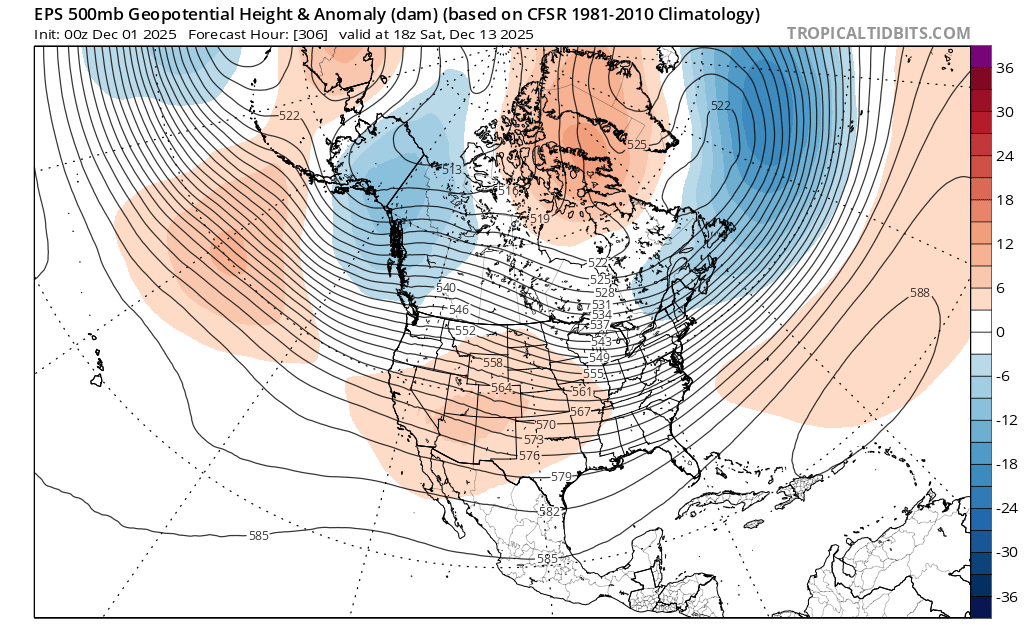
Yeah overall cold but I don't like seeing those low heights over Alaska ak vortex.

-
Euro with a little hope Friday morning?
.thumb.png.1b6b1df5bb77016bbfe7672bd0bcd0ca.png)
-

First Winter Storm to kickoff 2025-26 Winter season
George001 replied to Baroclinic Zone's topic in New England
That’s the right way to look at it. We have more storm threats ahead of this. This one looks like it’s going to be for northern areas. -

First Winter Storm to kickoff 2025-26 Winter season
dryslot replied to Baroclinic Zone's topic in New England
Start time is sooner down your way i would think. -

First Winter Storm to kickoff 2025-26 Winter season
HoarfrostHubb replied to Baroclinic Zone's topic in New England
I agree... in the Warning, they mention the morning commute -
First Winter Storm to kickoff 2025-26 Winter season
dryslot replied to Baroclinic Zone's topic in New England
It looks to get going late morning here but that late afternoon commute will be a bitch i believe. -
I edited my post but it is crawling up the coast. WxBell shows some ice for DC - did kind of assume that precip would’ve been snow
-

First Winter Storm to kickoff 2025-26 Winter season
CoastalWx replied to Baroclinic Zone's topic in New England
It’s great -
Through Friday afternoon the only snow is in SE VA.
-
First Winter Storm to kickoff 2025-26 Winter season
HoarfrostHubb replied to Baroclinic Zone's topic in New England
I still don't think the morning commute will be bad... -
On the western side of the county (Narrowsburg area) at slightly lower elevation so more 4-6” and possibly drizzle to end, if we even get that warm.
-

First Winter Storm to kickoff 2025-26 Winter season
Great Snow 1717 replied to Baroclinic Zone's topic in New England
When a hobby is impacting personal wellbeing it is time to find another hobby... -
First Winter Storm to kickoff 2025-26 Winter season
HoarfrostHubb replied to Baroclinic Zone's topic in New England
I just hit the "Switch to Beta" on Pivotal... wow. Much better. Any downsides to it? -
latest hrrr comes in pretty hot and heavy out here.
-
First Winter Storm to kickoff 2025-26 Winter season
dryslot replied to Baroclinic Zone's topic in New England
Winter Storm Warnings hoisted, 1236 PM EST Mon Dec 1 2025 ...WINTER STORM WARNING IN EFFECT FROM 8 AM TUESDAY TO 4 AM EST WEDNESDAY... * WHAT...Heavy snow expected. Total snow accumulations between 6 and 9 inches. * WHERE...Portions of south central, southwest, and western Maine and central, northern, and southern New Hampshire. * WHEN...From 8 AM Tuesday to 4 AM EST Wednesday. * IMPACTS...A snowstorm will bring plowable snow to the region with a period of moderate travel impacts expected. Periods of moderate snow and low visibility will be the biggest hazards. The potential exists for snowbands that will bring periods of locally heavy snowfall, which will lead to rapid snow accumulations and extremely dangerous travel conditions. Periods of moderate and heavy snow will combine with low visibility to create dangerous driving conditions. The hazardous conditions could impact the Tuesday morning and evening commutes. PRECAUTIONARY/PREPAREDNESS ACTIONS... If you must travel, keep an extra flashlight, food, and water in your vehicle in case of an emergency. The latest road conditions can be obtained by going to newengland511.org Persons should delay all travel if possible. If travel is absolutely necessary, drive with extreme caution and be prepared for sudden changes in visibility. Leave plenty of room between you and the motorist ahead of you, and allow extra time to reach your destination. Avoid sudden braking or acceleration, and be especially cautious on hills or when making turns. Make sure your car is winterized and in good working order. -

First Winter Storm to kickoff 2025-26 Winter season
Damage In Tolland replied to Baroclinic Zone's topic in New England
People wonder why I’m a worrier with weather … -
12z EURO should be better. Actually has a storm somewhere in the area
-

12/3 Snow/Sleet/Mix Bag of Everything Discussion/OBS
Newman replied to Mikeymac5306's topic in Philadelphia Region
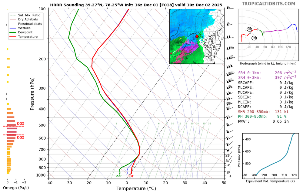
Not the trend you want to see up to storm onset. 925s and 850s are just too warm, which makes sense given the setup. Hopefully this trend halts and we see things shift SE tonight. But at that point, it's time to look at obs and radar watch. Shaping up to be a typical early season interior storm with maybe a surprise 1-2" thump on the southern boundary along I-78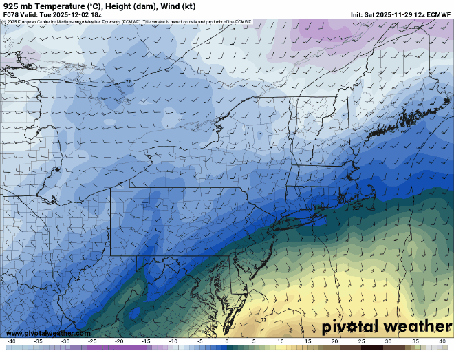
-
First Winter Storm to kickoff 2025-26 Winter season
HoarfrostHubb replied to Baroclinic Zone's topic in New England
Your area is interesting... hopefully the column cools a bit... tenuous -
First Winter Storm to kickoff 2025-26 Winter season
CoastalWx replied to Baroclinic Zone's topic in New England
-

First Winter Storm to kickoff 2025-26 Winter season
weatherwiz replied to Baroclinic Zone's topic in New England
Only people sniffing 10:1 ratios with this is going to be closer to CNE and probably into ME. Other than that, anyone snow down here is probably going to be closer to 8:1 -

First Winter Storm to kickoff 2025-26 Winter season
ma blizzard replied to Baroclinic Zone's topic in New England
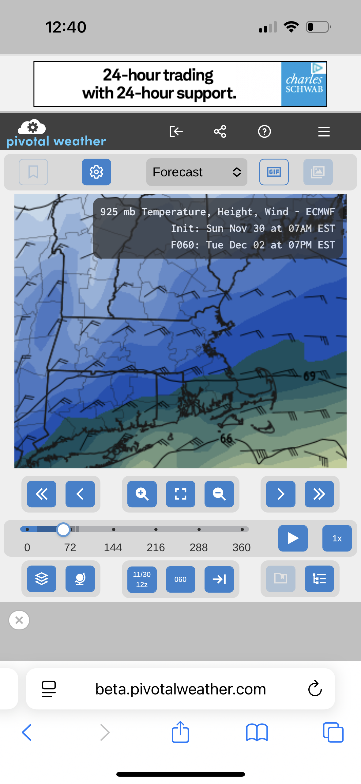
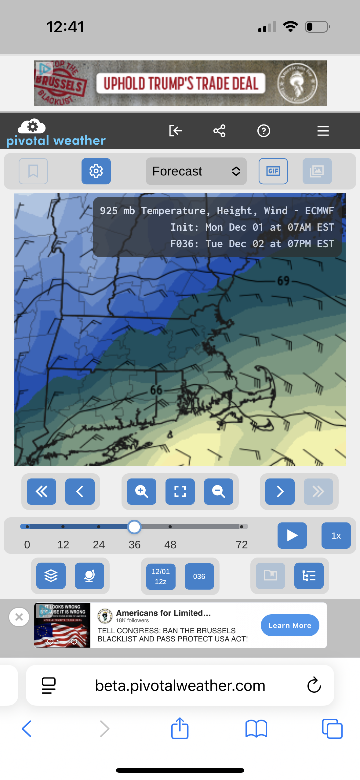
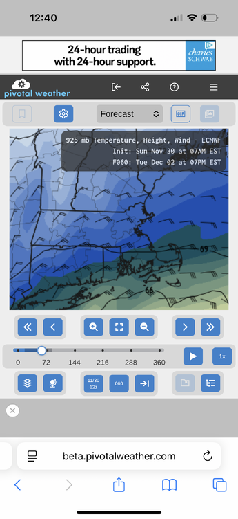
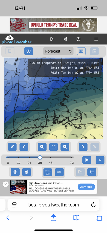
doesn't make it right even if it does thats a lot of snow its printing out with 925 mb > 0 C def not the trend you want to see for the marginal areas in metro west -
First Winter Storm to kickoff 2025-26 Winter season
weatherwiz replied to Baroclinic Zone's topic in New England
really? hmmm...I always thought it was around this time with DST. But good to know, thanks!


.png.a7f8facd1ef6f676b97a5b931924a756.png)