All Activity
- Past hour
-
Lindros was a concussion machine. The hit by Stevens was brutal...knocked Lindros into next week.
-
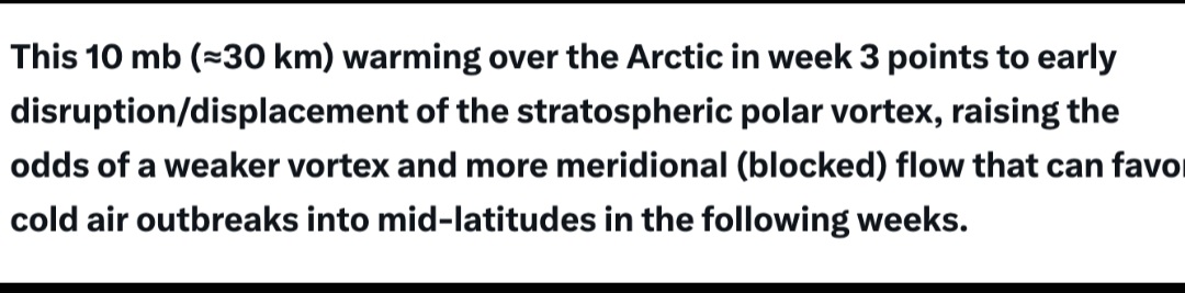
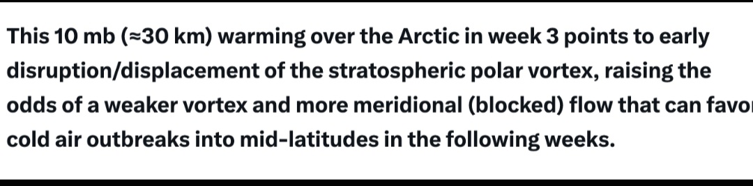
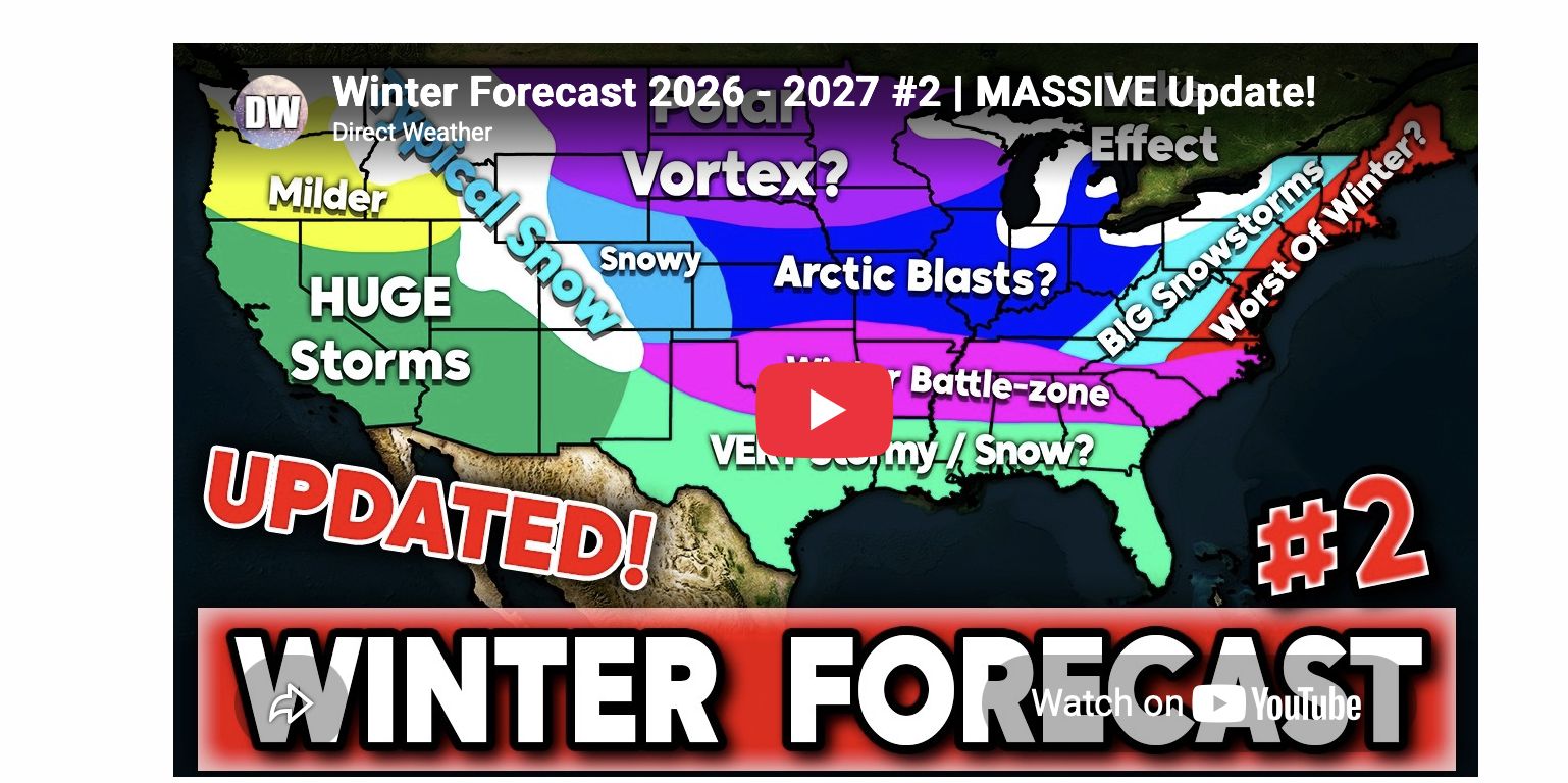
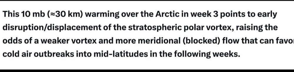
JB and Judah Cohen duo

-

2026-2027 Record-breaking El Nino
MJO812 replied to Stormchaserchuck1's topic in Weather Forecasting and Discussion
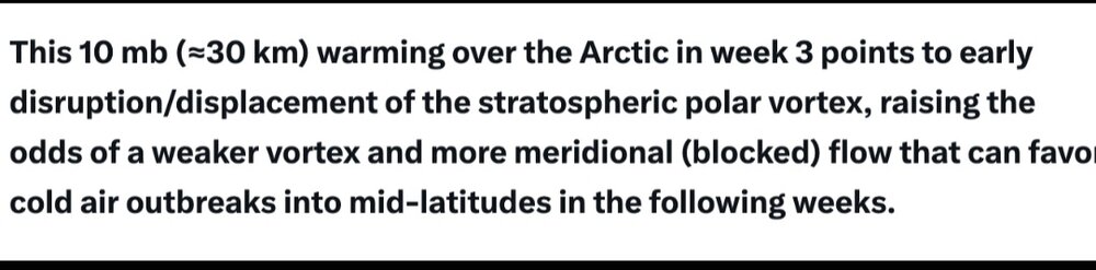
JB
-
2026-2027 Record-breaking El Nino
MJO812 replied to Stormchaserchuck1's topic in Weather Forecasting and Discussion
Alot of worthy bump material in this thread. -
 http://sildenrxexpress.com/# viagra without prescription
-
41.4 this morning, no 30’s here
-
Chris Bosh who played w/Lebron and D-Wade in Miami had blood clots and had to retire...no idea if same type as Jalen.
-
Commies didn’t know it was 4th down lol
-
I don’t make anything out…I say what I see. And why would anybody say it’s beautiful, if it wasn’t? I certainly wouldn’t. Now I guess one can say maybe I live in an area with alot of maples that provide good color. But as I said…drove down the shore yesterday, and it was stunning all the way down. Last year it ended up excellent too. I think more posters agree with me on this, than you. You live where there are alot of oaks…so color is duller where you are, so maybe that’s why you say it’s dull every year. No matter who you ask….they’re gonna tell you the color this year has been fabulous, because it has.
-

E PA/NJ/DE Autumn 2026 Obs/Discussion
Birds~69 replied to PhiEaglesfan712's topic in Philadelphia Region
Hurts out for the season. Accu Weather 5-15" Winter forecast and now this. Good grief... 6abc promotes Adam Joseph to Chief Meteorologist for Action News https://6abc.com/post/6abc-promotes-adam-joseph-chief-meteorologist-action-news/19956298/ -
I thought you were in Arizona, not Tolland, CT?
-

2026-2027 Fall/Winter Mountain Thread
Tyler Penland replied to BlueRidgeFolklore's topic in Southeastern States
A pair of freezing readings for me the last two mornings: 32.0 on the nose and 29.5 this morning. There's still a lot more green leaves than I would expect to see given the extended cool stretch. Quickly getting to a point here at the house where they are either green or gone. Weird. -
SPOILER ALERT! Have you been stopped by the train robbers yet?
-
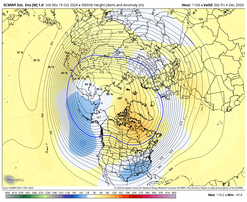
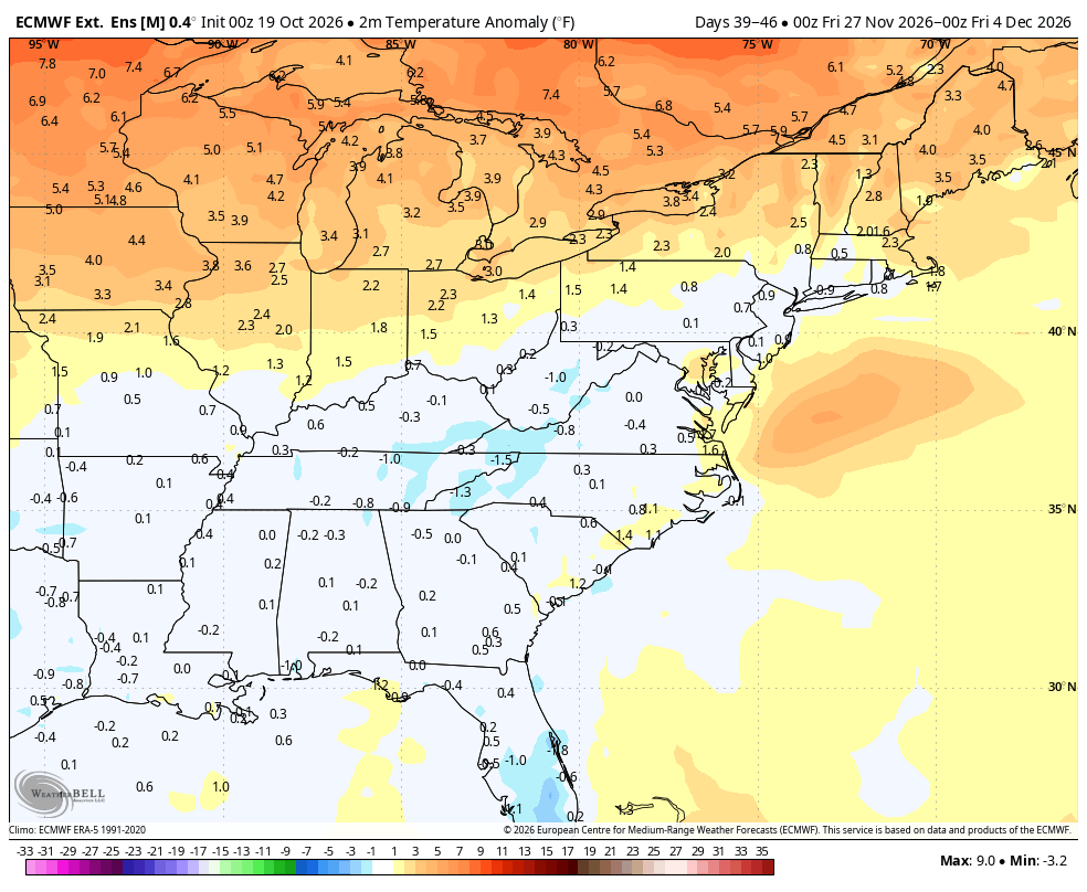
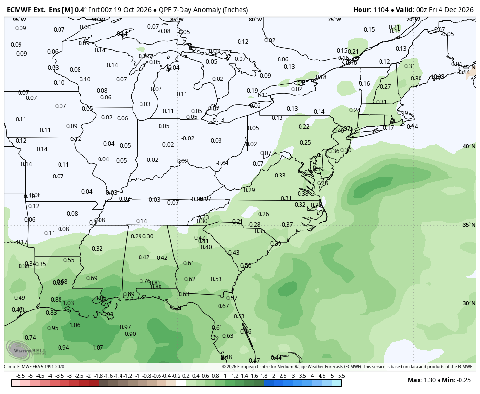
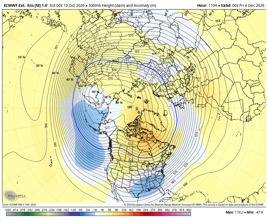
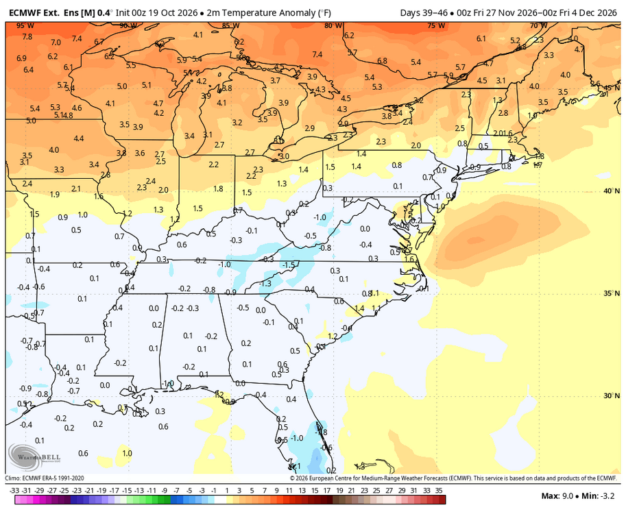
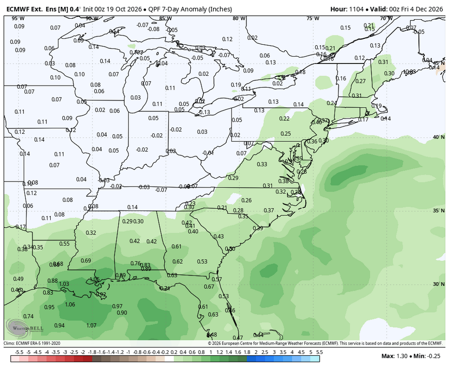
Latest WB EURO weeklies are not bad looking for early December either.
-
There may have been a mild inversion, which explains the slightly warmer readings at MPO.
-

2026-2027 Record-breaking El Nino
michsnowfreak replied to Stormchaserchuck1's topic in Weather Forecasting and Discussion
Ill make sure to bump this -
Interesting information. The NYBG labeled it 'Mother of Pearl.'
-
Temperatures are now moderating. Most of this week will see highs in the lower 60s. A strong storm will stay too offshore to bring rain to the region this week. Some elevated high tides are possible. The ENSO Region 1+2 anomaly was +5.2°C and the Region 3.4 anomaly was +3.3°C for the week centered around October 7. For the past six weeks, the ENSO Region 1+2 anomaly has averaged +4.98°C and the ENSO Region 3.4 anomaly has averaged +3.12°C. ENSO Region 3.4 ties the all-time record set in the prior week. The ongoing strong El Niño, will continue to strengthen through the mid-fall. The SOI was -30.17 today. The preliminary Arctic Oscillation (AO) was +2.902 today. Based on sensitivity analysis applied to the latest guidance, there is an implied near 69% probability that New York City will have a warmer than normal October (1991-2020 normal). October will likely finish with a mean temperature near 58.7° (0.8° above normal). Supplemental Information: The projected mean would be 1.8° above the 1981-2010 normal monthly value.
-
I come from the future... [code] STATION: LYNCHBURG VA MONTH: JANUARY YEAR: 2027 LATITUDE: 37 19 N LONGITUDE: 79 12 W TEMPERATURE IN F: :PCPN: SNOW: WIND :SUNSHINE: SKY :PK WND ================================================================================ 1 2 3 4 5 6A 6B 7 8 9 10 11 12 13 14 15 16 17 18 12Z AVG MX 2MIN DY MAX MIN AVG DEP HDD CDD WTR SNW DPTH SPD SPD DIR MIN PSBL S-S WX SPD DR ================================================================================ 1 73 44 59 22 6 0 0.00 0.0 0 6.0 15 300 M M 1 1 25 310 2 62 32 47 10 18 0 0.01 0.0 0 6.9 13 50 M M 7 18 50 3 53 22 38 1 27 0 0.15 0.1 0 2.5 10 40 M M 10 1 13 40 4 40 17 29 -8 36 0 0.00 0.0 0 4.0 10 200 M M 3 12 15 210 5 39 32 36 0 29 0 0.92 1.0 0 5.7 17 190 M M 10 12 25 190 6 43 29 36 0 29 0 0.10 0.0 1 4.5 15 40 M M 8 20 40 7 44 21 33 -3 32 0 0.00 0.0 0 8.7 26 200 M M 6 39 200 8 52 39 46 10 19 0 2.04 0.0 0 4.6 13 270 M M 10 1 22 280 9 46 23 35 -1 30 0 0.10 0.0 0 3.1 15 260 M M 8 12 23 280 10 43 23 33 -3 32 0 0.00 0.0 0 4.9 15 190 M M 1 22 190 11 57 26 42 6 23 0 0.00 0.0 0 8.6 23 190 M M 1 32 210 12 63 39 51 15 14 0 0.01 0.0 0 5.0 16 10 M M 5 12 30 20 13 68 44 56 21 9 0 0.00 0.0 0 11.3 30 200 M M 0 43 200 14 57 42 50 15 15 0 0.00 0.0 0 3.9 12 310 M M 0 20 310 15 56 40 48 13 17 0 0.07 0.0 0 6.9 14 40 M M 7 1 20 40 16 46 32 39 4 26 0 1.16 0.0 0 13.6 30 220 M M 10 1 48 220 17 41 23 32 -3 33 0 0.00 0.0 0 7.4 16 260 M M 3 28 270 18 44 25 35 0 30 0 0.00 0.0 0 4.8 14 190 M M 2 19 200 19 40 28 34 -1 31 0 0.00 0.0 0 2.3 9 220 M M 3 14 350 20 34 21 28 -8 37 0 T T 0 7.5 22 190 M M 6 36 180 21 38 23 31 -5 34 0 0.01 0.0 0 2.5 12 360 M M 6 21 340 22 37 23 30 -6 35 0 0.50 5.5 0 5.5 17 200 M M 10 29 270 23 34 23 29 -7 36 0 0.63 5.1 5 7.0 21 300 M M 10 36 320 24 43 24 34 -2 31 0 0.00 0.0 10 4.6 14 70 M M 0 24 40 25 53 22 38 2 27 0 0.00 0.0 8 4.9 17 190 M M 0 23 140 26 60 24 42 6 23 0 0.00 0.0 3 8.8 18 200 M M 1 28 210 27 69 37 53 17 12 0 0.21 0.0 0 7.4 17 40 M M 9 1 26 30 28 55 34 45 8 20 0 0.00 0.0 0 4.6 14 310 M M 1 30 0 29 42 30 36 -1 29 0 1.20 2.6 0 8.2 22 190 M M 10 32 200 30 34 24 29 -8 36 0 0.66 5.0 2 6.8 16 210 M M 10 22 210 31 32 20 26 -11 39 0 0.01 0.1 6 11.7 23 190 M M 8 30 200 ================================================================================ SM 1498 886 815 0 7.78 19.4 194.2 M 166 ================================================================================ AV 48.3 28.6 6.3 FASTST M M 5 MAX(MPH) MISC ----> # 30 200 48 220 ================================================================================ NOTES: # LAST OF SEVERAL OCCURRENCES COLUMN 17 PEAK WIND IN M.P.H. [/code] [code] PRELIMINARY LOCAL CLIMATOLOGICAL DATA (WS FORM: F-6) , PAGE 2 STATION: LYNCHBURG VA MONTH: JANUARY YEAR: 2027 LATITUDE: 37 19 N LONGITUDE: 79 12 W [TEMPERATURE DATA] [PRECIPITATION DATA] SYMBOLS USED IN COLUMN 16 AVERAGE MONTHLY: 38.7 TOTAL FOR MONTH: 7.78 1 = FOG OR MIST DPTR FM NORMAL: 2.7 DPTR FM NORMAL: +4.28 2 = FOG REDUCING VISIBILITY HIGHEST: 73 ON 1 GRTST 24HR 2.14 ON 8-9 TO 1/4 MILE OR LESS LOWEST: 17 ON 4 3 = THUNDER SNOW, ICE PELLETS, HAIL 4 = ICE PELLETS TOTAL MONTH: 19.4 INCH 5 = HAIL GRTST 24HR 10.6 ON 22-23 6 = FREEZING RAIN OR DRIZZLE GRTST DEPTH: 10 7 = DUSTSTORM OR SANDSTORM: VSBY 1/2 MILE OR LESS 8 = SMOKE OR HAZE [NO. OF DAYS WITH] [WEATHER - DAYS WITH] 9 = BLOWING SNOW X = TORNADO MAX 32 OR BELOW: 1 0.01 INCH OR MORE: 16 MAX 90 OR ABOVE: 0 0.10 INCH OR MORE: 11 MIN 32 OR BELOW: 23 0.50 INCH OR MORE: 7 MIN 0 OR BELOW: 0 1.00 INCH OR MORE: 3 [/code] [code] STATION: LYNCHBURG VA MONTH: FEBRUARY YEAR: 2027 LATITUDE: 37 19 N LONGITUDE: 79 12 W TEMPERATURE IN F: :PCPN: SNOW: WIND :SUNSHINE: SKY :PK WND ================================================================================ 1 2 3 4 5 6A 6B 7 8 9 10 11 12 13 14 15 16 17 18 12Z AVG MX 2MIN DY MAX MIN AVG DEP HDD CDD WTR SNW DPTH SPD SPD DIR MIN PSBL S-S WX SPD DR ================================================================================ 1 33 24 29 -8 36 0 0.00 0.0 0 6.0 15 300 M M 1 1 25 310 2 42 32 37 0 28 0 0.08 0.1 0 6.9 13 50 M M 7 18 50 3 43 22 33 -4 32 0 0.00 0.0 0 2.5 10 40 M M 10 1 13 40 4 50 27 39 2 26 0 0.00 0.0 0 4.0 10 200 M M 3 12 15 210 5 56 21 39 1 26 0 0.10 0.0 0 5.7 17 190 M M 7 12 25 190 6 43 28 36 -2 29 0 0.00 0.0 0 4.5 15 40 M M 2 20 40 7 30 21 26 -12 39 0 1.10 11.0 0 8.7 26 200 M M 10 39 200 8 32 19 26 -12 39 0 0.94 9.2 11 4.6 13 270 M M 10 1 22 280 9 26 3 15 -23 50 0 0.00 0.0 19 3.1 15 260 M M 2 12 23 280 10 33 13 23 -15 42 0 0.10 2.1 18 4.9 15 190 M M 9 22 190 11 37 16 27 -11 38 0 0.00 0.0 19 8.6 23 190 M M 1 32 210 12 43 24 34 -5 31 0 0.03 0.3 17 5.0 16 10 M M 6 12 30 20 13 58 34 46 7 19 0 0.00 0.0 14 11.3 30 200 M M 0 43 200 14 56 32 44 5 21 0 0.00 0.0 6 3.9 12 310 M M 0 20 310 15 66 50 58 19 7 0 0.57 0.0 1 6.9 14 40 M M 9 1 20 40 16 56 48 52 13 13 0 2.16 0.0 0 13.6 30 220 M M 10 3 48 220 17 51 29 40 1 25 0 1.20 0.0 0 7.4 16 260 M M 10 28 270 18 44 25 35 -5 30 0 0.00 0.0 0 4.8 14 190 M M 2 19 200 19 50 28 39 -1 26 0 0.00 0.0 0 2.3 9 220 M M 3 14 350 20 44 31 38 -2 27 0 1.32 T 0 7.5 22 190 M M 10 36 180 21 48 33 41 1 24 0 0.01 0.0 0 2.5 12 360 M M 6 21 340 22 57 33 45 5 20 0 0.00 0.0 0 5.5 17 200 M M 0 29 270 23 64 43 54 14 11 0 0.03 0.0 0 7.0 21 300 M M 6 36 320 24 53 34 44 4 21 0 0.50 0.0 0 4.6 14 70 M M 9 24 40 25 43 30 37 -4 28 0 0.00 0.0 0 4.9 17 190 M M 0 23 140 26 50 29 40 -1 25 0 0.10 0.3 0 8.8 18 200 M M 8 28 210 27 39 27 33 -8 32 0 0.31 4.0 0 7.4 17 40 M M 10 1 26 30 28 55 34 45 4 20 0 0.00 0.0 3 4.6 14 310 M M 1 30 0 ================================================================================ SM 1302 790 765 0 8.55 27.0 167.5 M 152 ================================================================================ AV 46.5 28.2 6.0 FASTST M M 5 MAX(MPH) MISC ----> # 30 220 48 220 ================================================================================ NOTES: # LAST OF SEVERAL OCCURRENCES COLUMN 17 PEAK WIND IN M.P.H. [/code] [code] PRELIMINARY LOCAL CLIMATOLOGICAL DATA (WS FORM: F-6) , PAGE 2 STATION: LYNCHBURG VA MONTH: FEBRUARY YEAR: 2027 LATITUDE: 37 19 N LONGITUDE: 79 12 W [TEMPERATURE DATA] [PRECIPITATION DATA] SYMBOLS USED IN COLUMN 16 AVERAGE MONTHLY: 37.7 TOTAL FOR MONTH: 8.55 1 = FOG OR MIST DPTR FM NORMAL: -1.3 DPTR FM NORMAL: +5.65 2 = FOG REDUCING VISIBILITY HIGHEST: 66 ON 15 GRTST 24HR 3.36 ON 16-17 TO 1/4 MILE OR LESS LOWEST: 3 ON 9 3 = THUNDER SNOW, ICE PELLETS, HAIL 4 = ICE PELLETS TOTAL MONTH: 27.0 INCH 5 = HAIL GRTST 24HR 20.2 ON 7-8 6 = FREEZING RAIN OR DRIZZLE GRTST DEPTH: 19 7 = DUSTSTORM OR SANDSTORM: VSBY 1/2 MILE OR LESS 8 = SMOKE OR HAZE [NO. OF DAYS WITH] [WEATHER - DAYS WITH] 9 = BLOWING SNOW X = TORNADO MAX 32 OR BELOW: 3 0.01 INCH OR MORE: 15 MAX 90 OR ABOVE: 0 0.10 INCH OR MORE: 11 MIN 32 OR BELOW: 20 0.50 INCH OR MORE: 7 MIN 0 OR BELOW: 0 1.00 INCH OR MORE: 4 [HDD (BASE 65) ] TOTAL THIS MO. 765 CLEAR (SCALE 0-3) 12 DPTR FM NORMAL +37 PTCLDY (SCALE 4-7) 5 TOTAL FM JUL 1 2708 CLOUDY (SCALE 8-10) 11 DPTR FM NORMAL -539 [CDD (BASE 65) ] TOTAL THIS MO. 0 DPTR FM NORMAL 0 [PRESSURE DATA] TOTAL FM JAN 1 0 HIGHEST SLP 30.61 ON 9 DPTR FM NORMAL 0 LOWEST SLP 29.24 ON 16 [/code] [code] CXUS51 KRNK 011132 CF6LYH PRELIMINARY LOCAL CLIMATOLOGICAL DATA (WS FORM: F-6) STATION: LYNCHBURG VA MONTH: MARCH YEAR: 2027 LATITUDE: 37 19 N LONGITUDE: 79 12 W TEMPERATURE IN F: :PCPN: SNOW: WIND :SUNSHINE: SKY :PK WND ================================================================================ 1 2 3 4 5 6A 6B 7 8 9 10 11 12 13 14 15 16 17 18 12Z AVG MX 2MIN DY MAX MIN AVG DEP HDD CDD WTR SNW DPTH SPD SPD DIR MIN PSBL S-S WX SPD DR ================================================================================ 1 54 34 44 2 21 0 0.00 0.0 0 6.0 15 300 M M 1 1 25 310 2 36 32 34 -8 31 0 0.88 4.3 0 12.4 25 40 M M 10 33 40 3 33 22 28 -14 37 0 2.10 19.0 4 18.7 38 30 M M 10 9 46 30 4 30 17 24 -18 41 0 0.20 2.0 21 15.2 31 320 M M 10 9 40 320 5 41 12 27 -16 38 0 0.00 0.0 22 8.3 20 320 M M 1 28 320 6 50 24 37 -6 28 0 0.00 0.0 18 7.1 17 310 M M 2 24 300 7 58 33 46 3 19 0 0.00 0.0 13 5.4 13 220 M M 3 18 210 8 68 44 56 12 9 0 0.32 0.0 8 9.8 24 190 M M 8 12 32 190 9 73 54 64 20 1 0 1.45 0.0 3 13.4 30 190 M M 10 12 41 190 10 78 60 69 25 0 4 2.30 0.0 0 15.1 34 200 M M 10 3 49 200 11 84 64 74 29 0 9 0.85 0.0 0 17.3 39 210 M M 9 35 61 220 12 73 50 62 17 3 0 0.40 0.0 0 14.6 36 280 M M 8 3 46 290 13 54 36 45 0 20 0 0.00 0.0 0 12.0 30 310 M M 3 39 310 14 57 33 45 0 20 0 0.00 0.0 0 7.9 18 320 M M 1 25 320 15 61 37 49 3 16 0 0.00 0.0 0 6.2 15 220 M M 2 21 230 16 65 42 54 8 11 0 0.12 0.0 0 8.1 19 200 M M 7 26 210 17 52 38 45 -1 20 0 0.47 0.0 0 9.3 22 40 M M 10 1 29 40 18 48 31 40 -7 25 0 0.00 0.0 0 10.7 26 320 M M 3 34 320 19 55 29 42 -5 23 0 0.00 0.0 0 6.5 16 290 M M 1 22 290 20 62 34 48 1 17 0 0.00 0.0 0 5.8 14 230 M M 2 19 240 21 68 41 55 7 10 0 0.00 0.0 0 7.7 20 210 M M 3 26 210 22 71 48 60 12 5 0 0.05 0.0 0 9.0 23 200 M M 6 31 200 23 63 45 54 6 11 0 0.62 0.0 0 10.2 25 270 M M 9 1 33 280 24 56 37 47 -1 18 0 0.00 0.0 0 8.8 21 310 M M 2 28 310 25 59 34 47 -2 18 0 0.00 0.0 0 6.4 15 320 M M 1 20 320 26 55 32 44 -5 21 0 0.00 0.0 0 7.2 18 40 M M 6 24 40 27 37 31 34 -15 31 0 0.22 2.0 0 9.8 22 40 M M 10 29 40 28 35 30 33 -17 32 0 0.13 1.4 2 11.4 26 10 M M 10 33 10 29 49 27 38 -12 27 0 0.00 0.0 3 9.6 22 330 M M 4 29 330 30 58 33 46 -4 19 0 0.00 0.0 0 6.8 16 250 M M 2 22 250 31 66 40 53 2 12 0 0.00 0.0 0 5.9 14 210 M M 1 19 210 ================================================================================ SM 1749 1124 584 13 10.11 28.7 302.6 M 165 ================================================================================ AV 56.4 36.3 9.8 FASTST M M 5 MAX(MPH) MISC ----> 39 210 61 220 ================================================================================ NOTES: COLUMN 17 PEAK WIND IN M.P.H. [/code] [code] PRELIMINARY LOCAL CLIMATOLOGICAL DATA (WS FORM: F-6) , PAGE 2 STATION: LYNCHBURG VA MONTH: MARCH YEAR: 2027 LATITUDE: 37 19 N LONGITUDE: 79 12 W [TEMPERATURE DATA] [PRECIPITATION DATA] SYMBOLS USED IN COLUMN 16 AVERAGE MONTHLY: 46.6 TOTAL FOR MONTH: 10.11 1 = FOG OR MIST DPTR FM NORMAL: +0.5 DPTR FM NORMAL: +6.31 2 = FOG REDUCING VISIBILITY HIGHEST: 84 ON 11 GRTST 24HR 3.75 ON 9-10 TO 1/4 MILE OR LESS LOWEST: 12 ON 5 3 = THUNDER SNOW, ICE PELLETS, HAIL 4 = ICE PELLETS TOTAL MONTH: 28.7 INCH 5 = HAIL GRTST 24HR 23.3 ON 2-3 6 = FREEZING RAIN OR DRIZZLE GRTST DEPTH: 22 7 = DUSTSTORM OR SANDSTORM: VSBY 1/2 MILE OR LESS 8 = SMOKE OR HAZE [NO. OF DAYS WITH] [WEATHER - DAYS WITH] 9 = BLOWING SNOW X = TORNADO MAX 32 OR BELOW: 1 0.01 INCH OR MORE: 14 MAX 90 OR ABOVE: 0 0.10 INCH OR MORE: 13 MIN 32 OR BELOW: 11 0.50 INCH OR MORE: 6 MIN 0 OR BELOW: 0 1.00 INCH OR MORE: 3 [HDD (BASE 65) ] TOTAL THIS MO. 584 CLEAR (SCALE 0-3) 15 DPTR FM NORMAL -3 PTCLDY (SCALE 4-7) 4 TOTAL FM JUL 1 3292 CLOUDY (SCALE 8-10) 12 DPTR FM NORMAL -542 [CDD (BASE 65) ] TOTAL THIS MO. 13 DPTR FM NORMAL +13 [PRESSURE DATA] TOTAL FM JAN 1 13 HIGHEST SLP 30.68 ON 5 DPTR FM NORMAL +13 LOWEST SLP 28.97 ON 3 [/code]
-
u are some pro forecaster man
-
Kinda looks like 50/50. Eyeballing it, but I don't see skill here. I would put money they are right this year, however given the screaming signal.
-
Low 52, high 68. Perfect weather except for the wind.
-
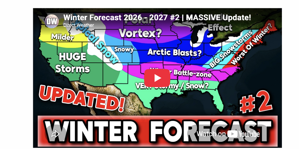
- Today
-
-
Looks like you were on the wrong side of the stationary front all month.